We’ve got showers and rain incoming – but how much will we see? The latest BoM high resolution models keep the biggest falls *just* to our north:
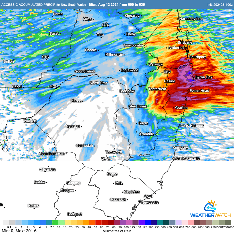
…and show totals up to around 200mm close to the coast. Other models likewise show some big totals just to our north:
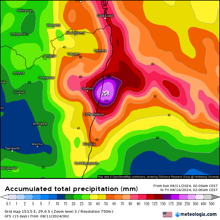
…and likely as a result the BoM have removed our rivers from the Flood Watch while keeping the Northern Rivers within the Watch:
Flood Watch for parts of the New South Wales Northern Rivers
Issued at 11:40 am EST on Sunday 11 August 2024 Flood Watch Number: 4
ISOLATED MINOR FLOODING POSSIBLE IN THE TWEED, RICHMOND AND WILSONS RIVERS
A weak trough will develop along the northern coast later today and Monday. Showers and potentially heavy rainfall is forecast which may result in river level rises along the Northern Rivers from Monday and into next week. Isolated minor flooding is possible along the Tweed, Richmond and Wilsons Rivers from Monday, with forecast rainfall.
Persistent moderate rainfall is forecast from Sunday into this coming week, with isolated heavier falls possible in the Northern Rivers. Localised river level rises and flash flooding are likely within the areas of heaviest rainfall, with isolated minor riverine flooding possible.
This is a very dynamic situation, with high levels of uncertainty in the timing and location of the heaviest falls. The Bureau is continuing to monitor the situation and will provide updated advice as required. Catchment specific warnings will be issued if and when required.
Flooding is no longer expected in the following catchments: Orara River, Bellinger and Kalang Rivers.
Other models however – such as the latest run from the ECMWF – keep the heaviest falls further south, over our region:
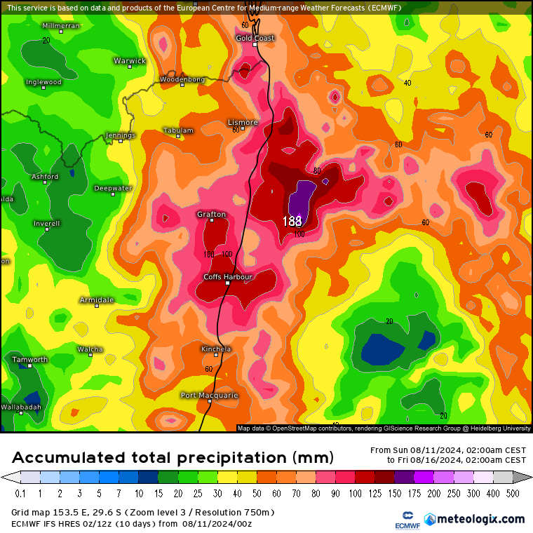
…so you can see what the BoM is talking about when it mentions that ‘this is a very dynamic situation, with high levels of uncertainty in the timing and location of the heaviest falls.‘ To be honest with the uncertainty I was expecting the BoM to keep our region within the Flood Watch area, but they have access to a lot more information than I do, and are the experts in this field, so will leave that call with them.
What we do know is that there is likely to be some heavy rain across parts of the NE NSW coast over the coming few days. It’s likely that the heaviest falls will be just to our north, but is by no means certain – so definitely worth keeping an eye on the radar and any updated warnings through the coming days. As you can see from the chart below, regardless of the flood risk, showers will last across our region right through this week (but looks like the sun will return for at least part of the weekend):

Sure the plants will enjoy the rain as the sun gets stronger. I’ll be back with another update if necessary as we run through this event.
Images: yr.no / BoM / Meteologix

