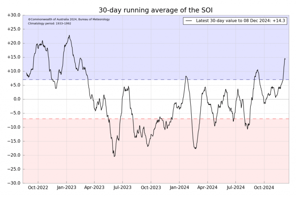
We’ve had the Southern Oscillation turn negative over the last week – and that means drier and warmer weather is possible over the coming few weeks as the easterly winds are pushed further north above our region. Here’s how the Southern Oscillation looks right now:

Remember that negative values mean the expansion of the westerlies further north – which means an increased chance of us dragging some hot weather across from inland…and that inland is getting hot – here’s one forecast chart from Xmas Eve as an example (noting that this will likely change before we arrive at Xmas):
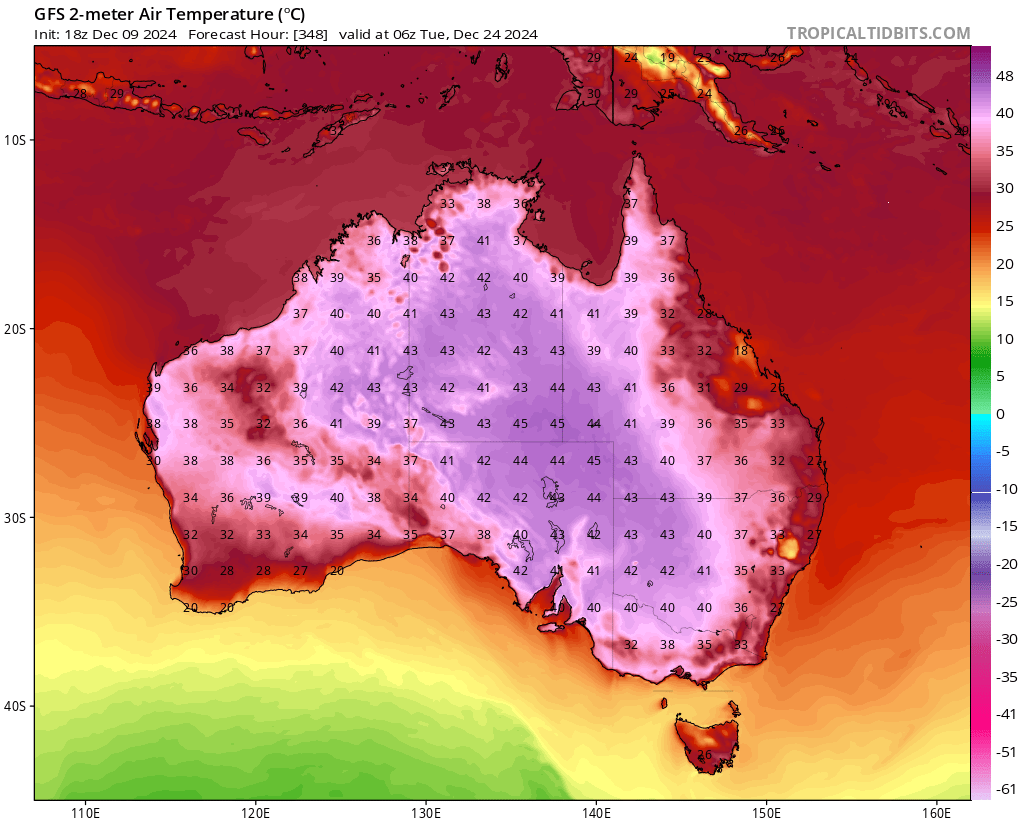
We’re unlikely to see those extreme values, but will still likely see some hotter air making its way across from time to time. Combine that with some very warm ocean temperatures off our shore (over 27C now in the East Australia Current):
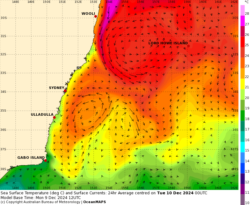
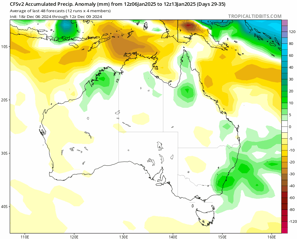
…and the humidity will combine to leave it pretty uncomfortable (if not just really hot) for much of the time. We’ll still likely see a few showers and storms at times but looking drier rather than wetter over the next few weeks. Here’s how one model sees the rain totals over the next 4 weeks:
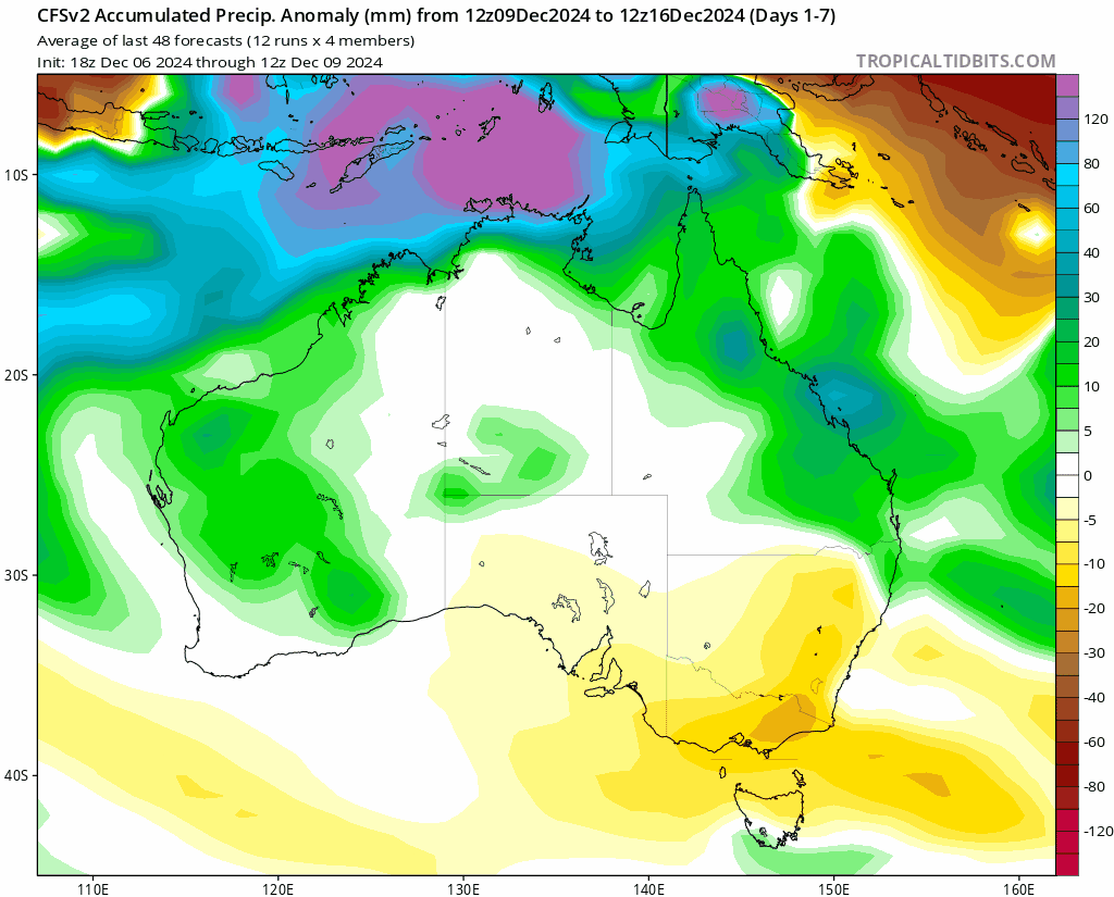
Even though the dice is weighted on the drier side over the coming month it doesn’t mean it will be dry right through – and it only takes one decent storm event / trough to take advantage of the high humidity levels to give us a decent downpour.
Looking further ahead and we have the Pacific looking very La Nina like right now:
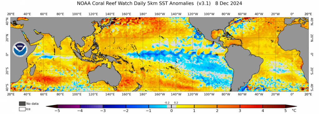
Check out the colder ocean temperatures across the Pacific and the much warmer than average ocean temperatures off our shore! You can also see the atmosphere starting to couple as well with the SOI turning positive:
…so when the Southern Oscillation returns to neutral over coming weeks we’ll see the Pacific come back into play – and likely combine with our very warm ocean temperatures to bring us wetter conditions once again. We can see this with the models already hinting at wetter weather in 5 to 6 weeks:
We’re heading into our traditional flood season so I’d be watching carefully over the first few months of 2025. No guarantees of wetter weather, but we’re certainly lining up some of the cards…
That’s it for now – keep cool and I’ll post again when particularly hot / wet weather is looking likely. I’ll also come back with a Christmas forecast in about 10 days 🙂