A quick post to acknowledge just how wet is has been recently. No huge rain totals but day after day (and week after week) of cloudy weather and showers. To highlight how consistent the showers have been here’s the daily rain totals for Bellingen over the last month:
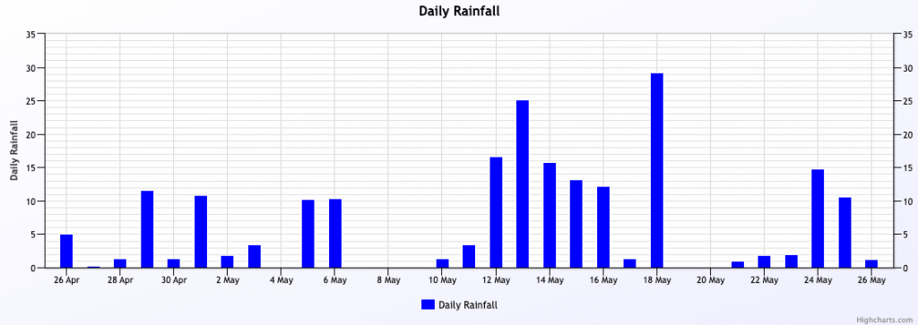
The good news – we’ve finally got a stronger westerly change moving in. As it moves in it’ll clatter up against the wet, humid air sitting across eastern NSW and bring some heavy falls to some locations. There’s also likely to be an East Coast Low developing as very cold upper air meets the warmer Tasman. There’s actually a Flood Watch and Severe Weather Warning out from the BoM – and those warnings include our region:
Severe Weather Warning for HEAVY RAINFALL
HEAVY RAINFALL which may lead to FLASH FLOODING is possible about elevated parts of the southern Mid North Coast, Upper Hunter, and adjacent districts from Thursday afternoon. 6-hourly rainfall totals between 40 and 70 mm are possible, with isolated falls up to 95 mm.
Thunderstorms that may bring isolated and localised heavy rainfall are also possible for the remainder of northeast NSW during Thursday. A Severe Thunderstorm Warning will be issued for those areas if thunderstorms with heavy rainfall are detected.
Flood Watch for the Hunter and parts of the Mid North Coast
A broad trough over northern and eastern NSW is expected to generate widespread moderate rainfall and thunderstorms over the next few days. A low within the trough is expected to result in heavy rainfall for parts of the Hunter and southern parts of the Mid North Coast from late Thursday.
Minor flooding may develop along the Orara, Manning and Gloucester, Bellinger, Hastings, Paterson Williams and parts of the Hunter Rivers from Thursday into Friday. Uncertainty remains in the location and timing of the heaviest falls, and the Flood Watch area will be reviewed over the coming days.
At this stage it looks like the worst of the weather will be to our south, but the strong instability and more than adequate moisture levels means that anywhere across NE NSW is at risk of heavier falls before the change clears away as we head into Friday. Tomorrow will be one for keeping an eye on the radar…we could see only reasonable totals with the heavier falls from Port Mac south, but there’s a chance we could see heavier storms form across our region bringing some quick heavier falls.
The good news – as the change clears through it will bring blue sky and sunshine back across our region. Here’s the 3 day cloud forecast – very nice to see the yellow reappear strongly as we head into the weekend:
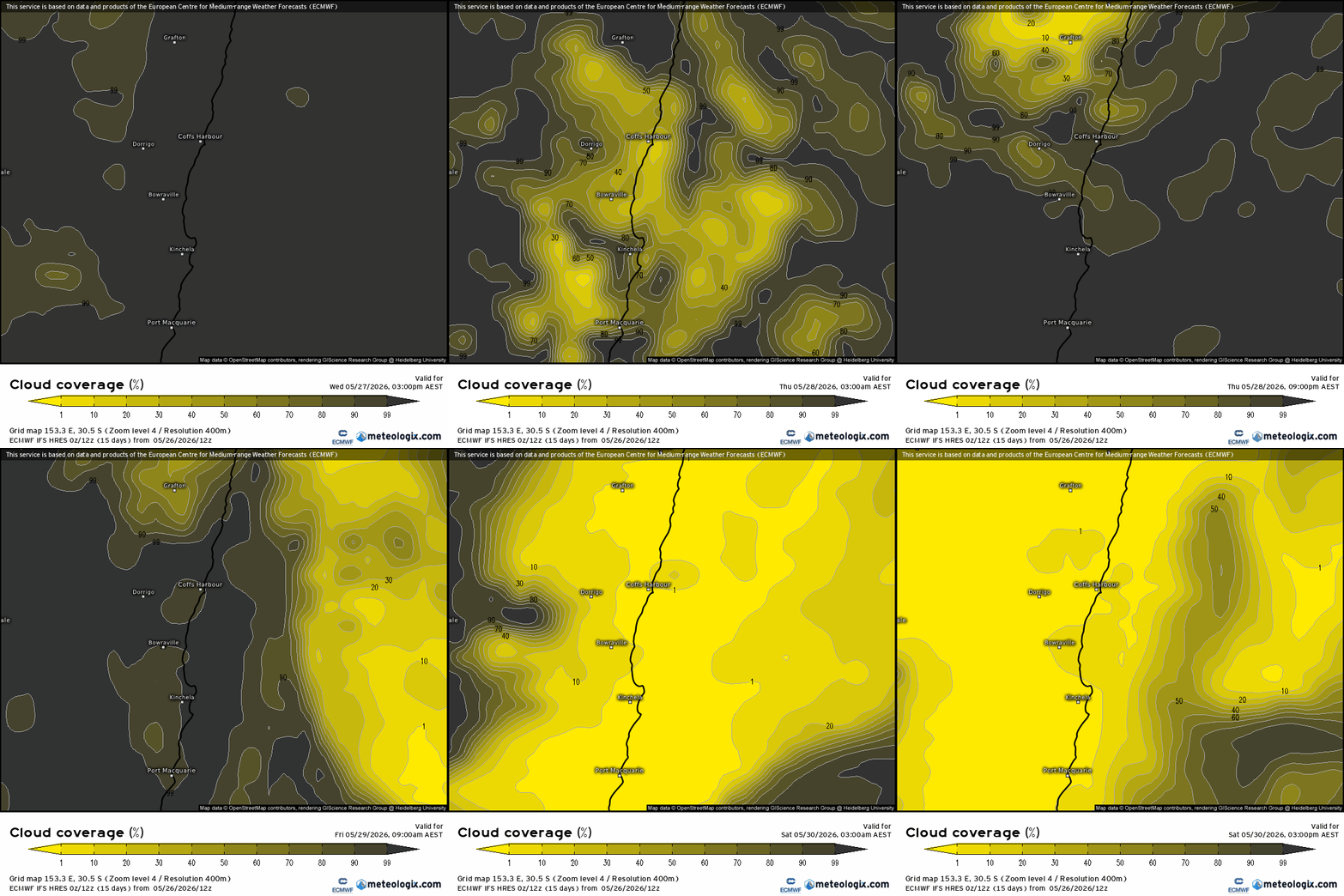
Once we’re back into the westerly flow it could stick around for a little while. That doesn’t mean it will be dry right through but we should be looking at significantly more sunshine and lower humidity levels than we have seen for some time.
I’ll be back again with a longer term outlook in a week or so when the monthly long term models are released. Until then keep an eye on the weather tomorrow, and enjoy the sunshine when it finally arrives back across our region 🙂