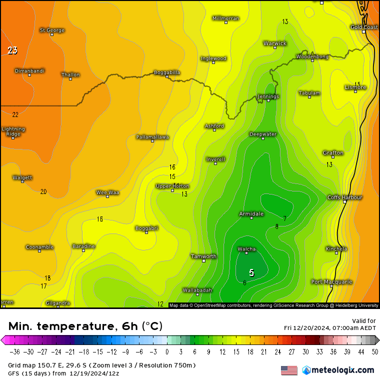
Was almost wintry this morning with some very low temps for this time of year:
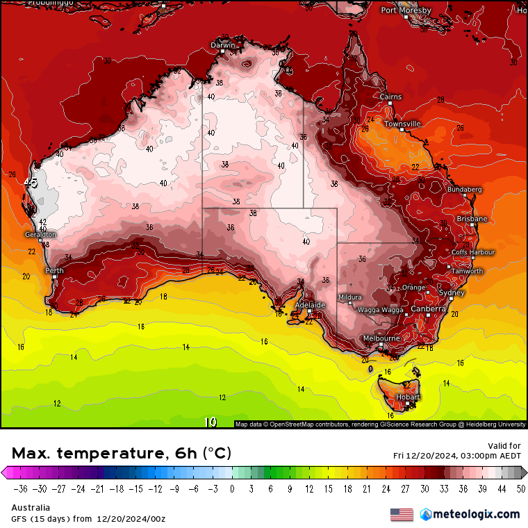
…but it’s December so that cool weather won’t last for long…and if we look at the wider picture we can see some hot temperatures again this arvo across inland Aus:
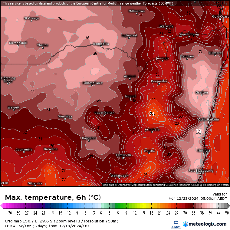
…and ahead of the next change on Monday we’ll find some of that hotter weather sweeping across our region – giving us maximum temps on Monday that look like this:
The good news is that it will cool down a little for Xmas Day and Boxing Day with sunshine and warm (but not-too-hot) temperatures 😎
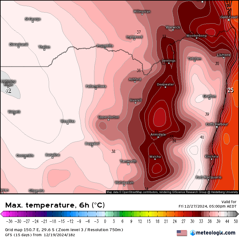
Move beyond Boxing Day and it looks like we’ll see some even hotter temperatures moving in for the 27th:
…and possibly the 28th:
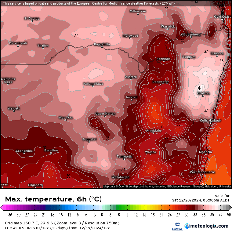
With a change moving up the coast on the 28th it currently looks like we’ll likely find the top temps for us in the morning before the change moves through…while areas just to our north will see top temps in the peak of the day – hence the higher temperatures. Worth watching because a change in speed of the change would make a big difference – a quick change and we’ll have a much cooler day, while a slow down will give us a scorcher. -worth checking on this one closer to the day. Regardless the 27th looks locked in as a hot one – take care out there!
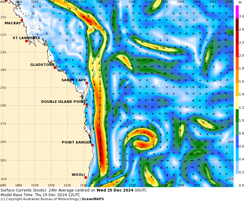
Looking further ahead and the East Australia current looks like it’ll be pumping over the coming week. You can see it clearly in this SE Qld image:
…and it’s going to be drawing more very warm water down our coast:
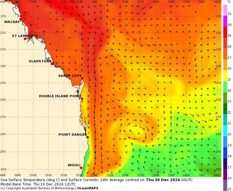
…so expect decent humidity levels at times – making that hot weather feel even hotter.
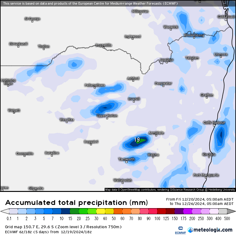
Very little rain on the 6 day charts but may see the odd storm on the hills with changes:
…but looking further ahead and conditions are ripe for some decent falls should everything align (which is no guarantee!) so I’ll be keeping an eye on the charts over coming weeks. Unless anything changes this will be the last post before Christmas so I’d like to take the opportunity to thank you for reading, and wish you a fantastic Christmas 🎅😊