We’ve got some exciting weather incoming up high. Several pools of very cold air are likely to move across SE Aus over the coming two weeks…and as that upper cold air hits the warm wet air sitting just above a warmer than average Tasman Sea we’ll see strong instability develop. That means a likely east coast low, strong winds and heavy rain…but right now it looks like most of the action will be to our south – more on that in a minute. First off here’s an animation of the upper air temperatures over the coming two weeks:
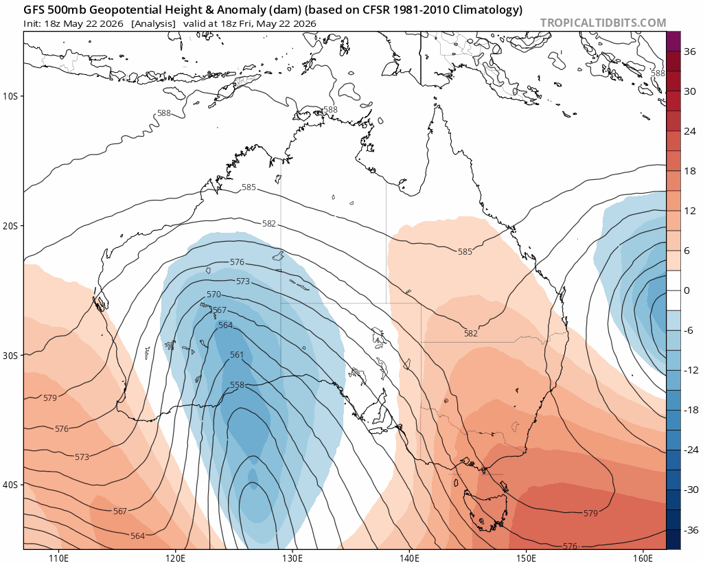
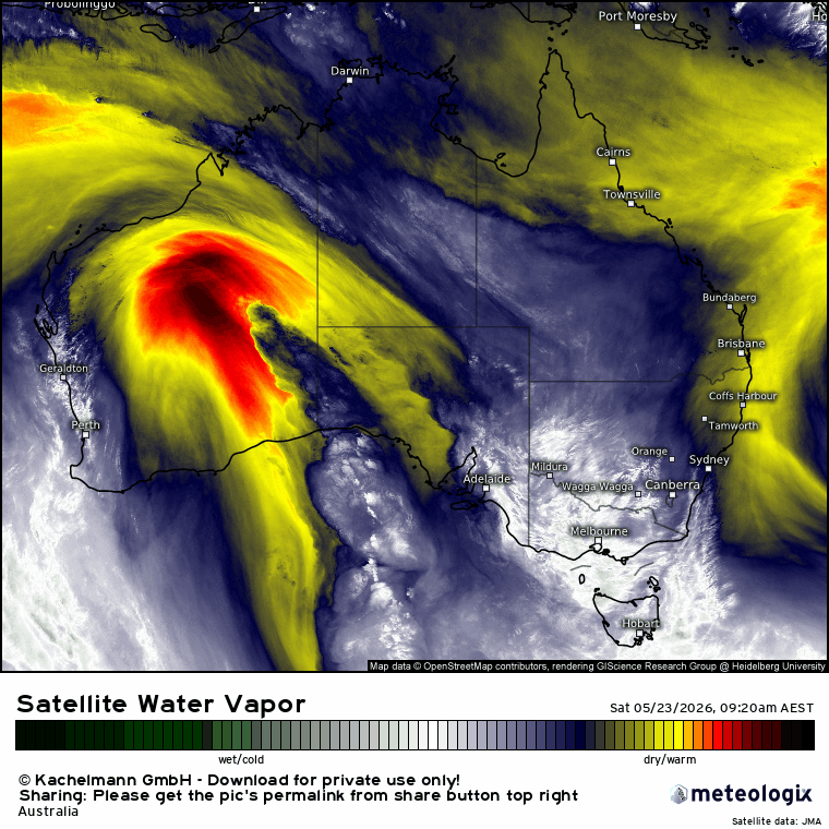
As spectacular as you’ll see at upper levels. The initial pool of upper cold air is developing over eastern WA right now – and we can see it on the latest satellite animation:
That upper feature sits over inland Aus for a week or so before moving off to the east. We then see a couple of faster moving (and likely even colder) cold upper systems move through. As each one moves through it will push westerlies further north – so the good news is that over time we’ll likely see drier and sunnier weather move into our region.
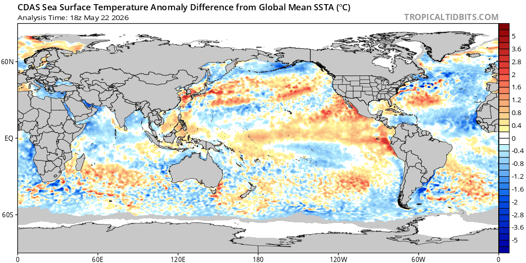
The ocean temps off the NSW coast are a little above average across our region – but much higher than average further south (as the East Australia Current pushed further south than normal):
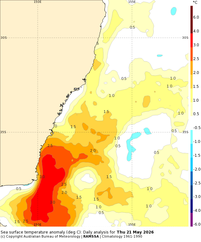
Worth noting that the highest rain totals from these systems is forecast to sit pretty much above that very warm ocean – no coincidence there:
Back to the bigger picture and the first upper system will induce a surface low that will drag warm and humid winds down from up north. As that surface air interacts with the cold upper air we’ll see a deepening surface circulation and rain developing to the east of the system:
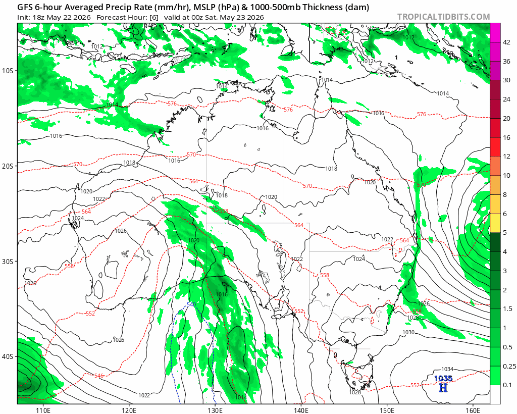
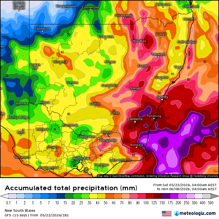
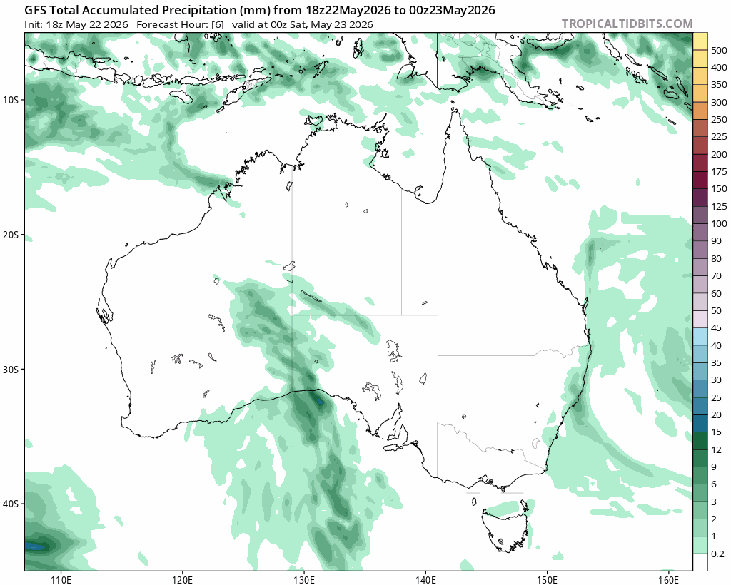
A good chance we’ll see some showers across our region, and potentially for some storms developing as the system approaches. We’ll have to keep a close eye on this system – anywhere to the south of the surface low will see big rain totals accumulating. We can see this happen in the rain total animation – the same period as above but showing rain totals:
Here’s how the rain totals are currently forecast in more detail – Sydney / Hunter south looking to be in the firing line:
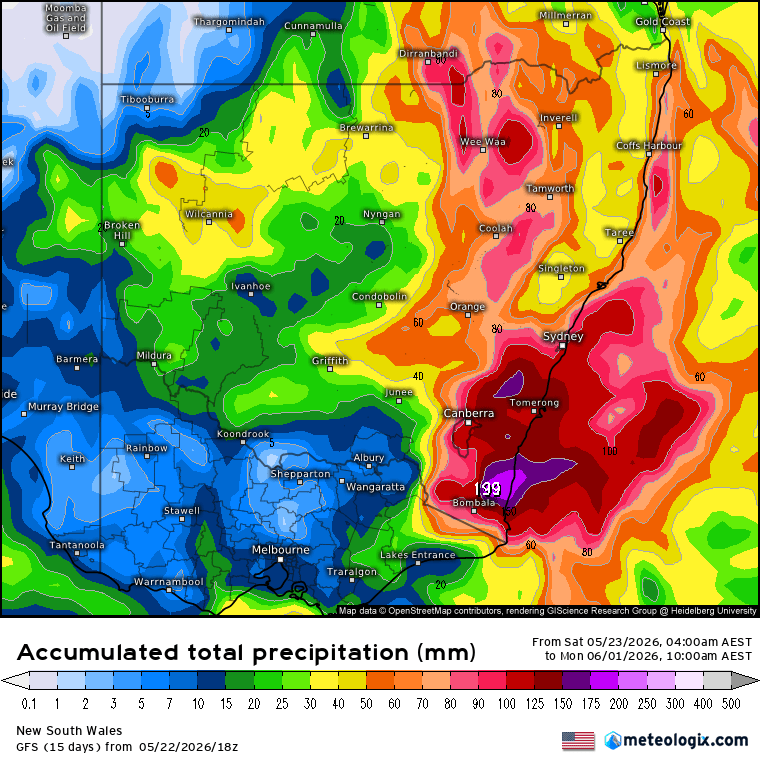
These systems are very dynamic and with strong instability some locations will see some big totals. As such we’ll have to keep an eye on this system as it develops – if it moves further north we could also see some big totals across our region…but right now odds are that the higher totals will be to our south.
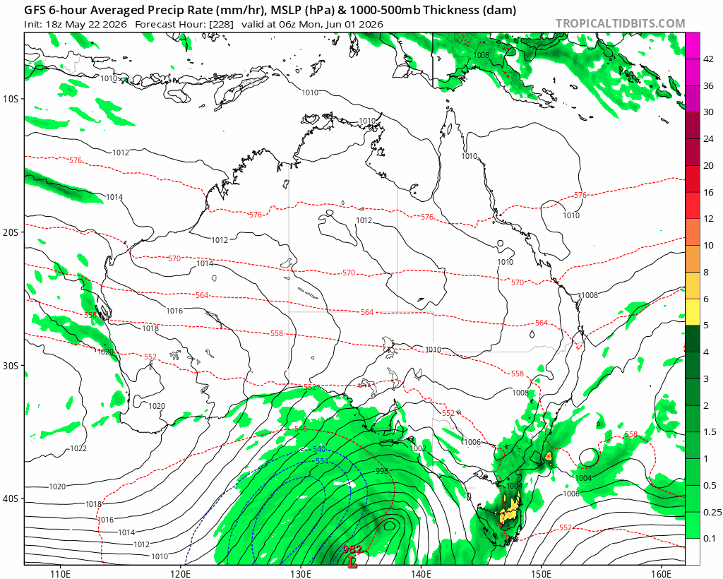
Looking further ahead and the two follow up cold systems will bring more rain, especially further south. With the focus of these systems looking further south we should sit within the drier westerly feed to the north of the system – and that would mean dry and sunny weather across our region with much lower humidity levels – but again that is a long way off so still time for change. Here’s how the forecast looks on the surface charts:
….those systems could also bring some good snow to the Southern Alps, kicking off the ski season in style.
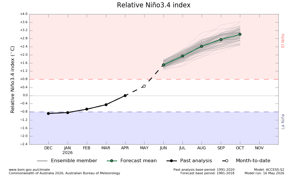
Looking further ahead and the El Nino signature is starting to appear across the Pacific:
Forecasts continue to show the El Nino developing quickly as we head into late winter:
That would mean drier for some parts of eastern Aus through spring – however the Indian Ocean (which was previously heading into the orange – drier – zone) is now looking like remaining neutral through late winter and spring:
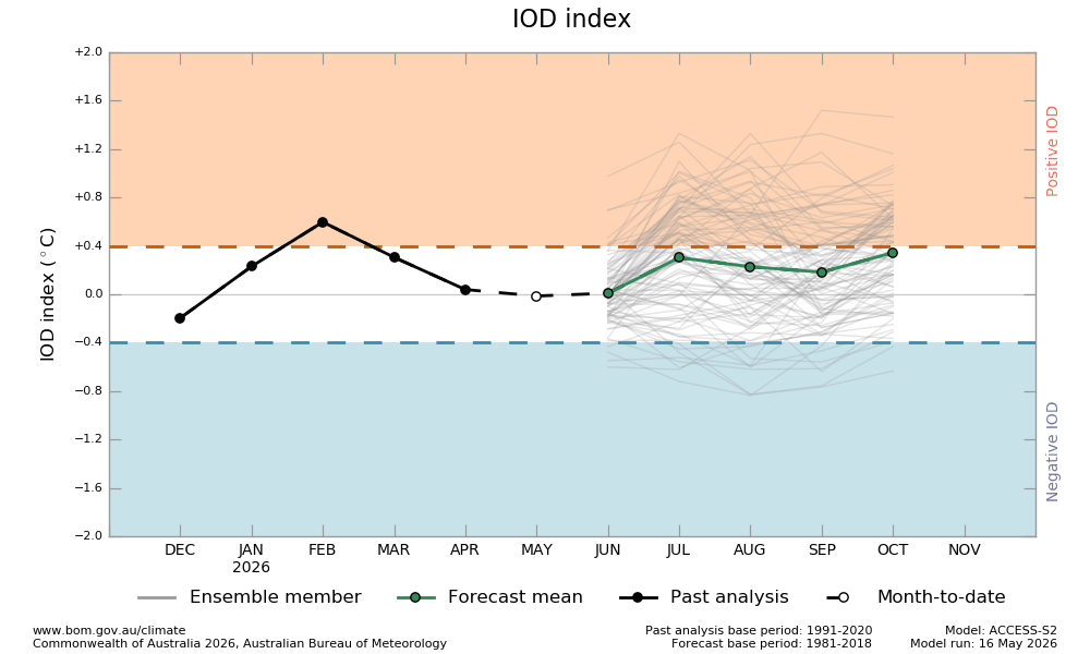
We usually see moisture dragged across Aus from the north west through winter giving decent rain at times, particularly inland…and a neutral Indian Ocean means we should see those bands bringing much needed moisture from time to time – just what the inland needs. No guarantees of those falls, but the odds are looking better than they were a few weeks back.
That’s it for now…more showers short term, currently looking to clear up later next week before sunnier weather finally returns…but with big rain totals currently forecast just to our south we’ll keep an eye on this system and post again if it looks like moving further north.


