Massive El Nino incoming – so why so wet? I’ve been asked this a few times this week and to answer it it pays to look at where we are now, as opposed to where we are heading….
Chance always plays a role in what weather we’ll likely be seeing, but the odds one way or another are really influenced by the climate drivers to our east, west and south.
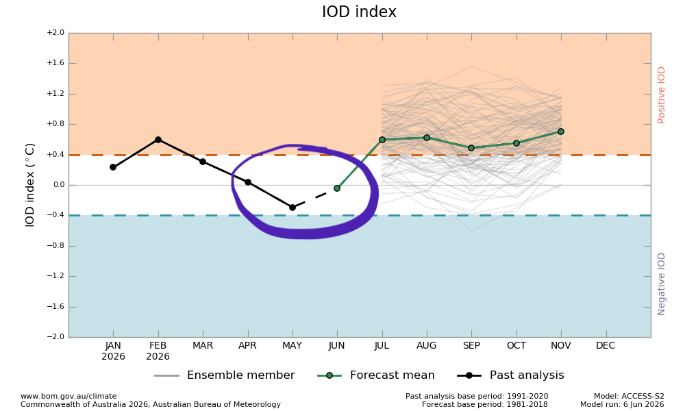
To our west the Indian Ocean dipole looks like it will head into positive (drier) territory as we head into late winter – and that increases (but does not guarantee) drier weather across much of SE Australia. Right now however – as circled below it’s sitting in neutral territory so doesn’t have much of an impact on the day to day weather:
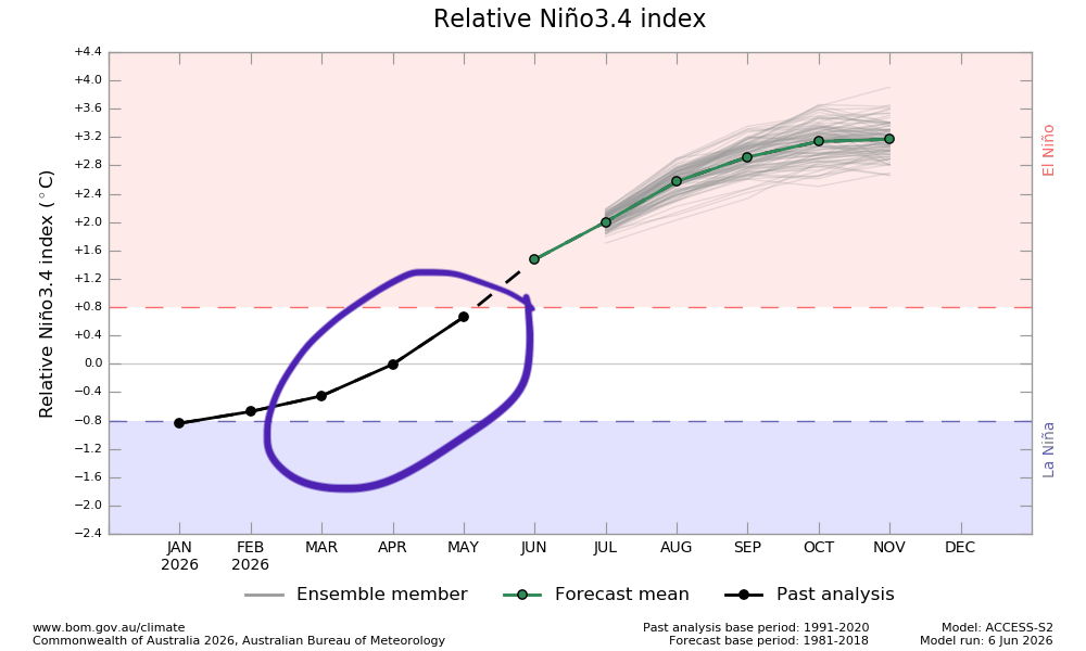
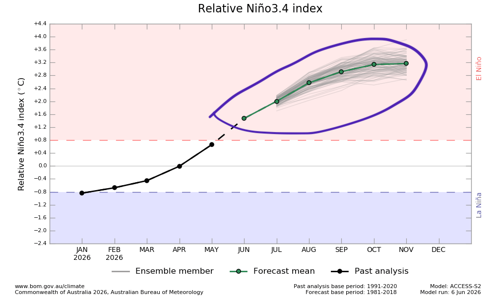
To our east the Pacific is heading quickly into El Nino (drier) territory, but until recently has been neutral – so again not yet a big climate driver for us:
To our south the Antarctic circulation has been in strongly positive territory however. That means the belt of westerly winds is sitting a lot further south than normal for this time of year:

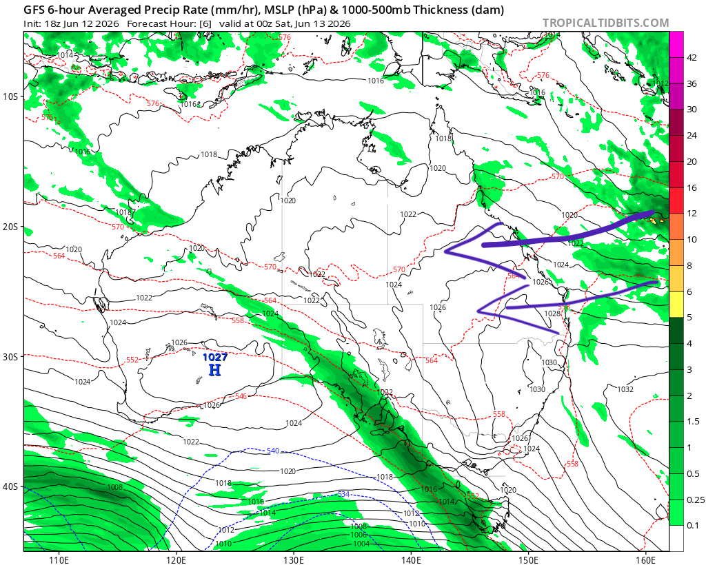
Westerly winds sitting a long way further south gives easterly winds an opportunity to flow across much of eastern Australia – and we can see that right now in the latest pressure / rainfall chart:
It’s been that way for some weeks now – and those winds are bringing a heap of moisture across the country. Whenever we get a cold pool up high moving in we get rain, both inland and across the coast. Until this pattern changes we’ll continue to see showers at times across eastern Australia.
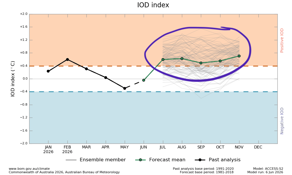
Looking further ahead using the same charts, and the Indian Ocean driver is forecast to turn more positive / drier as we head into late winter, increasing the likelihood of drier weather across SE Aus:
The Pacific is also likely to kick into drier mode for eastern Aus with a strong El Nino developing:
…and as far as the Antarctic circulation goes…right now it is way too early to know which way it will end the winter. More on that one over coming weeks.
The ocean just offshore is also warmer than average for the time of year:
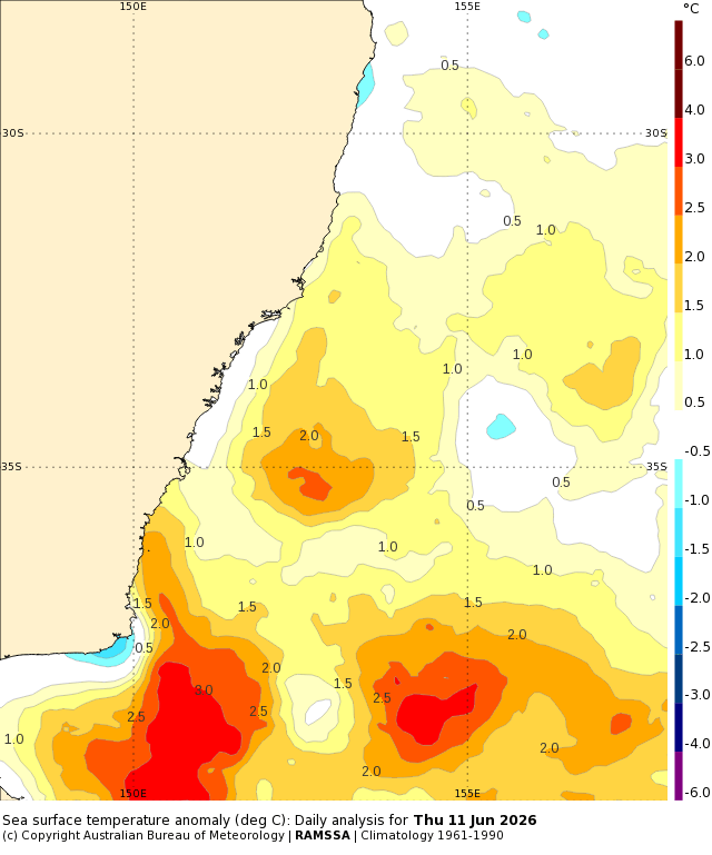
…and that means that any onshore winds will carry more moisture than they normally would for the time of year – and that means more cloud, and more showers.
As such, and as we head into late winter and spring, we should see a gradual drying trend – but that depends in part on chance, what happens to the Antarctic circulation, and if the waters off our coast remain warmer than average. A mighty strong El Nino will have significant global impacts, but in terms of how much / how little rain we see…that is, literally, up in the air right now. It’s worth being aware, but not alarmed.
What we can say with more certainty is that we are likely to see higher than average temperatures continue through late winter and through spring. We’ll still see some cold snaps but overall temps are likely to be above normal, with some strong heatwaves possible during the warmer months. Global ocean temperatures are already sitting at record levels for the time of year:
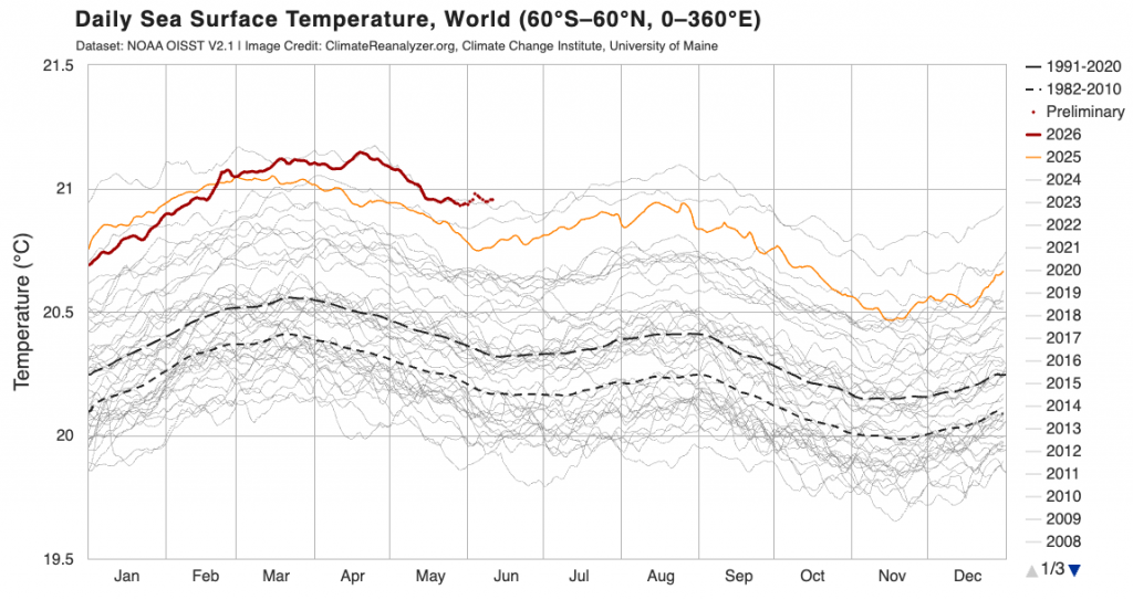
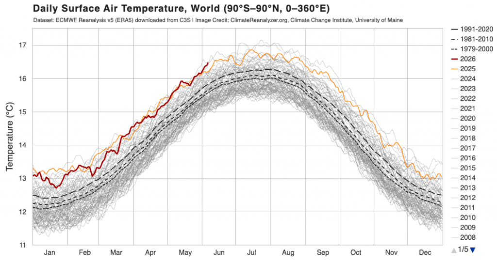
…and that anomaly is likely to grow further as the El Nino develops. Global air temperatures are also heading towards record territory:
These anomalies will also add to the chaos of day to day weather in ways that are not yet fully understood.
On that cheery note I’m going to head into the welcome sunshine. Thanks for reading!


