It’s that time at the start of a new month where we have a look into what lies ahead over the coming season. As you’ll likely be well aware by now we have three key climate drivers for our region – The Indian Ocean, Pacific Ocean and the Antarctic Circulation. Looking at each in turn:
Indian Ocean Dipole (IOD) – this one is heading into positive territory:
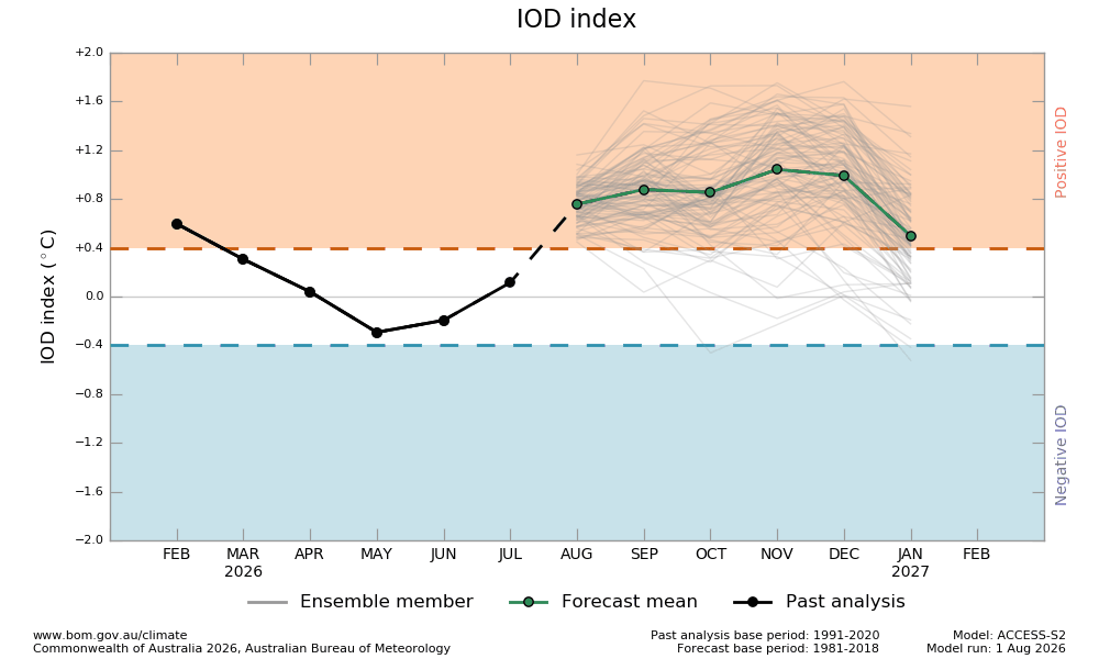
Positive means (usually) drier across much of SE Aus, including our region. This is because there is a heap less moisture for southern ocean fronts to tap into as they move across Australia. It looks like the IOD will remain positive until the end of the year. Worth flagging that drier than average is not the same as dry – it just means that overall we’re likely to finish the season with lower than average rain totals.
The South Pole Circulation (aka Southern Annular Mode or SAM) is in the air rather than the ocean, and this one is sitting neutral to slightly negative right now:
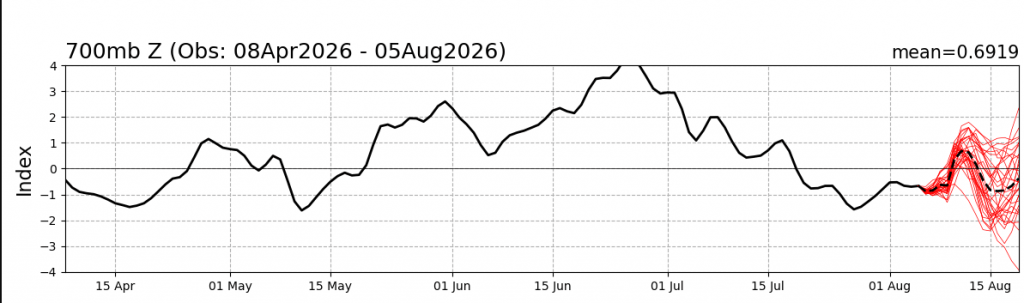
We can see the recent off-the-chart positive position…which gave us the cooler wetter weather through to the middle of July. It’s now sitting neutral to slightly negative. This means it won’t have too much influence right now, leaving that to the other drivers…the last one of which is:
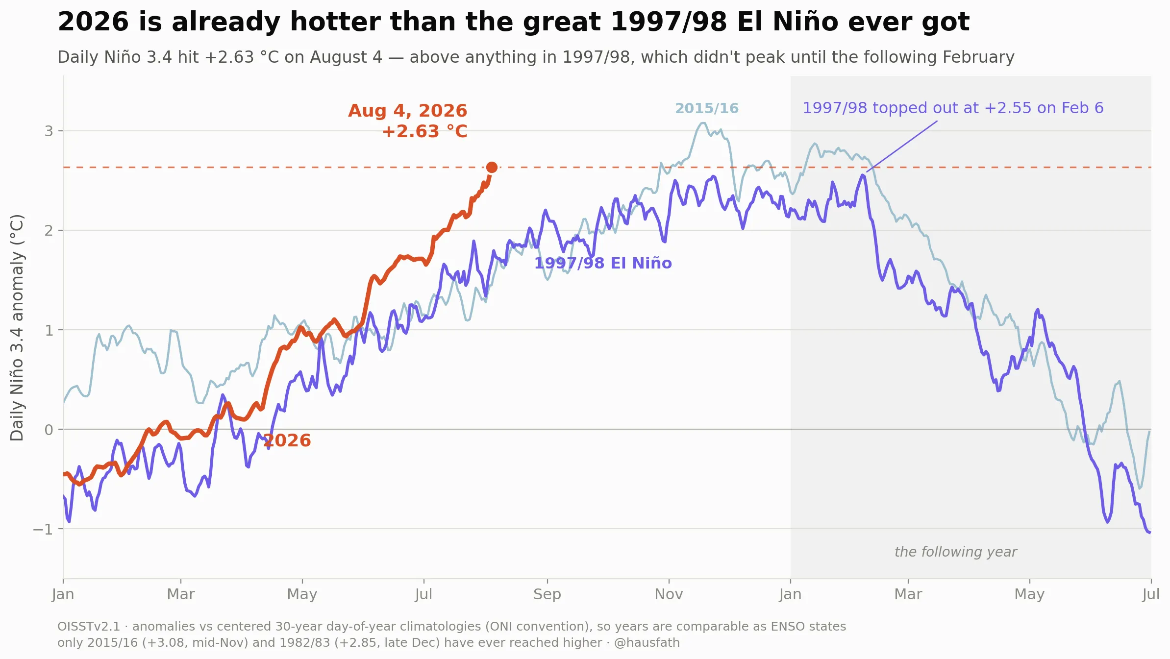
The El Niño-Southern Oscillation (ENSO), an indicator of how things are sitting across the tropical Pacific. Positive is drier for us (El Nino) and negative is wetter (La Nina)…and right now it looks like this:
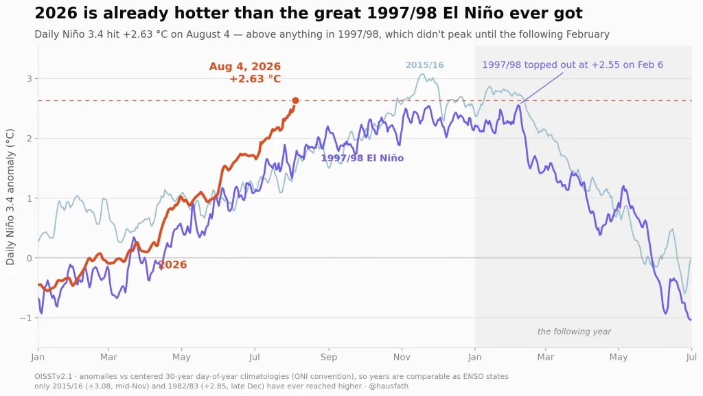
There is no other way to describe it – it is in a league of its own, reaching levels that very few thought possible. It’s way ahead of other El Nino events and will / is releasing a massive amount of energy into the atmosphere. We can easily see the El Nino in place in the current relative sea surface temperature anomaly image below:
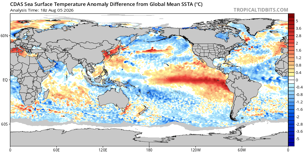
This is a relative chart so as the Pacific warms up it makes the other oceans look relatively cooler. This is used now as most oceans are now sitting above average (thanks to climate change) and that can make it harder to see what is actually happening. Looking ahead and models show the event continuing to strengthen rapidly until the end of the year – and indicating that it may end up nearly twice as strong as it is already:
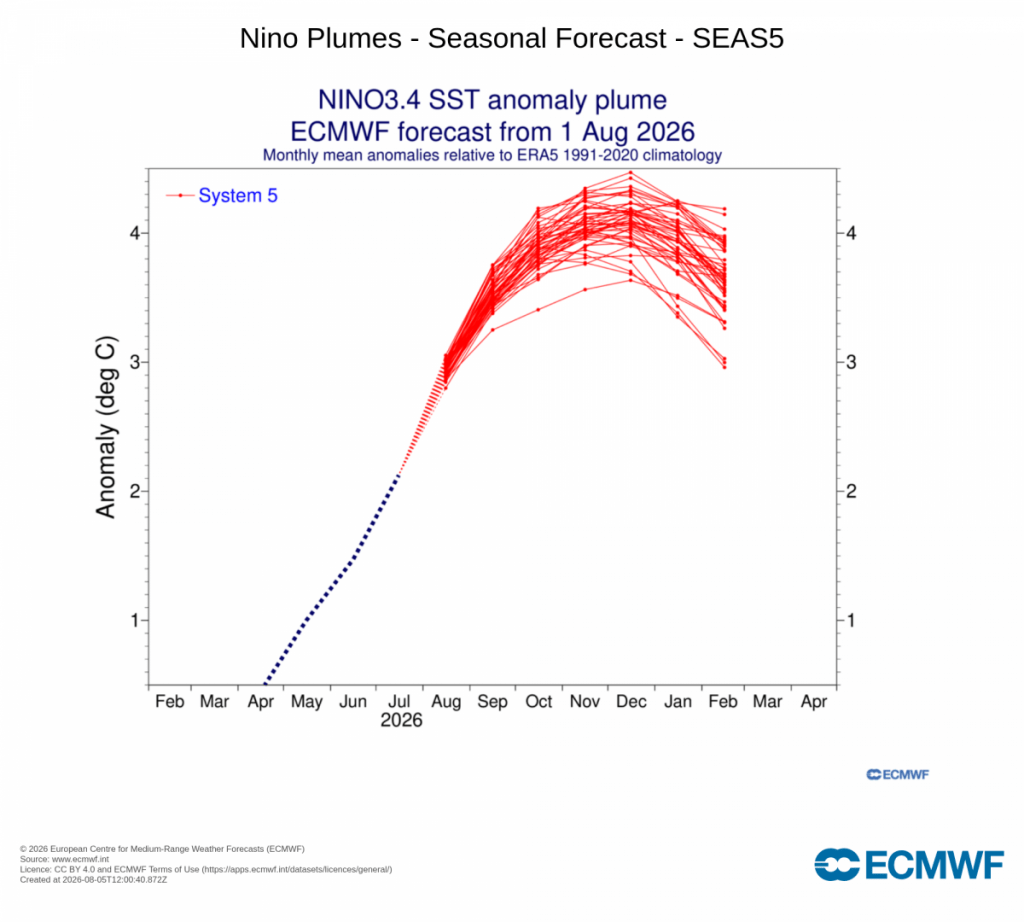
There’s no way to sugarcoat this – that’s a pretty scary outlook and will have global weather implications. We’ll have a couple of years of roller coastal global weather to come. That doesn’t mean we’ll be guaranteed dramatic weather across our region, but we can say with some certainty that some regions of the world – and that might include us – will see some damaging weather over the next year or two with heatwaves, floods and fires all looking more likely.
Looking more closely at our region and the latest models show above average – and potentially significantly above average – temperatures likely at times over the coming months. This animation shows how likely it is that we will see temperatures above the seasonal average…so when you see hotter than average forecast at a time when it’s already a summer month you know we could see some significant heatwaves incoming:
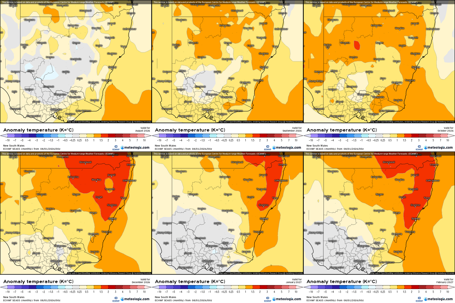
Those red colours as we head into mid-summer are a concern.
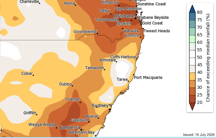
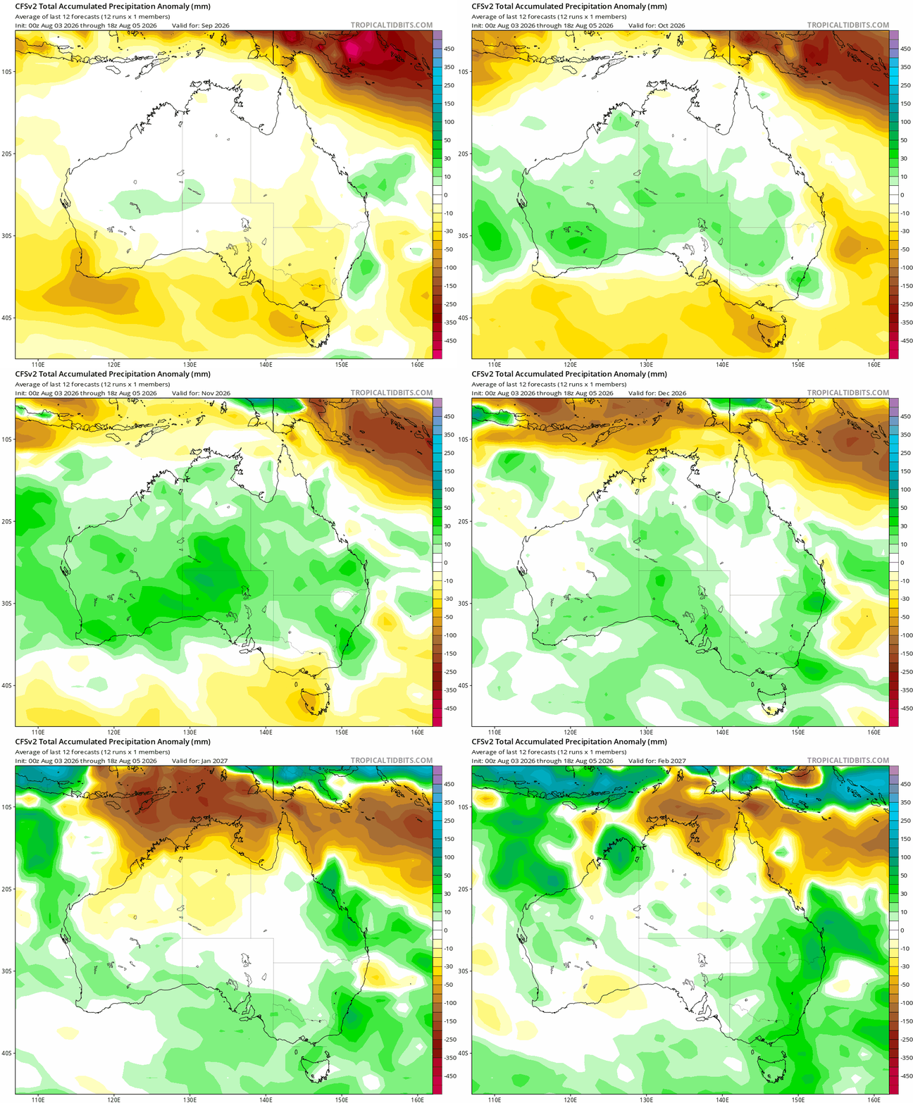
Models are a little more all over the place with rainfall. Some models – such as the US CFS model show above rainfall likely at times through the summer:
The usually more reliable European model however shows drier than average weather along the coastal strip (wetter at times inland) right through the same period:
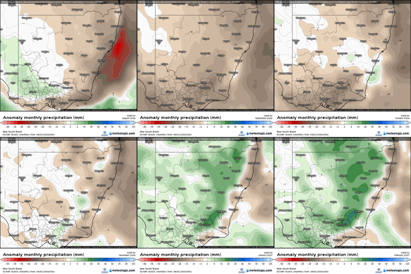
As such we know that there’s a risk we’ll see extended drier spells, but there’s no certainty around this at this time. We’re also lucky to live in a part of the world where we tend to see showers and storms while others remain dry – fingers crossed that remains that way this year….in fact if you look at the historical records for our area there are very few months that are completely rain-free. Regardless of overall rainfall the above average temperatures (at times – it will not be hot all the time) can quickly dry out fuel loads in the bush – as such we’re likely to see fire risks sitting higher than recent years over the coming spring / summer even if we do see some rain at times.
On that cheery note I’ll head off to enjoy the remaining cooler days of winter. Thanks for making it to the end…and if you don’t have a bushfire plan in place yet please consider putting one together.