We’ve got some great winter weather outside right now. We’ve also got a pool of cold upper air moving up from way down south. With only a few days until it arrives it would be great to have model agreement on what will happen. I’ve been holding out from writing a post until we had clarity…but even a couple of days out that is still not there. More than one of the main models shows the upper system moving north to the east of Australia:
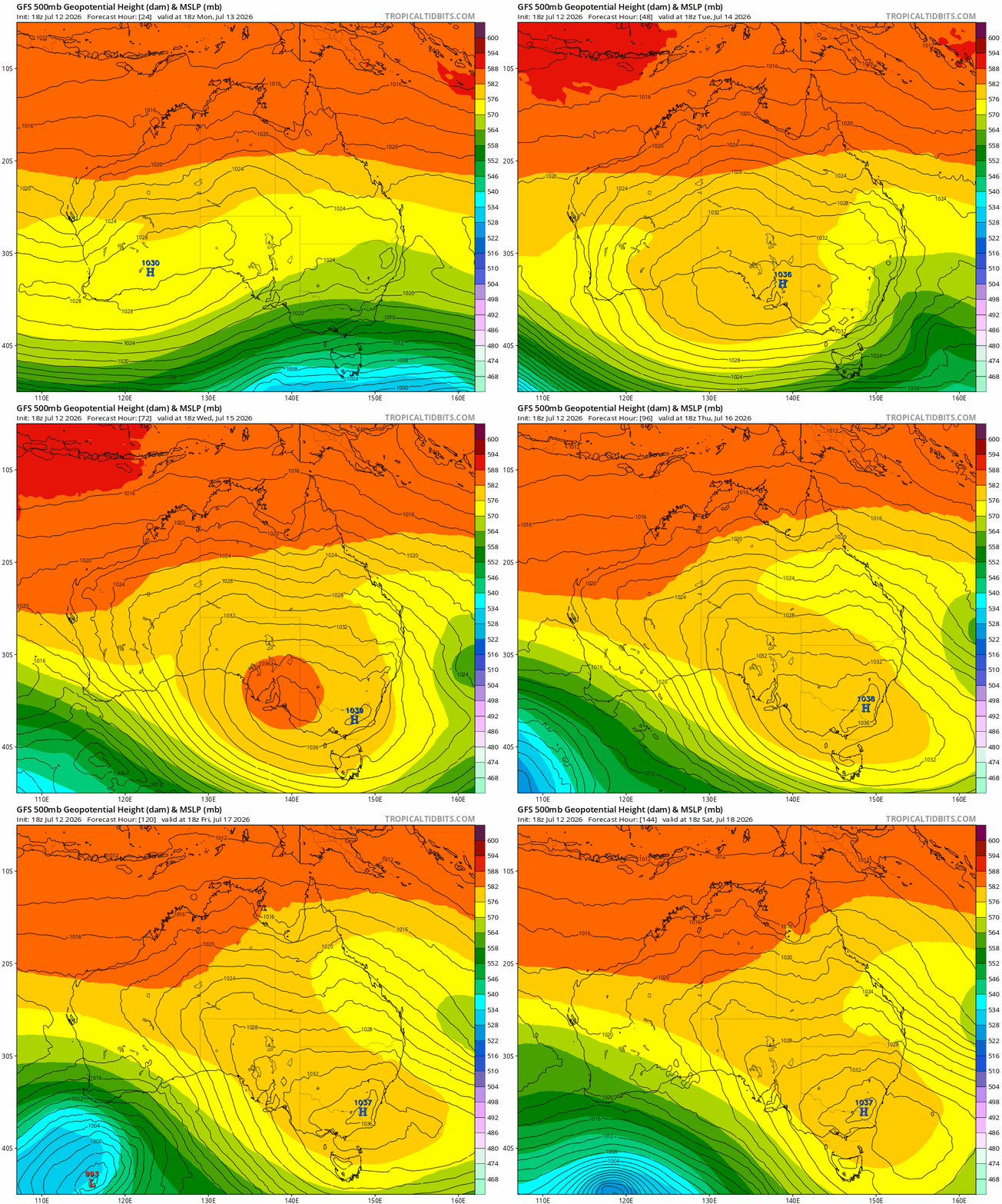
Some rain for the oceans in that case, with a few showers moving in on the easterly flow to the north of the large high. Other models however move the upper system across the east coast of Aus:
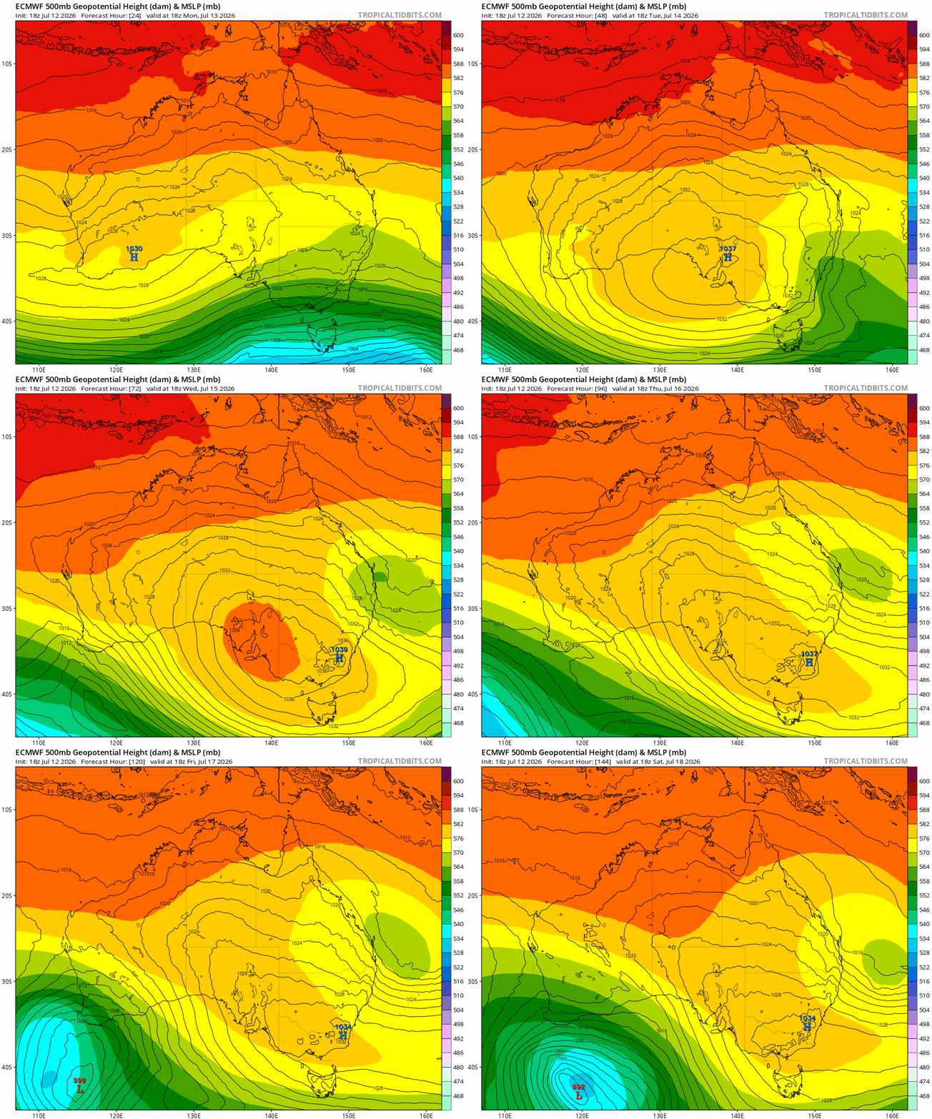
…and if that outcome eventuates we’ll see a lot more rain close to the coast. The first scenario gives us rain totals over the next 5 days looking like this:
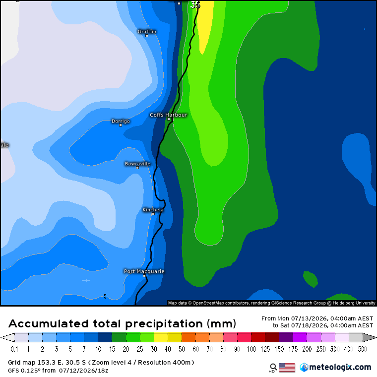
…nothing out of the ordinary. Other models – the usually reliable EC model as an example – look like this:
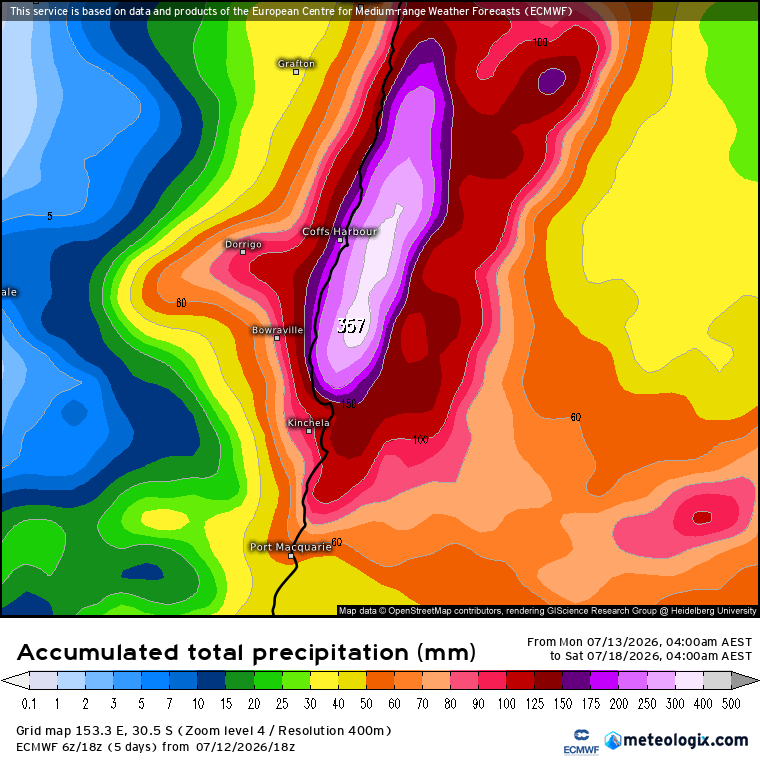
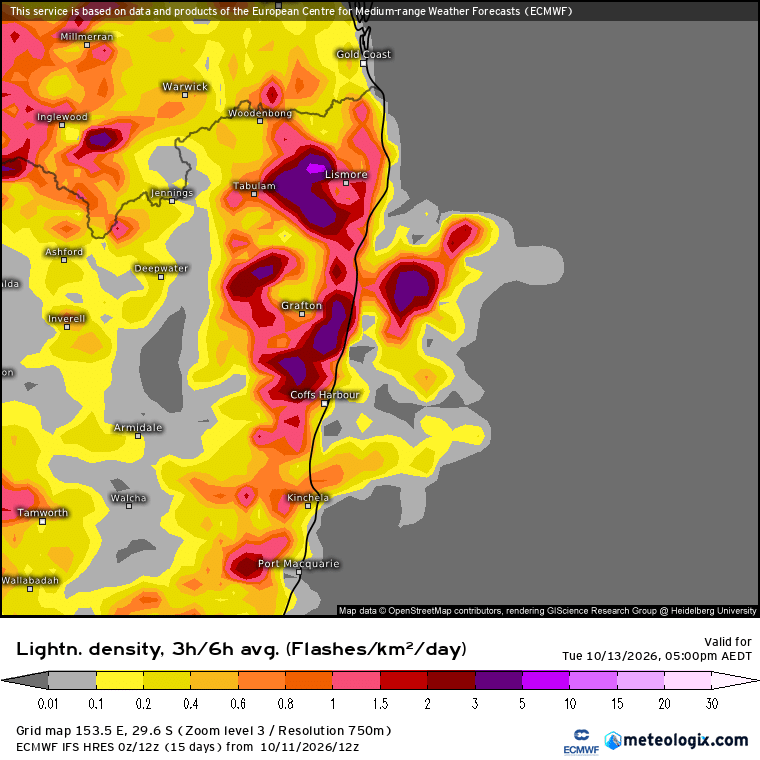
We can even have a look at how the individual members of a model forecast this event – and using the same European model as an example we can see how some members show a BIG dumping for our region, while others show very little:
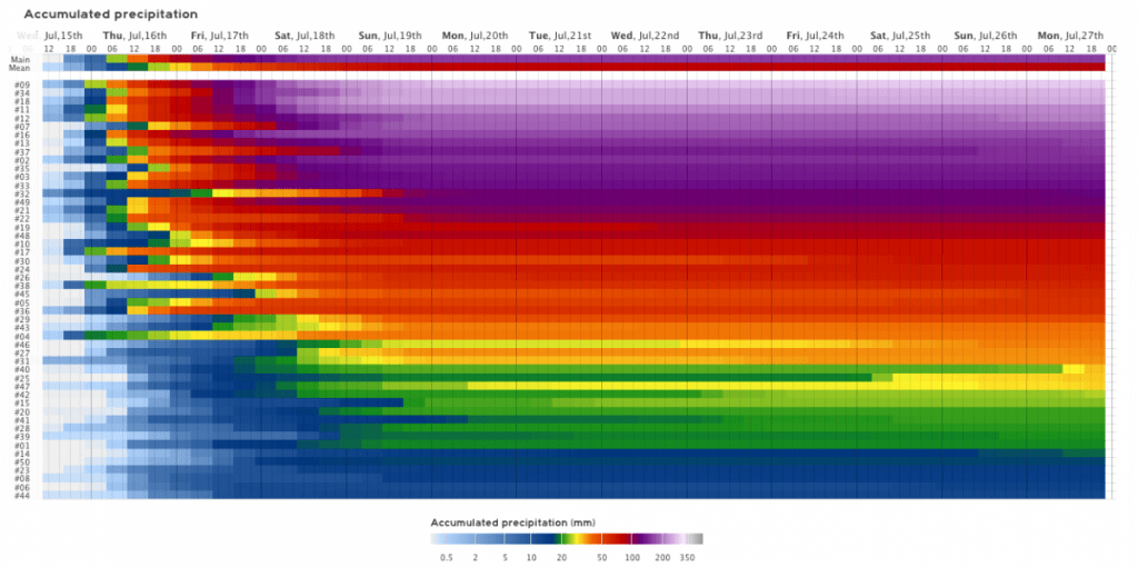
So whilst some social media sites are showing a doom and gloom scenario right now…the fact is that it’s not clear, even close to the event, how much rain we’ll see. At these times we usually find the total ends up somewhere in the middle, and right now that average figure looks like this:
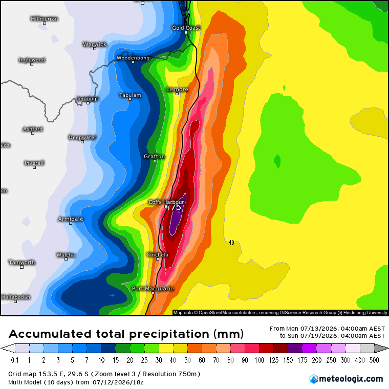
I’ll post an update in the next 36 hours when models settle down and the outcome is clearer. Until then it’s worth being aware that we could (especially coast and hills) see a good dump later on this week…but also a decent chance that we’ll just see a few showers.
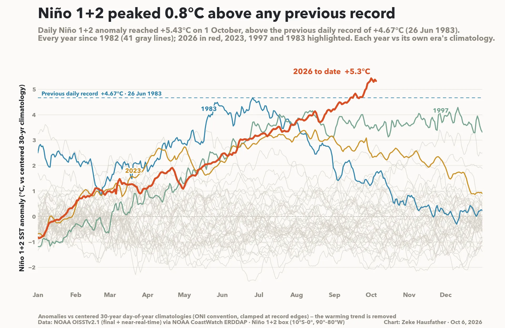
In other news the El Nino continues to develop in spectacular fashion:
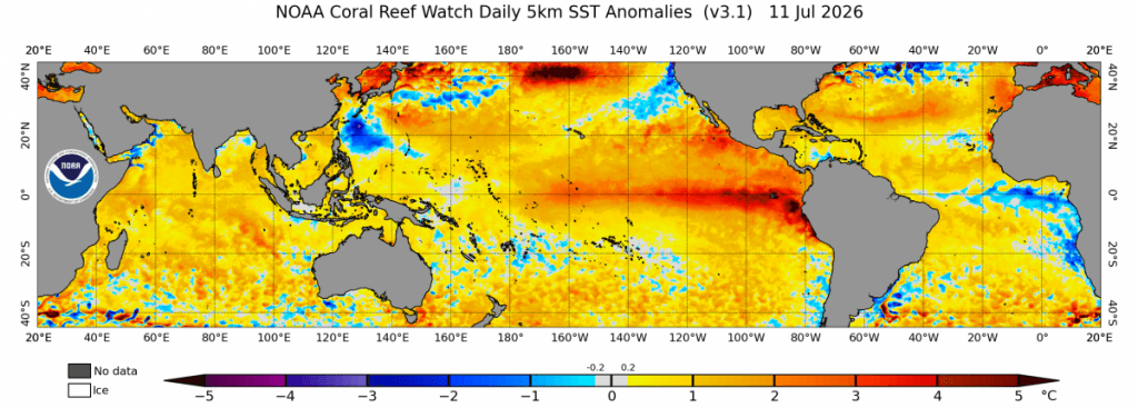
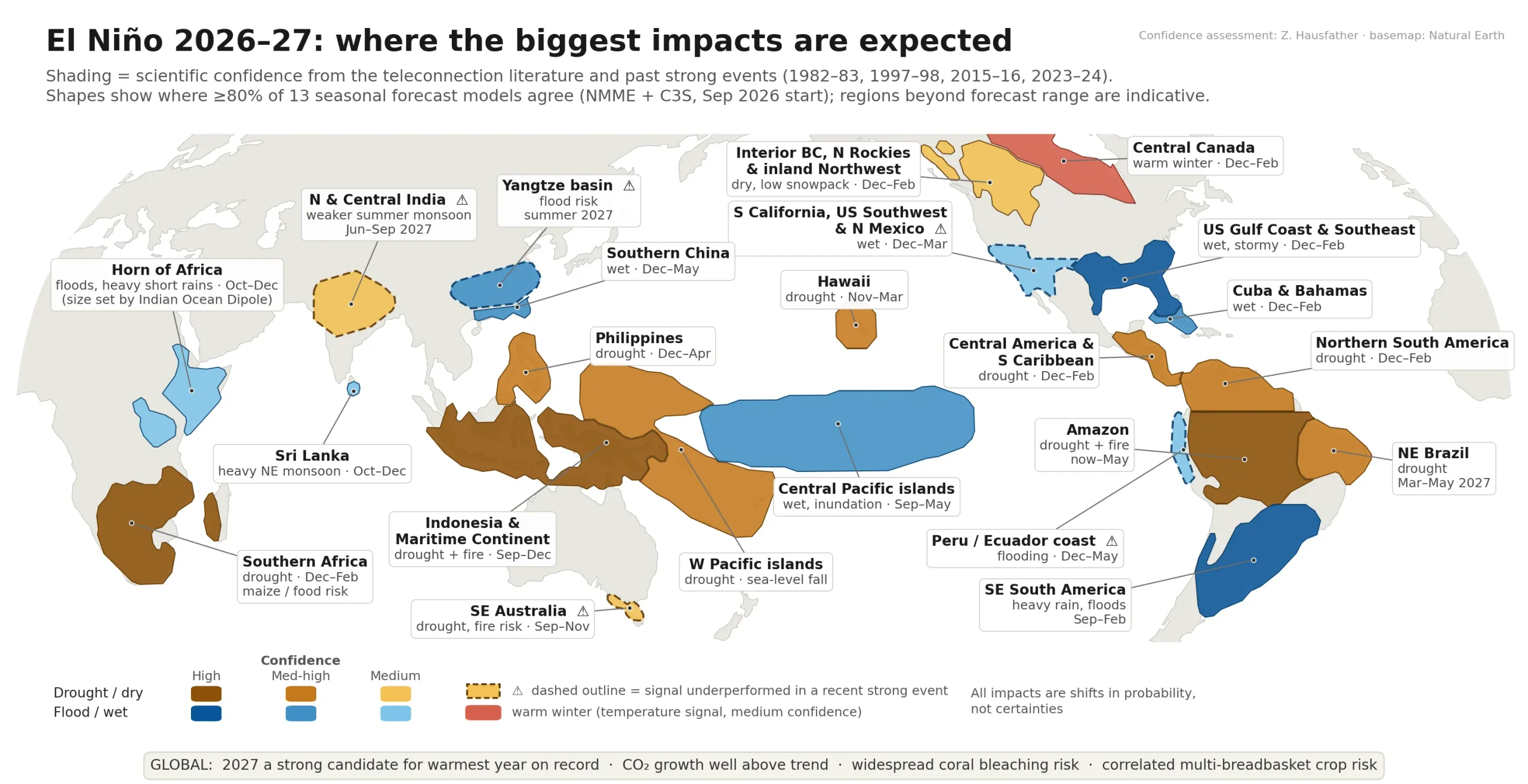
Models continue to show it strengthening further to record levels over the next few months – perhaps the suggestion of some drier weather to come. More on that later in the month…