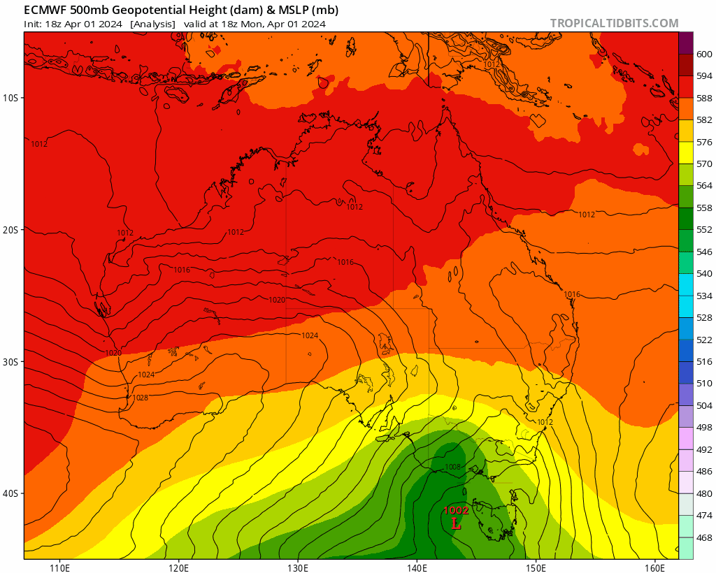
It looks like the models were on the money last week and we’ll see a decent upper trough (and potentially a cut off upper low) move across NSW later this week. Combine that with an onshore flow and there will be a heap of instability out there. The upper low is possibly going to sit a little further south than models were first predicting, which could mean less rain for us…but still the chance of some good totals as a coastal trough forms – and potentially deepens into an East Coast Low late this week. The development of that low will play a big part in rain totals but the exact location is, literally, still up in the air – if it forms to our south we’ll see rain focus to our south, but if it forms closer to us or doesn’t form at all then we could see much higher totals. Here’s how one of the models is forecasting the coming few days:
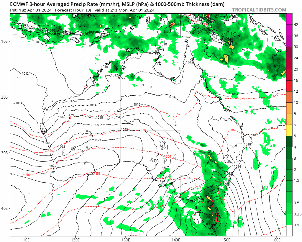
If you check out the rain chart above you can see the southerly change move to our north, with the boundary then getting caught up in the upper flow ahead of the incoming trough and then getting pulled back south. Pretty cool to watch 🙂
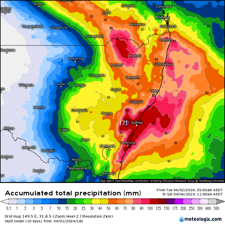
What we know right now is that some areas of the NSW coast will see some big dumps this week. Right now it looks like the highest totals might be to our south but models are still unclear – east coast lows are *very* hard to forecast well in advance, and if / when they form they can really ramp up / decrease rainfall across short distances. Current rainfall totals from a range of models out to 4 days look like this:
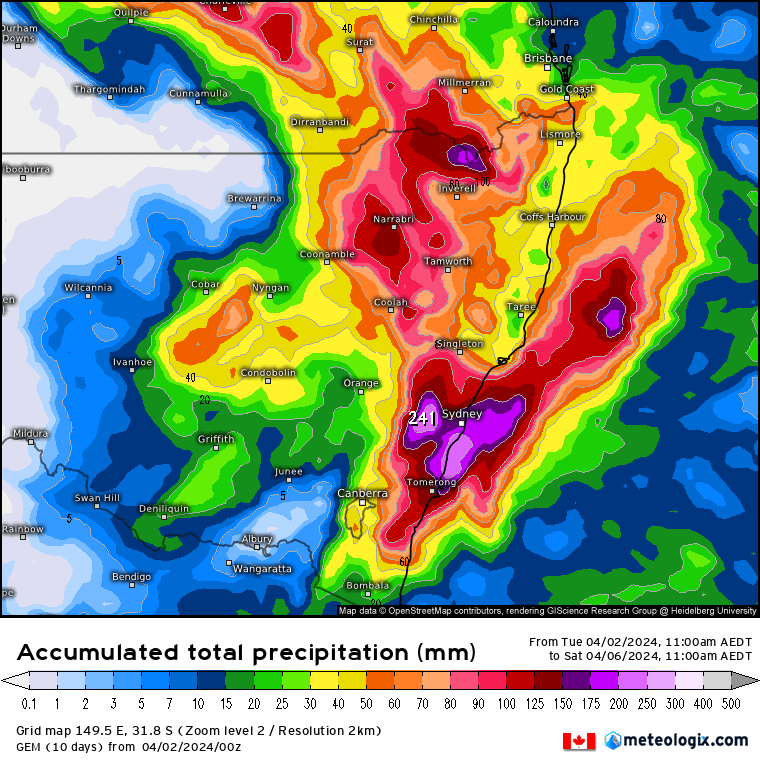
With models still not sure where the big totals will be the average across a range of models is usually a good indicator…
Worth watching across our region – could even see some storms with the approaching cold upper air. At this stage it’s not looking like a top-end flood event for us but could still see some very decent falls…and there is still time for that to change with higher totals possible. I’m sure authorities are also watching the potential in the Hawkesbury / Napean very carefully…
The BoM high resolution models only run out two days, so I’ll post again Thursday morning with up to date high resolution forecasts for our region. Worth keeping an eye on BoM warnings and the radar through this week.
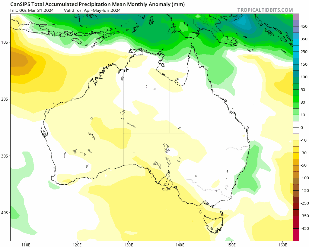
Looking much further ahead and the first of the monthly outlooks is with us – and still shows a decent La Nina forming this year:
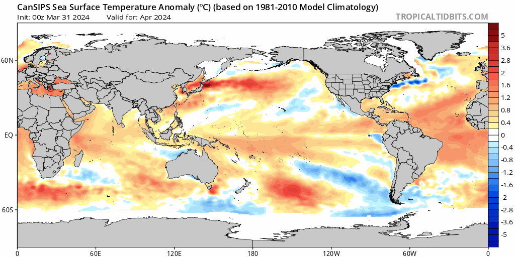
…and if the La Nina forms as currently predicted we’ll see increasing rainfall later this year. Here’s how it currently looks:
Thanks to Meteologix / Tropical Tidbits for the images. Animations by Bellingen Weather and Tropical Tidbits.
Thanks as always to Kombu and Snapfrozen for sponsoring this site 🙂