Cyclone Albert is still moving south through the Coral Sea, but has dry air wrapped around it and has lost a lot of its convection this afternoon:
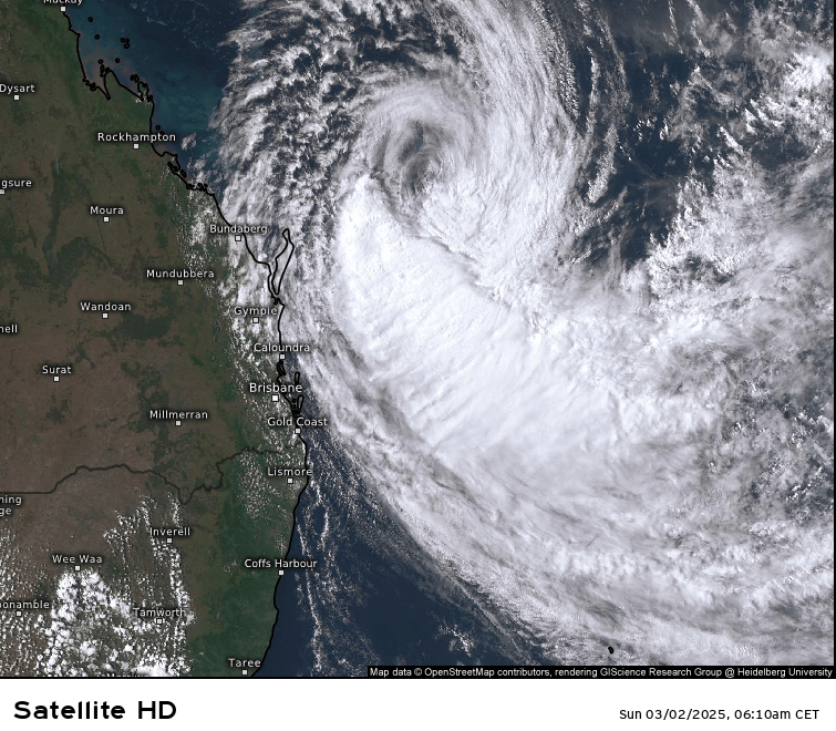
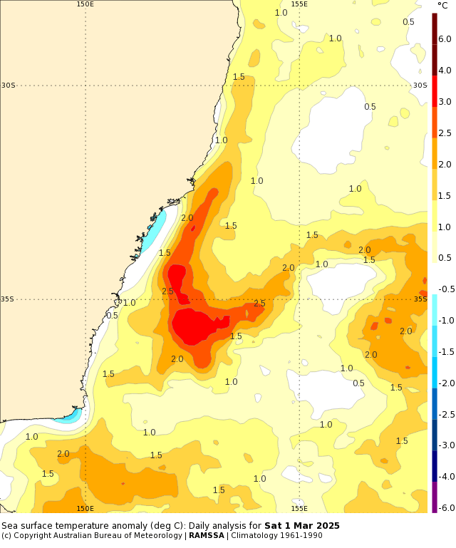
It’s still a cat 2 system right now but is likely to be downgraded to cat 1 later today…however that’s not the end of the story as it looks like it might re-intensify as it swings back towards the SE Qld coast next week. Right now the surf is starting to increase along our coastline and should continue to increase as we head through next week, with large waves and coastal erosion a real threat. Ocean temperatures are also well above average a long much of the NSW coast which has the potential to add more fuel to the fire:
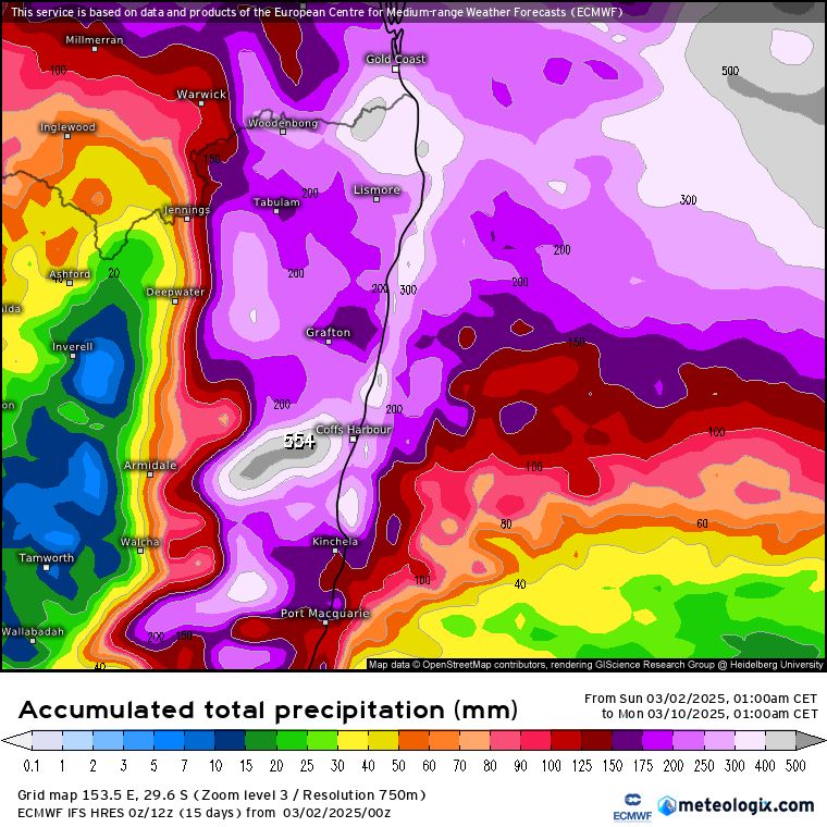
At this stage most models show the system making landfall in SE Qld through the mid to latter part of next week…and if it does it will be the first cyclone to do so since Zoe in 1974. There will be strong winds right along the coast, with focus close to where the cyclone makes landfall. The system will also bring a very deep and wet onshore flow to the south of the centre, and as a result it looks like we’ll see some significant rain later this week. 5 days is a LONG time in the world of cyclones and there is a lot of time for things to change, but right now there is a real risk that we’ll see flooding down our way as a result of the persistent onshore flow as the cyclone moves inland and weakens. Here’s how it looks from the latest GFS model:
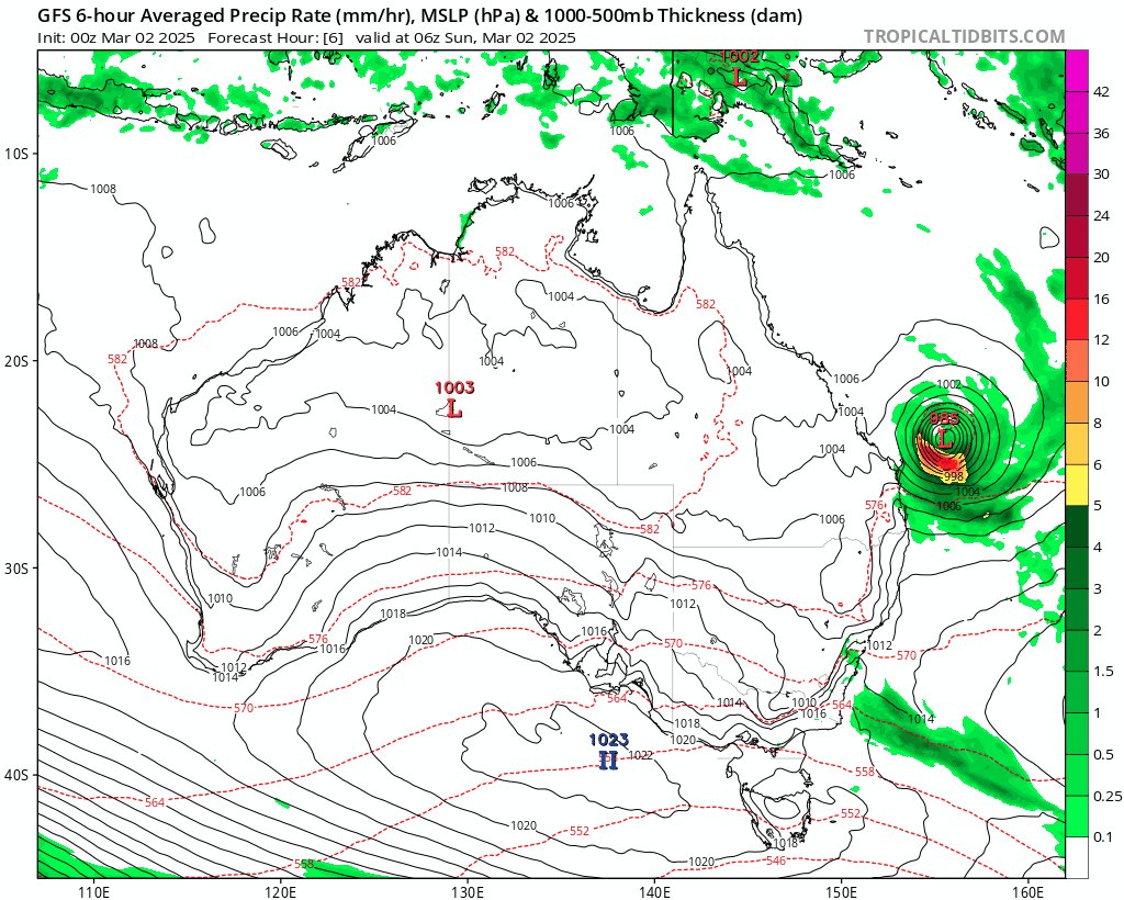
You can easily see the cyclone move ashore – and wet weather that persists to the south of the system as it moves inland. The current multi-model average for NE NSW has these 9 day totals:
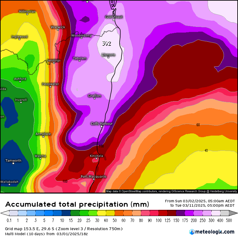
Worth noting that this is a multi model average and some models show totals well in excess of those detailed above, particularly on our hills. As noted before there are a decent number of days before this system moves in and thus time for the rain totals to change…but right now enough models are locked onto this scenario for their to be reasonable confidence that it will happen in some form – and enough confidence for the BoM to issue a very early Flood Watch for moderate to major flooding across NE NSW:
MAJOR RIVERINE FLOODING WITH SIGNIFICANT LOCALISED FLOODING POSSIBLE ALONG THE NORTHERN RIVERS AND MID NORTH COAST LATER THIS WEEK
Rainfall associated with Tropical Cyclone Alfred has the potential to cause major flooding along NSW coastal rivers from the Queensland Border to Port Macquarie, with the locations and severity of flooding dependent on the track of the Tropical Cyclone. Flooding may develop from late Wednesday, and continue until at least the weekend.
Tropical Cyclone Alfred is currently located off the Queensland Coast and is forecast to move southwards parallel to the coast before tracking westward on Tuesday. This will bring heavy and locally intense rainfall from late Wednesday over the South East of Queensland, and the Northern Rivers and Mid North Coast of New South Wales, and continuing on Thursday, Friday and into the weekend. The heaviest rainfall will be south of the Tropical Cyclone track.
Coastal catchments in the flood watch area are relatively wet. Abnormally high tides are expected to increase the flood risk in coastal low lying areas. High sea levels and large waves are likely at coastal locations, and may exacerbate flooding and cause flooding impacts.
Moderate to major flooding may develop across the flood watch area from late Wednesday into Thursday. The location of the most severe flooding will depend on the location of the heaviest rainfall, and the areas at risk will continue to be revised during the coming days.
Rapid river levels rises and flash flooding is expected across many creeks, associated with the heaviest rainfall with widespread, including major, riverine flooding possible. Flood Classes (minor, moderate, major) are only defined for catchments where the Bureau provides a flood warning service.
Catchments likely to be affected include:
Tweed and Rous Rivers: moderate to major flooding
Brunswick River and Marshalls Creek: moderate to major flooding
Wilsons River: moderate to major flooding
Richmond River: moderate to major flooding
Clarence River: moderate to major flooding
Orara River: moderate to major flooding
Coffs Coast
Bellinger and Kalang Rivers: moderate to major flooding
Nambucca River: moderate to major flooding
That warning will update daily – please check each day on the BoM warnings page. As I type the latest European forecast has just come out and again shows very large falls on our hills as well as to our north:
The latest swell mapping from the BoM also shows waves up to 8m along our coast from midweek:

As such we have an impactful week of weather coming up. If you live out of town please make sure you have enough food to see you through a flood. Please check gutters are cleared and you have access to torches and battery radios should power go out for any period of time. We have put together a list of useful online links on our Emergency Info page.
As stated before there is enough time for the forecast rain totals to change significantly as we move into the week. I’ll post again through this week with updated totals.


