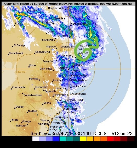
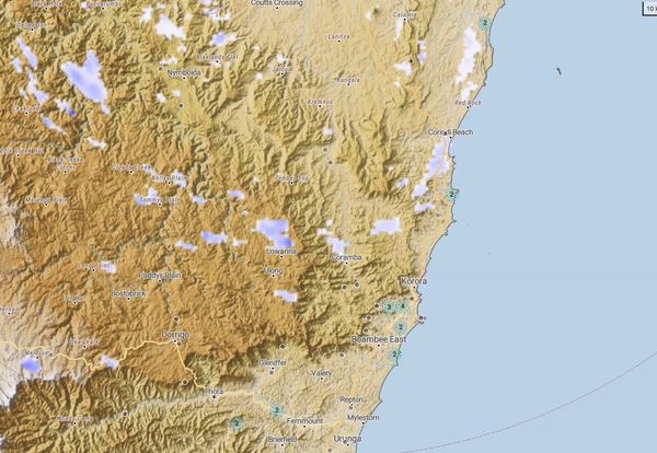
Another night of storms last night – with close strikes and decent sized hail waking many of us up late in the night. Here’s how it looked on the radar – you can see the storms exploding just west of our region and then sweeping across:
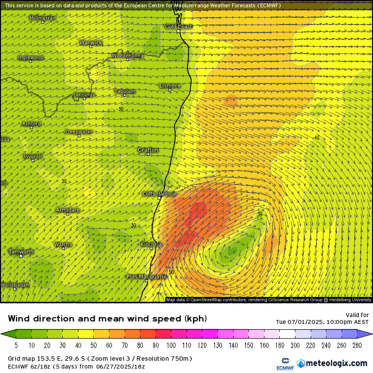
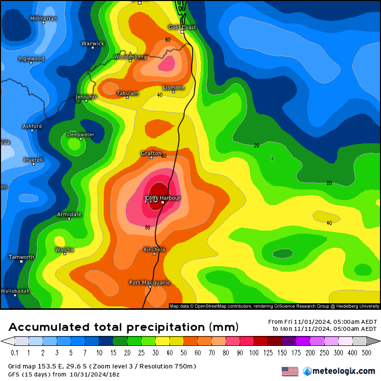
We actually missed out on a very decent storm yesterday which formed in the heat just north of Coffs – and then sat there for some time, likely giving some decent accumulations to anyone underneath:
…and that lack of cloud cover led to some decent temps, which made it up into the 30s in the centre of town. Looking ahead and we’ll have more warm days before changes move through, before the risk of storms increases once again as the changes approach. At this time it looks like the troughs will move through early and then again later next week, with temps potentially into the 30s as the changes approach. Models continue to show the potential for some decent totals in some locations over the coming couple of weeks – though as is the nature of storms don’t take the exact positioning of the higher totals as gospel:
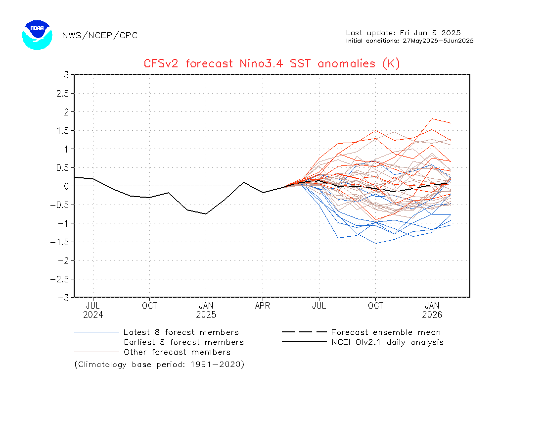
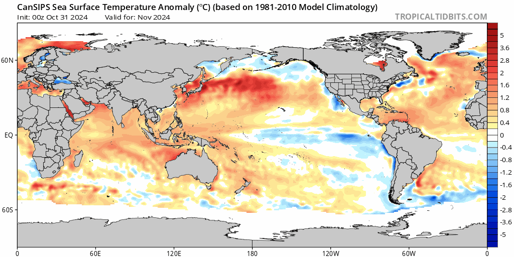
Looking longer term and it’s the beginning of the month and that means the first of the monthly models are now out – and they continue to show a weak la nina for the next few months before a distinct warm up across the tropical Pacific, potentially resulting in drier and warmer condition later next year….but that’s a long way off! Forecast sea temperature anomalies below:
Finishing today with some snippets from an interesting ABC article on our changing climate – and it looks like the number of low pressure systems we’re seeing across the country (including East Coast Lows) is decreasing as a result of climate change:
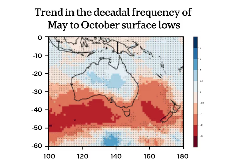
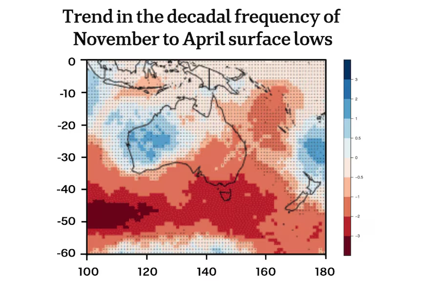
…however that doesn’t mean it is getting drier – rather we’re seeing an increase in rainfall across much of the east coast, however that rain is now coming from shorter, but higher intensity events such as thunderstorms – so the dry spells are getting drier while the wet spells are getting wetter.
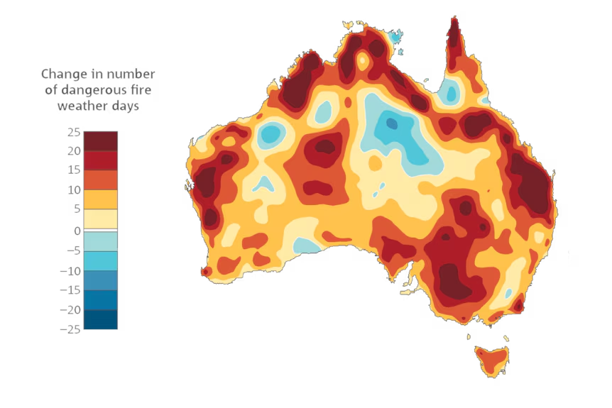
Connected with that outcome is an increase in the number of severe fire weather days across much of the country:
…something else to keep an eye on going forwards. On that happy note I’ll wish you a fantastic weekend and some good dancing for all at the Taranta Festival in town this weekend! There’s the chance of a few showers on Saturday, with Sunday looking warmer and drier. Enjoy 🙂