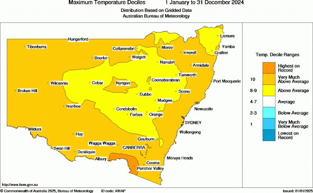
Happy New Year! Going to kick off with a quick look back at 2024 – and it was a hot one across Aus. Maximum temps were very much above average across our region for the year:
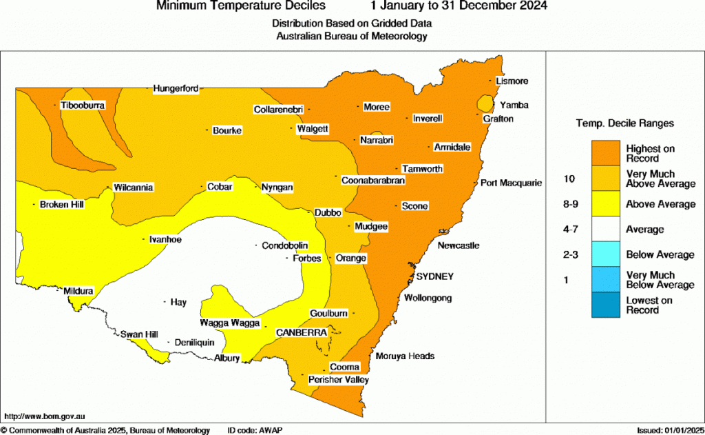
…while minimum (overnight) temps were the highest on record across pretty much all of NE NSW:
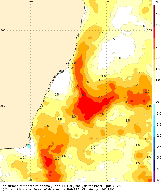
A BIG influencer on overnight temps is the ocean temperature…so as that increases over time then we’ll continue to see overnight temps rise. Rainfall through 2024 was average, though the current La Nina / warm ocean temps may produce something wetter through early 2025. Looking at current ocean temperatures and they are sitting well above average off the NSW coast:
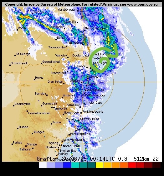
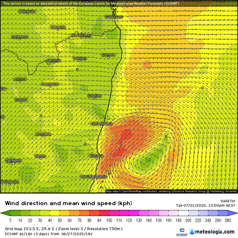
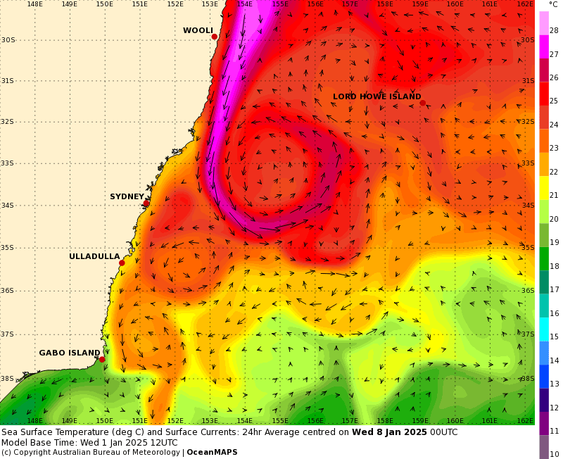
…and the East Australia Current is pumping some very warm water down the coast right now – 27c to 28c looking possible over the coming week:
We’ll likely see some showers moving in tomorrow with a change, and weather models are currently indicating that we could see some wetter weather moving in over the next couple of weeks – though details still need a lot of work -> I’ll post again if / when wetter weather looks likely.
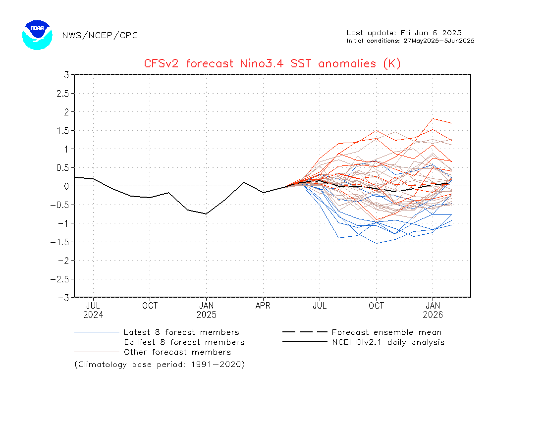
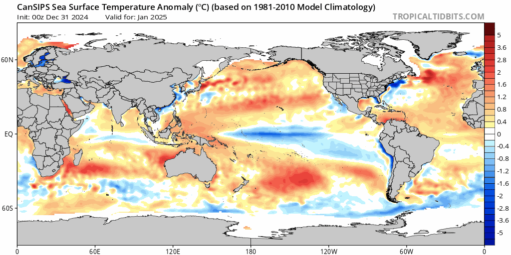
Looking even further ahead and models show the La Nina fading as we head into the middle of the year – though worth flagging that climate change is playing some decent games with broader climate patterns so there is less certainty on this than has been the case…but regardless it’s looking like we’ll see neutral conditions return as we head into winter:
Rainfall looks above average through summer before returning to closer-to-average values as we move through the year – but with those much warmer than average ocean temperatures likely to remain along our coast there’s still a good chance of decent rain events when the elements line up.
Temperatures are looking like they’ll remain fairly high, with above average looking likely through much of the year across our region:
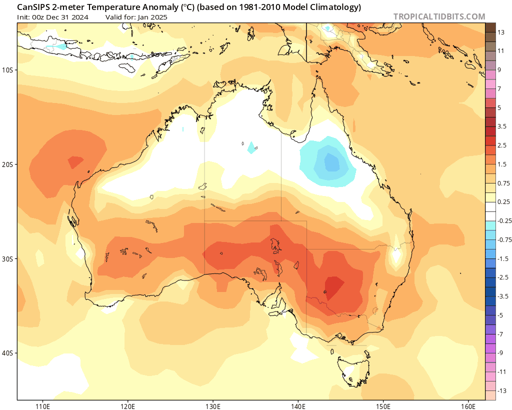
Worth noting the cooler temps forecast across inland N Aus through summer – a good indication that models are forecasting a wetter-than-average monsoon across those areas.
For now wishing you all the best for 2025, thanks to Tropical Tidbits and BoM for the images, and a thank you to Kombu Wholefoods and Snapfrozen for ongoing sponsorship of this site 🙂