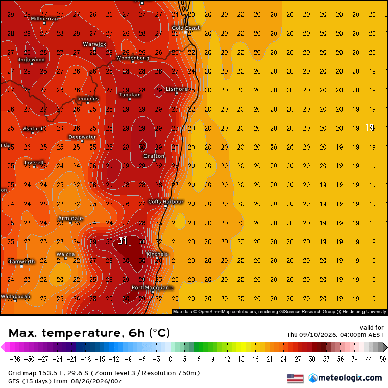
We’ve got a big change incoming this week – the sunshine will give way to a lot more cloud and some showers, and the temperatures will drop significantly. Kicking off today and we’ve got temperatures in the 30s – and this is how much above average they’re sitting:
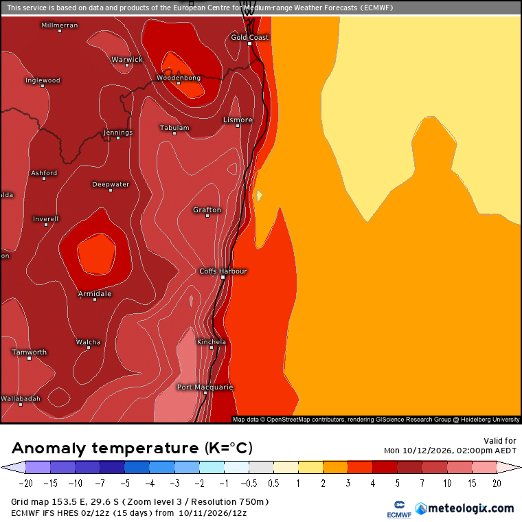
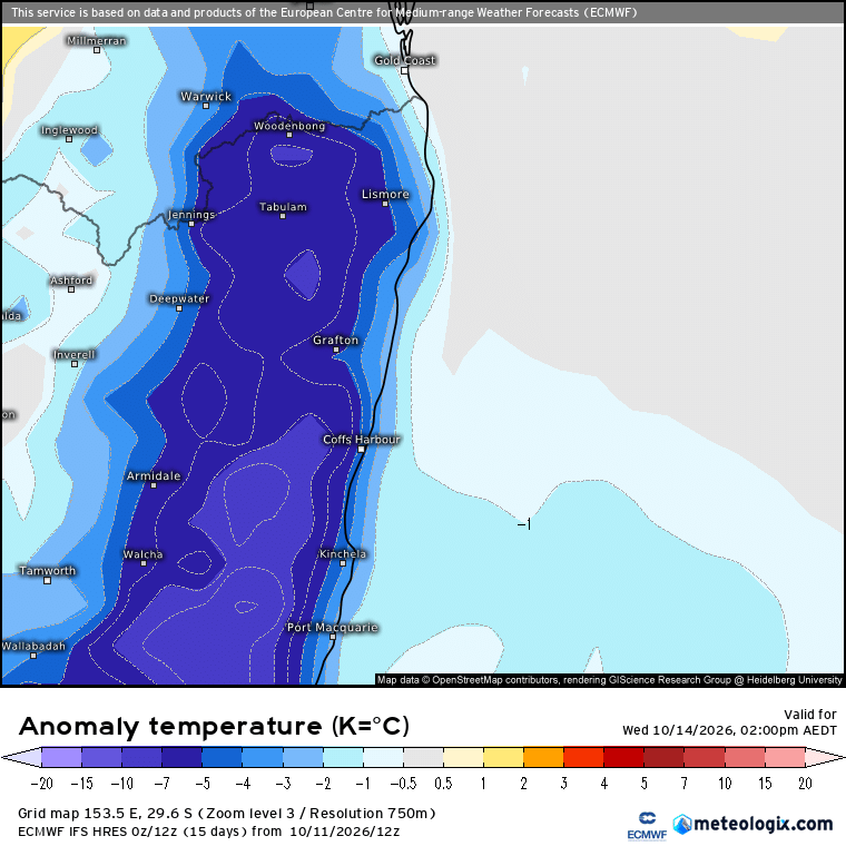
…but we’ve got a significant change moving through tomorrow bringing much cooler weather – in fact by Wednesday we’ll see afternoon temperatures sitting well below average:
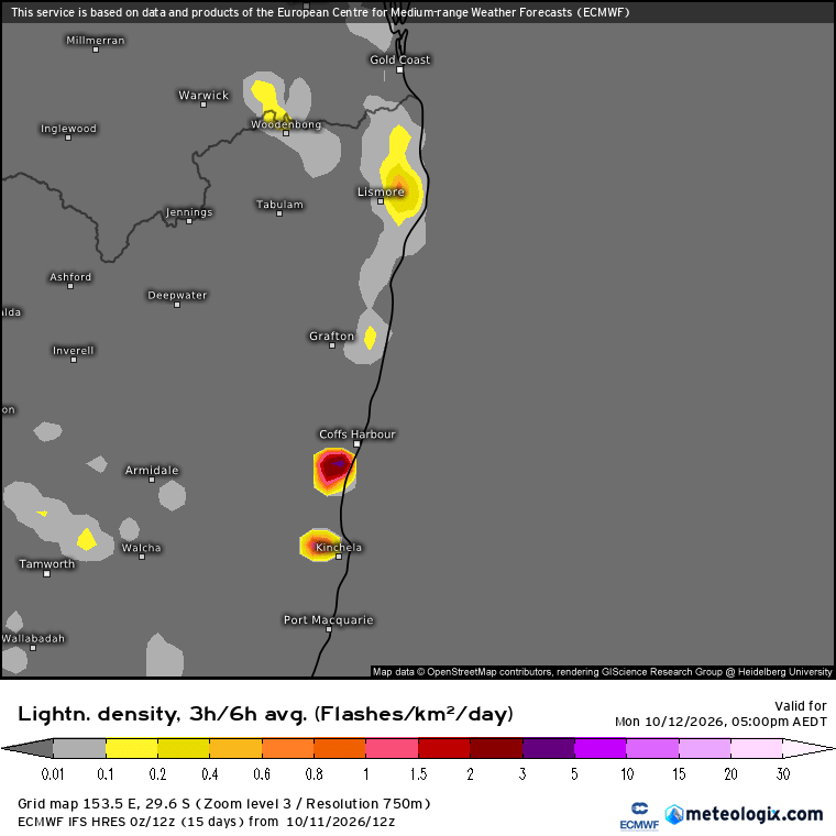
When you’ve got that strong a change moving in you usually see storms – and that will be the case this week. There’s the chance of a storm this afternoon, as we can see on the forecast lightning map for 5pm today:
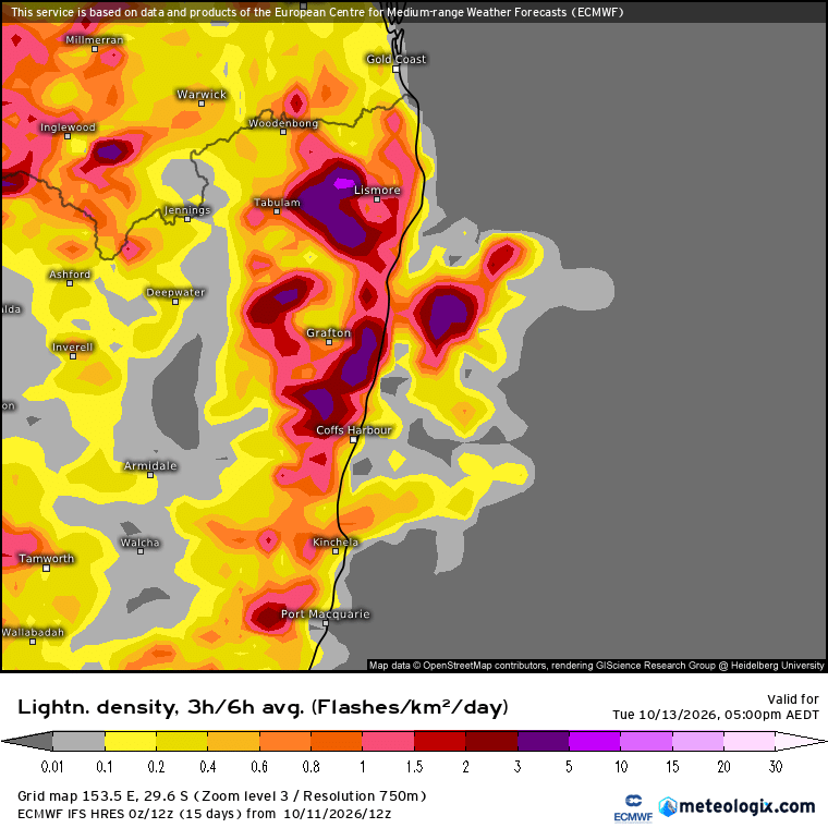
…but move ahead to the same chart for Tuesday afternoon and we can see how much more widespread storms will be:
Storms being storms, as is usually the case not everyone will see one, but if you do it has the chance to have a decent impact. At this stage it looks like the strongest focus will be just to our north, but we’ll see how it goes on the day. Here’s how the BoM sees Tuesday:
Thunderstorms are possible (>10% chance within 10 km of a given point) in the central and western areas Tuesday morning, extending to the northeastern areas through the day, while becoming more frequent in the northeast during the afternoon and evening as a southerly change crosses the region.
Severe thunderstorms are possible (10-30% chance of becoming severe if thunderstorms develop) along the north coast and adjacent ranges during the afternoon and evening. Damaging winds (gust > 90 km/h), large hail (diameter > 2cm), and localised heavy falls leading to flash flooding are all concerns.
Once the change moves through we’ll see a high sitting to our south and that means winds turning onshore. Without further cold fronts to push the high away the onshore winds could last for some time. Those winds will bring a lot more cloud, some showers and help maintain much cooler temperatures. Here’s the forecast rain totals over the coming week – the potential for quite a bit more than we’ve seen recently:
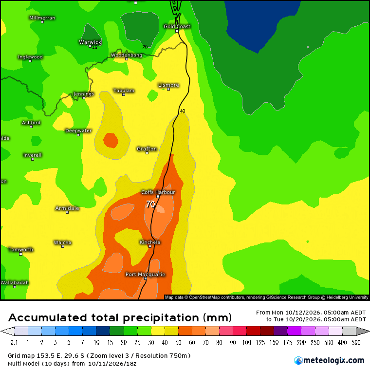
Don’t take those totals for granted – as with all showery periods we could see the focus to our north or south (and thus lower totals)…and could equally see a stream of showers across our region (and thus higher totals).
After this showery spell moves through it may dry up a little – so fingers crossed we see some soaking totals over the coming week! Worth noting the Grafton radar is down at the time of writing (EDIT – now back up) which is less than ideal. Hopefully back up before the Tuesday change rolls in.