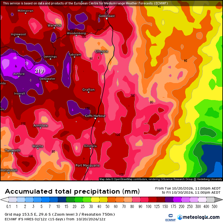
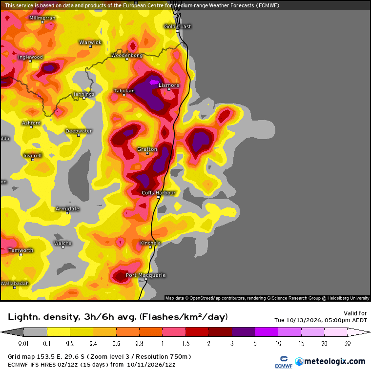
A quick post about tomorrow…which is looking like it could be fairly stormy….and a chance for a quick look at longer term outlooks as we head into a new month.
First off tomorrow…and we have a dynamic situation evolving across NE NSW. A surface low will move across our region, drawing in warm, humid north easterly winds as it does. Combine that with strong sunshine and rapidly cooling uppers and you have a very volatile situation. Here’s how it looks on forecast charts:

The yellow and green show the upper trough moving in, cooling upper temperatures, which the lines show the surface feature. It’s a classic set up for NE NSW. One measure of potential storm energy is to use CAPE. CAPE (Convective Available Potential Energy) measures the amount of energy available in the atmosphere to fuel rising air, thunderstorms and potentially severe weather. Measured in joules per kilogram (J/kg), the higher the CAPE, the greater the potential for strong updrafts and intense storms. As a general guide, 0–100 J/kg indicates very little instability, 100–500 weak instability with possible showers or isolated storms, 500–1,000 moderate instability with thunderstorms possible, 1,000–2,000 strong instability supporting potentially heavy rain, lightning and hail, 2,000–3,000 very strong instability with a greater risk of severe storms, and above 3,000 extreme instability capable of supporting exceptionally powerful thunderstorms. Here’s the forecast CAPE for 2pm tomorrow:

As you can see we’ll be hitting some very high levels tomorrow across parts of NE NSW so severe storms are likely. According to the BoM storm forecast for Tuesday: “Severe thunderstorms are possible (>10% chance of becoming severe with any storms in the area) in the northeast and central east (including the Sydney Metropolitan Area, the Central Coast, and Wollongong) from the morning, becoming more likely (>30% chance of becoming severe) in the northeast (red area) from the late morning, including Northern Rivers, Northern Tablelands, parts of Mid North Coast districts and northern slopes.
Damaging winds (gust > 90 km/h), large hail (diameter > 2cm), and locally heavy falls leading to flash flooding are all concerns with severe thunderstorms. Isolated high-end severe thunderstorms are also possible in northern parts of Northern Rivers and Northern Tablelands districts, where giant hail (diameter > 5cm) and destructive winds (gust > 125 km/h) are all concerns if such storms eventuate. The risk of tornado in the area remains a watch point.”
It will be a dynamic day, not everyone will see a severe storm, but some locations will certainly feel the full affects of mother nature. Strong sunshine in the morning will add fuel to the event – and in these situations we can sometimes find the local hills kicking off storms fairly early which can save us from the strongest impacts later in the day…but regardless one to watch. If the days kicks off with blue sky and strong morning sunshine then we are more likely to see stronger storms, but even with morning activity the strongly unstable atmosphere might still throw a few surprises in our direction.
Worth noting that we’re already seeing some strong storms today – here’s the latest radar image:

Black usually means hail – and the current warning states: “VERY DANGEROUS THUNDERSTORMS are likely to produce large, possibly giant hailstones, damaging, locally destructive winds and heavy rainfall that may lead to flash flooding over the next several hours in parts of the Northern Rivers and Northern Tablelands districts. Locations which may be affected include Grafton, Woodenbong.”
A good early heads up of what we might see tomorrow…
A quick look further ahead and models indicate temperatures likely to move increasingly above average over coming months – here’s the current forecast from one of the top models out to July next year (you can see the month of the forecast in the centre towards the top of the images):

Looking at another model – this one runs out to October next year – and we can see it is also forecast higher than average temperatures, giving us more confidence that we’ll see this outcome:

The first model is also indicating the risk of higher than average rain fall through to July next year – despite the El Nino:

…however the second model doesn’t have such a strong wet signal – here’s how it runs from December through October:

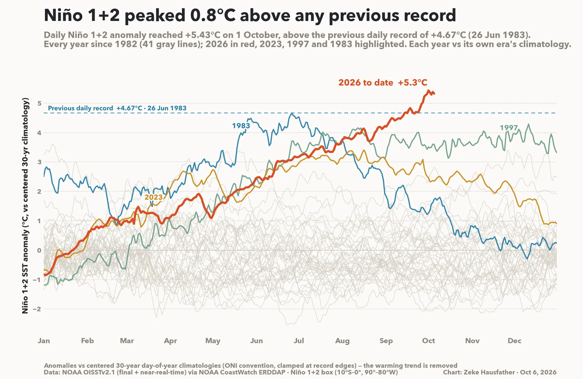
The takeout from all those animations? Higher than average temperatures appear pretty much locked in through into next year – and they may in fact start running well above average as we head into 2027. This fits with the huge El Nino kicking vast amounts of heat into the atmosphere. Rainfall however is less certain – the southern circulation is trying to push wetter while the El Nino tries to push drier. The extreme eastern focus of the El Nino also means it has less of an impact across our region – as such we may see some wetter months, but there is less certainty about that outlook.