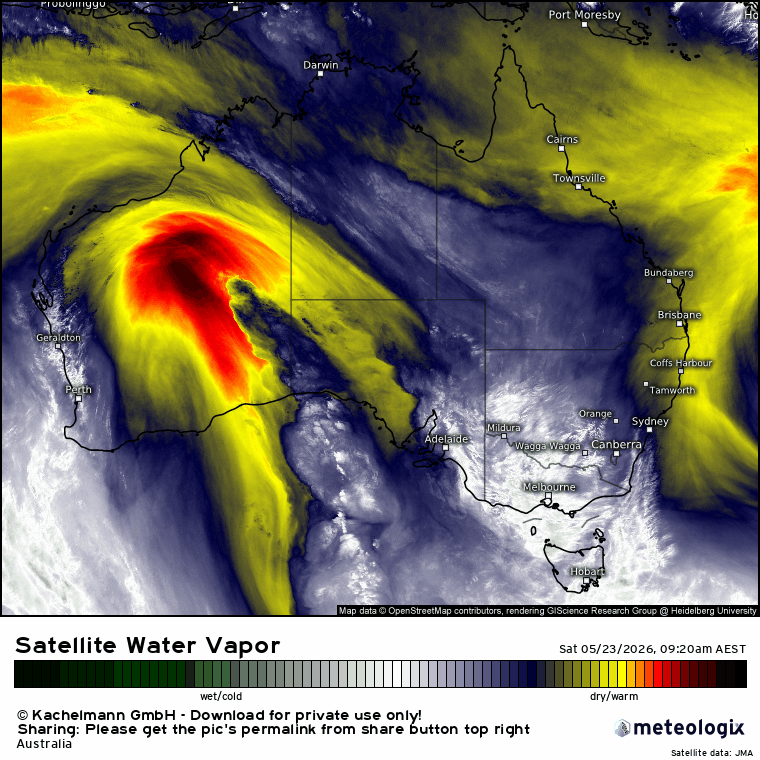
Wow, was a hot one today, glad to get that out of the way! The good news is that we have a change coming through tomorrow…and that change has a higher chance of producing storms than they saw down south this afternoon. A big reason for that is because the uppers are going to look a lot different tomorrow compared to today. Today we saw an upper ridge bring higher temps up high and a decent level of stability. You can see it (just) in this chart from 4pm today – I’ve highlighted the upper trough:
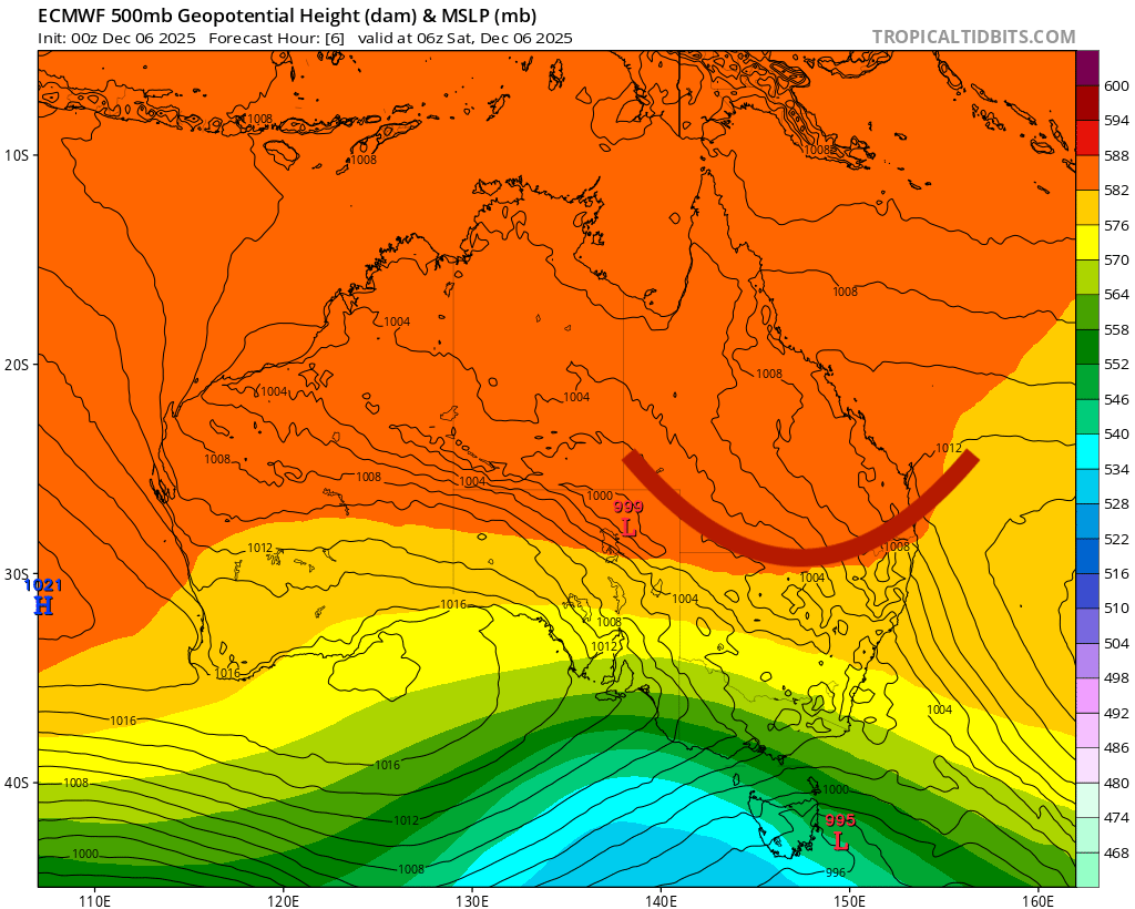
…but coming in from the west we can see an upper trough moving in. It’s going to be transient, but is likely to move across above us as peak heat tomorrow. That trough will bring slightly cooler temps up high and more in the way of instability:
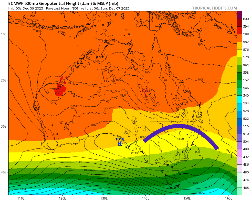
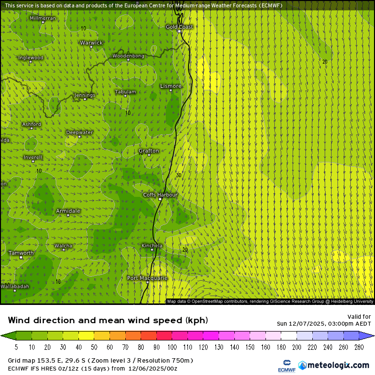
We’ll also see a southerly change moving through tomorrow afternoon, again at around peak heat:
Those winds moving in from the north before the change are moving over some very warm ocean…add in good moisture levels, decent levels of morning heat (assuming morning cloud doesn’t hang around for too long), cooling uppers and a southerly change…the result should be some decent storms kicking off. As is usually the case not everyone will see them – but if you do catch one you’ll likely know about it. In the words of the BoM:
“For the Mid North Coast and the Northern Rivers, there is the chance of severe thunderstorms resulting in large hail (>2cm), damaging winds and heavy rain, with the chance of heavy rain more likely north of Port Macquarie. There is also the chance of giant hail (>5cm) and destructive winds (>125km/h) for the Mid North Coast and Northern Rivers, particularly for southern parts of the Northern Rivers and northern parts of Mid North Coast.”
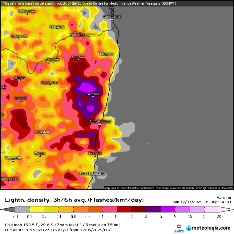
Needless to say the lightning forecast for tomorrow arvo is looking decent:
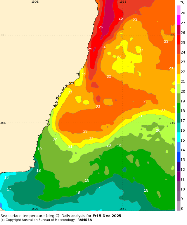
A quick couple of notes to finish – ocean temps off our coast are now sitting close to 26c, which is well above average for early December. There is a pool of colder than average waters further offshore – will be interesting to see how that one develops over coming weeks. Here’s the current ocean temps and anomalies:
Latest long term model runs are now in and continue to show the end of La Nina over coming months with warmer than average temps likely across the eastern Pacific by the middle of next year:
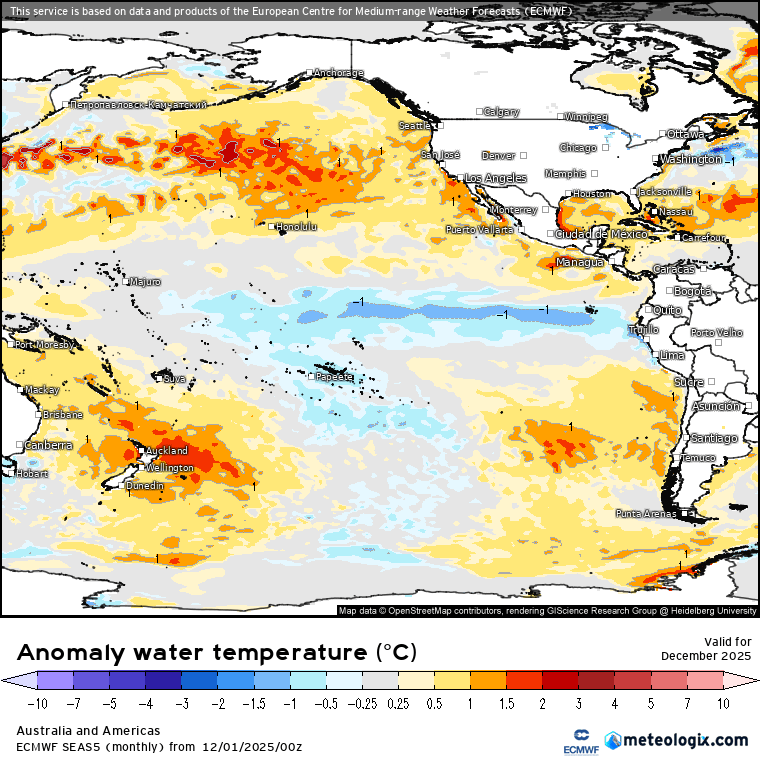
…and that could result in drier than average conditions during next spring…but that’s a long way off. if it does come off as currently forecast we’ll be grateful that the southern circulation weakness happened this year and only comes around rarely.
Enough on that for now, and thanks for reading 🙂