We’re now through the end of March – and it was a wet one. Nearly 700mm recorded on the Bellingen Weather station, which from my records is only second behind 2001 for March rainfall. The plateau saw even higher totals than the valley – anyone else looking for some sunshine?
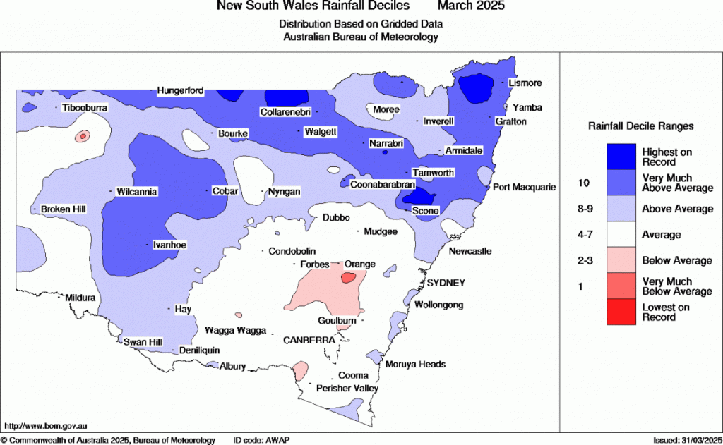
Rain totals across NSW looked like this for March:
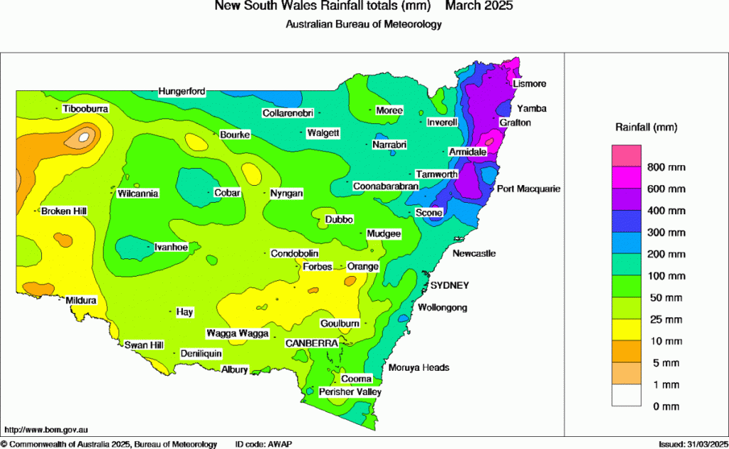
….and that’s a lot higher than average:
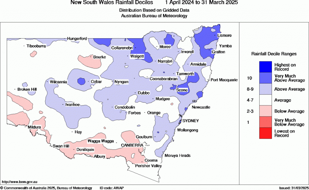
Those totals add to a much wetter-than-average 12 months to the end of March:
it might have been wetter than average but it has also been warmer than average – Australia has experienced its hottest 12-month period on record, ending with its hottest March on record, with last month seeing temperatures 2.41C above average! If we see temperatures that high when so much of the country has been wetter than usual then just wait until the next El Nino…
After all this rain the good news is that we should *finally* see some sunshine moving in for this weekend – just in time for the River Sounds festival at the showground. Looking further ahead and we should see the really wet weather ease back a little over coming months as the current atmospheric La Nina conditions return to neutral.
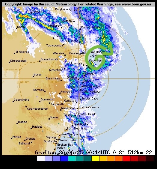
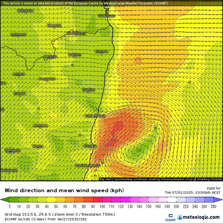
What is also worth being aware of in the meantime are the well-above-average ocean temperatures just offshore:
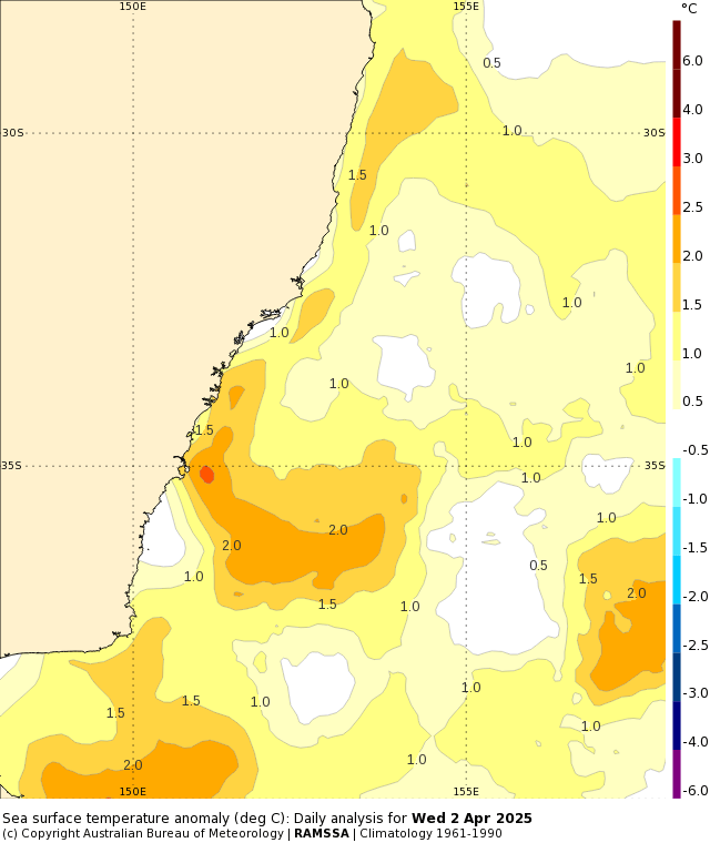
Those above average ocean temperatures will likely lead to more above average daytime – and particularly nighttime temperatures – over the next couple of months. The additional energy in our oceans also increase the chance of heavier rain events when other conditions line up. It’s worth noting that the ocean off the Queensland coast is sitting even higher above average:
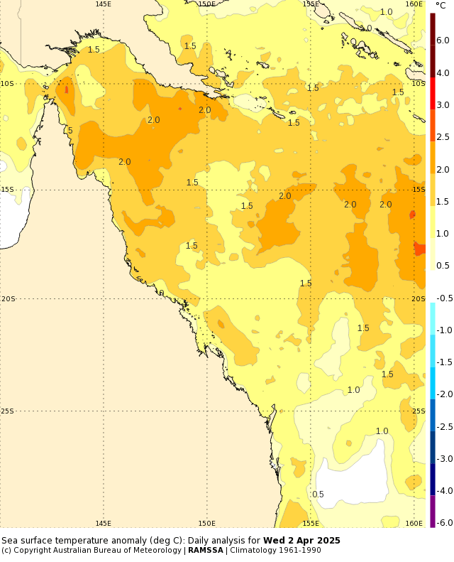
The East Australia Current will pump some of that Queensland above average water south along our coast over the coming week, with offshore ocean temperatures once again likely to hit 27C+:
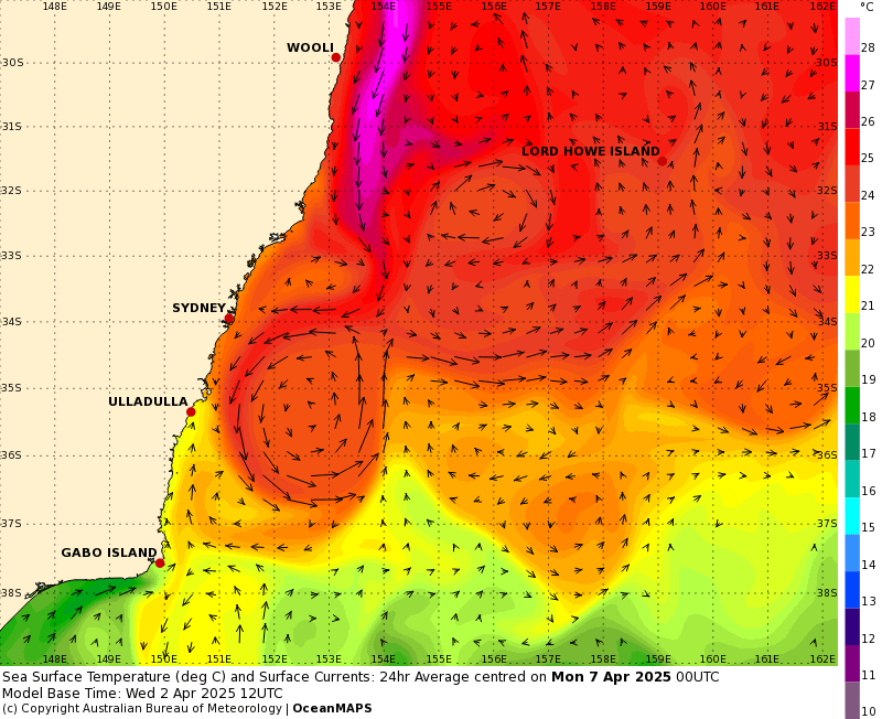
I’ll keep an eye on potential events and post again when anything looks likely – 27C ocean temperatures are easily high enough to power some decent downpours across our region…something we don’t really need right now.
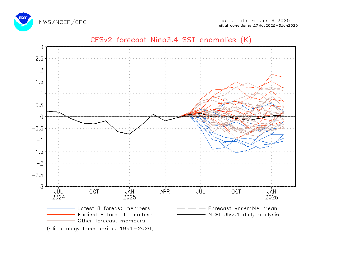
This is the time of year when it’s hard to know where the Pacific will head. That’s represented in model output, with some models showing weak La Nina / cool neutral conditions at the end of this year:
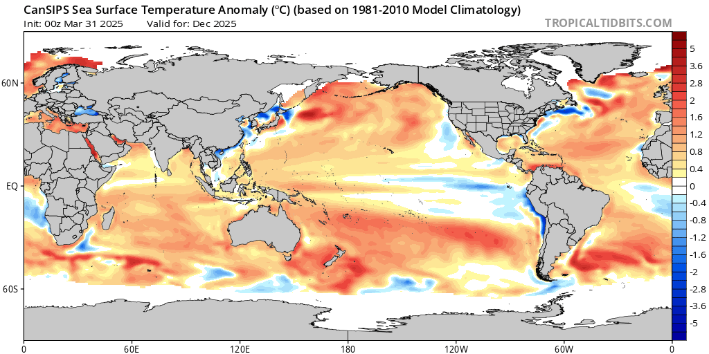
…while other models show more El Nino-like conditions:
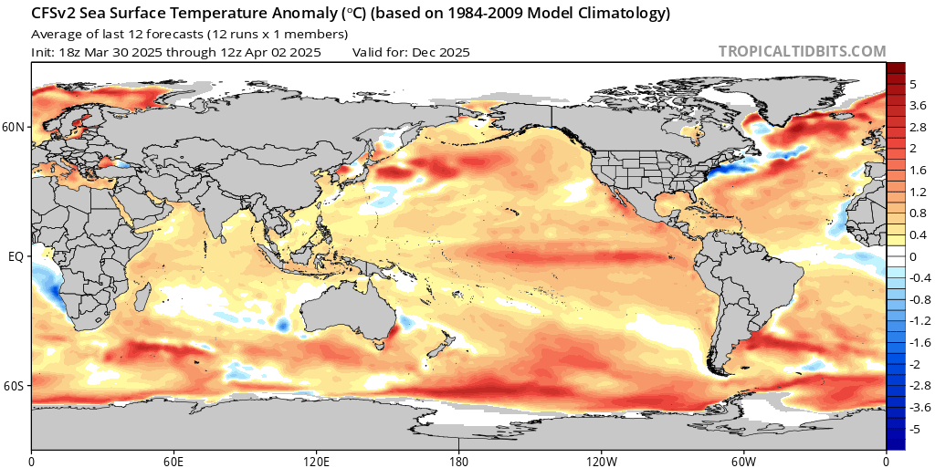
…I’ll post more on the Pacific when models come into alignment. One thing that does indicate the change in the seasons is the Antarctic vortex, which has been absent for some months but is currently in the process of forming once again. Here’s how it’ll look in a couple of weeks, stretching from high in the atmosphere right down towards the surface:
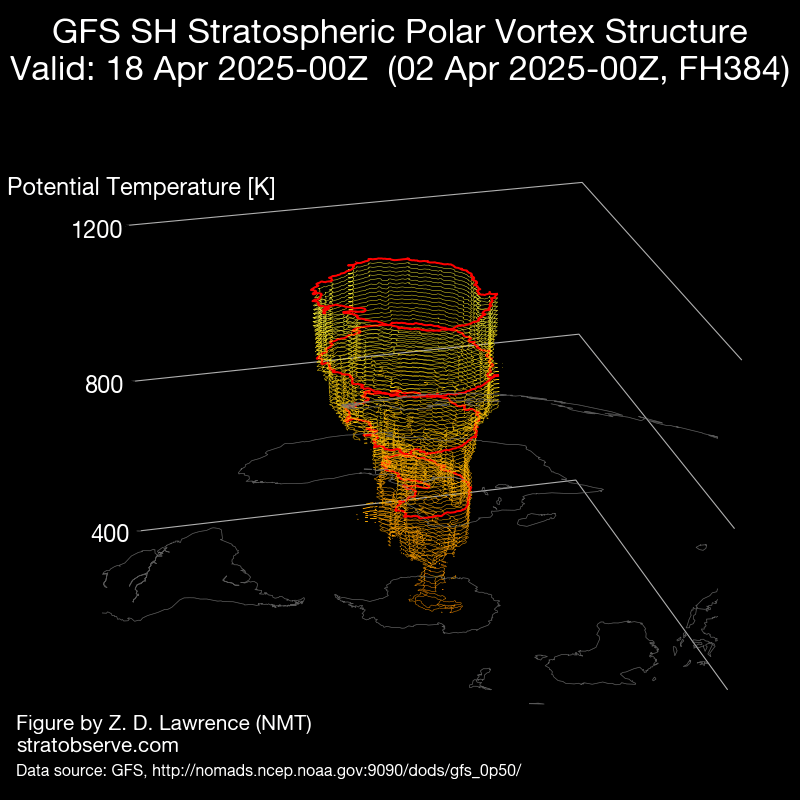
Once the vortex is in place then we need to keep an eye on its position and strength over winter as it becomes one of our key cool season climate drivers. Excuse the pun but pretty cool hey!
Thanks for reading – and thanks to the numerous weather sites and clever individuals who supply images for us to use. Thanks also to our sponsors 🙂