Sometime since my last post, apologies! Time for a quick update on what’s happening weather wise around our area. It’s been a pretty dry month so far – here’s the current percentages for September:
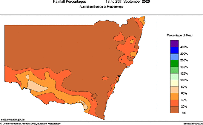
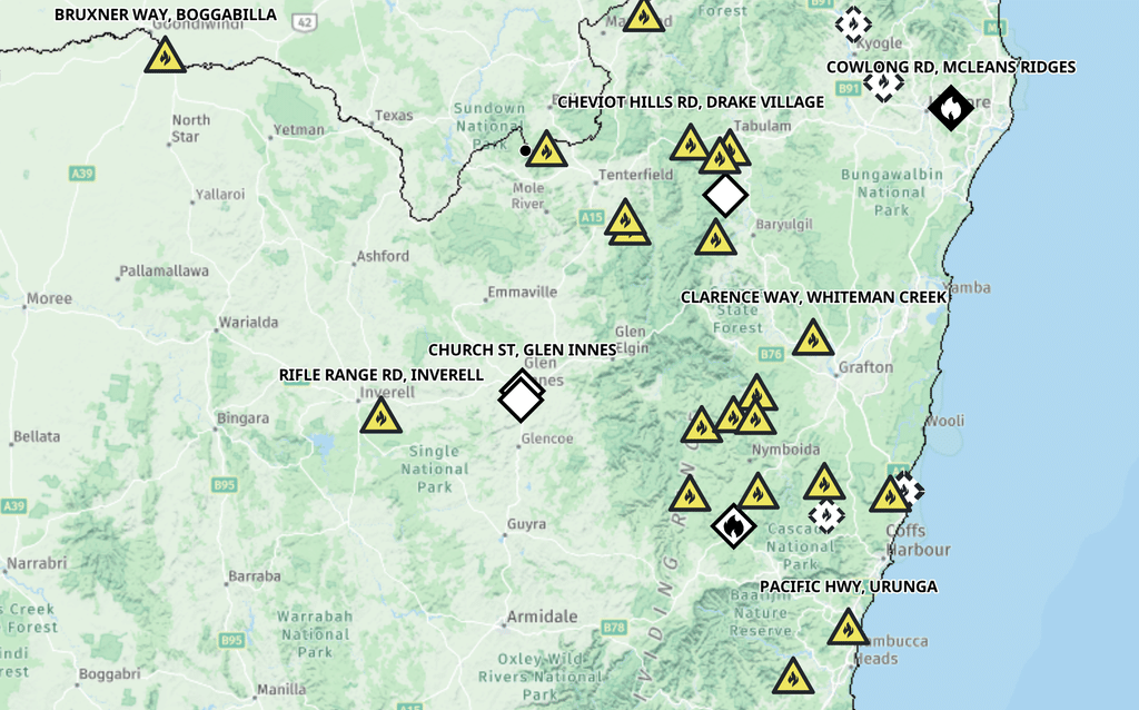
Between 0% and 20% across our region so perhaps not a surprise we’ve had some fires across NE NSW. Here’s the current fire map – very dry out there:
A couple of key reasons for the drier weather –
- It’s that time of year – this is typically our dry season so not that unusual to see some longer dry spells
- The El Nino is in full swing and is having an increasing influence on our weather – more below
- The Southern Circulation has been negative the last few weeks – again more below
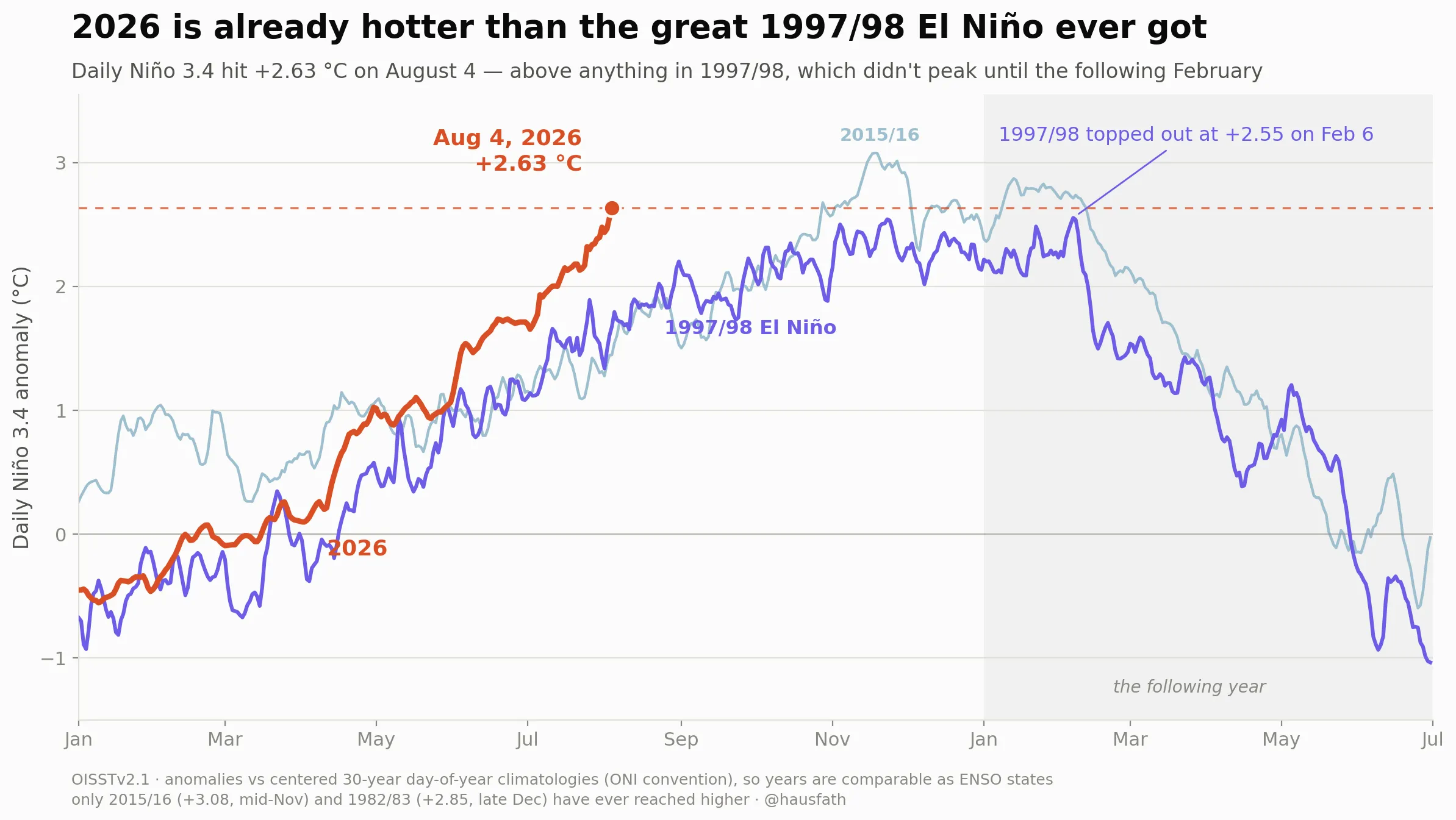
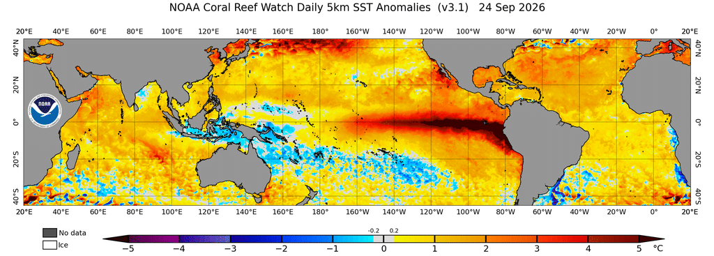
Yep El Nino – the big one that is only just starting to show it’s strength. Here’s how it looks right now – check out how much heat is sitting in the eastern Pacific – and worth noting the cooler than average ocean temperatures in the Coral Sea:
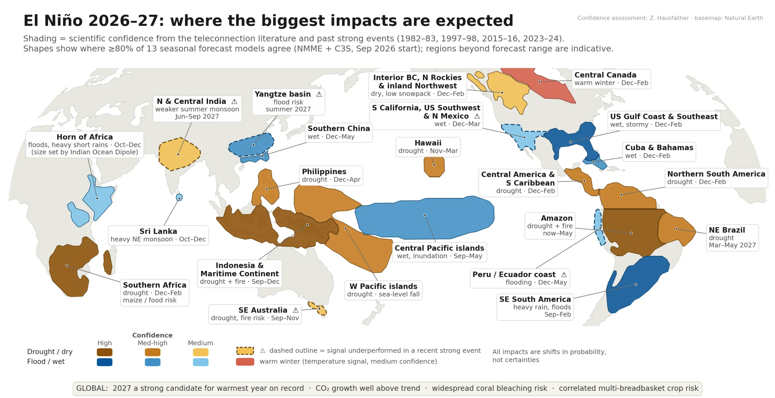
This El Nino will continue to strengthen over coming weeks before slowly declining as we move through 2027. Worth noting that while El Nino traditionally brings drought to eastern Australia, models this year are now flagging that this is less of a chance than we would normally sea as climate change fuelled warm oceans bring higher than usual humidity across our coasts. The current thinking looks like this:
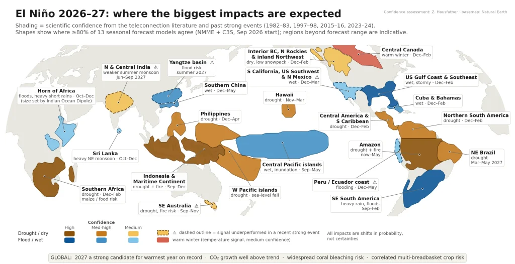
A big global flag from that map is the significant drought picture across Indonesia, Southern Africa and the Amazon. If it plays out as forecast we could see significant drought / bushfire threats across those regions through summer. Conversely the southern parts of South America and North America could see some real flooding concerns over the coming 6 months.
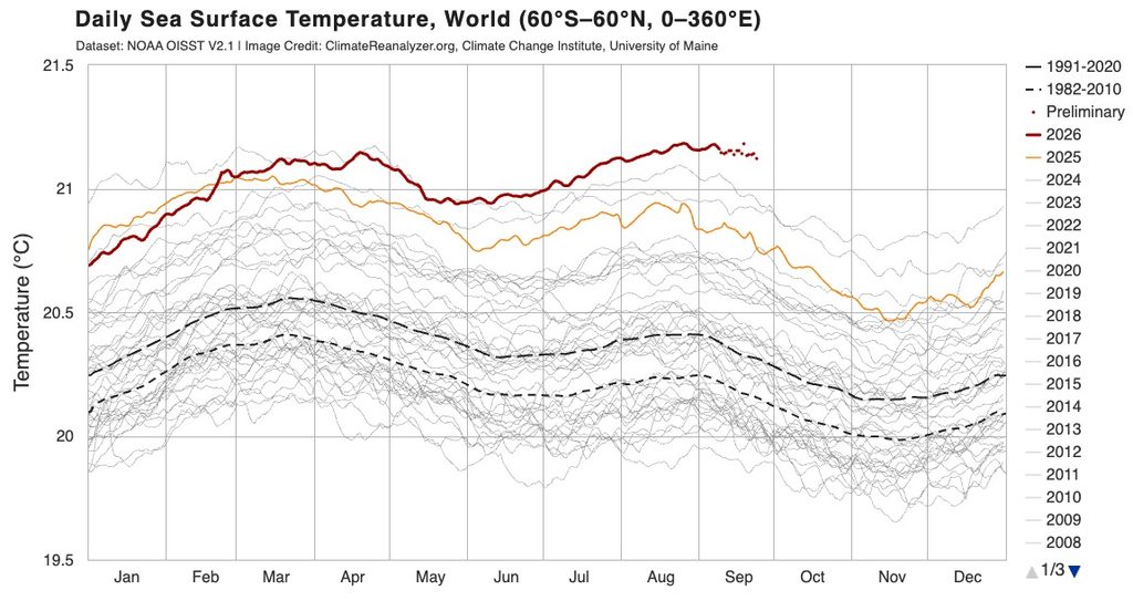
We can also see from global ocean temperatures just how much warmer than usual (in fact how much warmer than ever recorded before) ocean temperatures are sitting right now:
The Southern Circulation is also a big player for us at this time of year. If we look at the current chart / forecast…
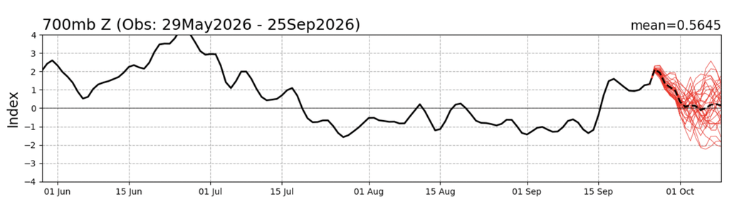
…we can see it sitting positive through much of July (when we saw damper conditions) then turning negative through August and mid September (which brought us much drier conditions)…and then turning positive over the last couple of weeks (so perhaps some wetter weather to come)…before returning to neutral as we move into October.
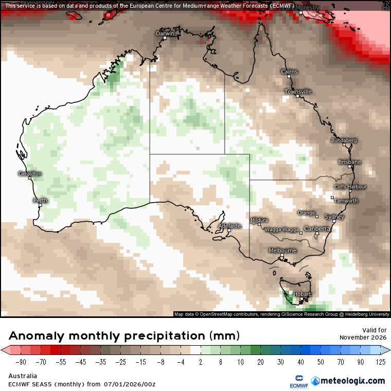
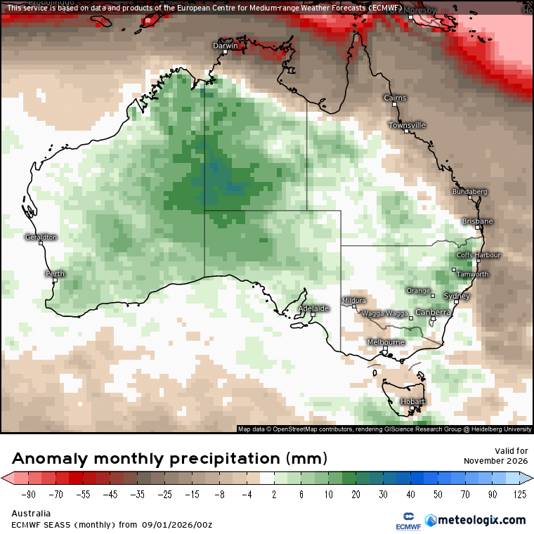
So what does that mean going forward? An increased risk of showers and storms over the next couple of weeks, particularly over the hills. Models are also indicating a similar pattern as we move through into November – the European model has been trending wetter over recent weeks, particularly for just inland and over the hills. If we compare the July run to now we can see how it has trended wetter away from the coast:
July forecast for November:
Current forecast for November:
This is reflected in the current thinking from the BoM, which shows much wetter conditions likely for much of Aus for November through January:
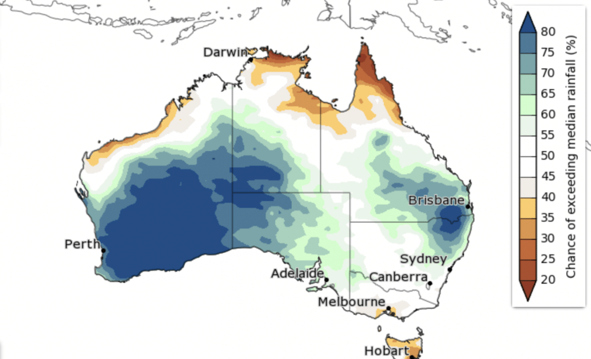
Much of this forecast depends on how the southern circulation plays out over coming weeks. The southern circulation is notoriously hard to forecast. A weakening of the vortex is actually currently looking plausible and there is already some evidence of disturbance. Model runs are looking more interesting than they were a week or two ago, particularly if the current wave activity continues and propagates downward…but we’re not there yet and there is no certainty about any outcomes. If it does weaken we could see a push towards drier conditions as we head into the latter part of the year as it combines with the El Nino – but if it doesn’t happen then the warmer than average oceans could give us wetter weather at times regardless of the strength of the El Nino…it’s complicated (but fascinating!) What we can say right now is that we’ve got multiple forces at work and which ones will the battle is yet to be determined. Worth being aware but not alarmed. I’ll update southern circulation forecasts over coming weeks as outcomes become clearer.
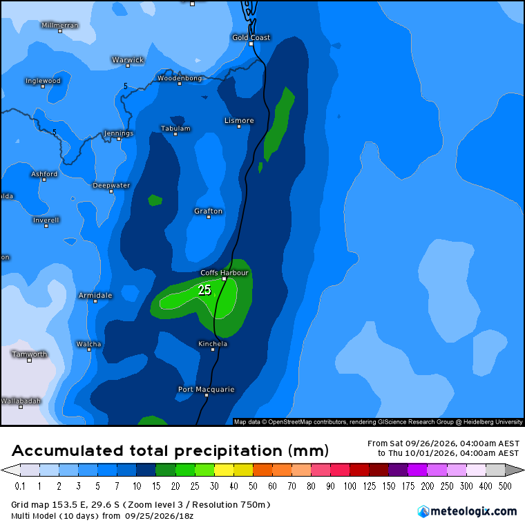
At times like that it can be worth focussing on what we can see happening in the short term – and right now what we can see is a much stronger southerly change moving up the NSW coast later on Sunday / Monday. Combined with some cold air up high we could actually see some showers / storms through Monday. Not everyone will see bigger totals but some locations, particularly hills and inland, could see some reasonable falls, fingers crossed. Models show a range of outcomes, but most show us getting our best falls for some weeks. An average across all models gives us these totals:
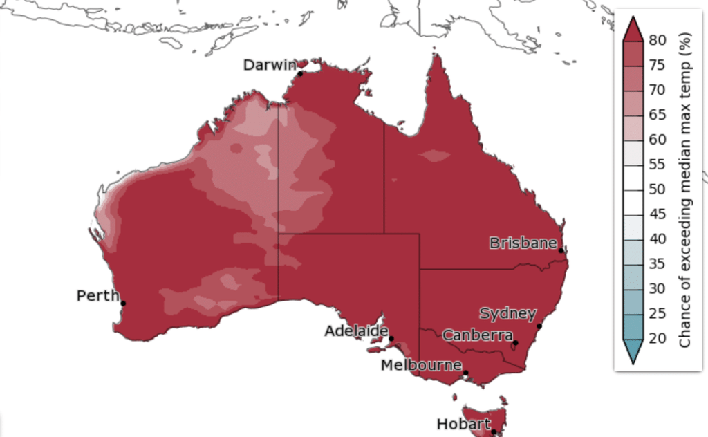
Once thing not mentioned so far is the temperature – and there is more consistency between models on this one. It’s still looking like we’ll see warmer than average conditions at times right through summer. This is also likely to be a theme through 2027 as the heat from the El Nino remains in the atmosphere even after the event has concluded. Current November through January BoM forecasts offer this outcome:
On that warm note I’m going to head off – back again with another update soon. Thanks for making it to the end, and thanks to Kombu and Snapfrozen for continuing to sponsor this site 🙂