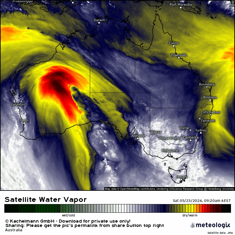
A fairly benign period of weather for our region right now, which gives us a chance for a quick look forwards (and backwards). First off the rank – rainfall last week. As per the models there were some BIG totals across far NE NSW and much of Queensland. Here’s the one week totals across Aus:
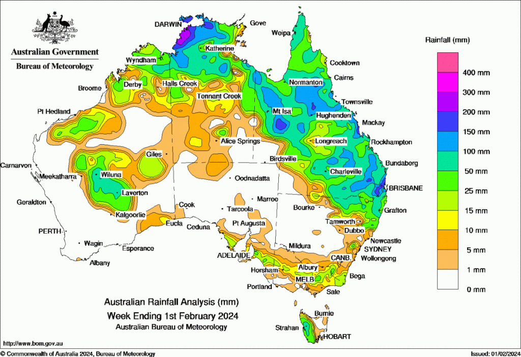
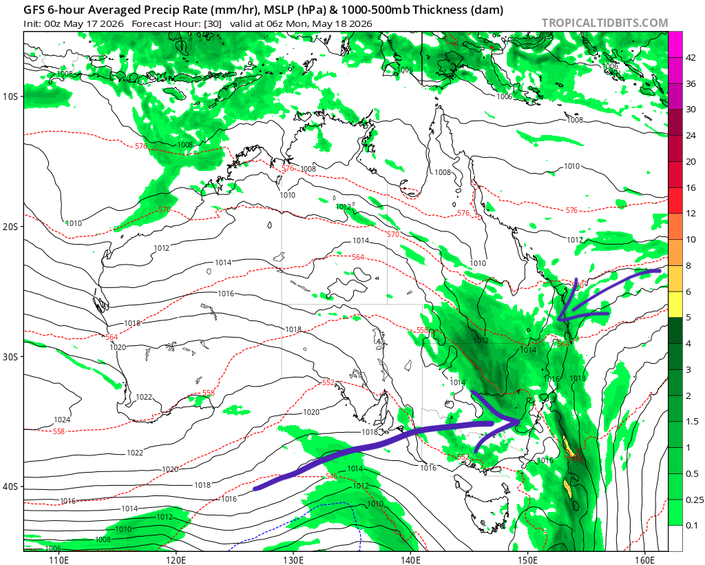
We missed out on the higher falls, which is likely a good thing with local soils relatively wet after recent rains. Looking slightly further ahead there are a number of monsoonal lows circulating around Aus. At this stage there are few indications that we’ll be impacted by any of them, but if that changes I’ll make a post.
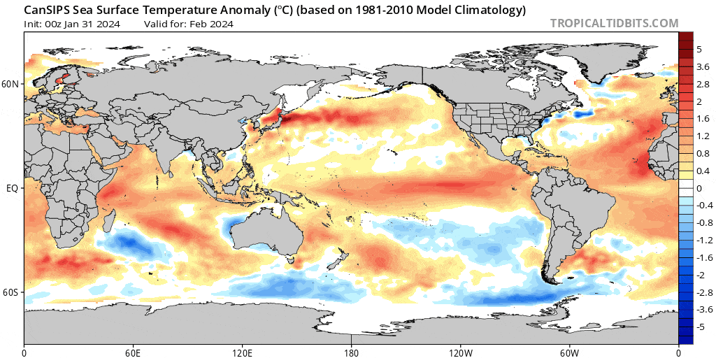
Looking further ahead and models are still confident with a relatively strong La Nina developing over the coming months and lasting into (and likely through) next summer – so much higher chances of wetter weather ahead. Here’s the latest outlook from the Canadian model – which looks fairly close to all other models at this time:
And sure enough, here’s how the forecast rain looks across the coming 11 months – you can easily see the move from drier to wetter conditions:
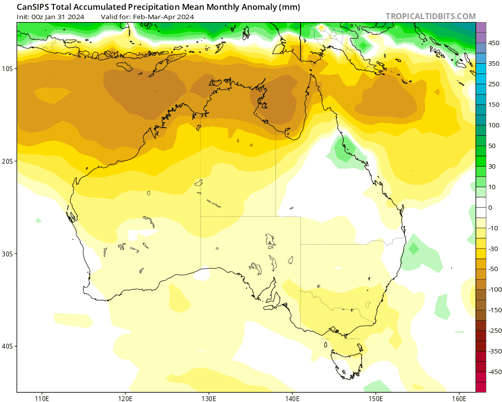
These are only odds – so there is still a chance of seeing a wetter spell in a drier month and vice-versa…but La Nina does tend to have a decent impact across our region so there is some confidence in the move from drier to wetter conditions. Some good news – if we do see increased rainfall later this year we’ll also likely see local temperatures returning closer to average:
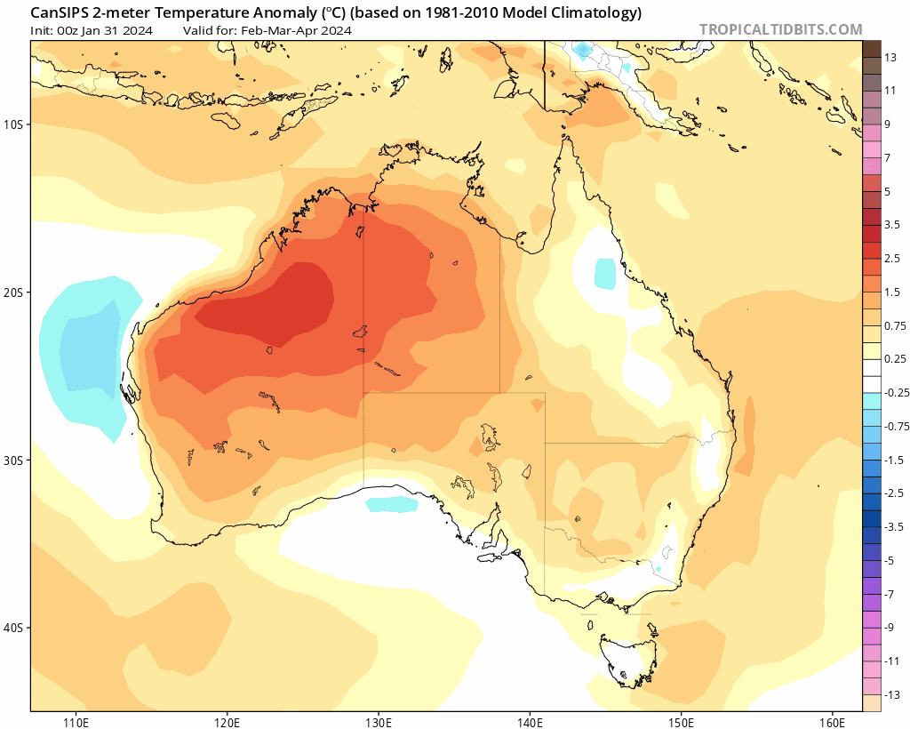
Again we’ll still likely see some hot days, but the day to day chances are likely to be lower than they have been this summer.
Thanks to Tropical Tidbits / Bellingen Weather / BoM for images and animations
Many thanks to local sponsors / hosts Kombu Wholefoods and Snapfrozen for ongoing support