After many years of running the Bellingen Weather blog I decided there was not much call for it and decided to remove it from the site. It would have perhaps been good to check in first with subscribers, because I’ve since received a flood of requests to put the blog back in place. So here it is – and glad it is of some use. I’ve also taken the opportunity to update the blog page on the website as well as the software we use for post notification emails. If I’ve stuffed up anywhere (which is likely) please let me know so I can fix it.
By way of introduction I am not a professional meteorologist – just a passionate amateur who feels lucky to live in such a fantastic part of the world for weather events. As such the posts only reflect my personal opinion, which is given with the best intention but is never intended to replace official forecasts and warnings from the BoM and other agencies.
Back to the weather. We’ve currently got three key influences impacting our weather – the Indian Ocean Dipole, El Nino and Southern Oscillation. Together the three of them have been working to keep our weather drier than usual. In fact our rain totals from 1st Jan to 31st October are very much below average:
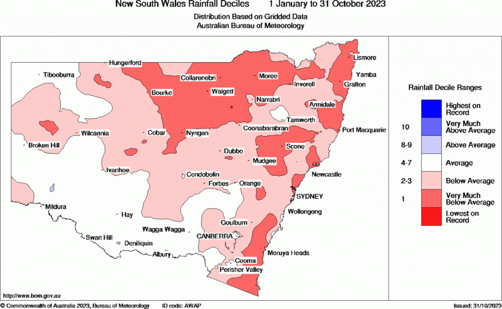
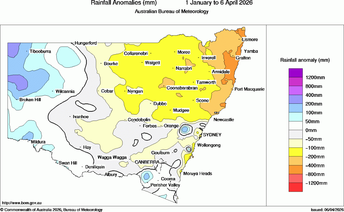
Late winter and spring is usually our drier time of year – so combine that with the three key drivers all pointing towards drier weather and it is no surprise we had a very dry spell that only ended recently – leading to a number of severe fire weather events with large fires burning around us. Looking at the time series plume for Coffs Harbour we can see the dry weather kick in during May, and then last until very recently:
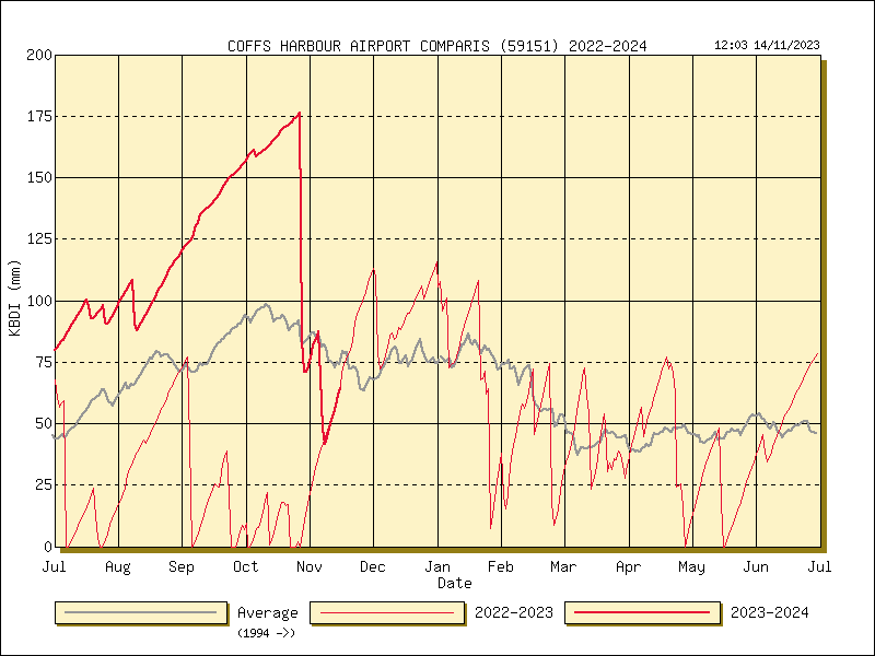
To give some understanding of how high the numbers got, 0 – 25 is classed as mild, 25 – 63 is average, 63 – 100 is serious and anything over 100 is classed as extreme. Coffs reach over 175 in late October. It was a significant relief to receive big rains late month that took the figure down to a much more manageable level and reduced fire risk and drought stress across our region.
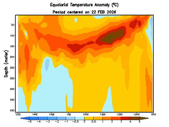
Looking ahead and the oceans currently look like this:
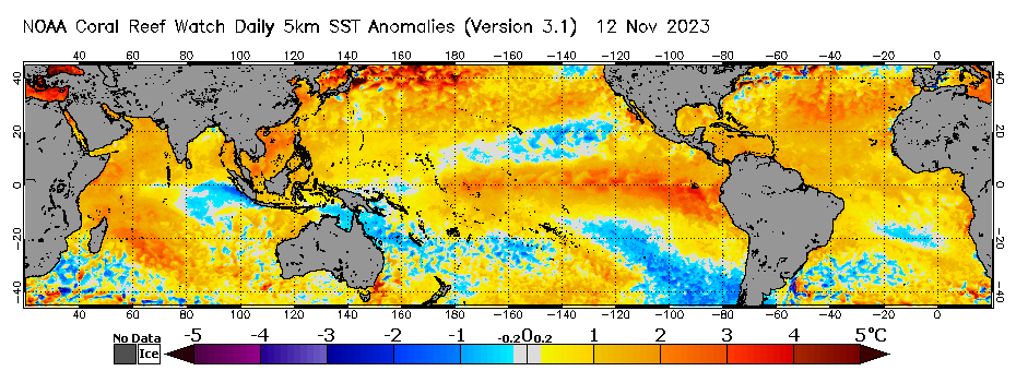
You can see the El Nino still firmly in place across the Pacific (bringing drier than average conditions) and a patch of cold water off the Indonesian coast (stretching into the Indian Ocean) that indicates the Indian Ocean Dipole is also still bringing drier than average conditions. You can also see warmer than average sea temperatures across much of the globe, which is definitely complicating forecasting.
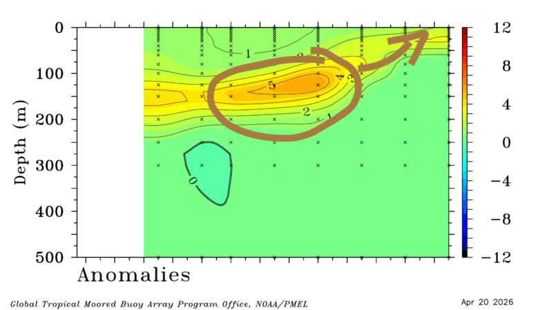
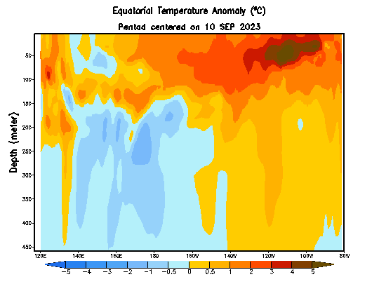
Back to what we do know…Looking ahead and a westerly wind burst is in progress across the Pacific:

You can see it happening where the GFS Op Forecast line sits. The westerly winds will generate an underwater wave that will slowly move east across the Pacific and further strengthen the current event as it rises to the surface in the far east. You can likewise see this starting to happen in this animation – check out the warmer water starting to descend in the central Pacific:
The good news for us? El Nino has less impact across our region in summer, and it’s currently looking unlikely at this time that we’ll see another El Nino event next year.
The Indian Ocean Dipole is starting to weaken, and is likely to fully dissipate in the next couple of months. This will likewise reduce the drier trend across our region.
The Southern Oscillation recently went positive – hence the onshore winds and showers / storms that broke the back of the dry spell. It’s currently heading negative in the short term (hence drier conditions, though nothing like as severe as our previous dry spell) before likely trending neutral as we head into summer:

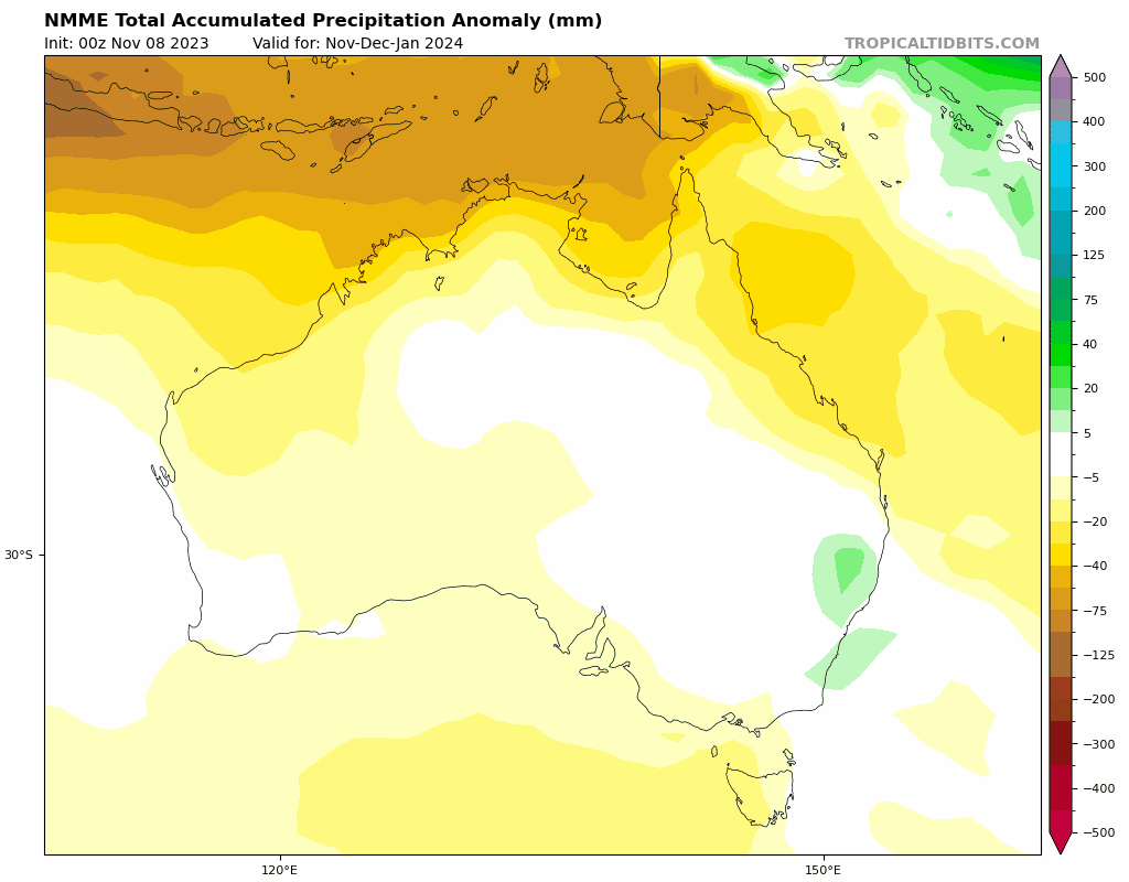
Looking ahead and the some of the longer term models are indicating drier than average conditions right through, while others are showing wetter conditions likely. The likely outcome is somewhere in the middle, which is where the multi-model NMME model currently sits. Here’s the NMME rainfall forecast into 2024:
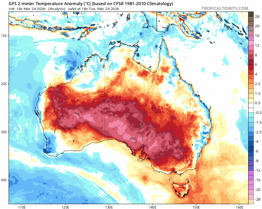
Temperature-wise there is a lot more consistency between models, with the all models showing warmer than average conditions likely right through. You can see this reflected in the latest NMME forecast:
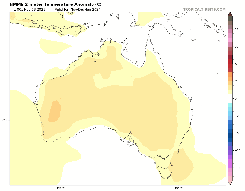
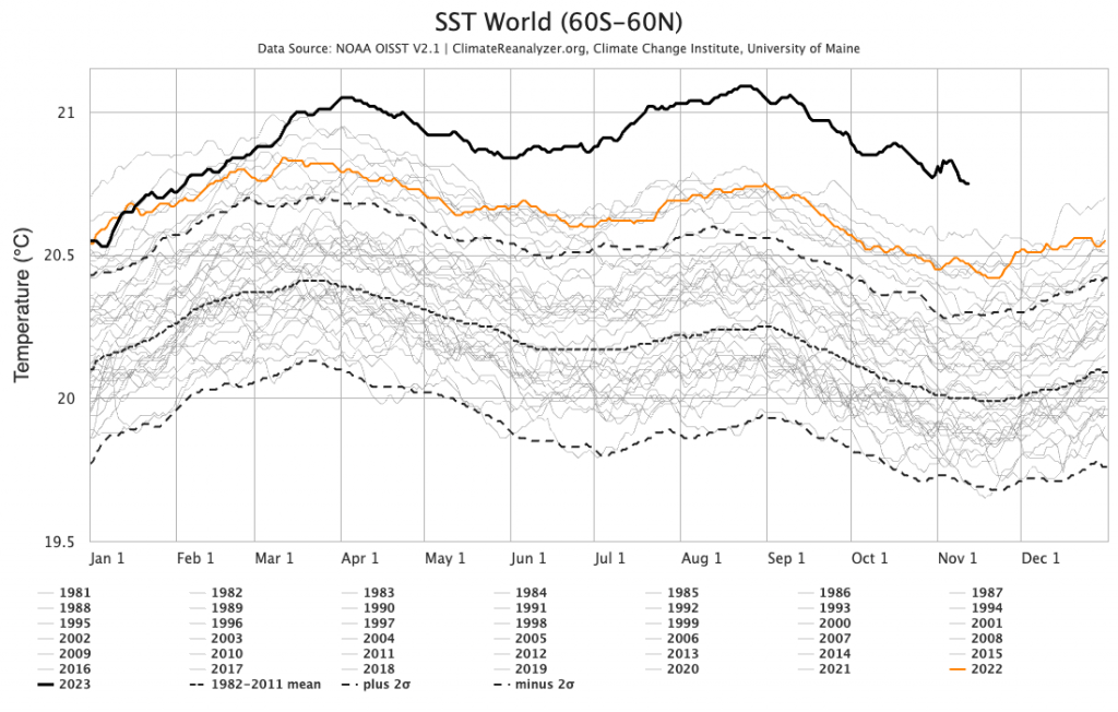
The warmer than average temperatures come about as a result of the El Nino and record high sea temperatures across the world – 2023 is a standout hot year:
I’ll post again as short term events and longer term outlooks come up. In the meantime thanks to all who gave me feedback about the posts, and wishing you all the best.
Kev
Thanks to Kombu and Snapfrozen for supporting the website and this blog
Thanks to NOAA / Tropical Tidbits / BoM / Bellingen Weather for the images and animations.