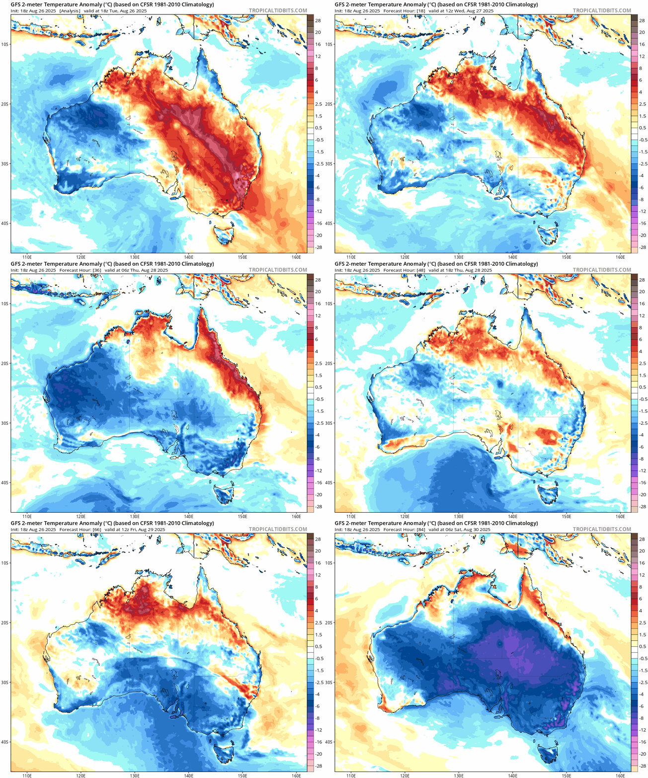
Gooood morning weather community! Spring is still a few days off officially – but the weather pays heed to no dates, and today we’ve got a blast of heat ahead of a cold change. The animation below shows the cold front blasting in today, with another even stronger front to follow late week / early weekend:
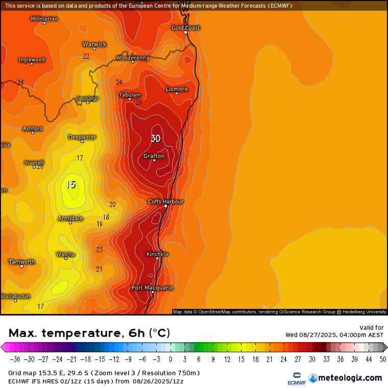
The first front today is drawing warmer winds across our region – with 30 looking possible this arvo across NE NSW:
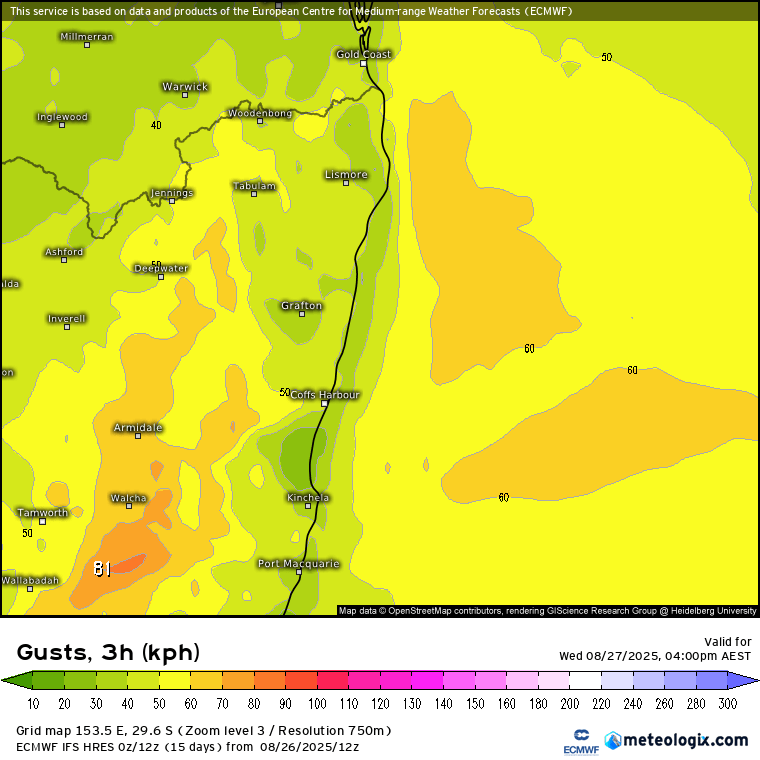
…but make sure you enjoy it as tomorrow will be considerably cooler – though with the warm spring sunshine the real bite of winter is quickly fading. Could be breezy, particularly up high as the change moves in this afternoon – image below shows peak gusts through this arvo:
With the colder air moving in the next change into the weekend won’t have as much warm air to draw upon as it moves in – but it’s a very strong change so what we will see are some very gusty winds on Saturday. Here’s the current peak gust forecast for Saturday morning:
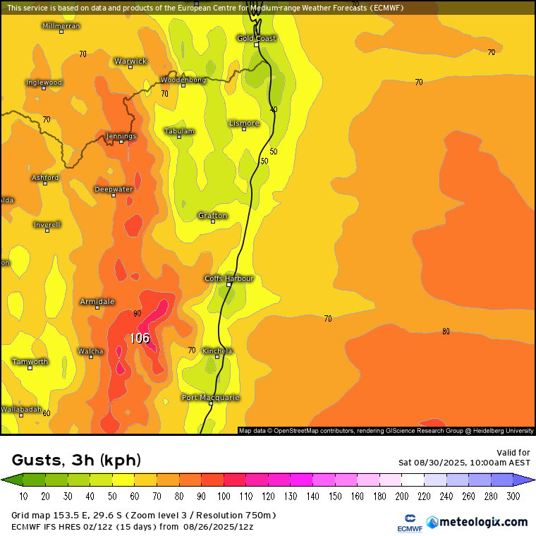
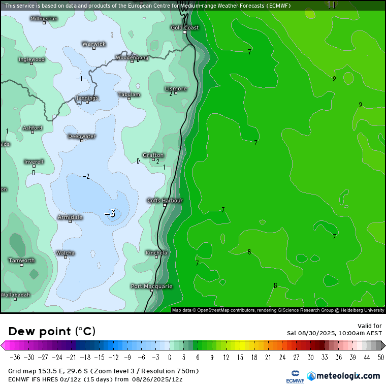
Yep – going to notice that change as it moves through! Could well see some trees down as a result. This classic spring change would normally bring much higher fire danger ratings….luckily the recent wet weather should keep a lid on fire risks – though with some very dry air moving through we could still see some of the fine fuels drying out fairly quickly. The dew point on Saturday morning will sit below zero, typical for dry spring changes:
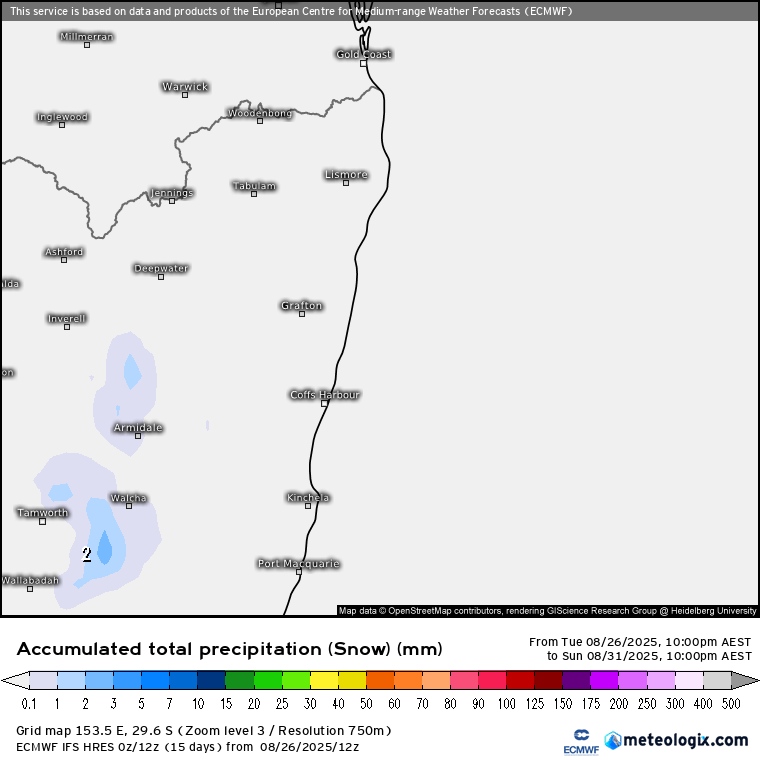
And perhaps not surprisingly we could see some snow flurries in the usual places to our west as the weekend change moves through – though with drier air any totals will be much more limited that the recent snow event:
One of the reasons we are seeing stronger cold changes is because the southern circulation (aka AAO) is in a weakening phase:
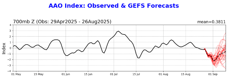
Below zero means a weaker than average southern circulation – which means the westerlies are more likely to move further north…hence the cold fronts pushing their way much further north than usual. And talking of the southern circulation – currently watching the forecast temperatures for the south pole over the coming two weeks…looking like we could see a significant warming up very high with temps up to 40c above average:
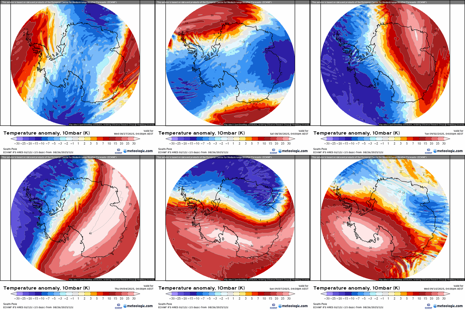
This doesn’t mean it’ll be 40c above average at ground level – the chart above is very high up in the atmoshphere – but it does indicate a potential further longer term weakening of the southern circulation as we head into spring. That would usually mean drier weather for our region as the westerlies move further north. That potential drying influence (if it comes off) is going to come up against a wetter push from both the Indian and Pacific oceans…so going to be an interesting couple of months coming up. We could find that they happily cancel each other out, but could also find enhanced drier spells sandwiched between enhanced wetter spells…something I’ll keep an eye on over coming weeks…

