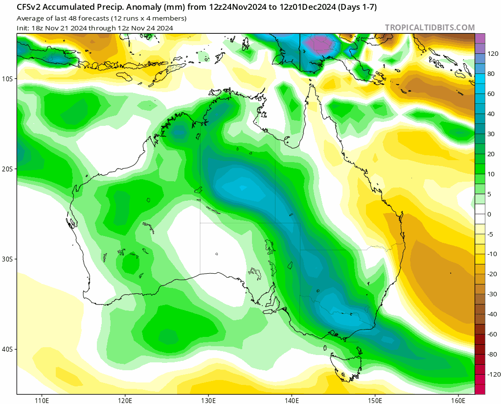
We’ve finally got some drier weather overhead – but a waterfall of tropical moisture is flooding south across the centre of Australia – and that moisture will be moving east over time. Here’s how it looks over the coming 9 days:
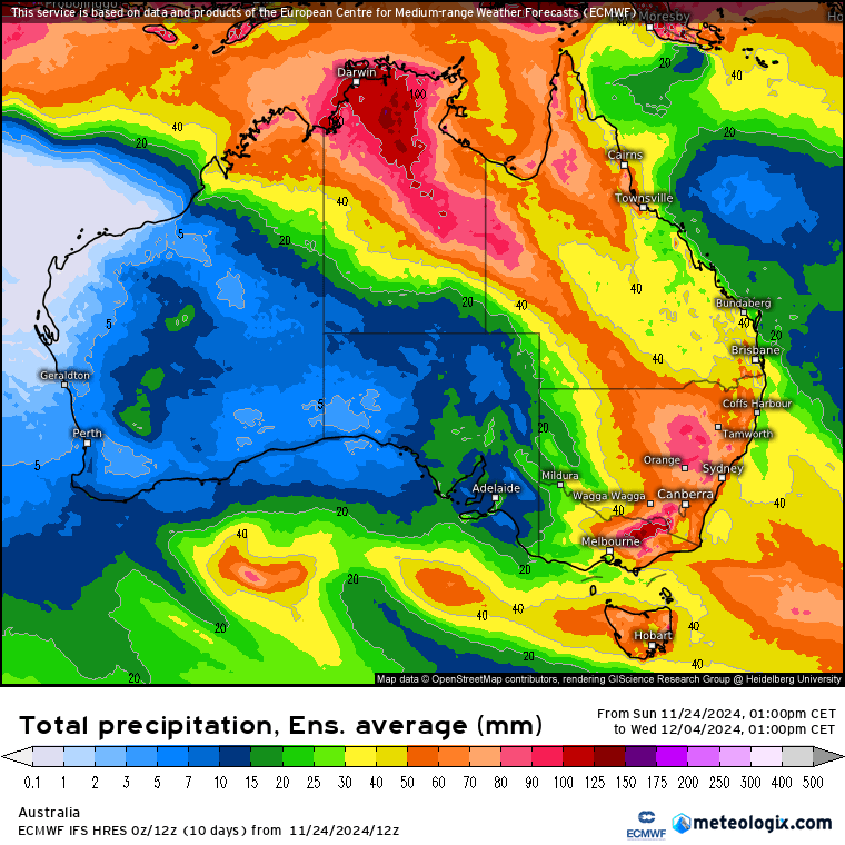
That moisture is going to bring some decent falls across much of central and eastern Australia over coming days – here’s the 10 day rain forecast – great to see the sweep south and then east:
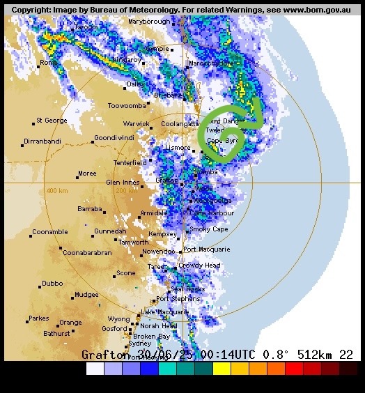
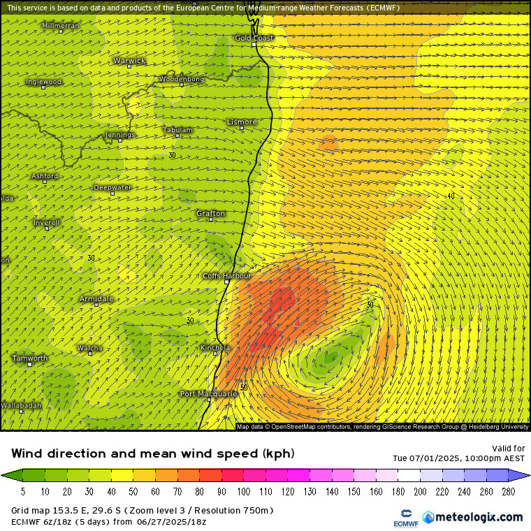
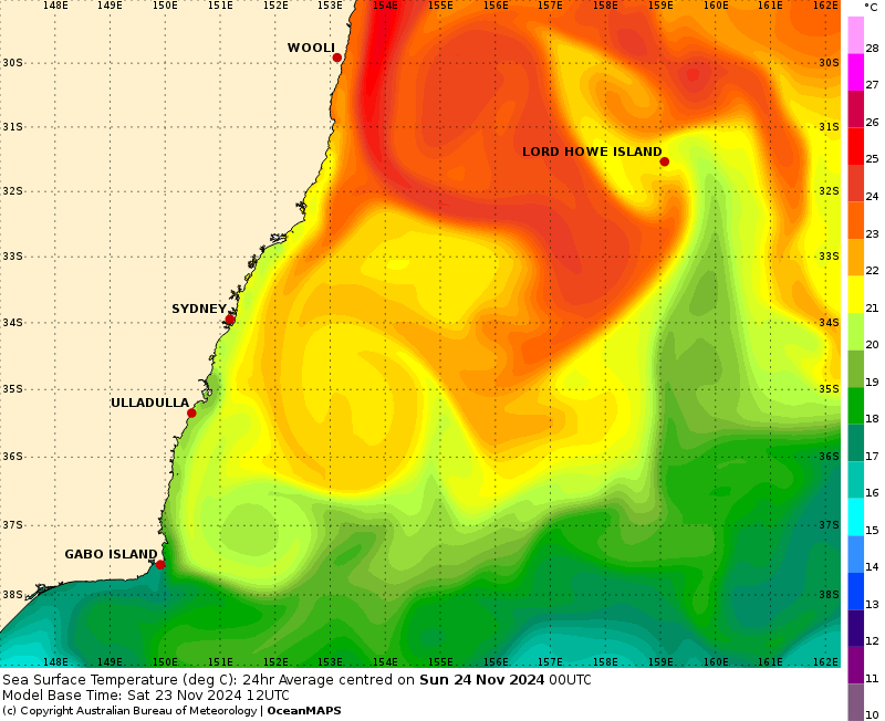
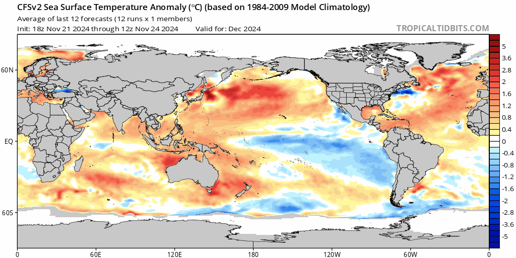
Rain coming in from the west doesn’t usually bring us the highest totals – but we’ll also likely see some moisture moving in from the ocean whenever surface winds swing onshore, and that will add to the totals. The ocean is warmer than average right now – and you can see the large vortex of warmer water circling offshore from the N NSW coast:
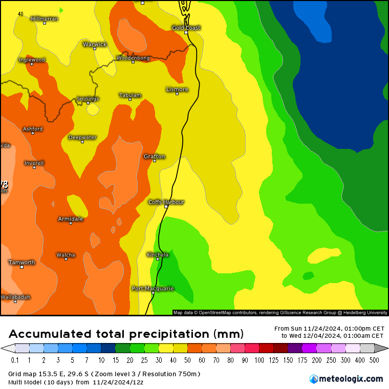
In terms of totals for our region – looking decent but not huge (at this time) for our region – though the higher totals inland could see some impacts over those regions over time. Here’s the multi-model 9 day average for NE NSW:
…and it looks like once the wet weather moves in it could hang around for a while. We’ll still likely see some drier and warmer weather at times, but overall the forecast is for a drier start to this week before wetter than average weather moves in – and then remain over our region at times right through until the end of the year:
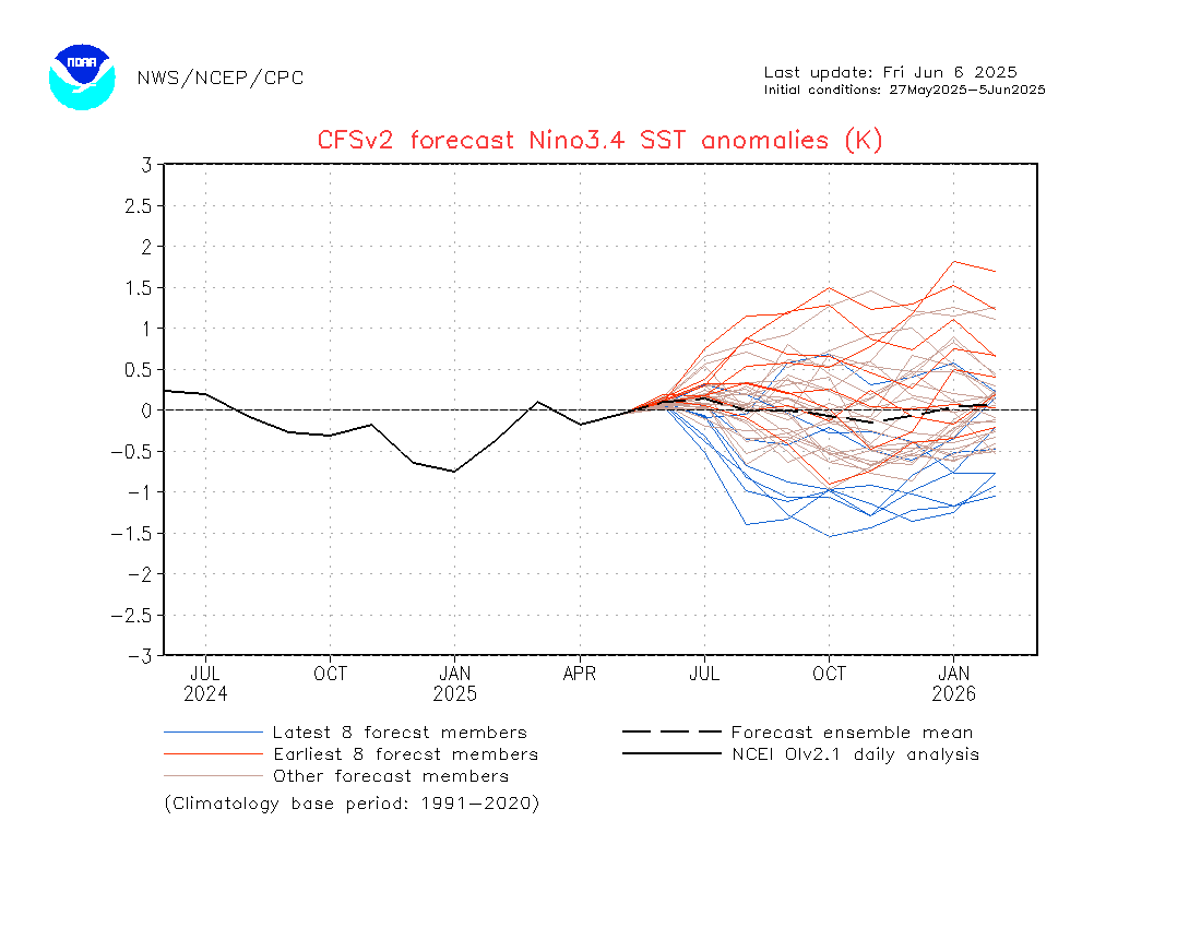
You can also see the pulse of much wetter weather move across the tropics to our north over the same period as an active phase of the MJO moves across. Looking further ahead and there are early signs that the cooler ocean temperatures in the tropical Pacific (La Nina-like but not yet strong enough to be classed as a La Nina) will ease later in summer, before potentially moving towards warmer than average as we move through next winter….something to keep an eye on:
…as such we’ll likely see wetter than average conditions through summer before it starts drying out as we move into winter. That’s a long way off however – in the meantime enjoy the drier and sunnier weather while it lasts!
Images thanks to Tropical Tidbits / Bellingen Weather / NWS / Meteologix
Thanks to our long term supporters, Snapfrozen and Kombu Wholefoods