Wow, a lot to get through in this post! Will keep it as short and sweet as I can. First off…here’s some of the content from the last post:
What is looking possible is for some snow to fall over the hills to our west – Cathedral Rocks / Guyra / Black Mountain all looking possible for some accumulations as that very cold air up high mixes down towards the surface and combines with low level moisture. The positioning of the low will determine how much snow falls to our west, but there is the potential for some decent falls.
…and here’s how it played out:
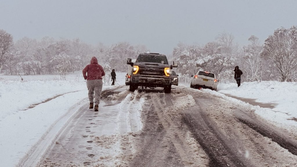
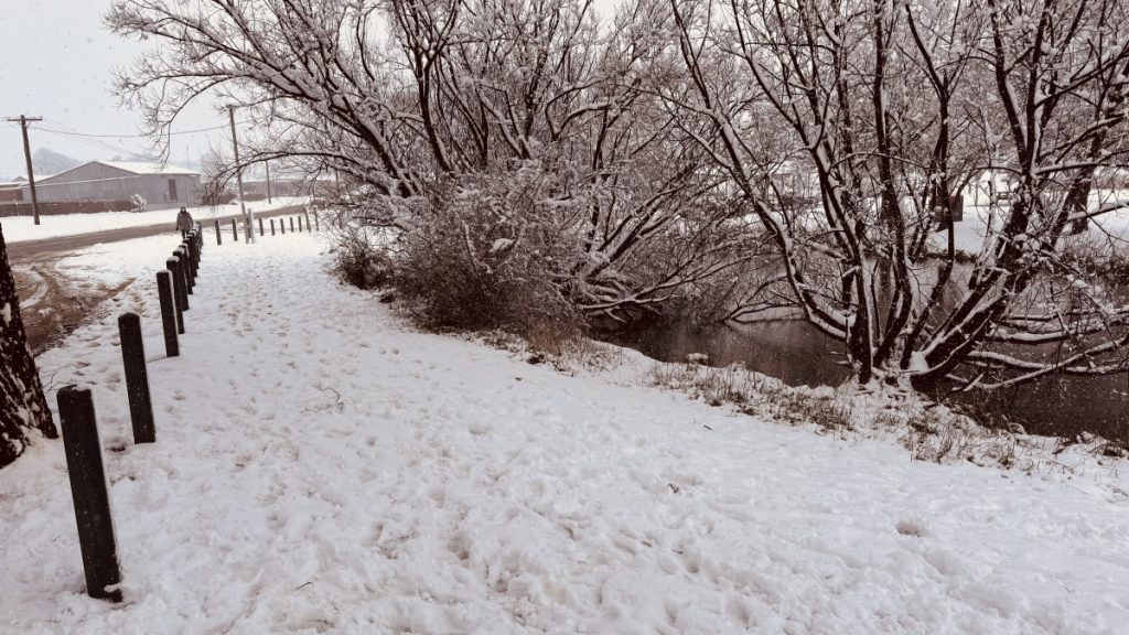
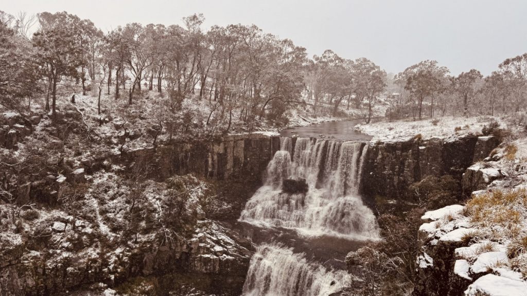
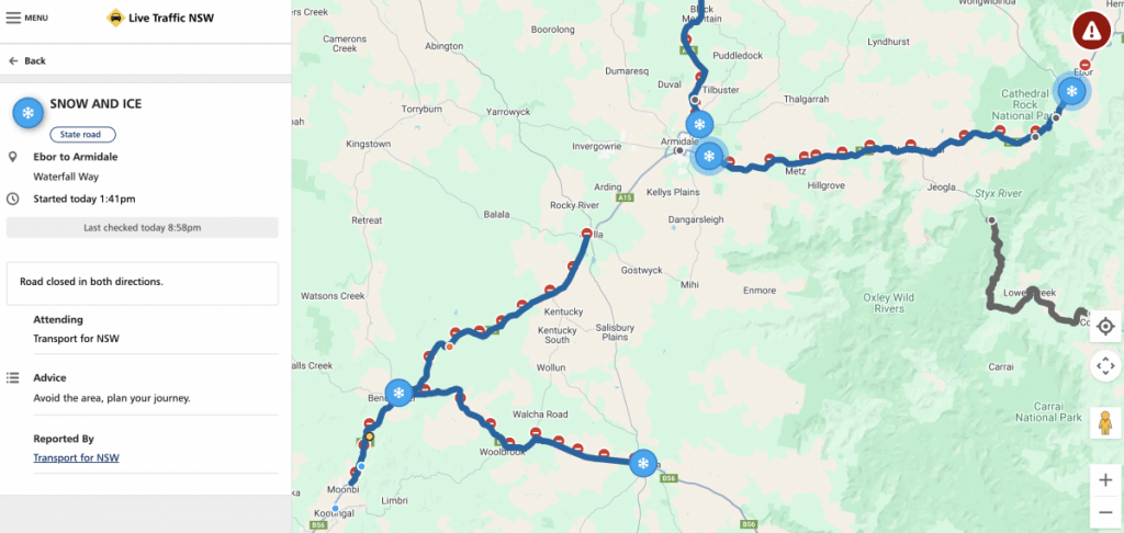
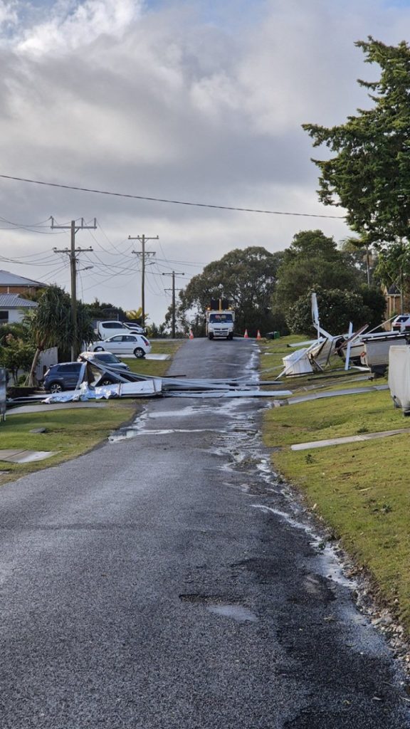
Yep – ended up a huge event with the heaviest falls since 1984. The downside was the loss of power for many, roads closed and some significant damage to infrastructure from snow bringing down power lines. Just for the record – not often we see Live Traffic show the Waterfall Way closed due to snow:
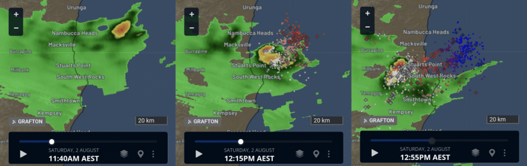
Whilst just inland from us saw big snow…just to our south saw a small low move ashore and bring winds of well over 100km/hour. We were *very* lucky it didn’t move across slightly further north as we would have then seen significant damage across our region. In the words of SeabreezyWx, a long term weather friend from South West Rocks:
Saturday started innocently enough with rain and fresh to strong winds, the expectation was the low would near the coast and cross it further south, and there wouldn’t be any severe impacts here. The first sign of trouble brewing was an embedded squally shower that hit at 10:30am. Out of nowhere, we were getting hit by powerful winds of approx 90-100km/h. I got taken by surprised by the sudden increase in intensity, and on the backend of the embedded squall, it knocked the power out at about 10:45am. The wind “eased” slightly afterwards to frequent approx 80-90km/h bursts.
Not long later, I noticed a cell building up off Nambucca Heads which then suddenly became lightning active, and I very soon realised this was the low’s centre and was heading pretty much straight towards us and was evidently intensifying too with the increasing lightning activity. Around 12:15pm, it started getting really wild with powerful winds, which lasted for around 45 minutes. I’m certain winds were peaking around 110-120km/h. I saw a sheet of metal fly down the street as I was peering through the front windows as they got blasted by the wind-driven rain. We were in the worst place to be, on the southern flank of the low’s centre making landfall a short distance to the north.
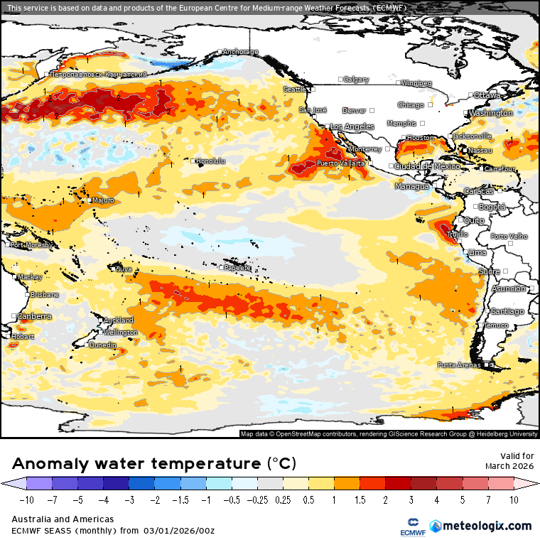
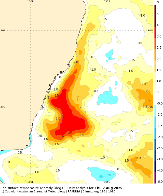
That’s enough from what we’ve had…back to the future and coming up in the short term we have onshore winds blowing over significantly warmer than average ocean temperatures off our coast:
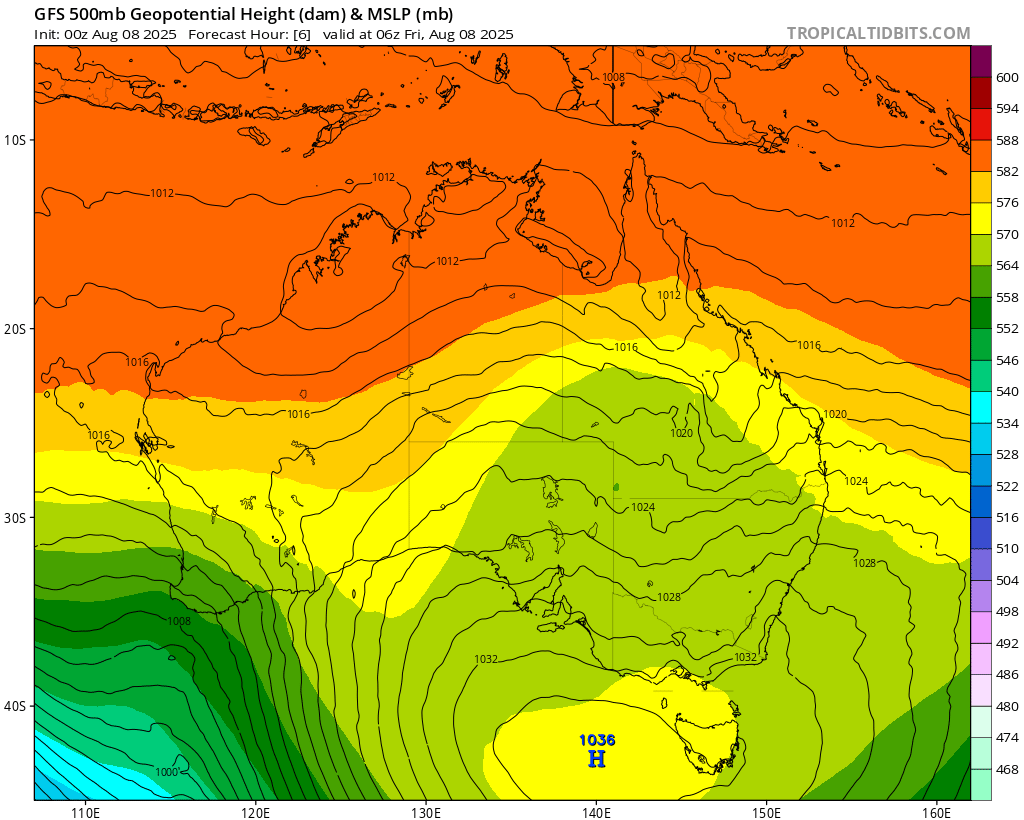
…and a significant upper trough moving in from the west – check out the width and height of this incoming upper cold air:
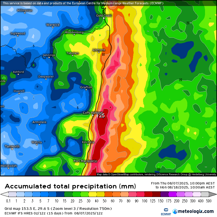
…and needless to say the result will be showers over the next few days. No huge totals likely…but a good chance we’ll be pretty much over the showers by the time they clear away. Here’s the 10 day forecast (and note the peak falls coinciding with the warmer water current just offshore):
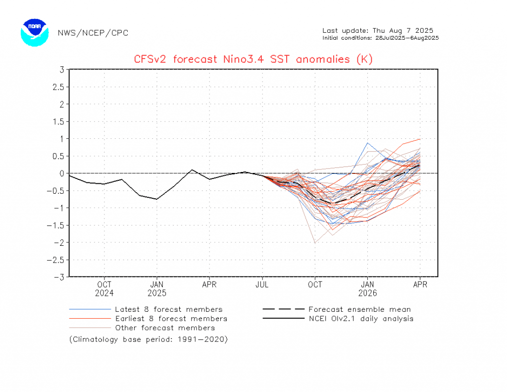
The longer term ocean patterns are looking pretty clear right now – and that is wetter than average right through until early next year. The Pacific is looking fairly La Nina-ish as we head into summer:
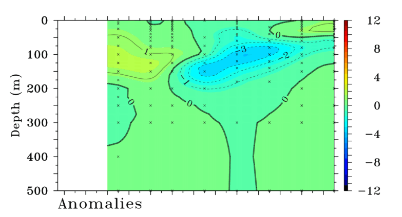
….and that’s a result of this sub-surface cold pool in the east gradually making it’s way to the surface:
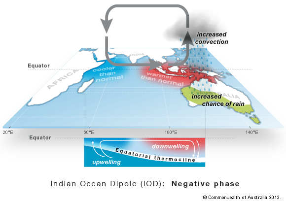
Add in the Indian Ocean, which is also trending wetter than average across Australia:
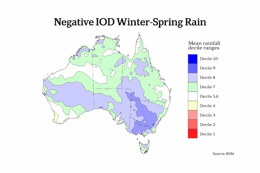
…and you can see why the BoM forecast for the next few months looks like this for September through November:
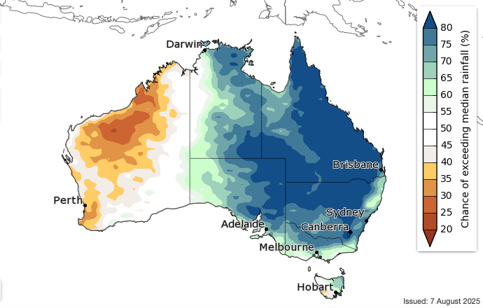
It does NOT mean it will be wet all the time, but likely overall wetter than we would normally expect for this time of year.
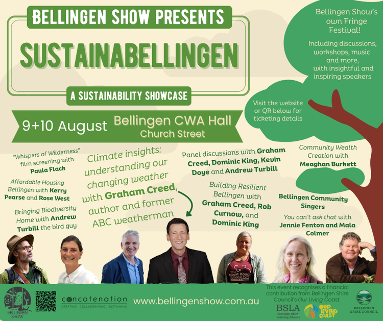
Going to finish with a plug for the SustainaBellingen event this weekend. There’s a great range of speakers right through the weekend and I’ll be there on Sunday from 11.15 to 12.15 discussing climate change and adaptions, with a focus on our region. It’s worth making it along for as much of the weekend as you can – and if you can make it on Sunday I look forward to seeing you there!
As always this site / blog would not be there without support from our sponsors / hosts – thanks to both for their ongoing support: