We’ve got a whole heap of warming happening right now around the south pole – and you can spot it easily from this animation of temperature anomalies way up high above the polar region:
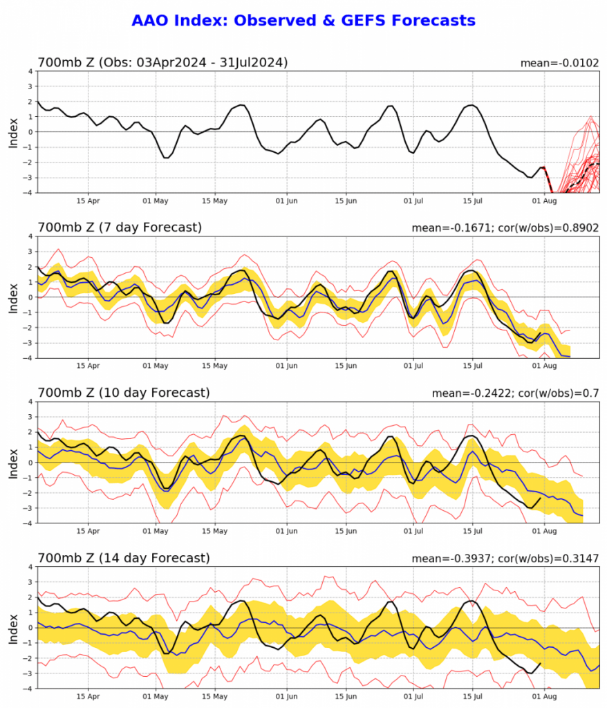
One result of this warming is a relaxation in the southern vortex – and that means both westerly winds moving further north away from the polar region (bringing us drier weather) and upper cold pools moving further north than usual – which can bring us wetter weather. You can see the weaker vortex indicated clearly in this forecast graph:
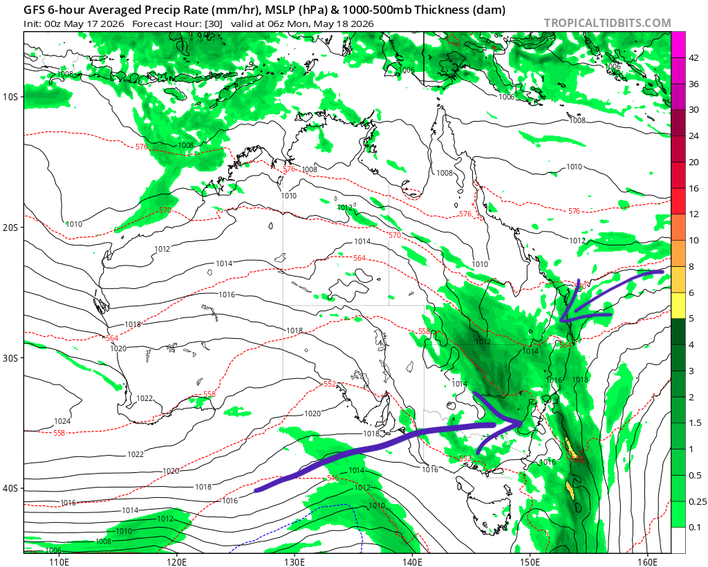
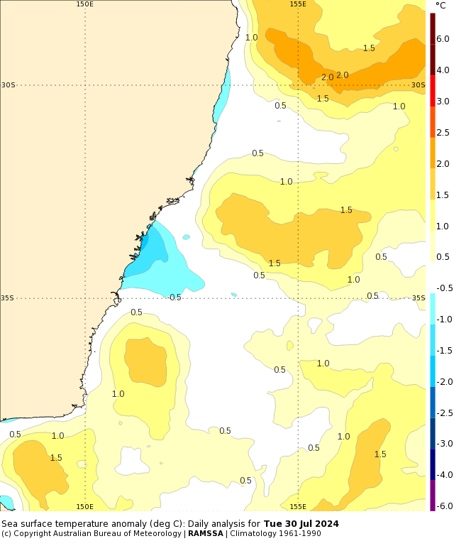
We’ve had westerlies for the last few weeks, and it now looks like we may see some wandering cold pools next week and into the following week, with areas of upper cold air moving north and helping trigger an onshore flow. Ocean temperatures are above average off our coast:
…and that combination could result in showers moving in from the ocean as we move into the middle of next week. Totals vary widely across the models right now (with some model runs showing significant totals while others show virtually nothing) but should settle down over the weekend, at which point I’ll post again. Right now the average across the next 9 days looks like this:
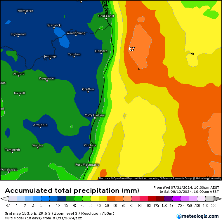
…so something to keep an eye on as higher totals are possible.
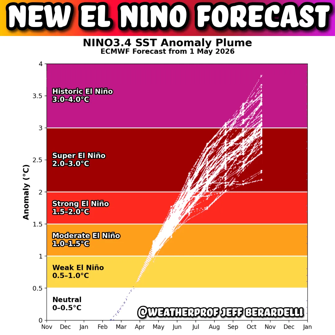
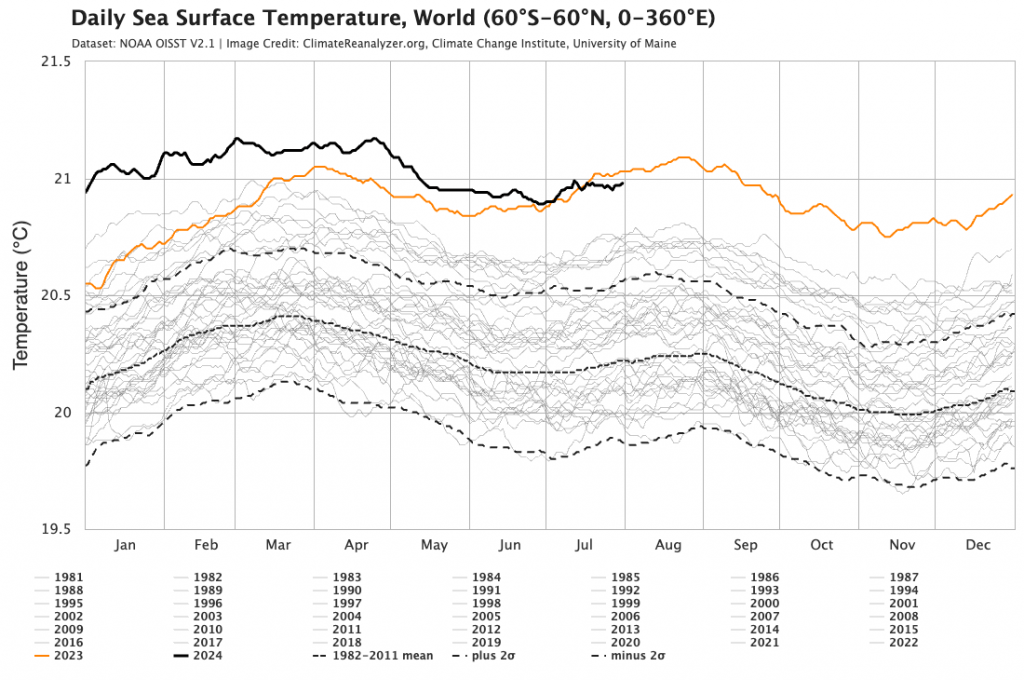
Looking longer term and the La Nina is still struggling to form, but models still show it developing over coming months – so once we’re through the current weaker than average southern vortex (which can bring rain but will usually bring drier conditions) we should see wetter conditions develop as we head into summer…again more on that as we head into that season. Worth noting (once again) that global ocean temperatures are once again well above average:
…and Antarctic sea ice is tying with last year as lowest recorded for this time of year:
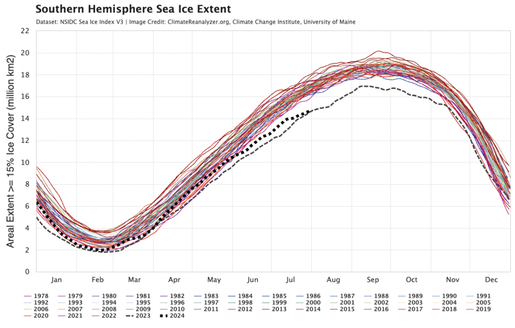
These values are likely to continue to add additional levels of chaos into weather model forecasting are are definitely not conducive for longer term wellbeing on/of our planet. Good to see global CO2 emissions may have peaked, but will need to come down quickly to avoid additional significant environmental and social impacts.
Back to the short term outlooks and I’ll be back this weekend with an update on the rain potential for next week. Until then thanks to Meteologix / Weathermodels / BoM for images, and thanks to Snapfrozen and Kombu Wholefoods for ongoing support.