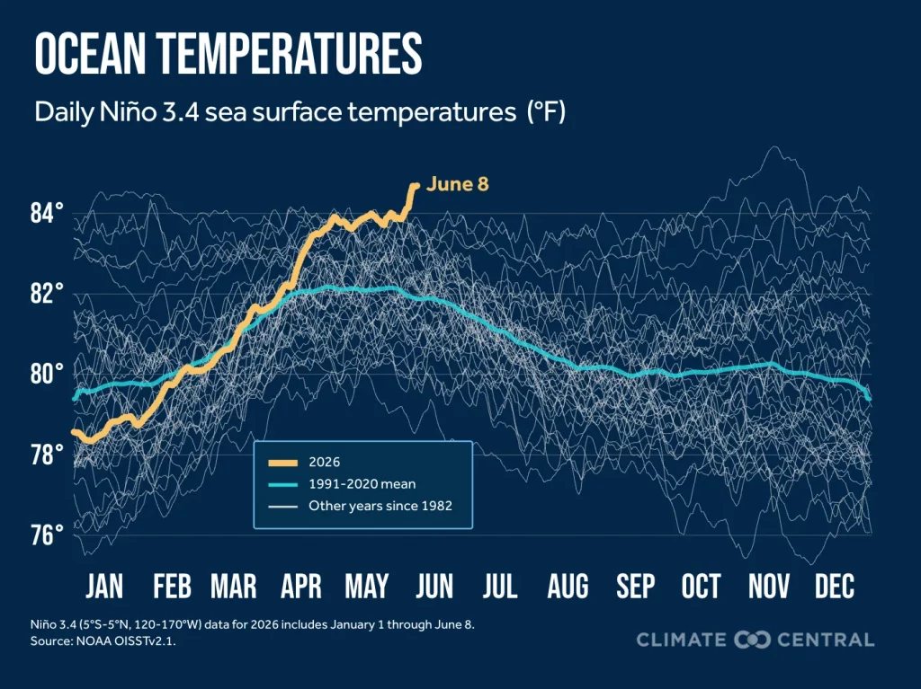
A few showers to come but no huge totals looking likely in the short term. Of much more interest – the latest monthly seasonal forecasts are now out – and they are all showing a very strong to record breaking El Nino developing later this winter. Ocean temperatures in the key Nino 3.4 region are already at record levels for the time of year:
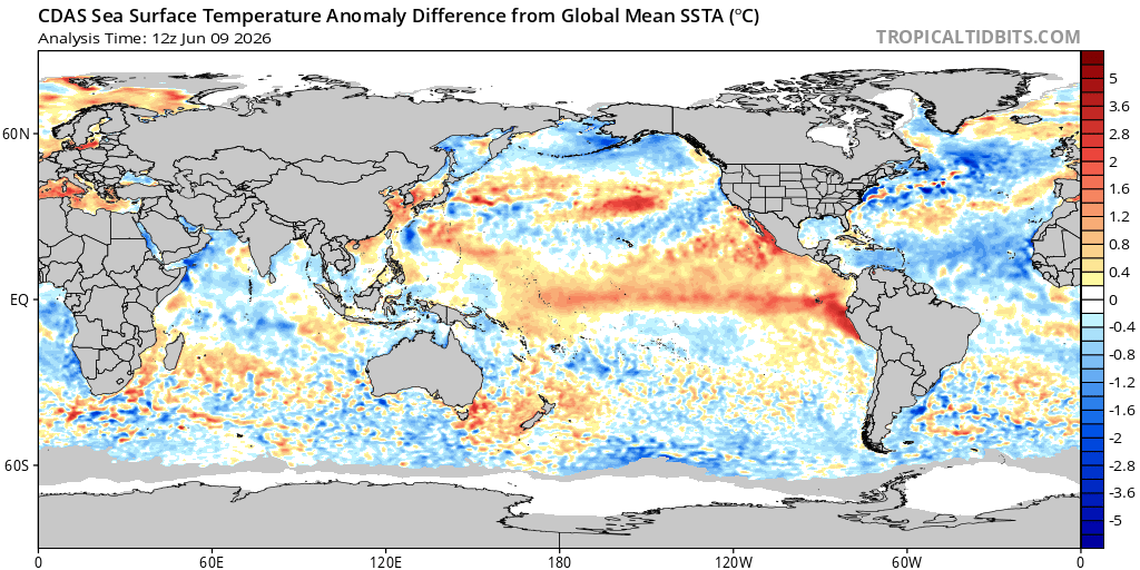
…and we can already see a decent El Nino signature on the relative sea surface temperature anomalies:
Models show the ocean temperature continuing to climb rapidly continuing to rise over coming months. The latest ECMWF forecast takes the temperatures well into record territory:
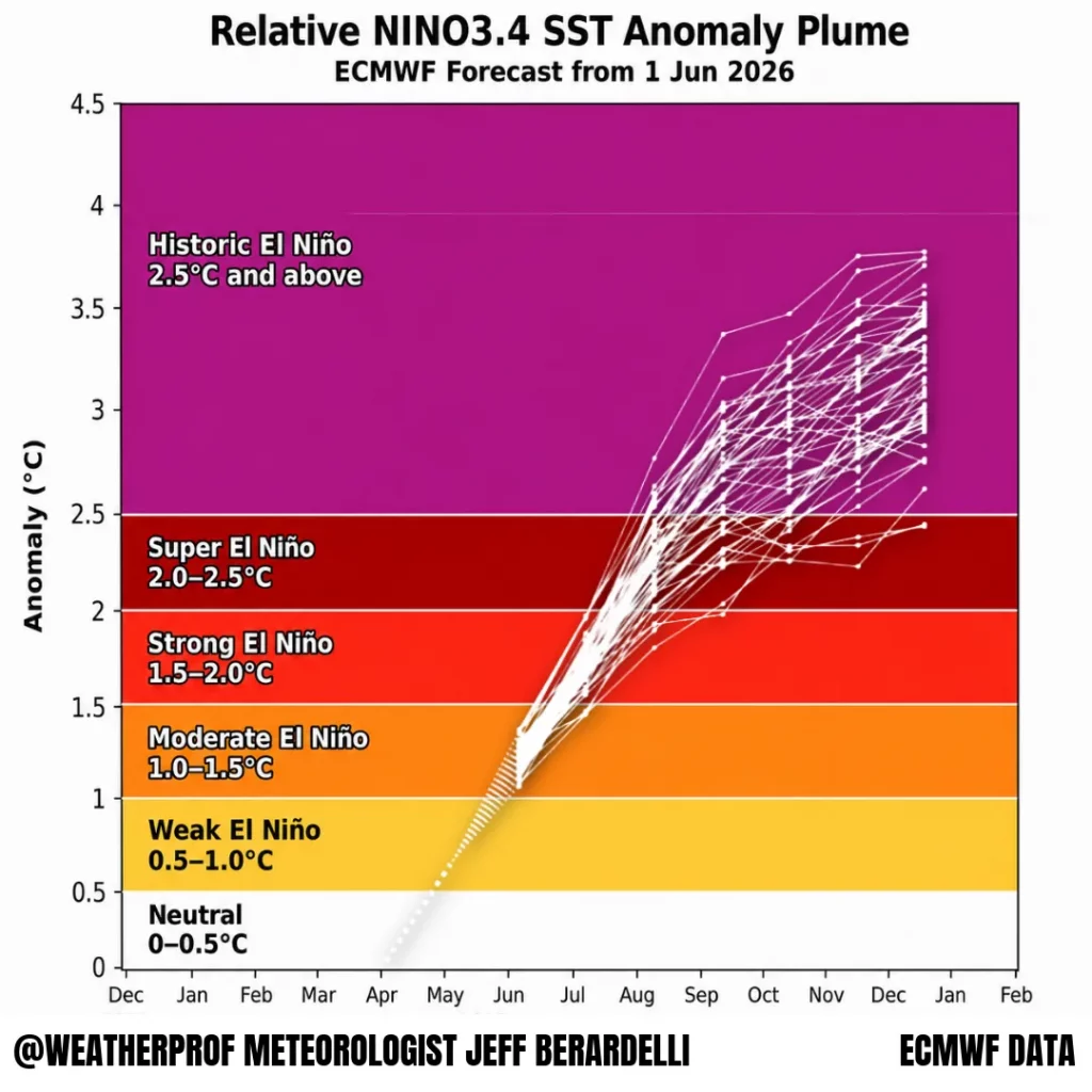
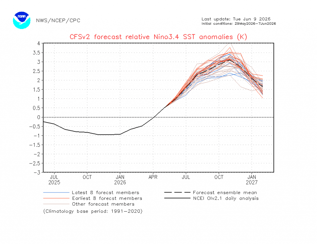
When you have pretty much every member of the run showing an El Nino at record levels it’s worth paying attention – especially when the CFS model also shows a similarly strong event:
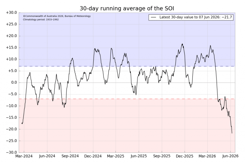
…so definitely something to watch (with some concern) over coming months. The BoM SOI model already shows the atmosphere linking with the oceans with a dramatic decline in the 30 day SOI value:
It’s worth remembering that the more extreme an event the less likely it is for models to accurately forecast it accurately…but that doesn’t mean that they are not on the money. A record-breaking El Niño has the potential to bring significant global impacts including severe drought, heatwaves and increased bushfire risk to Australia, Indonesia and parts of southern Africa. At the same time, it can cause heavier rainfall, flooding and storm damage in parts of North and South America and other regions. The event will also raise global temperatures – definitely not what is needed.
Current forecasts vary with the rain impacts across the east coast of Aus with a stronger signal inland, however models also consistently forecast higher than average temperatures as we move through spring and into summer, both east and west of the divide. As an example here’s the forecast temperature anomaly for October – a time of year when temperatures are already climbing:
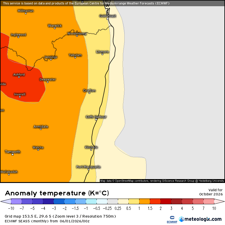
As such we’re looking likely to see some significant hotter-than-average weather as we move through spring (which doesn’t mean it will be hot all the time but we could see some daily temperature spikes as heat moves across our region from inland) and the potential for drier than average conditions, particularly away from the coast. It’s also worth remembering that heatwaves can also dry out the bush more quickly than cooler conditions – so even if we do see some rain we could also see things drying out fairly quickly when the rain clears. As such the bushfire risk for this season looks like it could be higher than it has been for a number of years, particularly inland.
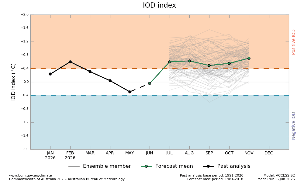
Looking at other drivers and the Indian Ocean Dipole forecast has also moved a little more positive (drier than average) over the coming months:
…and as we were last month it’s still too early to see how much of a role the Antarctic circulation will play this year – things should become a little clearer on that one in the next month or two. Once we see forecasts across all three of the main influencers we’ll have a clearer idea of what lays ahead.
Back with more over coming weeks / months as we move into what looks like a very interesting and potentially dramatic (for some) season to come….


