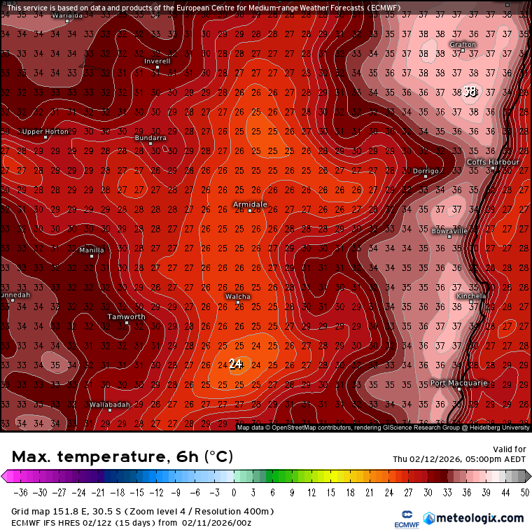
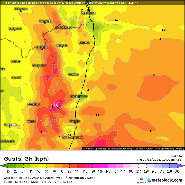
A sprinkle of rain outside as I write this…part of a complicated and developing system to our south. We’re unlikely to see much rain from this system up here – though a different picture down south where some coastal flooding is likely later on today. What we will see is some very gusty south westerly winds moving across tomorrow as a low develops to our south. Here’s the forecast top gusts today:
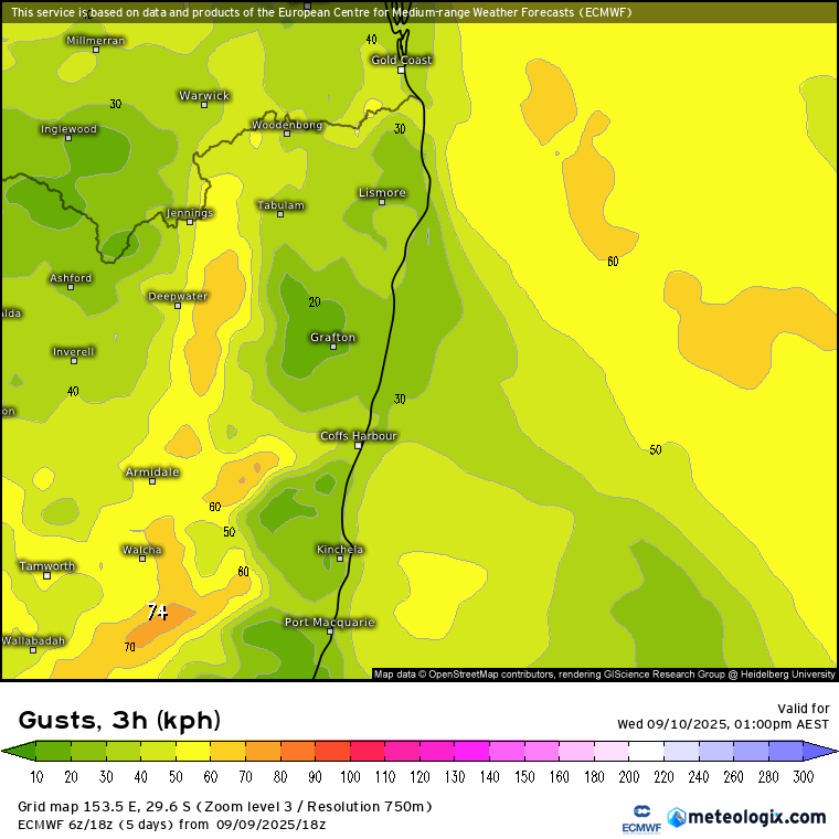
…breezy but not unusual for this time of year. By the time we get to tomorrow however the south westerly winds will certainly be ramping up – top gusts likely over 100km/h this time tomorrow over the hills and potentially down into the valleys as well:
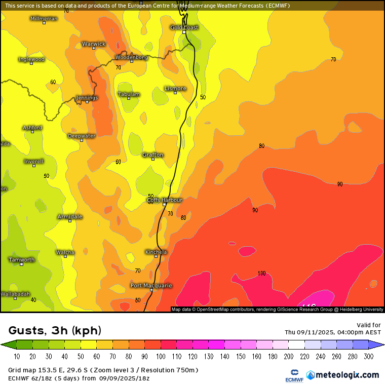
Those winds will swing more south to south west through the day as the low to our south moves further offshore – and that means those in the valleys will lose the protection of the hills to our west with stronger gusts more likely to reach the lower levels:
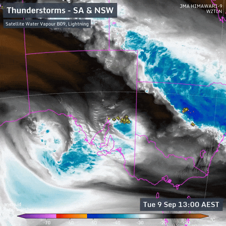
These events usually have the potential to bring significantly raised bushfire threats across eastern Australia during dry springs – but with the pattern in the Indian Ocean pumping moisture across Australia from the north-west, what we get to see instead is a heap of inland rain generated, with less making it to the coast – as can be seen on this excellent animation from Weatherzone / Andrew Miskelly:
Looking forward and the upper temperatures over the south pole look to head well above average again over the coming two weeks:
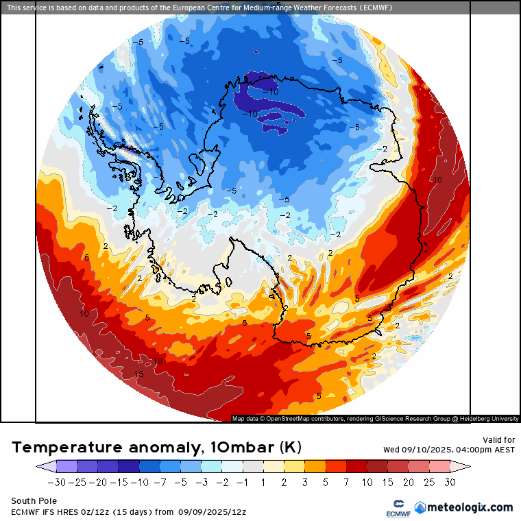
Yep – that’s forecast 40C above average at the top end of the atmosphere. Looking at the winds at that level and we can see the southern vortex is shifted from it’s regular position, allowing relatively warmer air to flood in:
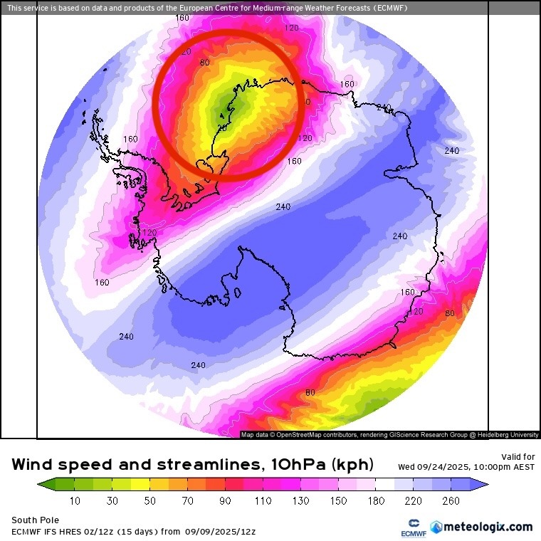
These raised temperatures will NOT be reflected at the surface (so you won’t see Antarctic ice melting as a result) but do indicate a more turbulent time coming up at the south pole weatherwise over coming weeks / months – something to keep an eye on. As per the above in some years we’d likely see an increase in bushfire weather as drier, hotter air is pulled across our region as the westerlies migrate further north than usual – but this year, with wetter air pumping into the middle of Australia as a result of a favourable Indian Ocean pattern, this is less of a risk – though not mitigated altogether.
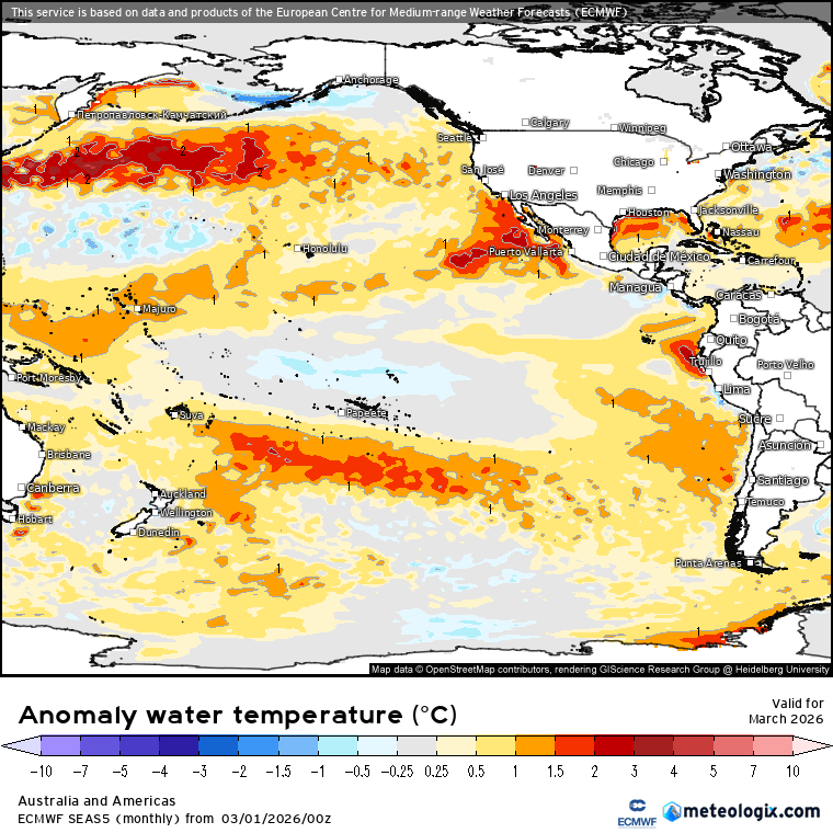
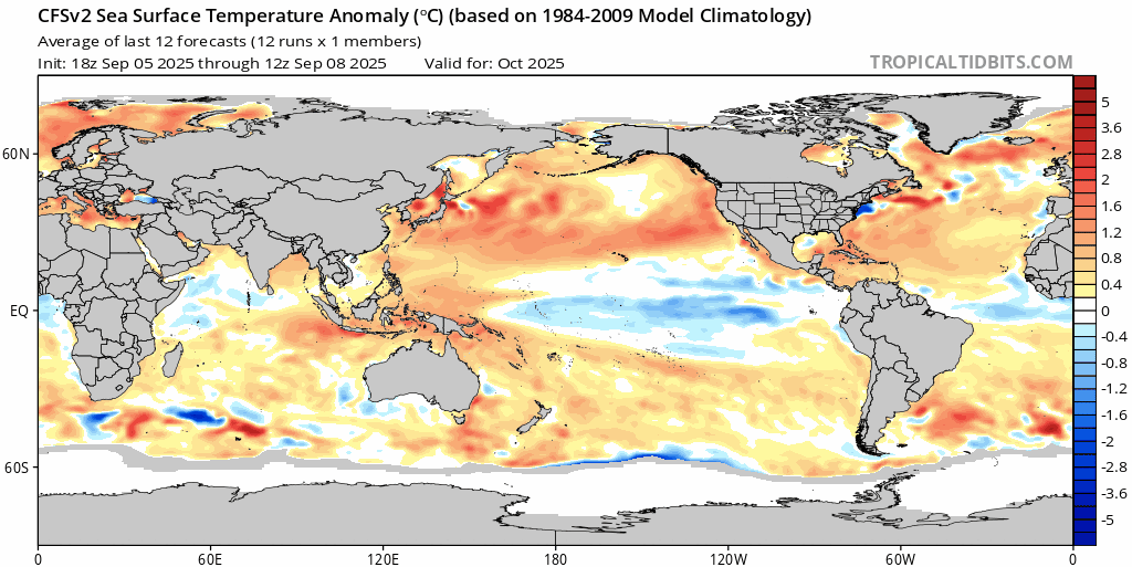
Looking at the broader influences we’ve also got the Pacific tending wetter (again) for the east coast. If you look at the temperature anomalies across the Pacific against expected temperatures you can see the cold pool again developing across the Eastern Pacific:
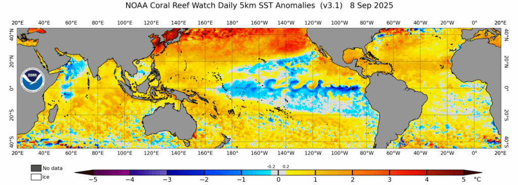
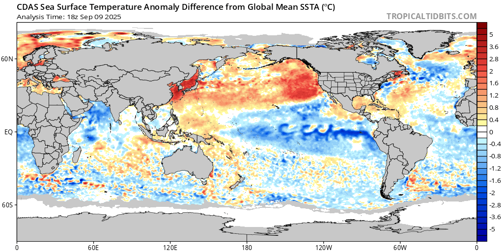
….but climate change is making it harder to spot La Nina patterns as the overall ocean surface temperatures warm. It’s the difference in temperature across the Pacific that really influences the weather patterns, so we now need to take that warming into account. When we do you can easily see the cooler than average temperatures across the east:
…and thus we’re once again likely to see wetter than average conditions across our region from October through to the end of summer. The ECMWF forecast for NSW looks like this:
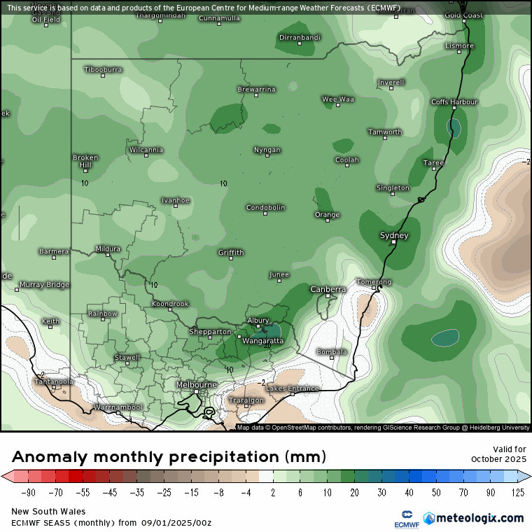
…and that shows wetter than average right throughout, including our usually-already-wet January through March period – something to keep an eye on. Worth emphasising that the models only show the likely outcome – there are no guarantees…the natural chaos of the weather means it’s still possible to get drier weather when wetter is more likely and vice versa. Other models however also indicate wetter than average conditions through the same period which gives weight to that likelihood.
Looking even further ahead and models are indicating a potential warming of the eastern Pacific as we enter next winter – you can see it clearly on the CFS model:
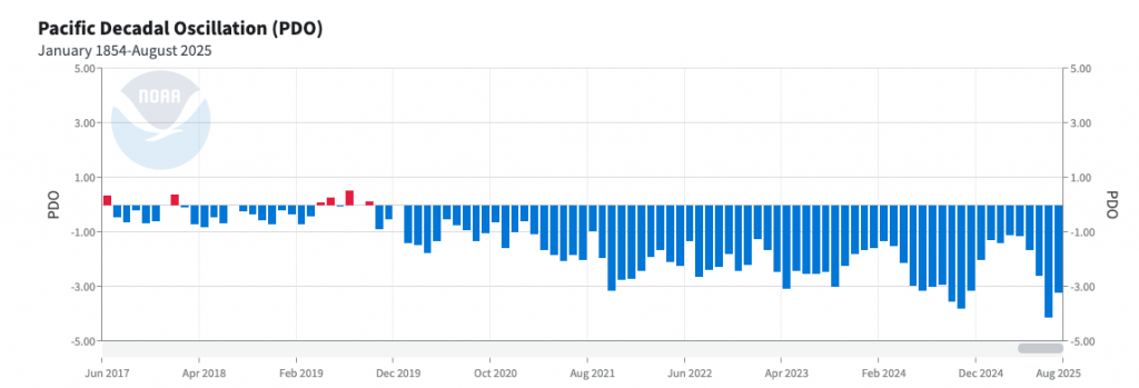
However…(1) we’ve seen models predicting this previously at long lead times (2) climate change appears to be pushing the Pacific more towards a longer term La Nina state through potential impacts on the long term Pacific Decadal Oscillation – which is currently sitting very much in the negative…which encourages La Ninas:
…and (3) the Tongan volcanic eruption in 2022 also appears to be pushing us towards a temporary wetter state. That doesn’t preclude El Nino events – in fact we can be pretty certain we’ll still see them – but does mean they are looking less likely than La Nina events – which is exactly what has played out over recent years. Worth noting that La Ninas encourage a lot of growth in the bush – something to be aware of when the next El Nino rolls around. As per the above long term models are hinting at next year, but we’ll have to wait until we are a lot closer to the event to have any real faith in the forecast. Needless to say I’ll keep watching and reporting back…
Thanks for reading right through to the end – see you again soon!