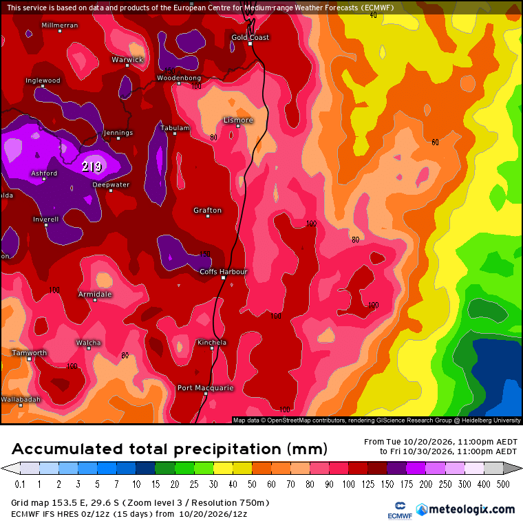
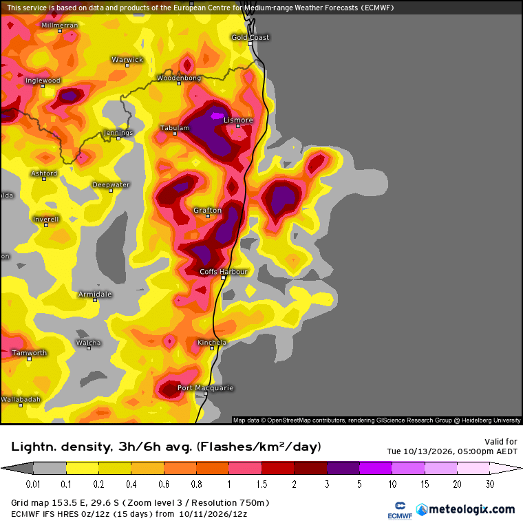
We saw storms on the hills yesterday. Prevailing winds up high were fairly weak yesterday – in fact too weak to push the storms through the sea breeze front and towards the coast. Here’s how steering winds looked at 5pm yesterday:
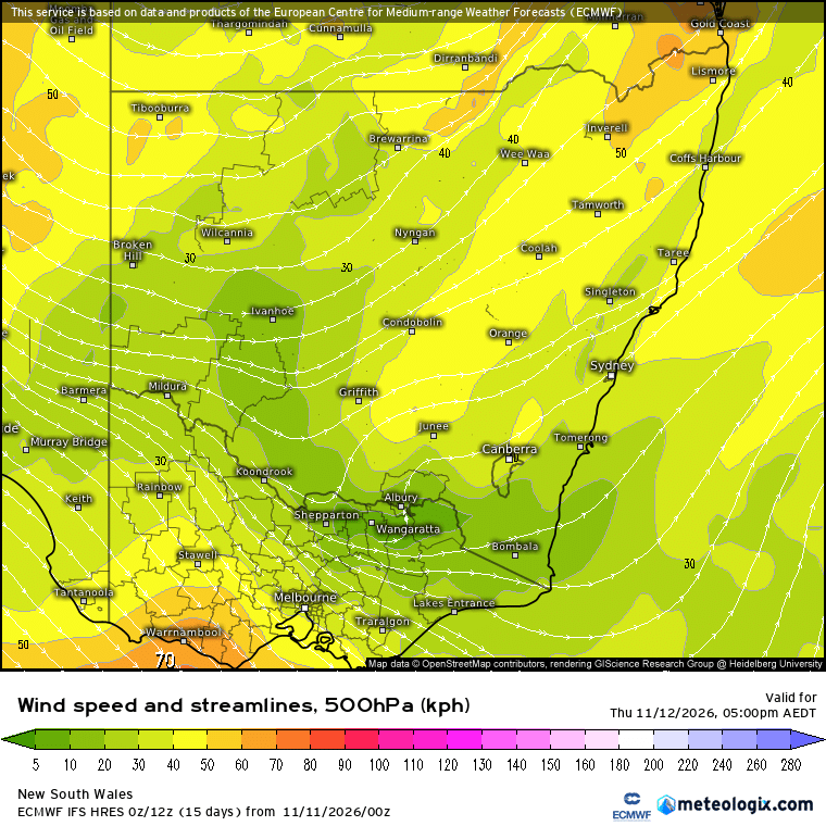
It’s spring and that’s storm season for us…so don’t expect it to be too long between stormy days. In fact if we take a look at the forecast upper winds for later today we can see some much stronger upper winds moving in:
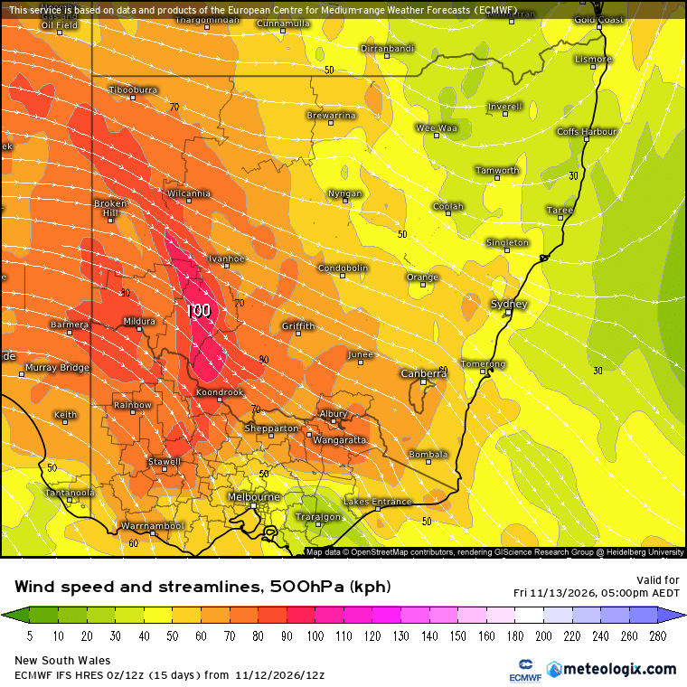
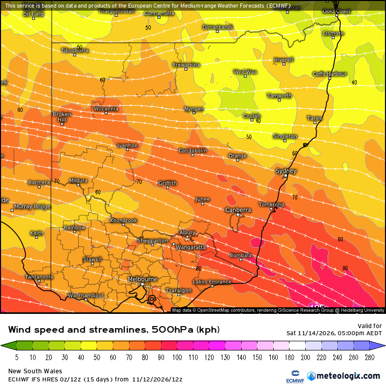
Those stronger upper winds will be gradually pushing in through the day – so not sure if they’ll be strong enough in our region to push storms towards the coast before they naturally die off overnight…but a much higher than yesterday so worth keeping an eye on the radar. By the time we hit Saturday we’ll see stronger upper winds across our region combine with summer sunshine and high levels of humidity to increase the risk of storms even further. Here’s upper winds for Saturday 5pm:
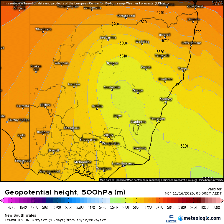
We’ll see a similar pattern through Sunday and Monday – in fact by Monday afternoon we’ll also see a pool of much colder upper air moving towards our region:
Combine that with *much* stronger winds up high:
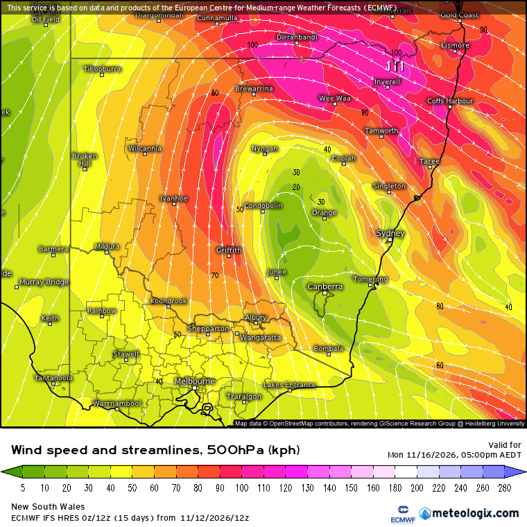
…and we can expect the risk of severe weather to increase through Sunday afternoon and into Monday with fast moving storms screaming across NE NSW. With upper winds looking very strong there’s the risk with any stronger storms to see some stronger gusts make their way down towards the surface.
As that upper feature moves through we’ll also see a surface feature develop as a result. To the south of the surface low winds will swing onshore – and combine those onshore winds with cold upper temps and we could see some decent totals across parts of the Mid North Coast from onshore showers as we move through the early part of next week.
Another way to look at the storm forecast is to look at expected lightning over the next few days. Here’s the 2pm forecast for Friday through Monday:
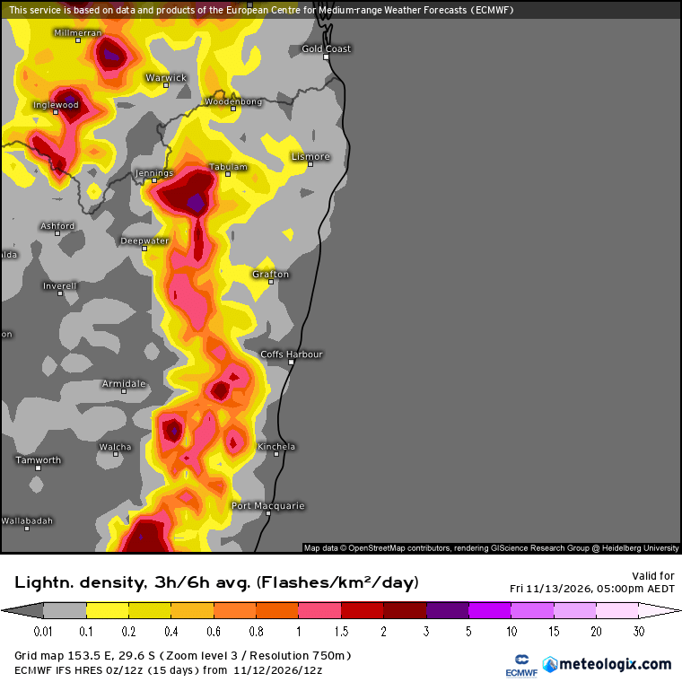
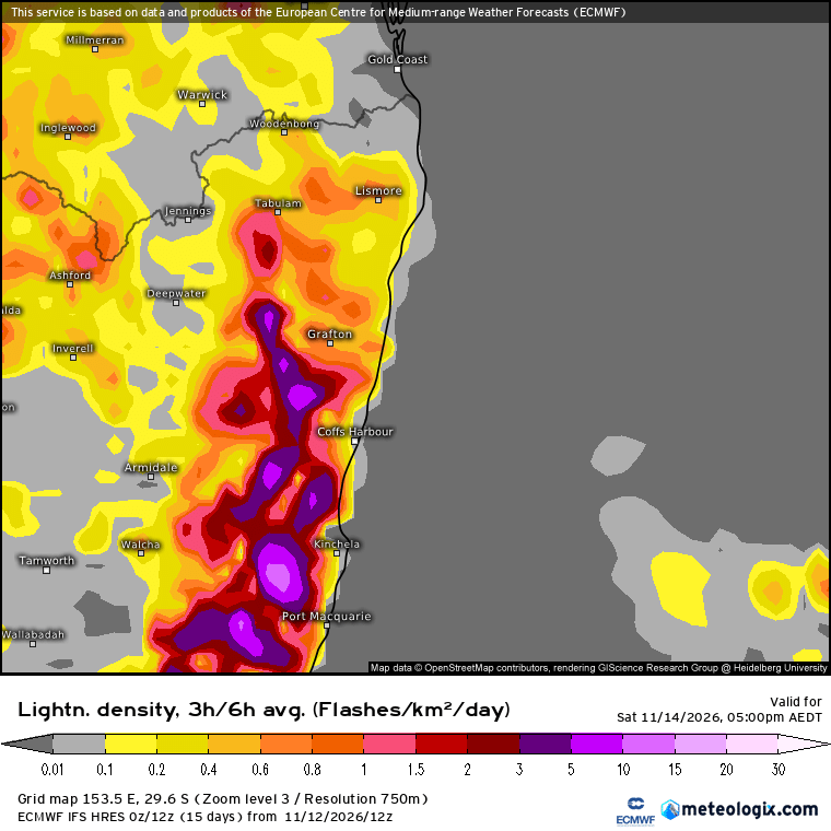
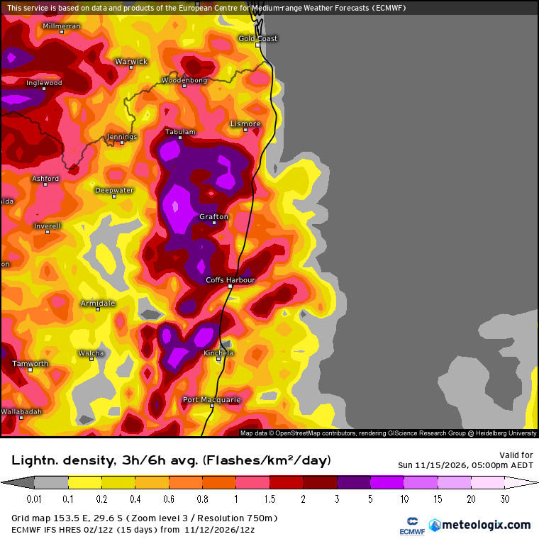
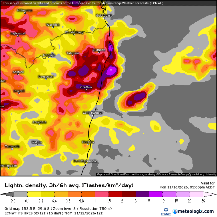
Don’t expect reality to completely match the forecast – but a strong chance of storms right through the next 96 hours and lightning forecasts that strong you’d expect to hear a decent amount of thunder over coming days. As uppers cool hail risk also increases…and as upper winds strengthen the risk of stronger surface gusts also ramps up.
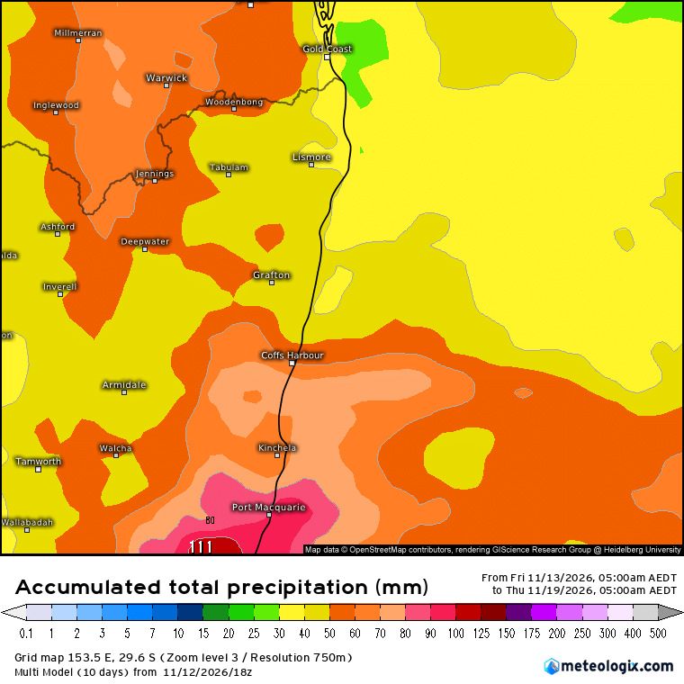
Total rain over the next 5 days will depend on storm development and storm paths – but some places will see some decent accumulating totals (while others see considerably less). At these times an average forecast is probably the best we can do – and right now that’s looking like this:
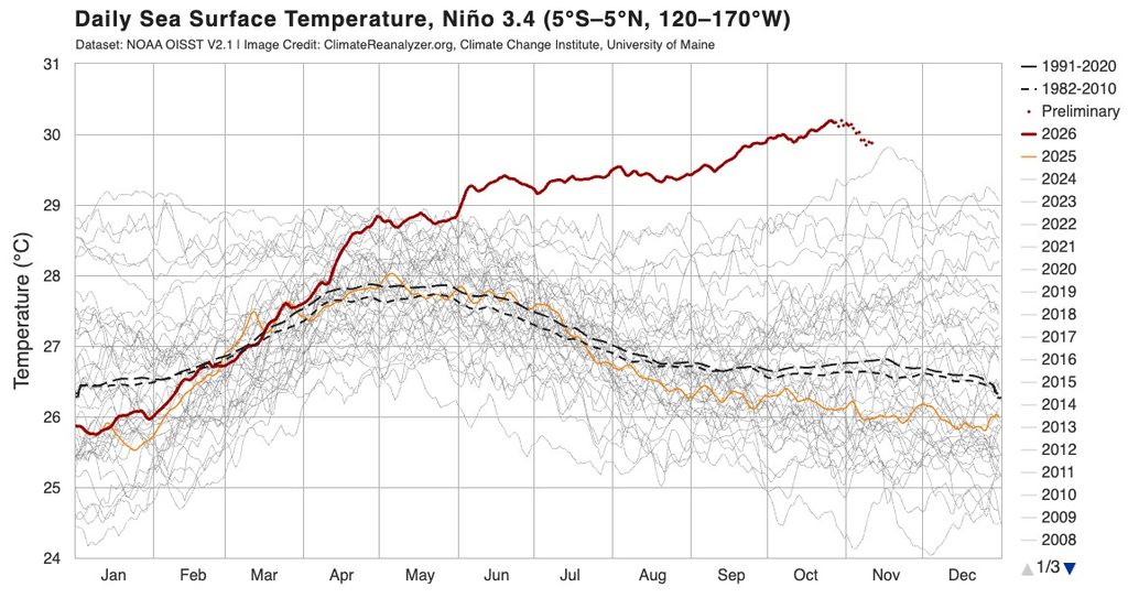
Looking much further ahead the current record-strong El Nino is likely near a peak, and will only slowly subside over coming months:
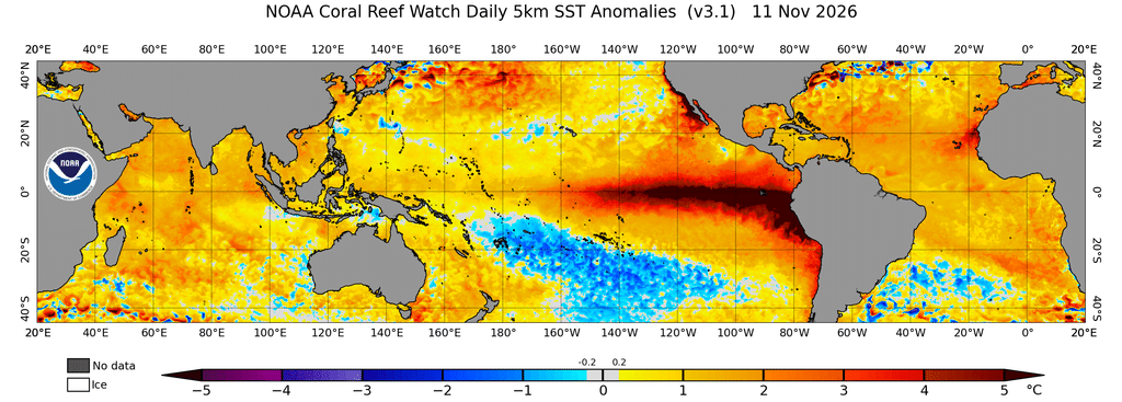
We can see just how strong this event has been from looking at the tropical Pacific ocean temperature anomaly:
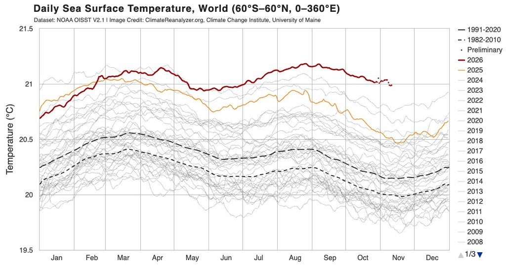
Those record high Pacific ocean temperatures are impacting the global average ocean temperature anomaly – currently also sitting well into record territory:
Expect ongoing global impacts from this event over the coming couple of years. Global models still show a mixed rainfall outlook over coming months for our region – but all still agree on hotter than average temperatures right through – perhaps not surprising when we see average global air temperatures also sitting at record levels:
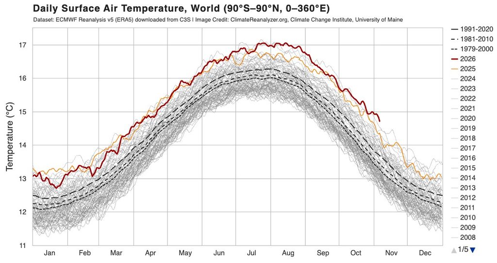
With the El Nino still in full swing we’ll continue to see heat pumped into the atmosphere from the oceans – as such expect higher than average / record global temperatures to continue through 2027, before slowly declining a little as the El Nino finally runs out of steam later next year.
Finishing on a positive note – Coffs Coast RFS has a series of high quality weather stations located across our region. There’s one just to the west of Bellingen CBD, one in Deervale and another in Nana Glen. The raw data from those stations is now available through the BoM, and we have managed to set up a plug in to gather that data and display in graphical form – you can view it here. It’s currently running about 20 to 30mins behind real time, but we’re working to resolve that over coming days. The live data from the Bellingen Weather station is still on the site, and updates every couple of minutes.