A late evening and likely overdue seasonal update for our region. We’ll kick off with the main drivers for our area at this time of year – the Southern Circulation and El Nino / La Nina.
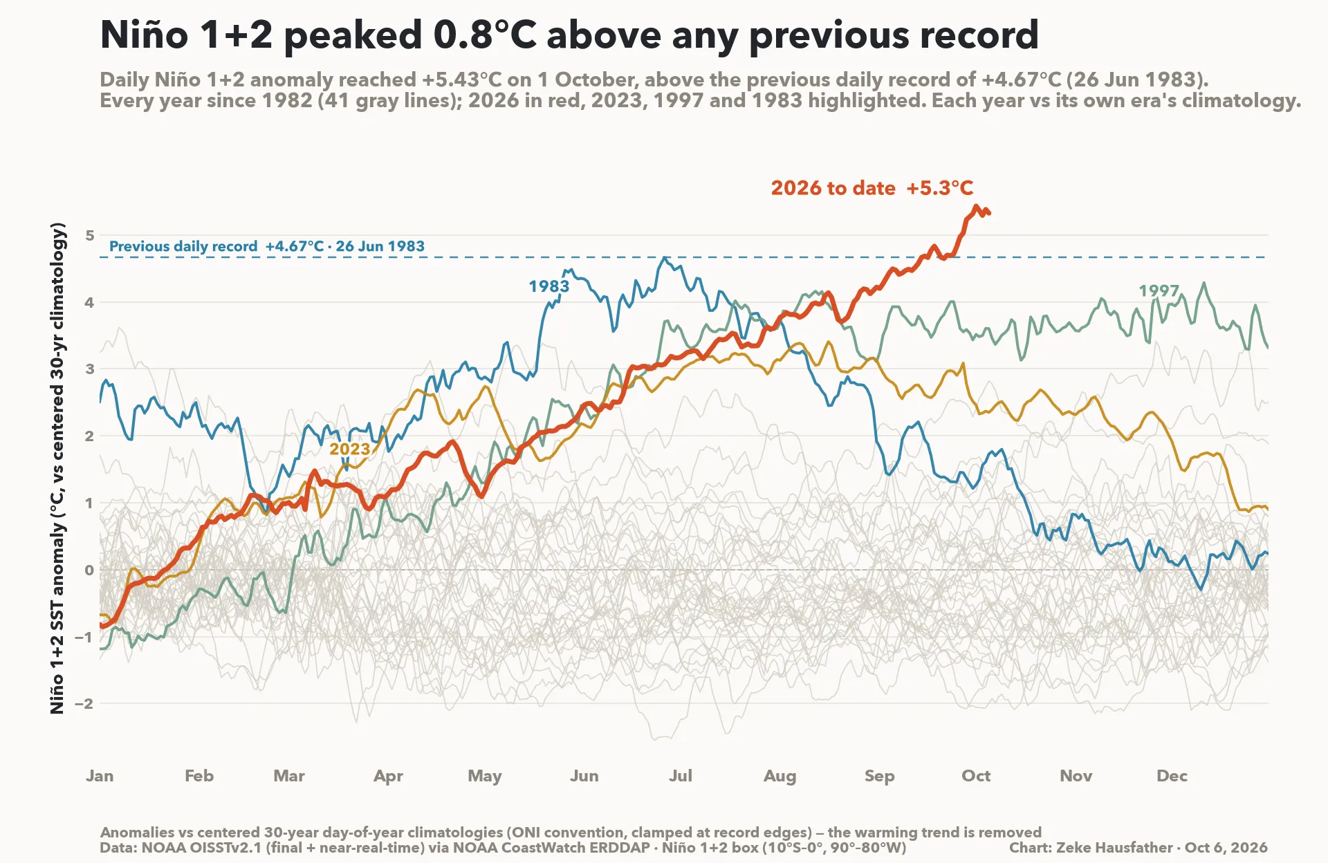
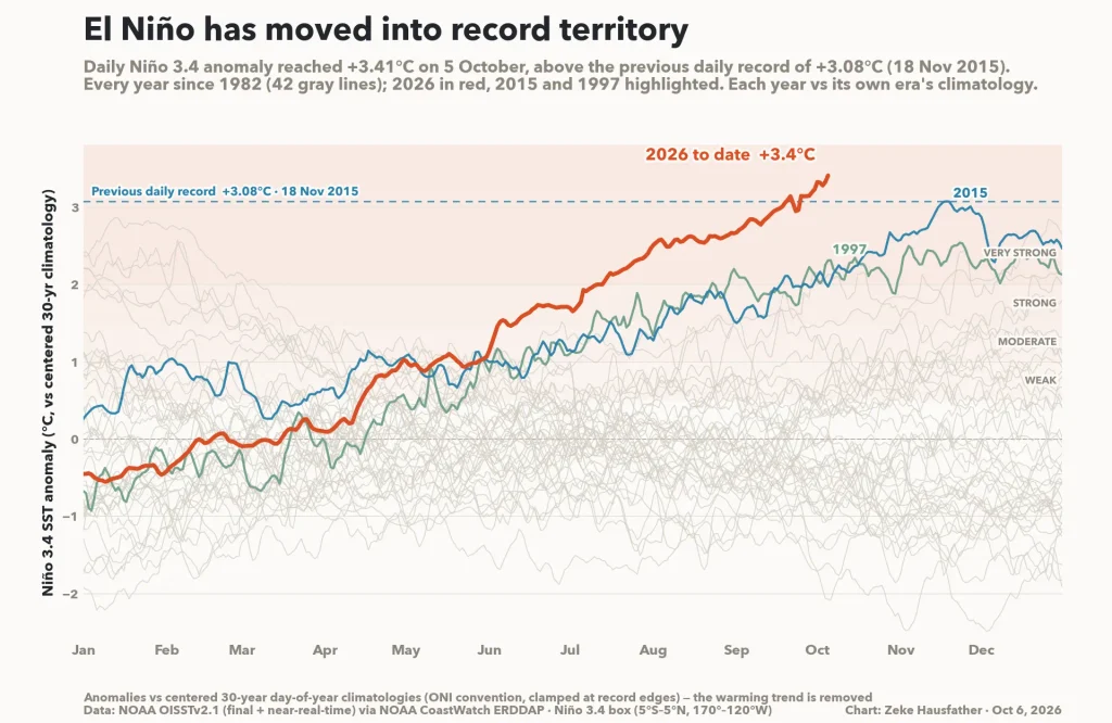
The El Nino is going monster – no other way to describe it. The main monitoring region is sitting at record levels and still climbing:
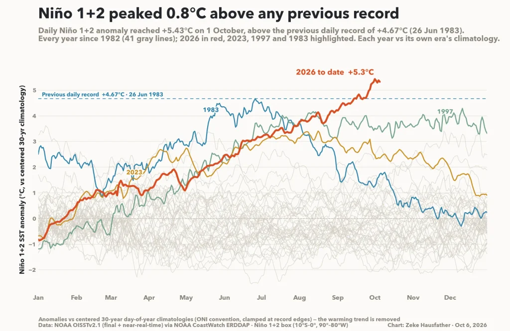
…and if we look further east across the Pacific another key monitoring area is currently sitting over 5C above average:
And despite these off-the-scale temperatures the models predict we still have some way to go – here’s the latest forecast from the European model:
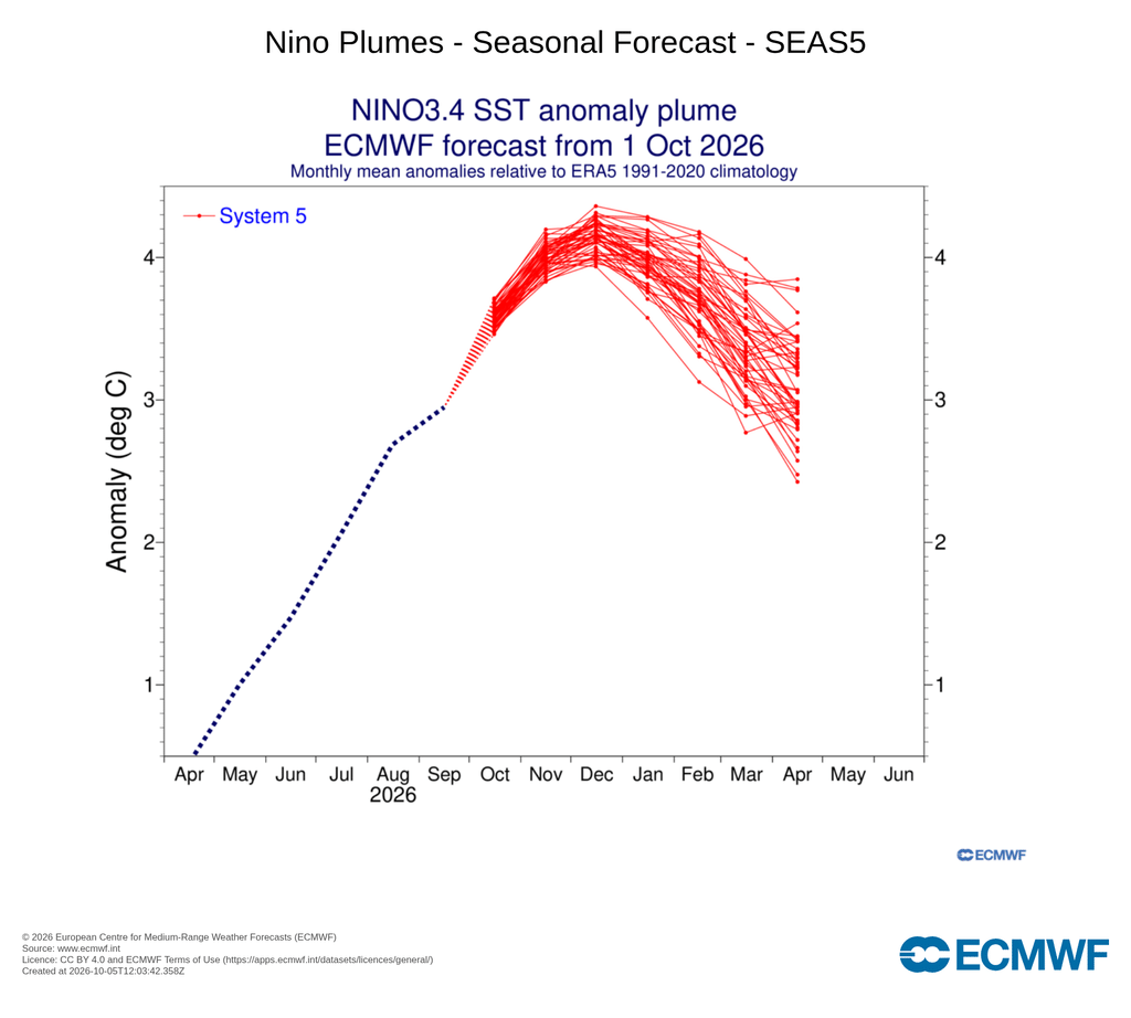
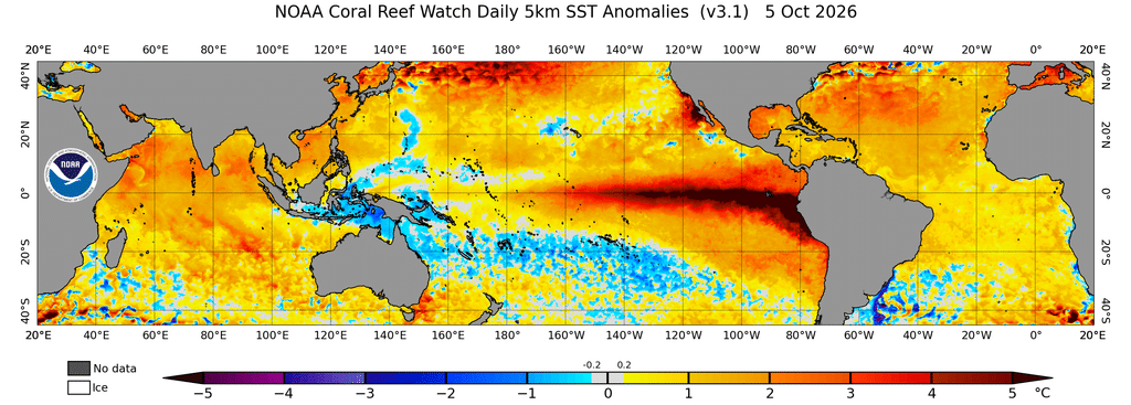
Just a huge event, unlike anything seen in recent times. We can see the current ocean temperature anomalies highlighting the massive event currently underway:
With El Nino events usually bringing drier weather to eastern Australia we would naturally be expecting drier conditions – and even though it might not have always felt like it, if we look at the last 3 months it has indeed been much drier than average across much of eastern Australia – here’s the rainfall anomalies for July through September:
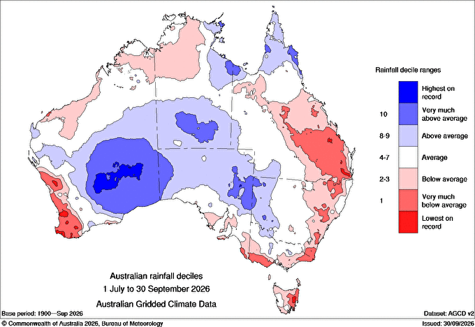
Worth noting that whilst many areas have been drier than average the coastal fringe across NE NSW – including our region – has received average rainfall. This isn’t that unusual for an El Nino – any onshore winds will bring higher humidity levels and the chance of coastal showers / storms despite the wider pattern. A bigger influence along the coast late winter and spring is the circulation around the South Pole. To get an idea of how much stronger or weaker than average the circulation is we can look way up high at the winds around the vortex. Higher winds -> stronger circulation -> westerly winds further south -> more chance of onshore winds across our region. The European forecast model has a great chart to indicate the strength of the winds. In this chart:
- The thin blue lines are each of the model runs
- The thick blue line is the average of all the model runs
- The thin red lines show the likely maximum / minimum levels we’ll see the winds get to, with maximum the higher line and minimum the lower line
- The thick red line shows the average wind strength
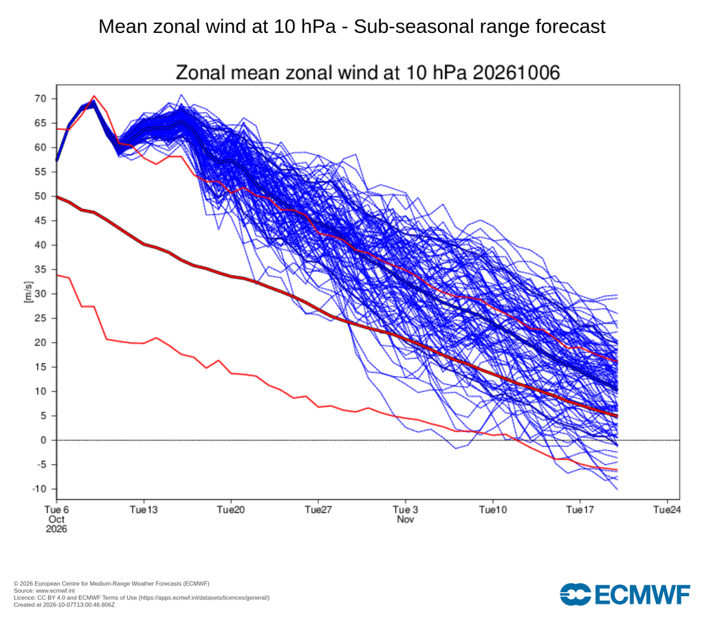
…and we can see that the winds are forecast to hit close to record high levels over coming weeks before slowly weakening but remaining well above average right through to the end of the run. That does not always transfer down to the surface but has a strong influence – and in this case that means westerly winds sitting further south than normal, allowing easterly winds to develop at times along the east coast, perpetuating the higher humidity levels and occasionally showery pattern.
One other factor to throw into the mix – much of the time the onshore winds follow southerly changes moving through – and those winds are rolling in from oceans that are sitting way above average off the NSW coast:
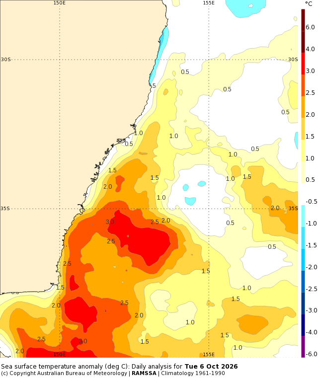
Those much warmer than average ocean temperatures mean higher humidity levels, and the potential for higher rain totals when conditions are right. Worth flagging that with the strengthening sun we are also moving into storm season – so with higher humidity levels at times we could well see an increase in stormy conditions from time to time.
The strength of the southern circulation has caught some models by surprise – for example the European model was predicting the El Nino winning the wet / dry battle and thus, even as recently as last month, was predicting a very dry October for us:
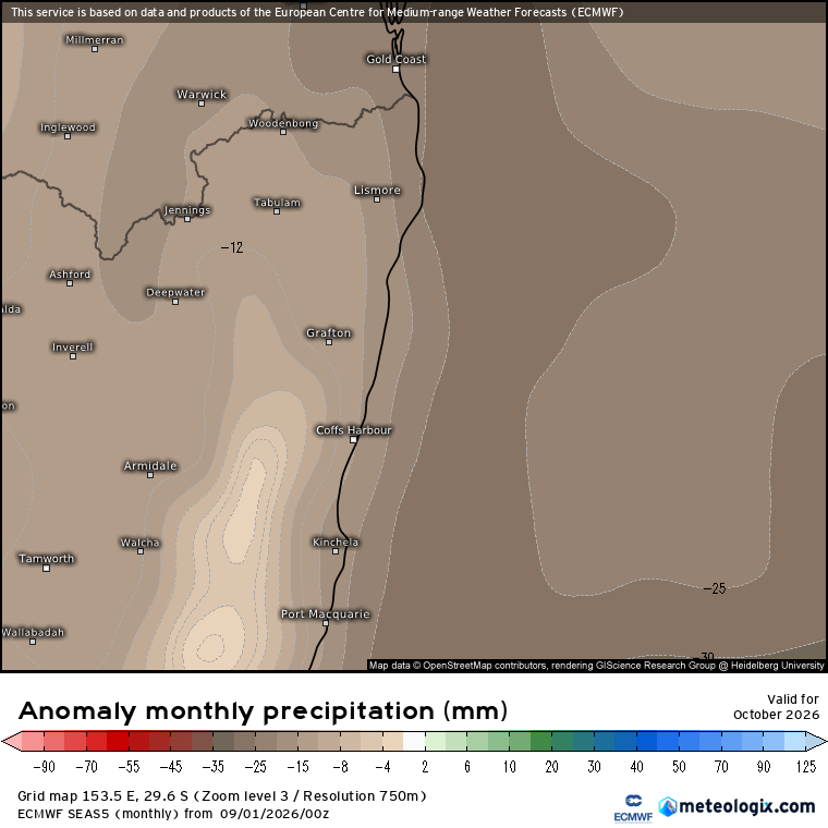
…but with the very strong southern circulation now battling against the El Nino the latest run is now forecasting the southern circulation having the greatest influence and thus a chance of wetter than average conditions across our region this month:
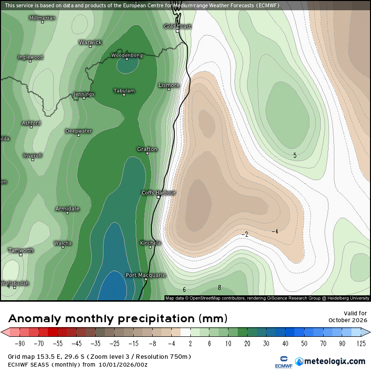
To give credit to the models it’s very hard to nail a forecast when you have two drivers pushing in opposite directions – one pushing dry and the other pushing wet. One thing to be aware of however is that the southern influence tends to die out as we move into summer, whilst the El Nino influence tends to last through the summer – so once we hit December the current forecast is still for drier conditions to start moving in again:
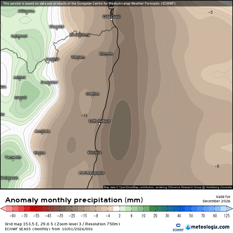
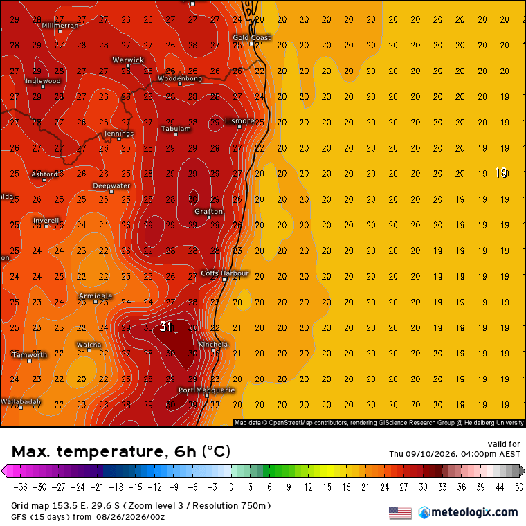
Also worth noting here that by the time we hit December we usually start to see higher rain totals – so drier than average at an increasingly wet time of year does not necessarily mean dry, just not quite as wet as we would usually see. I’ll update summer forecasts as we get closer to that season. One additional thing to note – all models still agree that we will see higher than average temperatures as we move through summer – for example here’s the forecast for February:
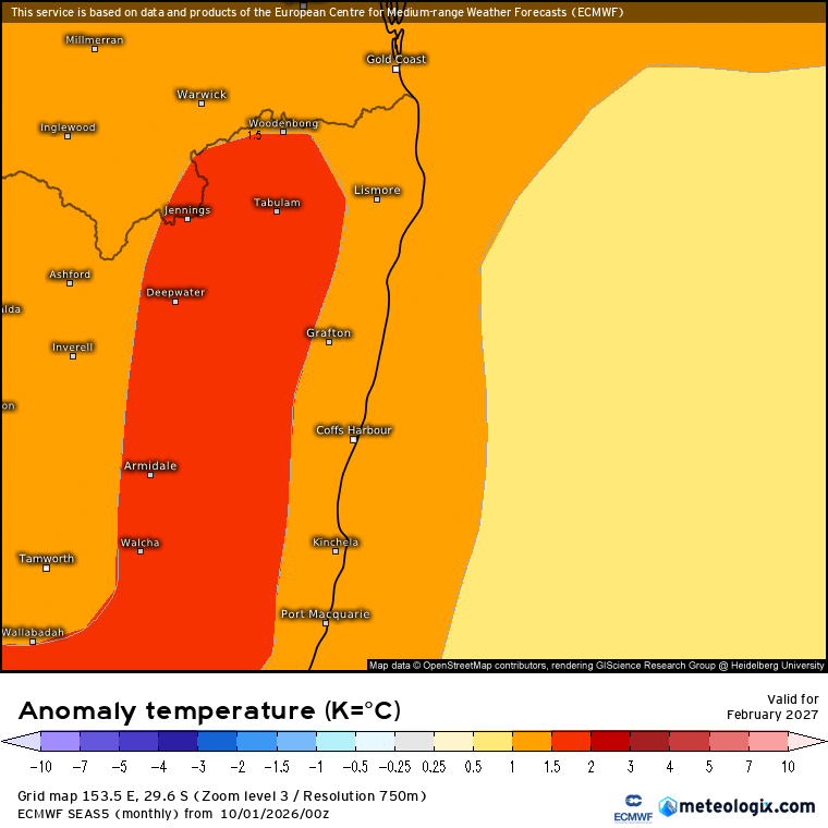
Even average temperatures in February can be pretty toasty, so to see these forecasts we need to be aware that we would see some very warm conditions incoming.
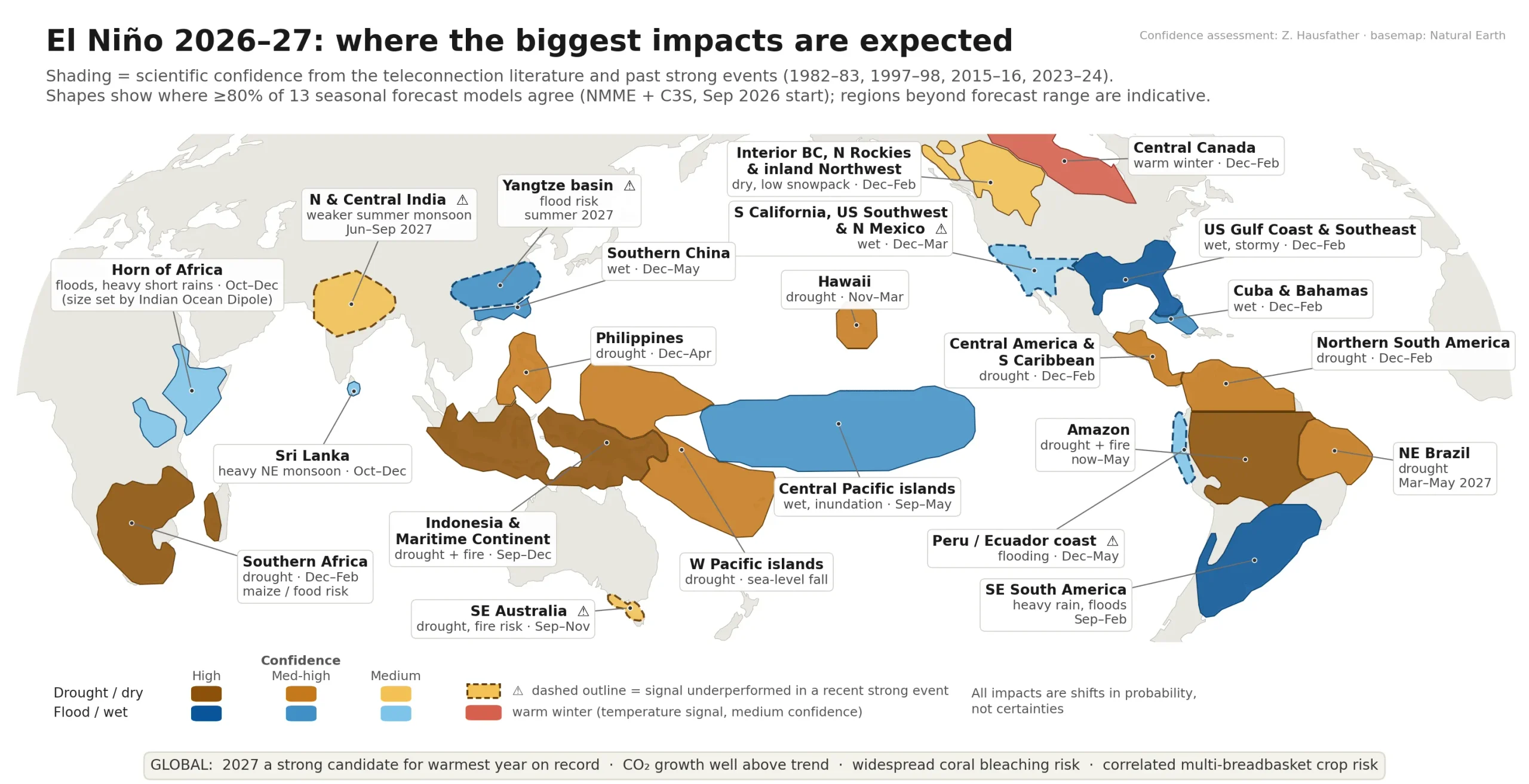
Looking quickly outside our region and it’s worth a mention that parts of the USA – notably Florida and California – usually see higher rain totals with an El Nino. The strength of this one could well send some very high winter rain totals across usually sunny California – for example here’s their forecast for January:
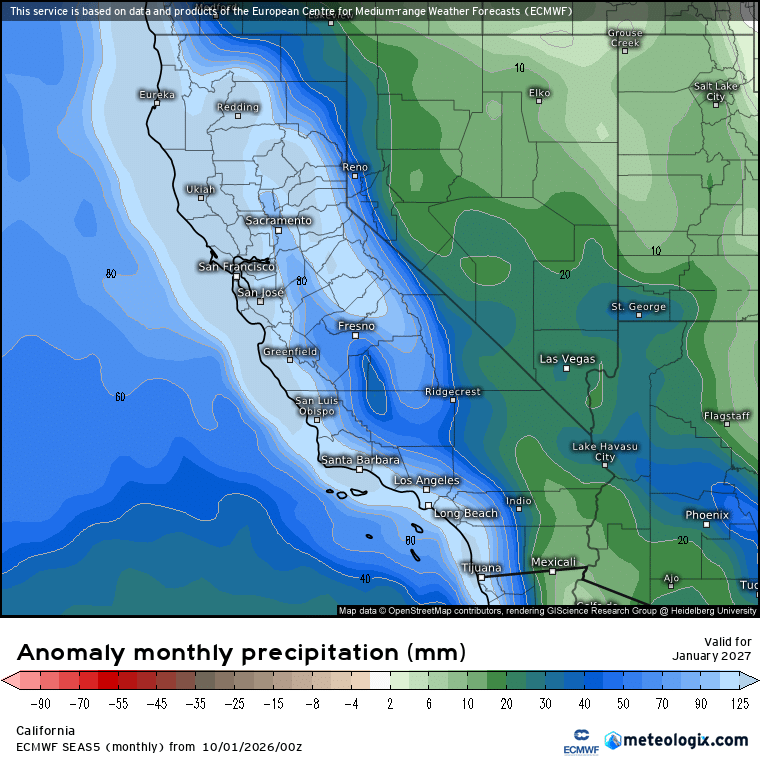
That is one strong forecast. As well as higher rain totals, storms moving in from the ocean could bring damaging waves and storm surge – so much so that the Californian Governor has already declared a State of Emergency across California for this upcoming winter. One to keep an eye on – and every chance it will pop up on the news from time to time as storms roll in.
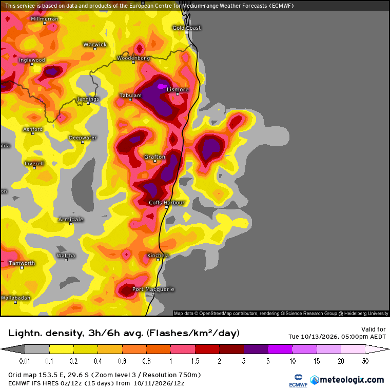
Back quickly to our region and a quick flag that we could well see the chance of storms move in this weekend, and again early next week – worth keeping an eye on the radar. I’ll leave you with the current lightning forecast for next Tuesday:
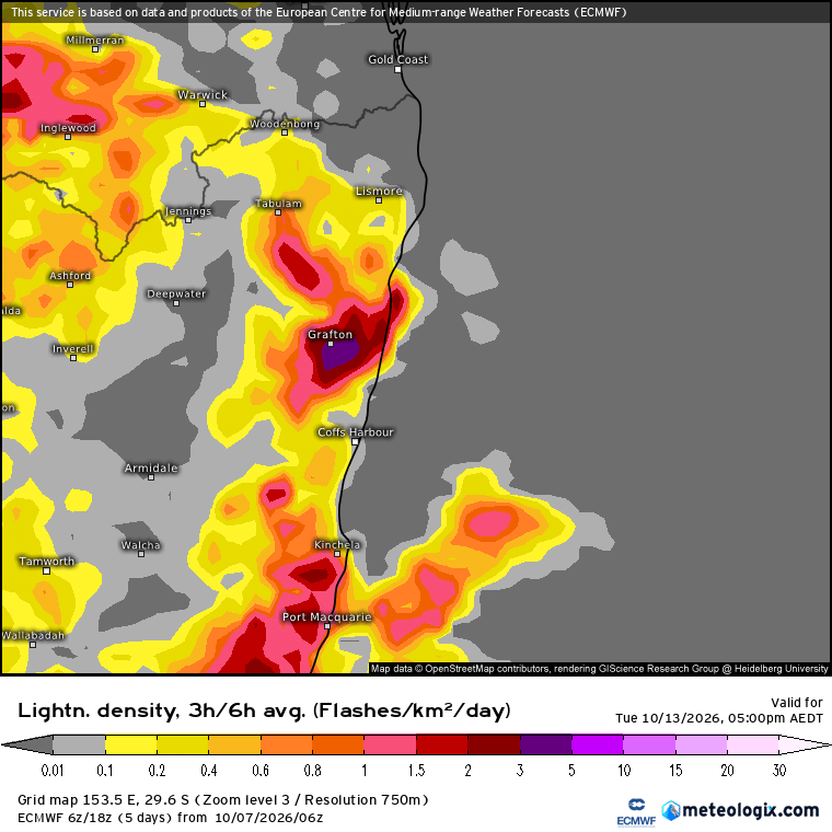
We might see some heavy bursts of rain with any storms but they’ll also be hit and miss. Still time for the forecast above to change but a great flag that we’re moving into storm season.
Many thanks to Kombu Wholefoods and Snapfrozen for ongoing support of this site, and wishing you a great remainder of the week. Thanks for making it to the end.