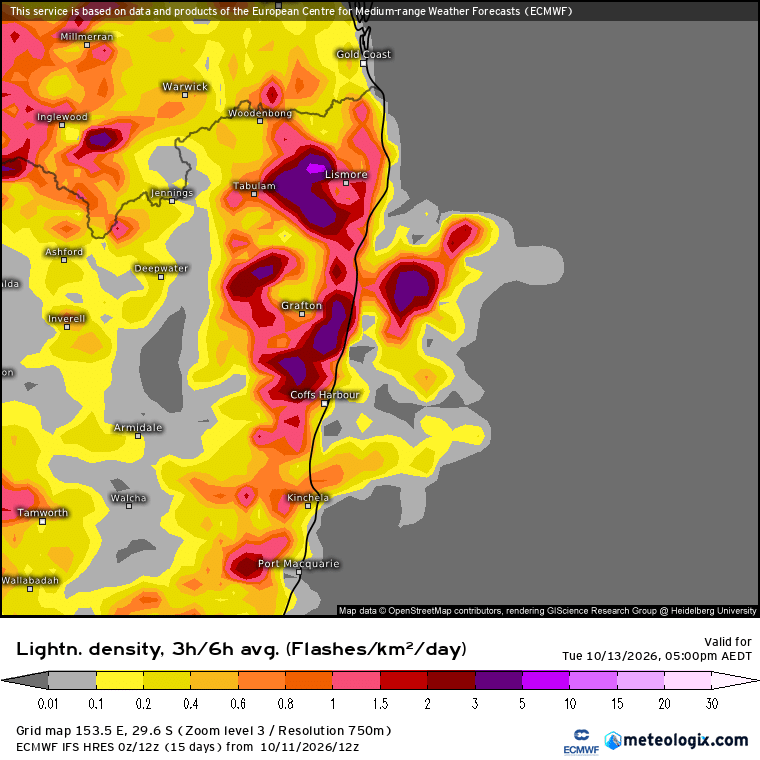
We’re at that time of year when the sun starts getting rapidly stronger – and that means hotter spells of weather can start kicking in as changes move through. The good news as we enter fire season? We’ve had some good rain which has knocked back the short term fire risk…but there are other conditions that can elevate risk – more below…
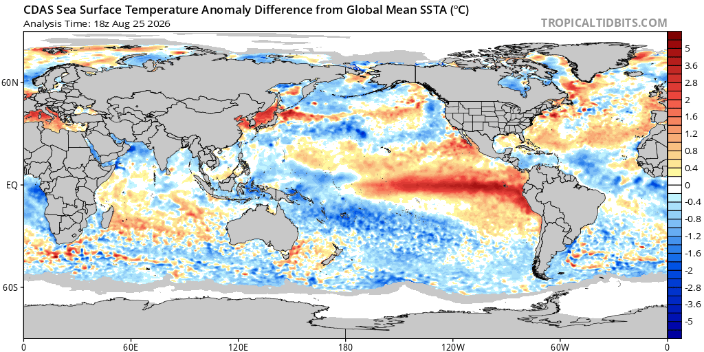
Kicking off with an update on our climate drivers. The El Nino is absolutely rocketing along. It stands out clearly on this difference from global mean map:
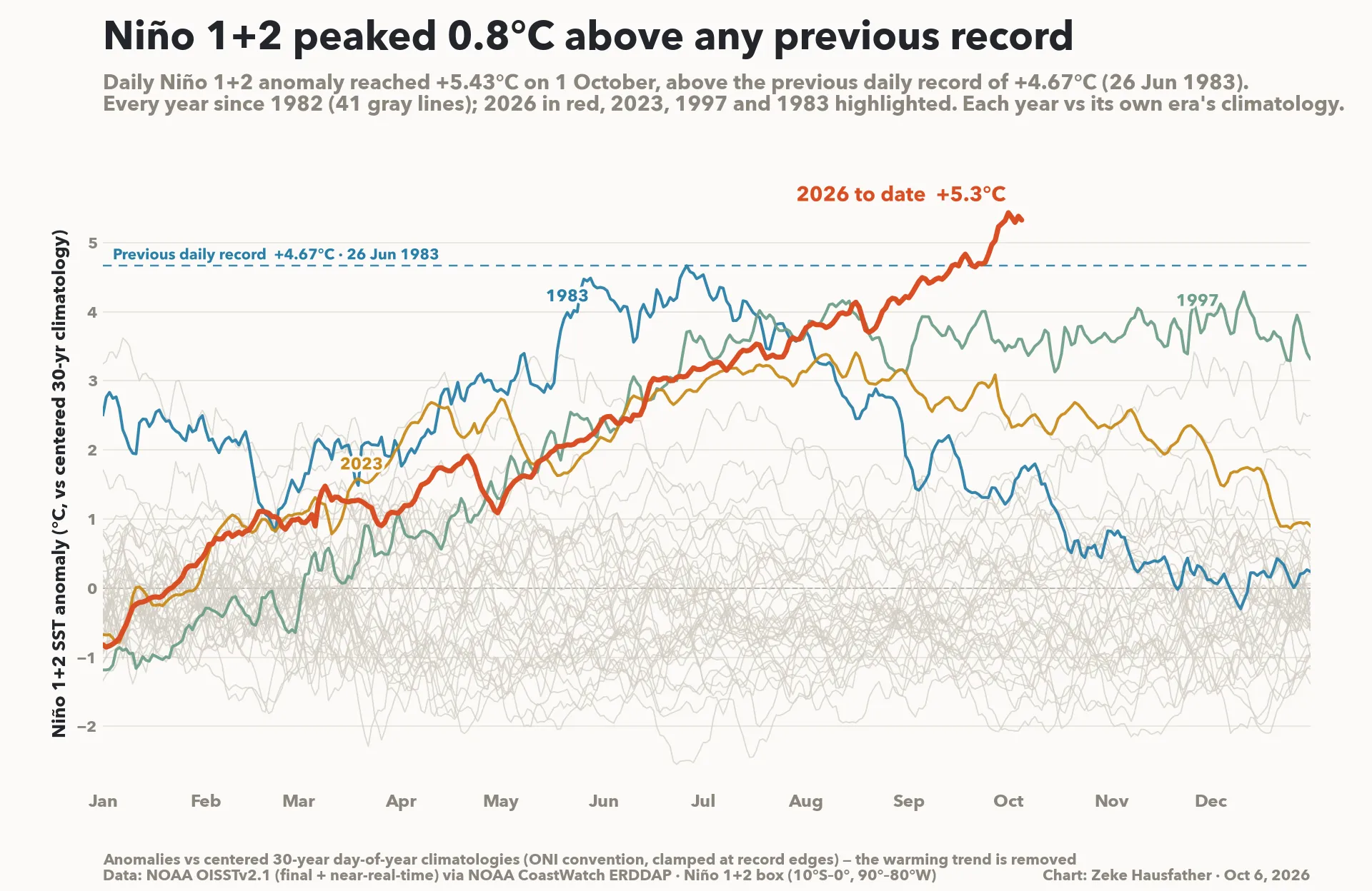
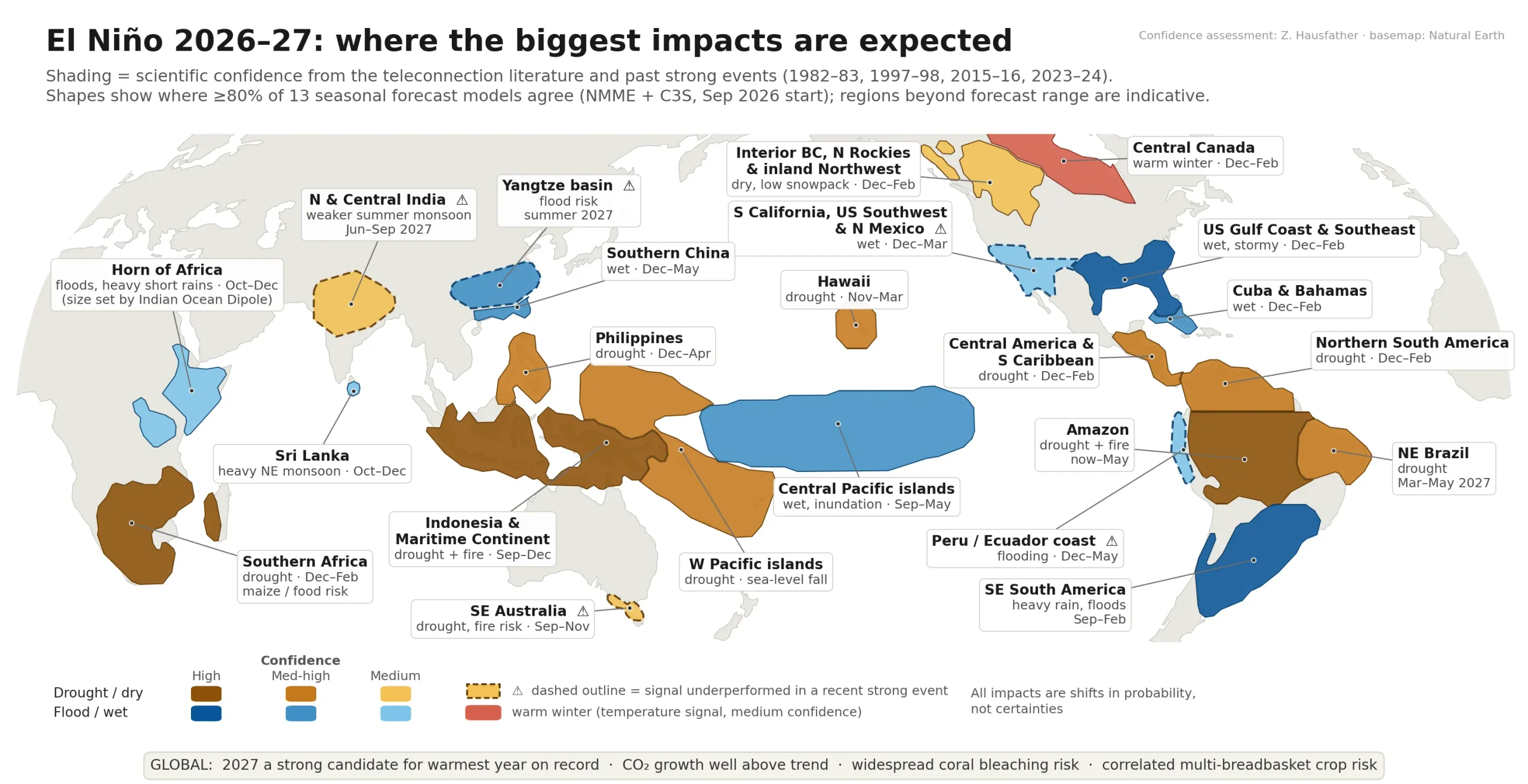
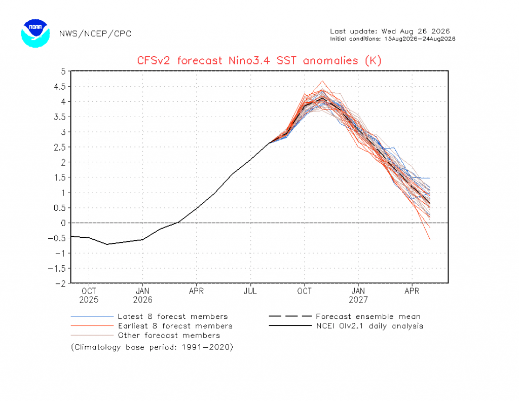
Absolutely no messing with this event – forecast to be the strongest on record. It looks strong now but models still indicate it has some way to go:
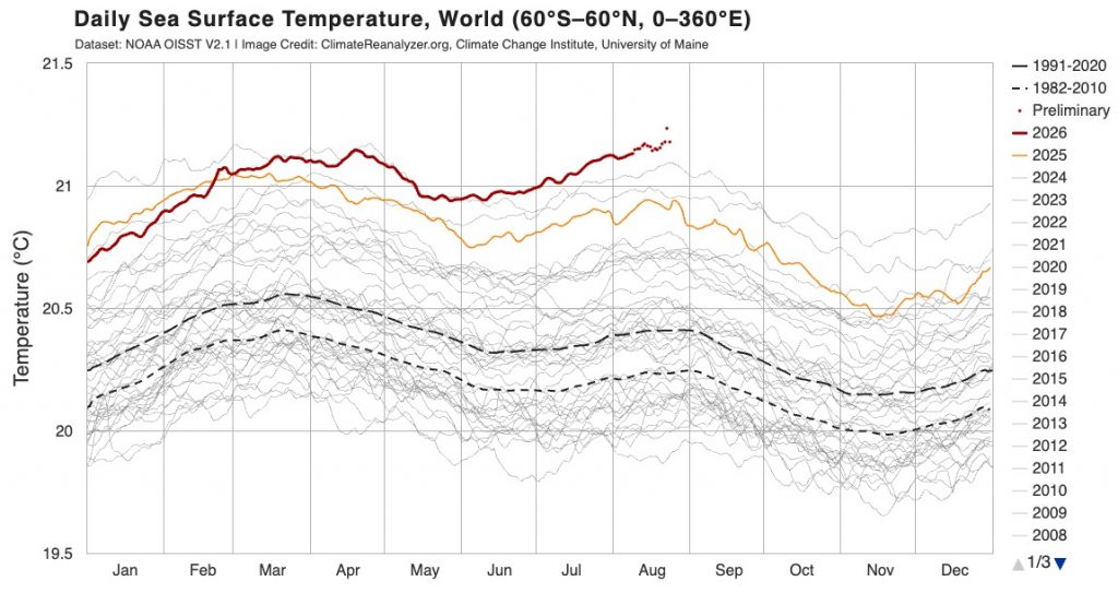
With climate change pushing more heat into the oceans events like El Nino give the oceans a chance to push some of that heat back into the atmosphere – and that is exactly what we are seeing right now. Global ocean temperatures (partly as a result of this El Nino) are currently sitting at the highest on record:
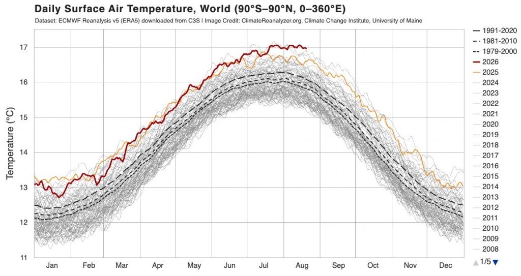
…and not surprisingly global air temperatures are also sitting at the highest on record for the time of year:
El Nino would normally push rain totals down across much of Eastern Aus, but those record-warm oceans also push a lot more moisture into the atmosphere, so things are not as clear cut as we might otherwise expect…
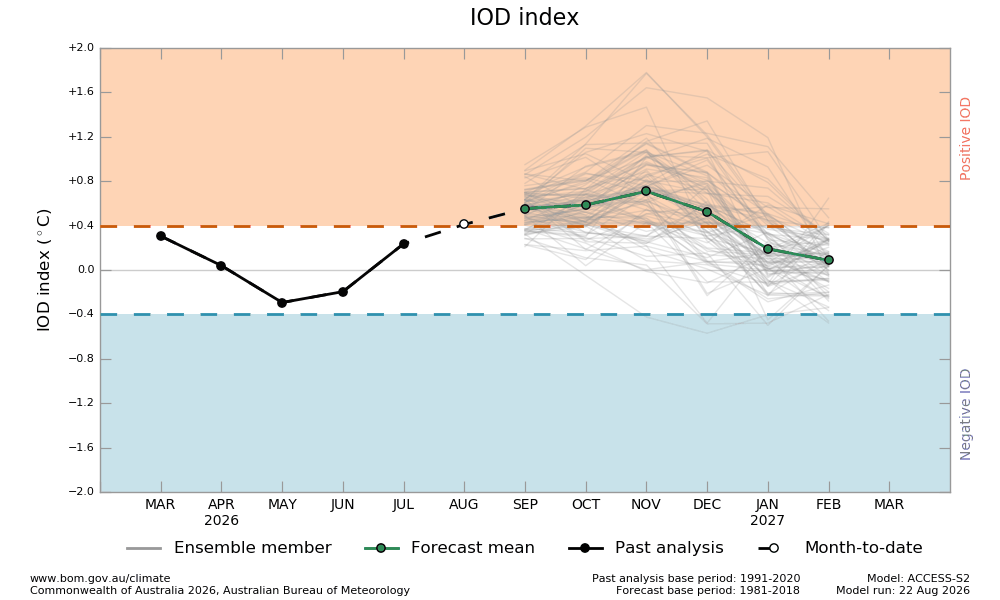
The Indian Ocean is also trending slightly positive, which would normally bring drier conditions across eastern Australia:
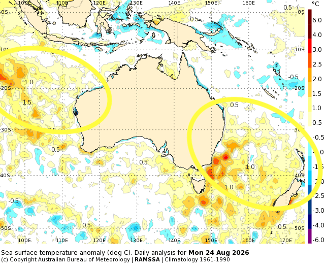
…but again warmer than average temperatures across the central Indian Ocean are still sending a decent amount of moisture across Australia, with record rainfall across some inland areas recently. Here’s how our offshore ocean temperatures are looking right now:
The Southern Ocean circulation is now sitting a little negative, which would again usually mean drier than average conditions across eastern Australia:
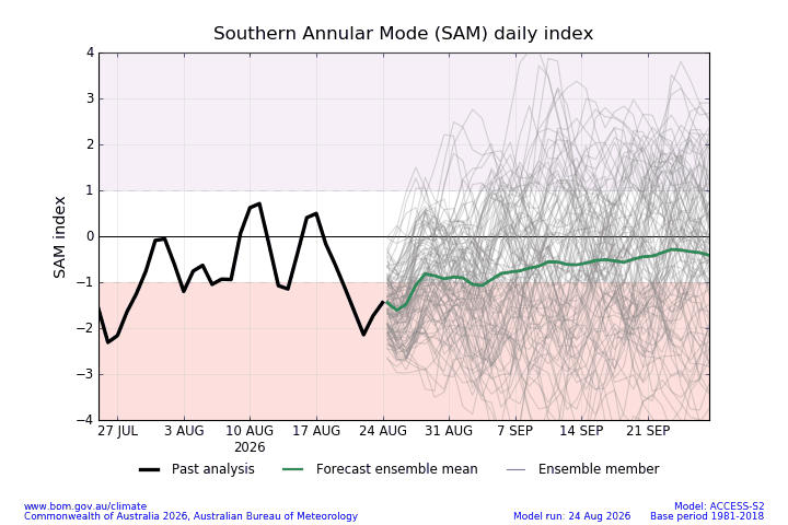
So what does all that mean? Well, right now we’ve been seeing wetter conditions at times across our region – however there could well be a point where the three drivers pushing drier could overcome the impacts of the warmer oceans and bring us some drier weather. The next couple of weeks actually look drier across our region, with just a few showers and storms with changes (such as this afternoon and this weekend). Longer term rain forecasts remain, as they did on previous posts, a little undecided with some models indicating much drier weather whilst others keep us wetter. One to keep an eye on – we could stay a little wetter but the drier push from all three drivers could well bring in drier conditions.
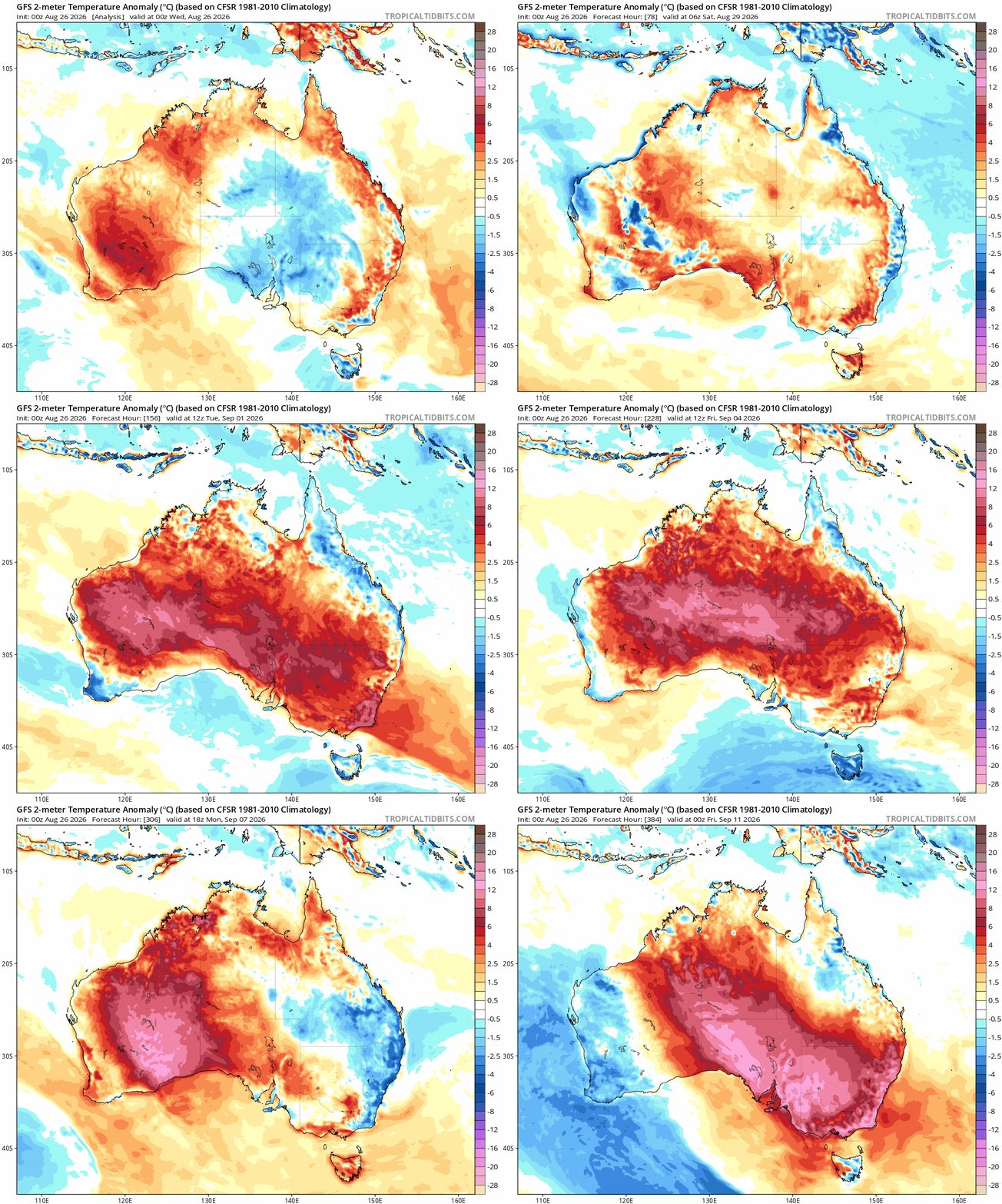
One thing that has a real impact on how quickly the landscape dries out is the temperature – and that brings us back to the opening line of this post. One area where there is decent model agreement is on temperature, with all models indicating warmer than average conditions through spring and summer. Inland WA is a real heat generating machine in spring / summer. As southern changes move through we can see hotter weather swept across much of Aus, including our region. We can see this clearly in the forecast temperature anomalies for the coming two weeks – watch the heat develop across WA and then get swept east with changes:
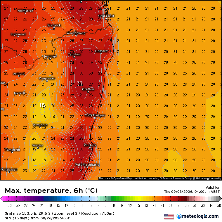
That doesn’t mean it will be hot all the time – far from it – but we’re going to see the warmer spells start to roll in ahead of changes – for example here’s the current forecast max temps on Thursday 3rd September:
…and again for Thursday 10th September:
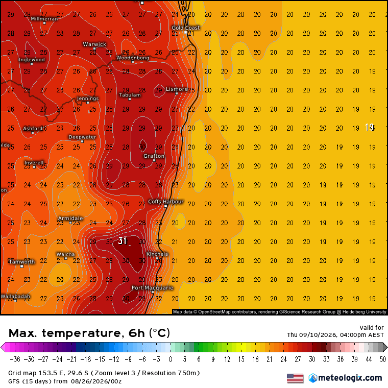
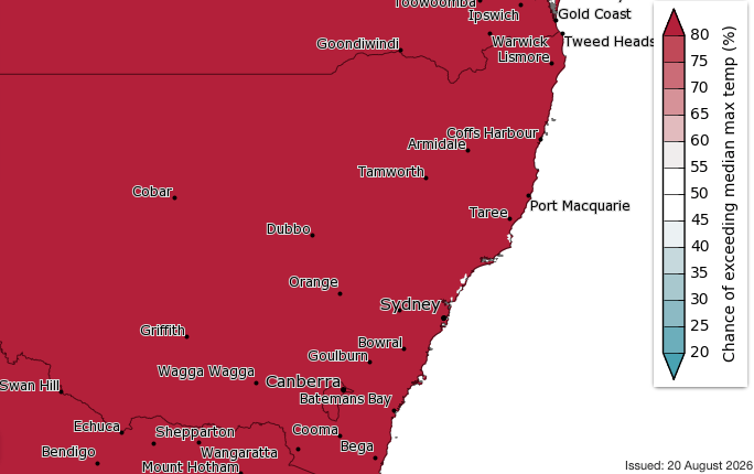
Just as the changes bring warmer air across from the west, they also bring cooler weather from the south to follow. Right now it’s good not to rely on the two temperature forecasts above for anything other than a heads up that warmer weather is incoming – the days of peak warmth can / will change…but expect to see a lot more heat moving in as we head into an El Nino summer. The BoM outlook is a classic – everywhere across NSW virtually guaranteed warmer than average conditions through spring:
As we enter fire season North Bellingen Rural Fire Brigade will be at Bellingen Markets on Saturday 19th September with a heap of fire plan information – please take 5 to pop in, say hello and make sure you’re ready for fire season. See you there for any weather questions as well!
Thanks for reading, and thanks as always to Snapfrozen and Kombu for keeping this site up and running 🙂