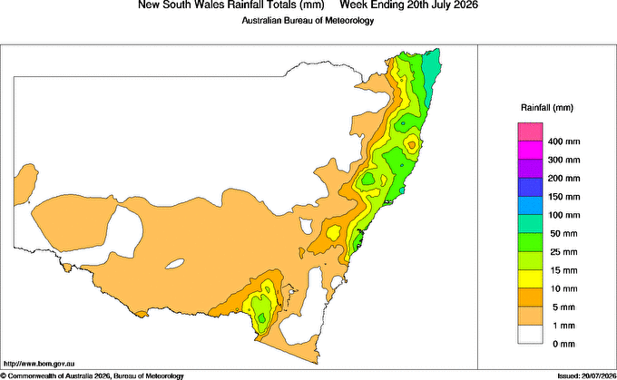
It was a wild, windy and fairly damp weekend. Rain kept mainly to the coast and hills, but everywhere saw a little. 7 day rain totals looked like this:
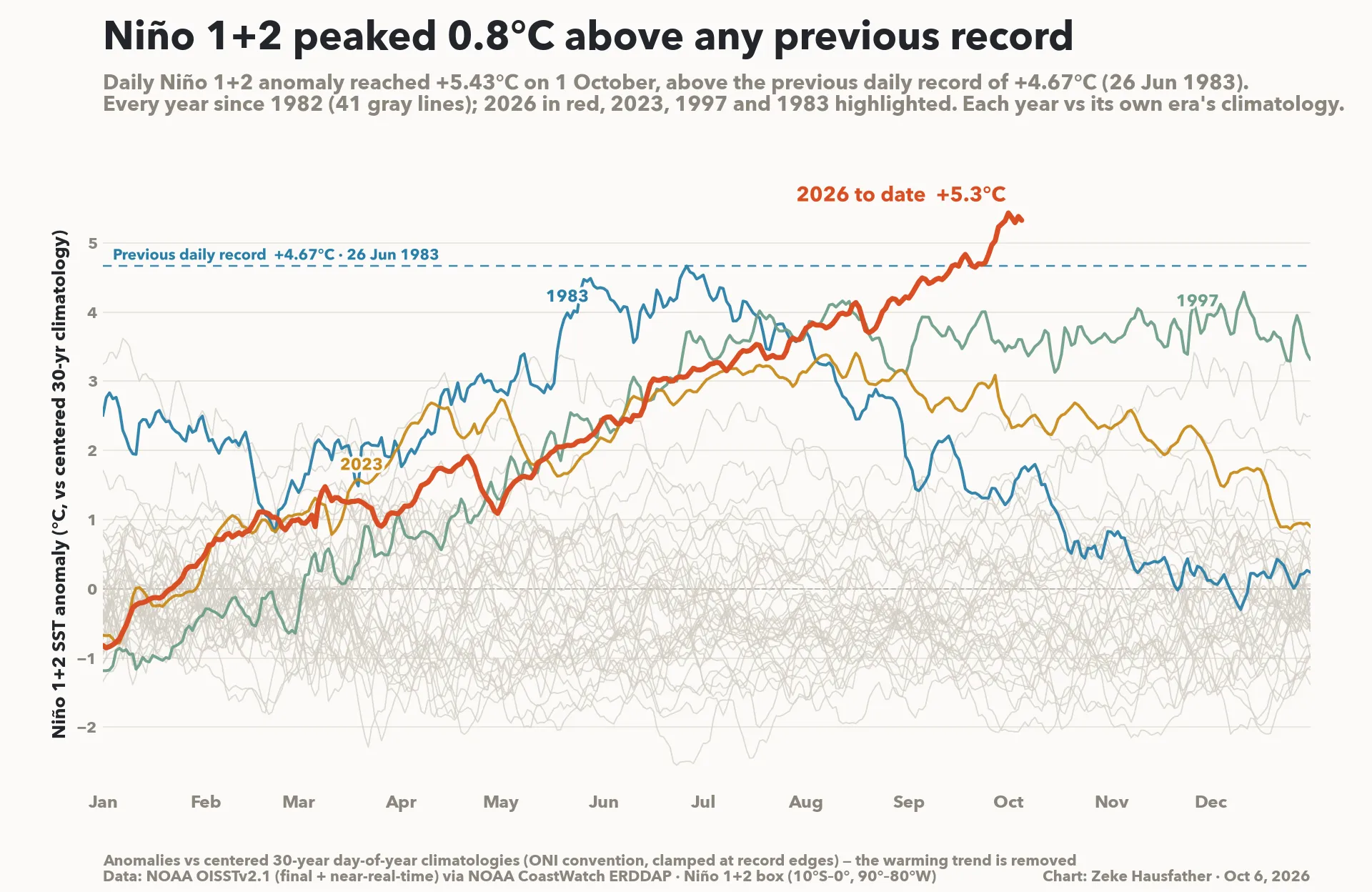
The good news is that the low responsible for the dreary weather has now moved away and the weather is settling down. To get an idea of what lies ahead it’s a good time to look at our climate drivers. The El Nino in the Pacific is still heading well into record territory:
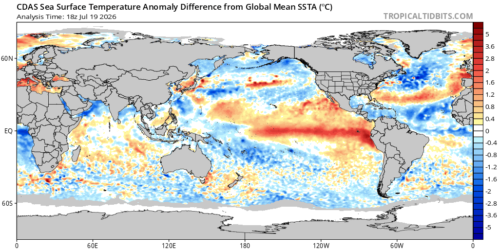
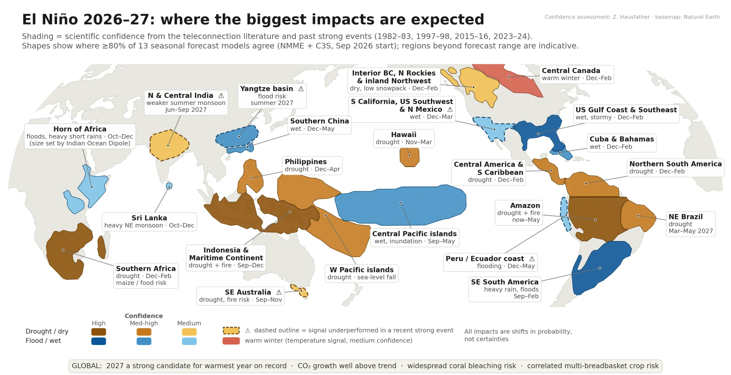
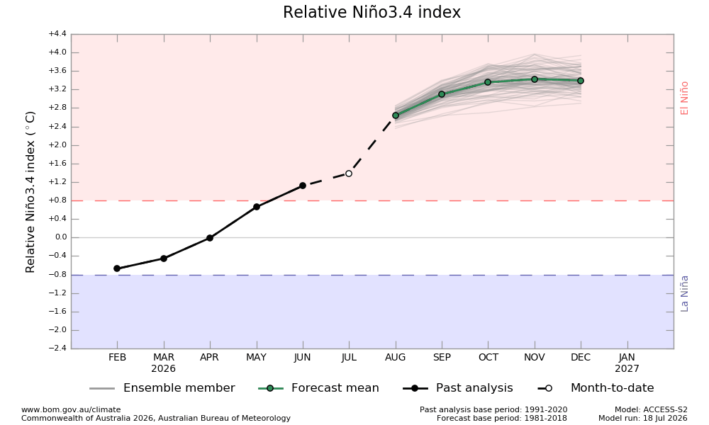
No mistaking the pattern in the Pacific – and it looks like it will continue to strengthen as we head into spring. El Niño often brings drier conditions to central and eastern Australia in winter and spring but outcomes can vary from event to event. We have never recorded an event this strong so it’s not clear what rainfall impacts will be…however it’s impact on global temperatures is more clear-cut, with record temperatures likely / continuing across many regions over the coming couple of years. Right now it looks like the El Nino will push us towards a much warmer late winter / spring compared to previous years, with drier than average conditions, particularly west of the divide. Current El Nino forecasts look like this – unlike anything we have seen before:
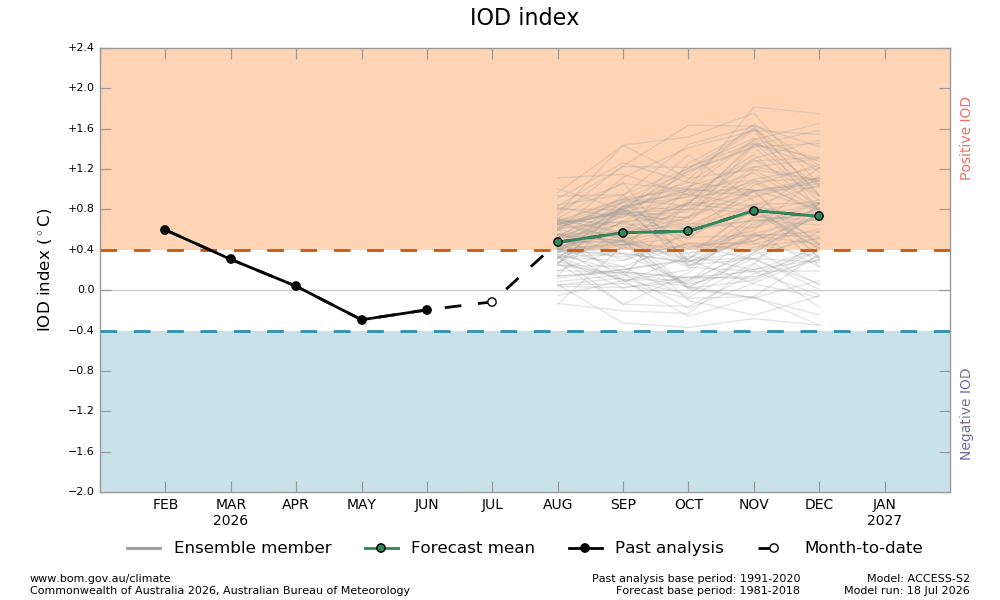
The Indian Ocean Dipole has been in a neutral phase – but going forward it may turn positive over coming months, before likely returning to neutral at the end of the year:
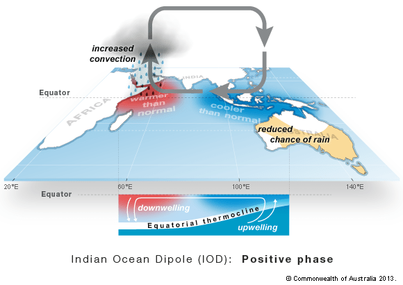
During positive events westerly winds weaken along the equator allowing warm water to shift towards Africa. Changes in the winds also allow cool water to rise up from the deep ocean in the east. This sets up a temperature difference across the tropical Indian Ocean with cooler than normal water in the east and warmer than normal water in the west.
Generally this means there is less moisture than normal in the atmosphere to the northwest of Australia. This changes the path of weather systems coming from Australia’s west, often resulting in less rainfall and higher than normal temperatures over parts of Australia during winter and spring:
With both these drivers drier than average weather would look likely – but we’ve had the circulation around the south pole a lot stronger (more positive) than usual – and that’s kept westerly winds to the south of Aus (terrible for snow season) and easterly winds sweeping onto the east coast – hence the weeks of cloud and showers. The current forecast shows the extended positive phase coming to an end, with a negative period incoming:
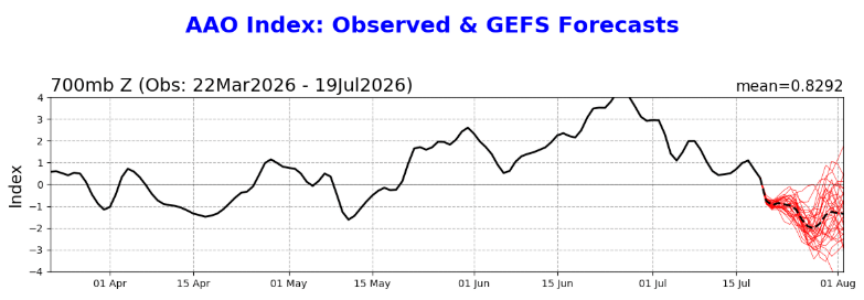
While the negative phase lasts (and at this stage without a strong warming event impacting the circulation it could be from days to weeks) we will likely see slightly drier conditions over coming weeks – particularly with the El Nino in place and a positive Indian Ocean event looking likely. That doesn’t mean it’ll be dry right through, but we should see more sunshine than we’ve seen over recent weeks.
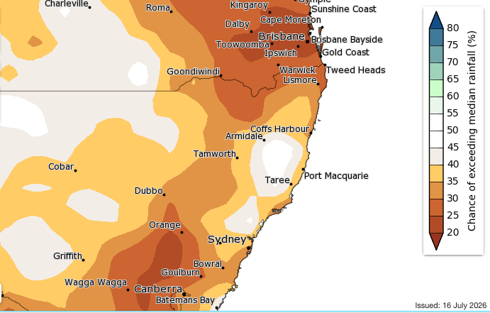
As far as spring is concerned the outlook for our region is dependant in part on the southern circulation….whilst it is looking negative over the coming week there are still no clear indications as to which way it will move…as such I’ll keep an eye over coming weeks and update any longer term forecasts as more information becomes available. The latest BoM rainfall outlook for August through October indicates as such, with drier weather likely for many:
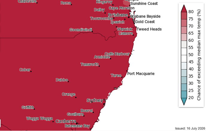
And as indicated earlier, temperatures look easier to forecast – check out this maxed-out BoM map of NSW for August through October:
That’ll do for now. Next post either early August (when the new monthly outlooks are released) or whenever the next interesting weather looks likely. In the meantime hope you get a chance to enjoy the sunshine through the latter half of this week!