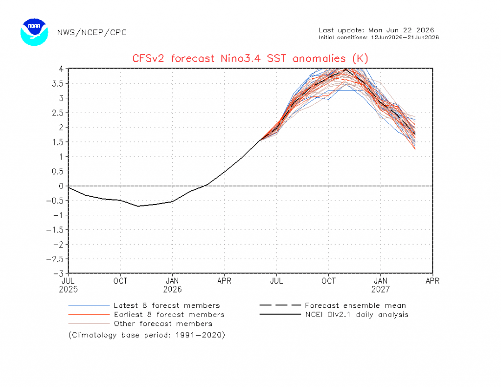
As we pass through the shortest day we’re now into a time of year when the sun strengthens every day for the next 6 months. It might not feel like it (with a record warm June to date) but the sun is currently as weak as it gets for us. While all this is going on we’ve got a fascinating climate stand off taking place. El Nino is already in record territory for the time of year and is forecast to continue to strengthen for the next few months:
The atmosphere is also playing ball with the Southern Oscillation Index dropping well into the negatives:
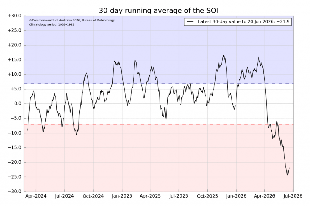
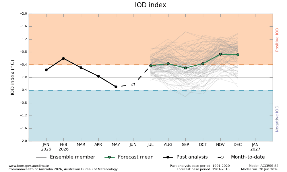
…and that would usually mean move towards drier conditions, particularly inland. The Indian Ocean climate driver is currently neutral so not adding much of an impact either way:
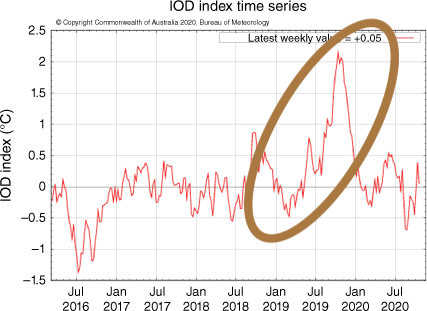
(As an aside compare that to 2019 (just before the black summer fires) when it was heading into record positive (dry) territory:)
So not much influence from the Indian Ocean…but check out the Antarctic Circulation – currently heading into off-the-chart positive territory:
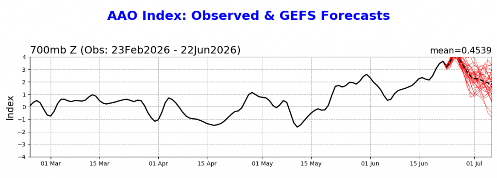
A positive phase pushes the westerly winds much further south – and that lets easterly winds push onto the Australian east coast. Here’s a great explainer from the BoM:

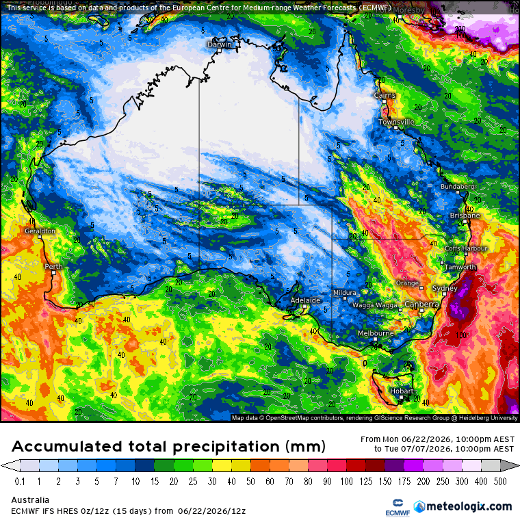
….and until the Antarctic Circulation weakens we’ll continue to see wetter than average conditions across much of eastern Australia. Worth checking out the latest two week outlook from one of the key models and comparing to the image above…you can certainly see how much of an influence the Antarctic Circulation is having:
Looking ahead and the Indian Ocean looks to move into a drier phase as we hit spring. The El Nino in the Pacific is likely to continue to strengthen, bringing drier weather particularly west of the divide…and it’s still too early to see what the Antarctic Circulation will do. It’s a fickle beast and very hard to forecast. If it remains very strong we’ll likely see less of a rainfall impact from the El Nino (though hot days are still very likely at times)…but if it weakens or turns negative we could well see a much drier spell moving in. No sign of that just yet however – will keep an eye on that one and post updates over coming months.
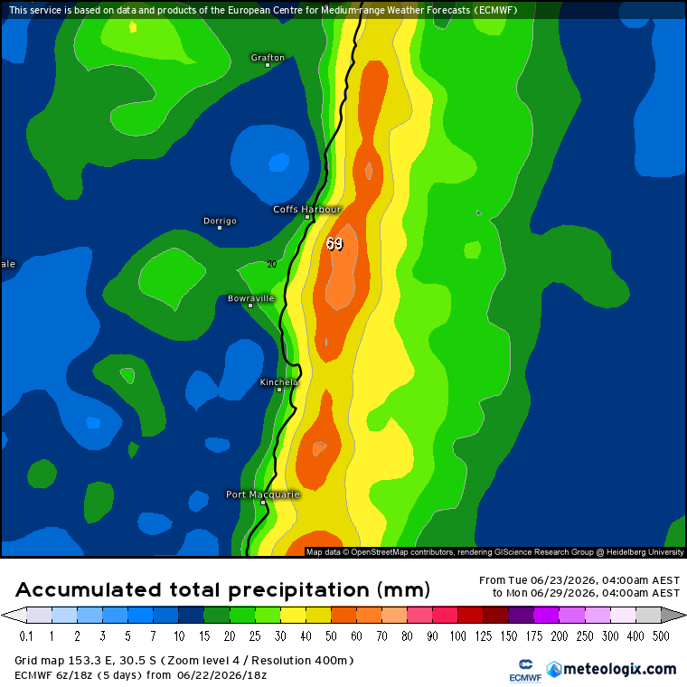
For now we’ll likely see showers move in once again as another change moves through – the pattern of the winter so far. Here’s the latest 6 day outlook showing the focus on the coast and hills (once again):
…so enjoy the sunshine while it lasts 🙂


