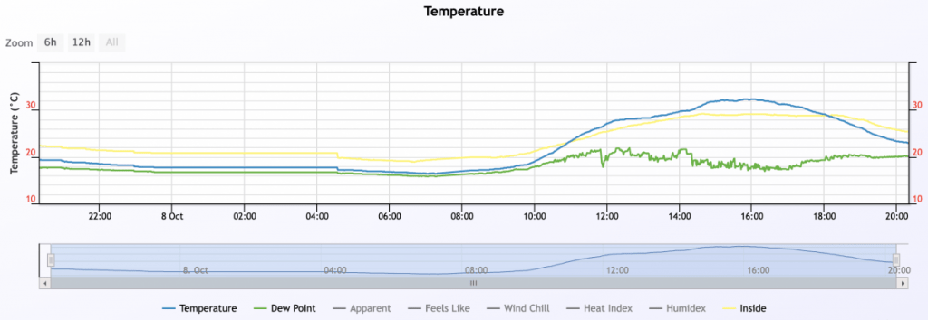
Anyone else notice the heat move in this afternoon? Reached a decent 32c after a damp 20c start to the day:
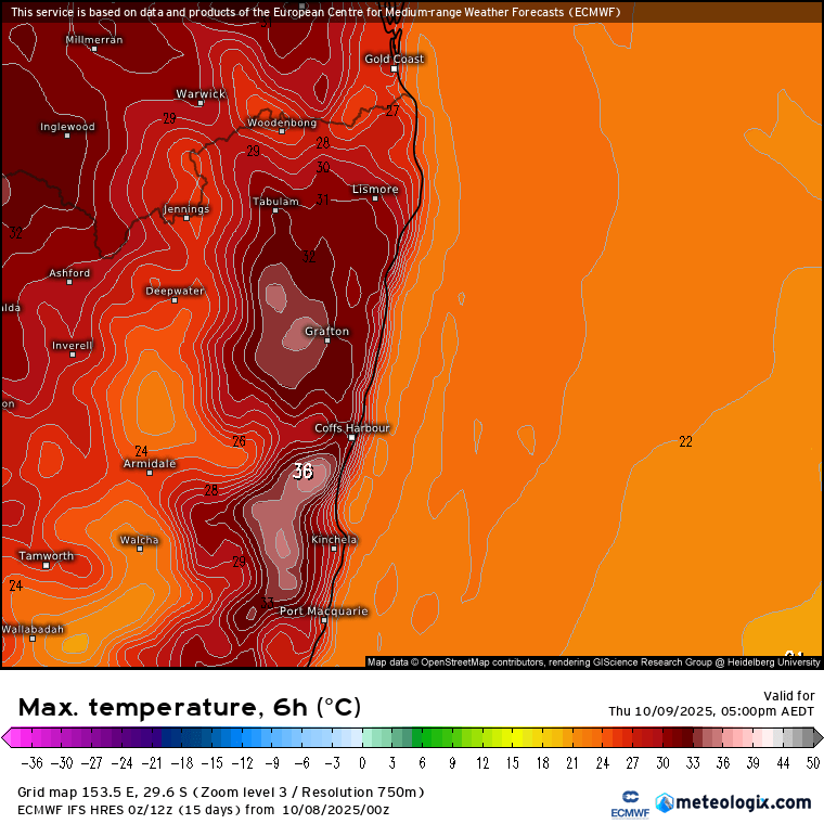
If that felt warm…tomorrow is going to be warmer still, with tops close to 36c as a trough draws in hot air from the west:
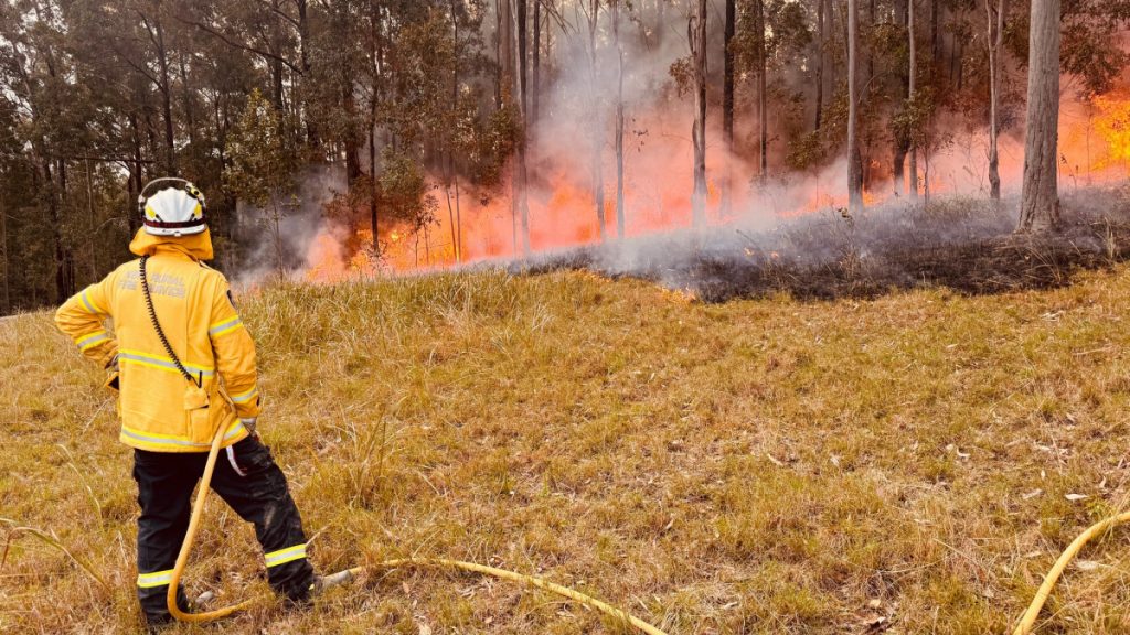
That heat will combine with the recent dry weather to bring us High fire danger ratings tomorrow and again Saturday. Fires are already burning to our north – here’s how it looked just outside Nymboida yesterday afternoon:
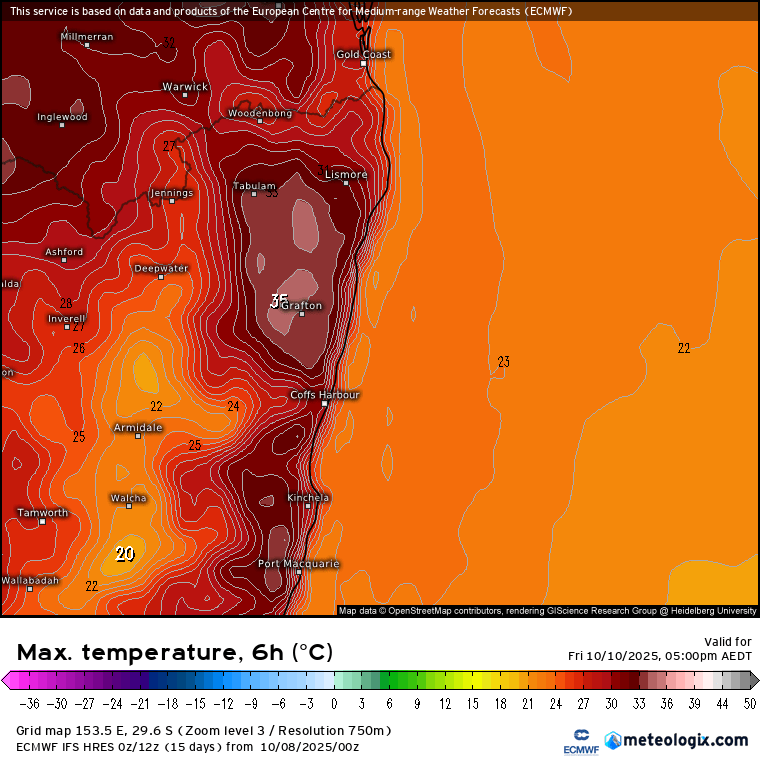
Looking ahead and the peak of the heat will be sitting just to our north on Friday:
…but still hot for us. Whilst we have both the Pacific and Indian Ocean working hard to push moisture across Australia we’ve had a warming event over the south pole (that we first discussed about 6 weeks ago). That upper atmospheric heat weakened the polar vortex, which relaxes and moves (the westerly winds) further north. That has been responsible for our recent drier spell. The good news in the very short term is that the vortex has temporarily strengthened again. Westerly winds have moved further south and some moister air has moved in…so don’t be too surprised to see the chance of some showers and storms over coming days. The not-so-good news is that both the European and American models show the vortex weakening significantly over coming weeks – the large circles in the images below show the latest model run:
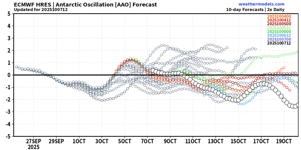
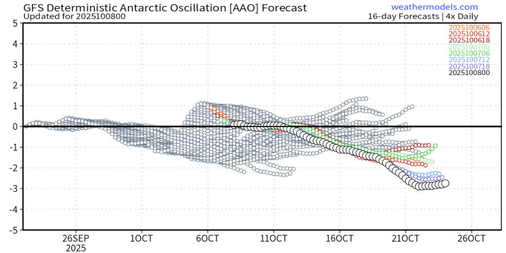
You can easily see the recent slightly positive position (stronger vortex) but then a steady weakening over coming weeks. Whilst this doesn’t guarantee drier and hotter weather it does increase the chances of seeing drier / hotter weather at times over the weeks to come. The good news – forecast showers and storms over coming days could bring some decent falls / the recent wetter weather means it’s greener than it might be / the wetter signals from our eastern and western oceans will take any opportunities to throw some storms our way given half a chance / we live in an area that typically sees higher rainfall…however it’s worth being aware that there is also an increased risk of some fire weather over coming weeks.
I’ll post again if it looks like we’ll see either severe storms or fire weather – both are possible. If you’re concerned about fire risks please come and have a chat with Fernmount and North Bellingen RFS crews at the monthly market on Saturday 18th October. There will be a range of Get Ready information for young and old together with some great giveaways for the kids. Brigades are also looking for new members – this is a great time to sign up.


