We’re just about to hit mid-winter – the day when the daylight is at it’s shortest and the night is longest. By the end of the weekend we’ll see days start to lengthen and the sun start to strengthen once again. Some of the local trees are getting in early with blossom already appearing on some of them – in fact here’s a peach tree in my garden:

We’ve had a heap of cold nights but temperatures are still looking to trend higher than average over coming weeks, in part because of the warmer than average ocean temperatures off our coast:

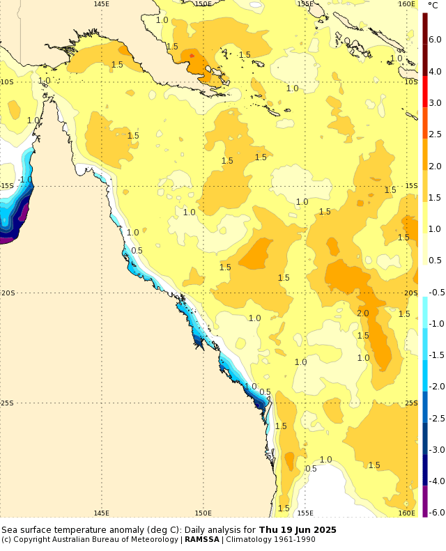
…and if we look a little more locally we can see ocean temperatures sitting well above average off the Queensland coast:
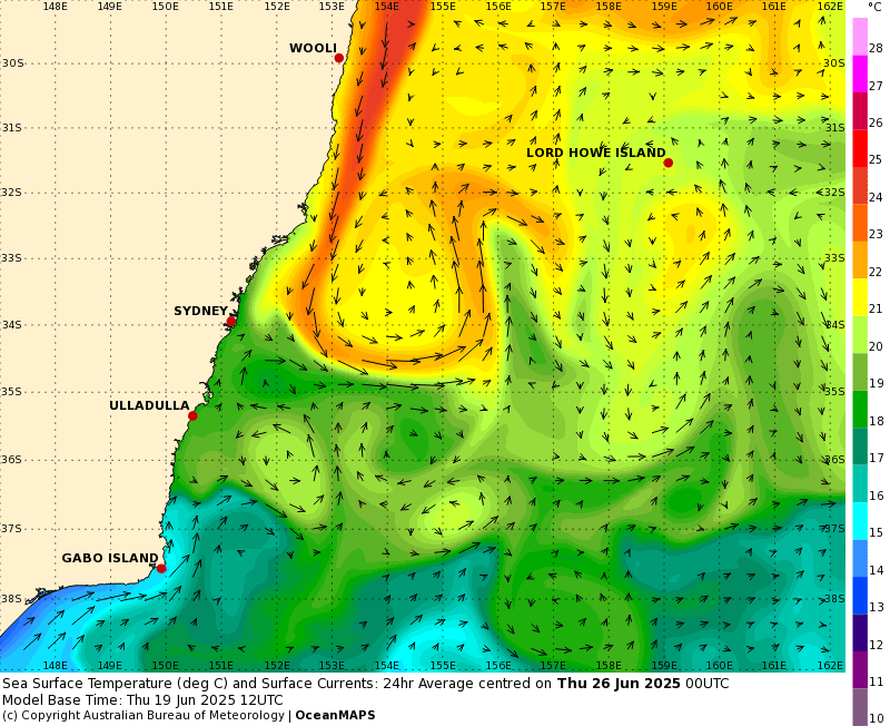
Add a decent East Australia current pumping water south past our part of the world:
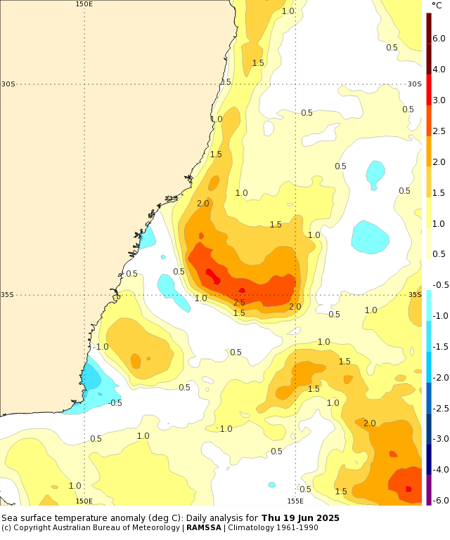
…and sure enough we can therefore see those above-average ocean temperatures off parts of the NSW coast as well:
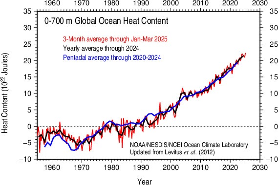
This is part of a global pattern with ocean heat sitting at close to record levels right now:
We’ve had a weaker than average southern circulation recently and that’s kept the westerly winds sitting further north, however the BoM forecast for coming weeks shows the southern circulation strengthening – and thus tightening with the westerlies contracting further south as a result:
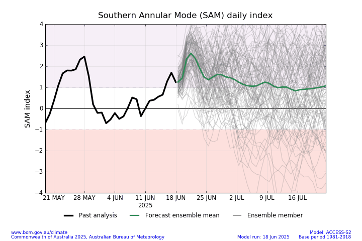
Whilst that doesn’t guarantee we’ll see onshore winds it does increase the likelihood that we’ll see them over coming weeks. With above average ocean temperatures we would likely see a return to higher than average temperatures (particularly at night) and some wetter weather if that happened. There’s no guarantee this will happen – global drivers only increase the chance of something happening (with a heap of other elements needing to come together to actually create an event) – however don’t be surprised if we see onshore winds and wetter conditions making a return at some point in the weeks to come. I’ll keep an eye on the models and post an update if a significantly wetter spell looks likely.
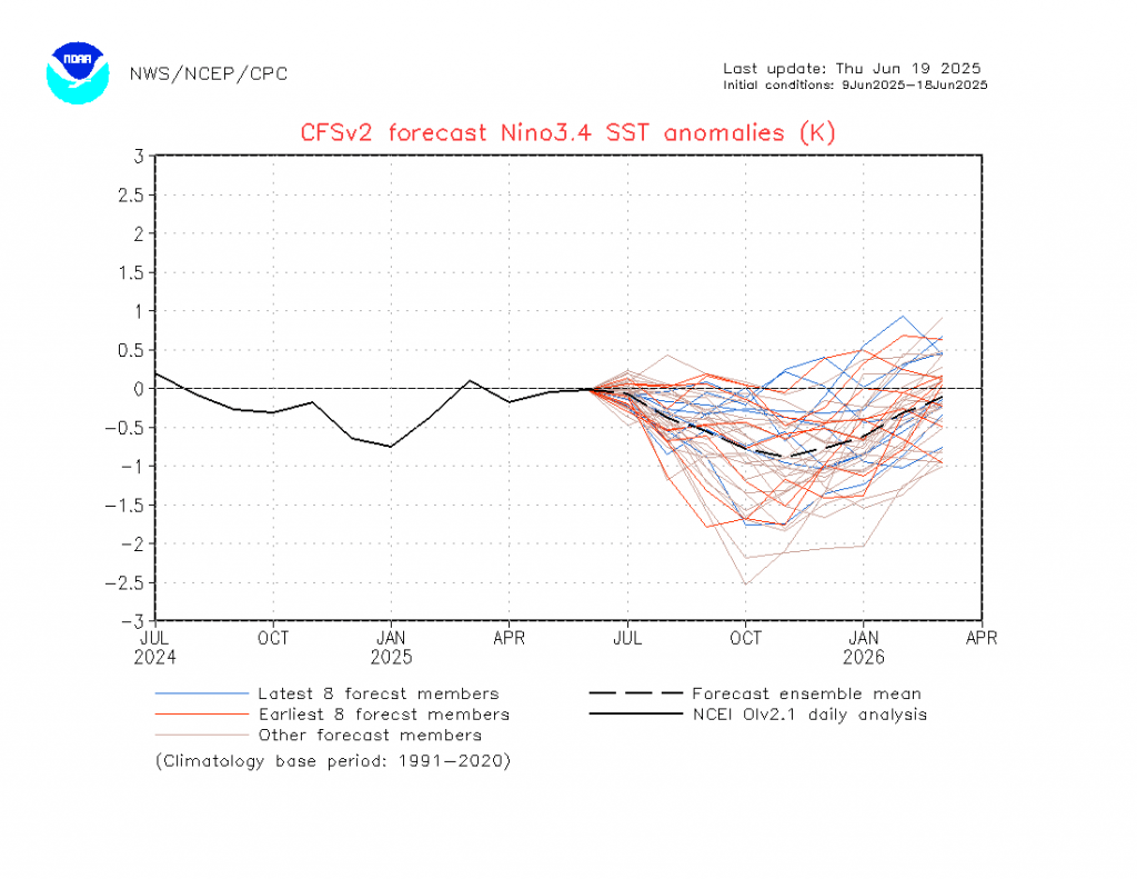
Looking at the Pacific and models show a return of the stronger than average easterlies over the eastern and central Pacific over the weeks to come (blue shading in the top third of this chart, have added a blue oval to show the area):
…and if that plays out as forecast we’ll see cooler waters again rising in the eastern Pacific, leading to higher than average chances of a wetter late spring and summer. Models are likewise indicating as such, with the key 3.4 Nino region forecast showing the forecast drop in ocean temperatures once again over coming months:
For now however we’re in neutral territory which will limit the impacts of the strengthening southern circulation – it’s when they both turn ‘wetter’ that we see our highest chances of significant rainfall…but regardless this is the season of east coast lows, and with the ocean temperatures sitting higher than average we’ll still need to be aware over coming months.
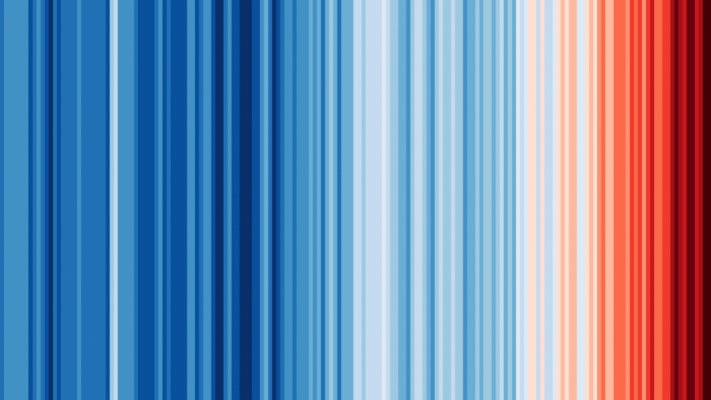
We’re coming up to Show Your Stripes day – a chance to highlight the rising temperatures across the globe. Globally it’s a pretty clear picture:
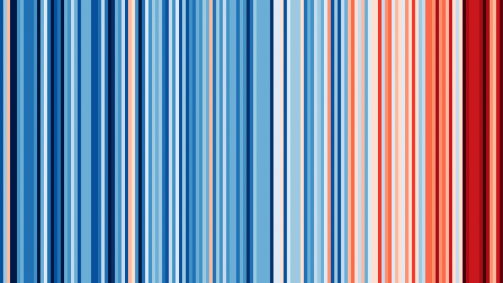
…and taking Australia alone we see a similar picture:
There’s still time to take action to limit greenhouse gas emissions, and it’s pretty clear what we need to do – let’s hope the politicians continue to act.
I’ll be back either when the next event looks likely, or when the next monthly outlooks come out in early July. Until then wishing you sunny days and warm homes.


