You’re likely to hear a lot about a Coral Sea cyclone over the coming days. A circulation has formed where the south easterly burst (that moved across our region a few days ago) met up with a monsoon trough in the northern Coral Sea. As a result a circulation developed along the monsoon trough, and that circulation has now developed into a tropical low. There’s a high chance it’ll develop into a tropical cyclone over coming days. There’s a lot of dry air to it’s south (for now) but it’s sitting in some fairly soupy air (and over an equally soupy ocean with temps close to 30c) just north of Willis Island. Here’s how it looks from the water vapour image, which shows how much water is in the atmosphere:
You can easily see the dry air to the south as well as a lot of lightning close to the centre of the low – a good sign that it is deepening quickly. The visible image from today is pretty stunning, and shows the low level circulation with a significant area of deep convection close to and just east of the centre:
The cyclone is forecast to move east, then south, then potentially west. Pretty complicated and the movement will depend on a whole range of different drivers – upper troughs, mid level troughs and how deep the cyclone actually gets. Needless to say the models will have some difficulties determining exactly where this system will end up, with models showing it ending up everywhere from north of New Zealand to Cairns to Coffs Harbour! Here’s the potential pathways from just one model:
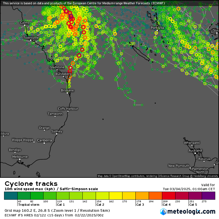
There is a very small (but non-zero) chance that we’ll see some weather as a result of this system, so I’ll keep an eye on it over coming days and post updates if it looks like it will impact us in any way. These systems can dump a lot of rain (and wind) where the move onshore so are not to be taken lightly. One positive result of this system should be localised cooling of the tropical waters in parts of the Coral Sea. With some coral bleaching now under way that is good news!
Thanks to Meteologix and MetCentre for images and to our local sponsors for supporting this site 🙂


