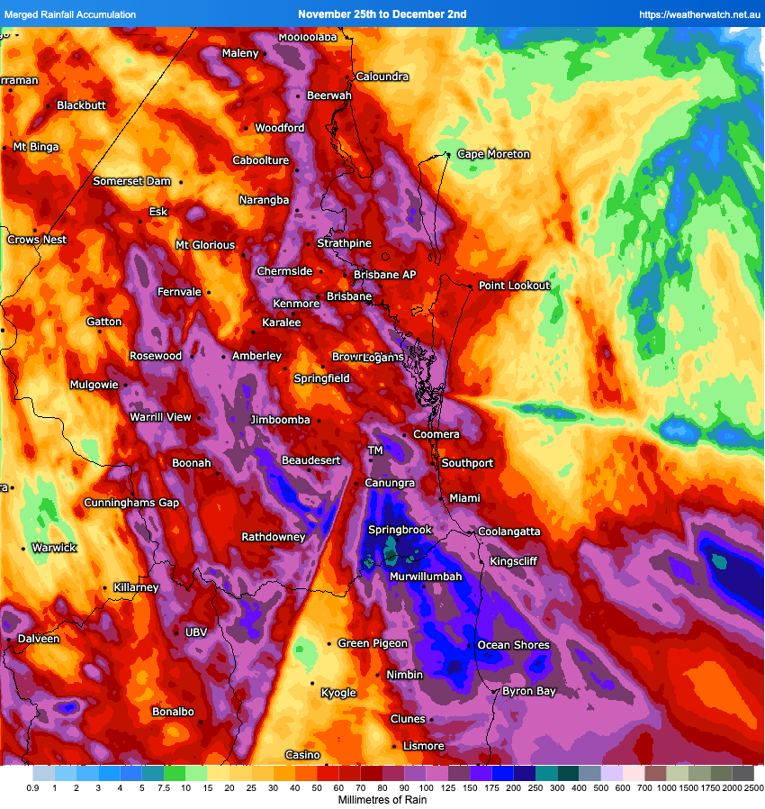
A stormy few days across our region. As expected the highest falls (and there were some BIG falls out there) were over the hills. The 7 day total rainfall (taken from the BoM radar) looks like this:
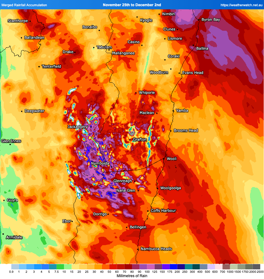
Big falls of over 100mm across the hills, with lower (but still decent) totals across the valleys. Far NE NSW saw some much higher totals as the trough stalled across that region, with falls of over 200mm in some locations:
A decent amount of lightning around as well over the last few days, with 72 hour cloud to ground strikes across our region looking like this:

Needless to say spring was a wet one across much of NE NSW. Here’s how much drier / wetter than average NSW looked over the last three months:
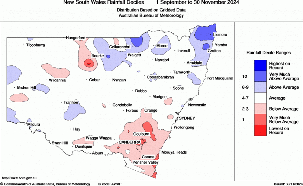
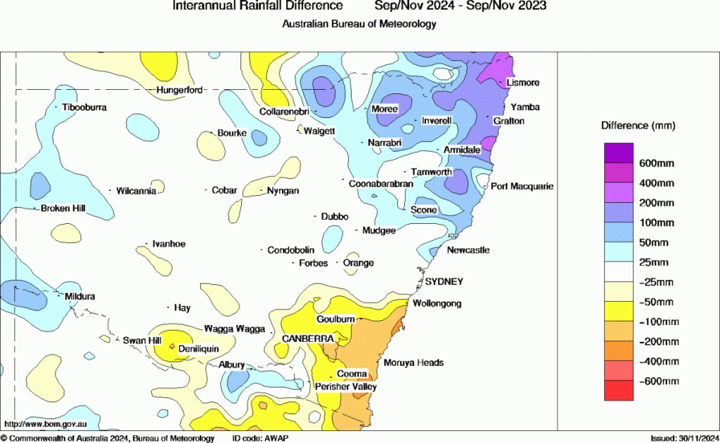
Wet for us but much drier than average for much of SE NSW. If it felt wetter (for us) than last year it was – and here’s how much this year differed from the same period last year – between 200mm and 400mm more rain than last year across our region:
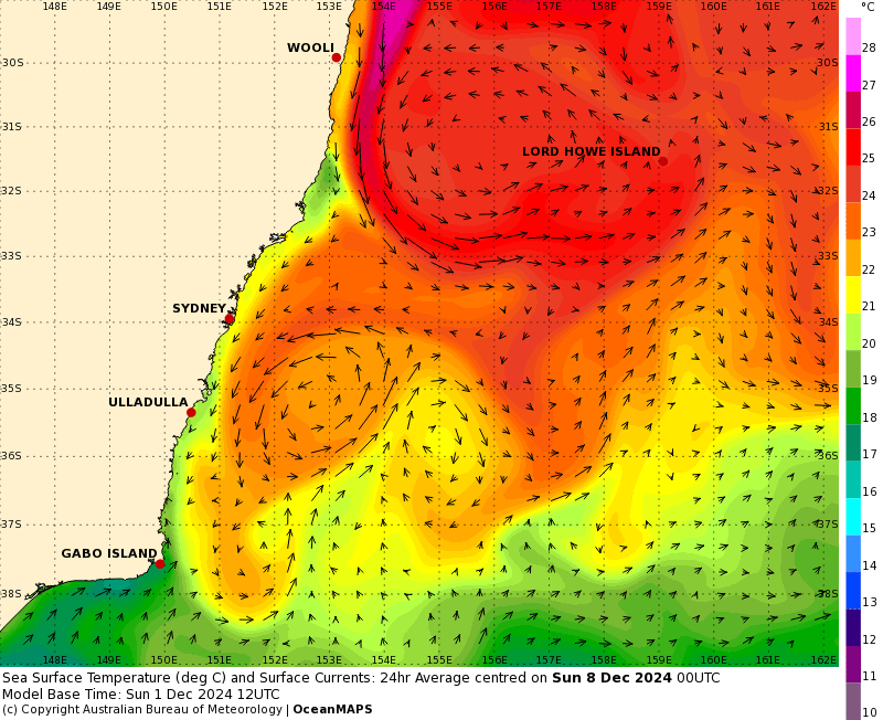
Moving ahead and we’ve got some very warm water moving down the East Australia Current over the coming weeks, with the 27C colours making an appearance across our region:
That heat will continue to increase humidity levels when winds turn onshore. Looking at the bigger picture there are strong easterly anomalies across the Pacific, which are (1) pushing a heap of warm, wet air towards Australia but also (2) strengthening the La Nina:
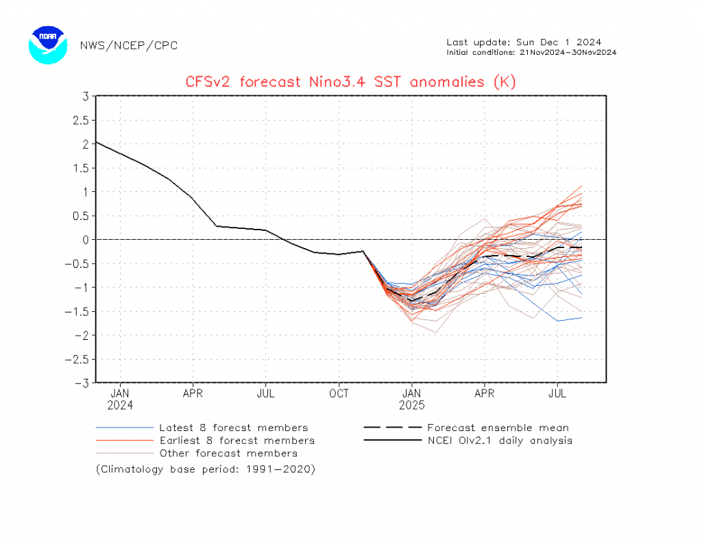
You can see the forecast drop in the critical 3.4 region – with some models indicating cool ENSO conditions remaining into next year…but way too far ahead for any detail there. Those conditions should ensure that, while there will be some drier and hotter spells, wetter than average conditions remains with us through summer.
in the short term we’ll see some storms at times this week, particularly on the hills, before a hot change moves in ahead of a trough over the weekend. That same trough could bring some higher rain totals once again through late Sunday and into Monday – something we’ll keep an eye on.
The Bellingen Weather station is in need of some TLC and is currently displaying incorrect dew points. There is a spare part on its way which will be fitted as soon as it arrives. The station itself is also going to be moving to a greener area just outside the centre of town to more accurately reflect the temperatures than many of us experience.
That’s it for now – enjoy the weather, keep cool and see you soon!