A quick post to flag that storms are likely over this afternoon and through tomorrow…and that the BoM high resolution models are indicating that some locations (particularly over the hills and in the headwaters) could see some big totals from storms that form. Here’s the forecast totals from two of the BoM high resolution model runs – you can see forecast totals over 100mm in some locations:
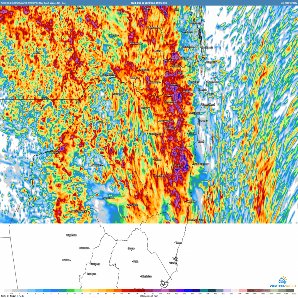
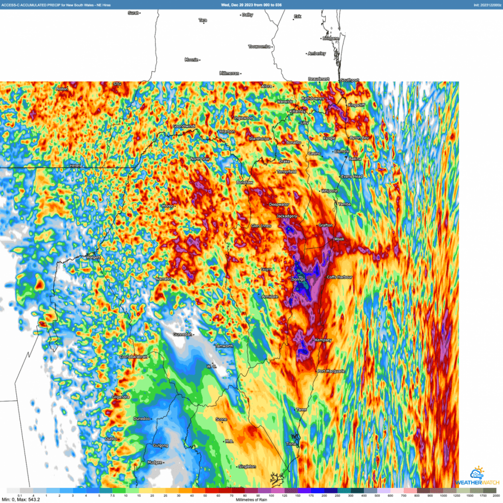
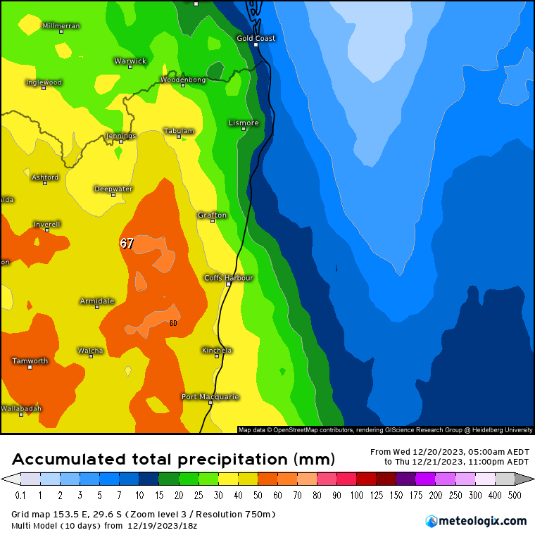
Don’t take the totals (which are for today and tomorrow) as gospel but worth a heads up that we could see some big falls in isolated locations. Other areas will likely see much lower totals, but with luck we should all see something. A combination of multiple models shows lower totals – but these lower resolution models can miss out on the bigger point totals we usually see with storms:
Please do post a reply with your totals – as well as any decent photos you have from storms today and tomorrow!