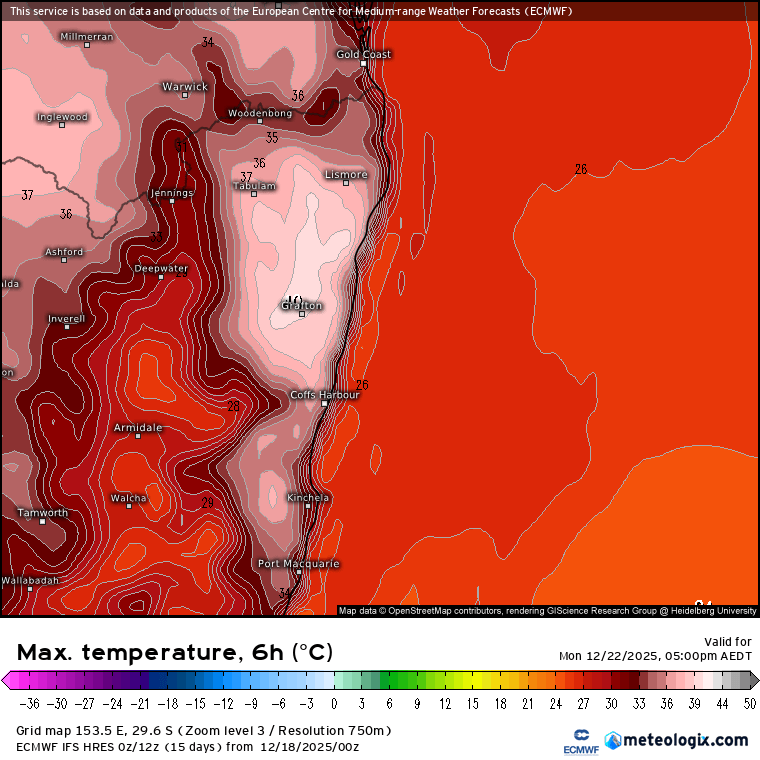
Heat Incoming…Storms Possible
A quick post flagging some incoming heat. We've got a trough moving slowly towards us. As is usual at this time of year the trough will drag in some heat…
A quick post flagging some incoming heat. We've got a trough moving slowly towards us. As is usual at this time of year the trough will drag in some heat…
We've had some big bushfires down south of us over the last few weeks - and sure enough if we look at the 3 month rain anomalies we can see…
Wow, was a hot one today, glad to get that out of the way! The good news is that we have a change coming through tomorrow...and that change has a…
After a stormy period recent days have seen drier (and much cooler) weather move in. This is mainly due to a stronger negative period for the southern circulation. A negative…
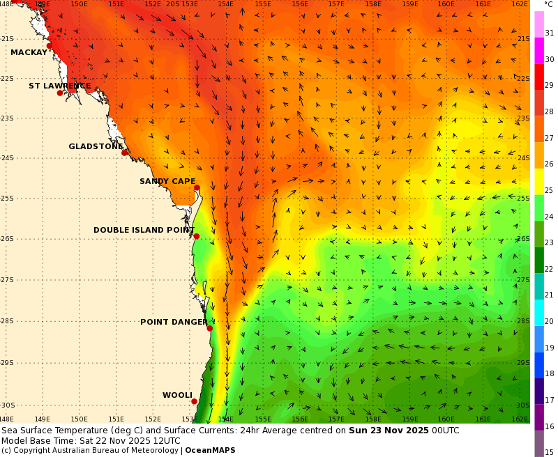
The humidity is rolling back in as we head towards summer and we're well into our storm season. Kicking off with the humidity - and the oceans to our north-east…
OK, we'll also likely see showers and storms Friday and possibly Sunday, but too good to miss the chance for three stormy Saturday posts in a row! We've got an…
We've had a beautiful day today with an inland trough far enough away to leave us with blue sky and not-too-hot temps. Tomorrow however that trough moves closer and we'll…
We've got a few showers popping up right now across our region but nothing much as of yet - we could see some showers and storms developing later this afternoon.…
With the southern circulation pushing dry and Indian / Pacific oceans pushing wet we're well into a spell of weather that swings from one side to the other. Today the…
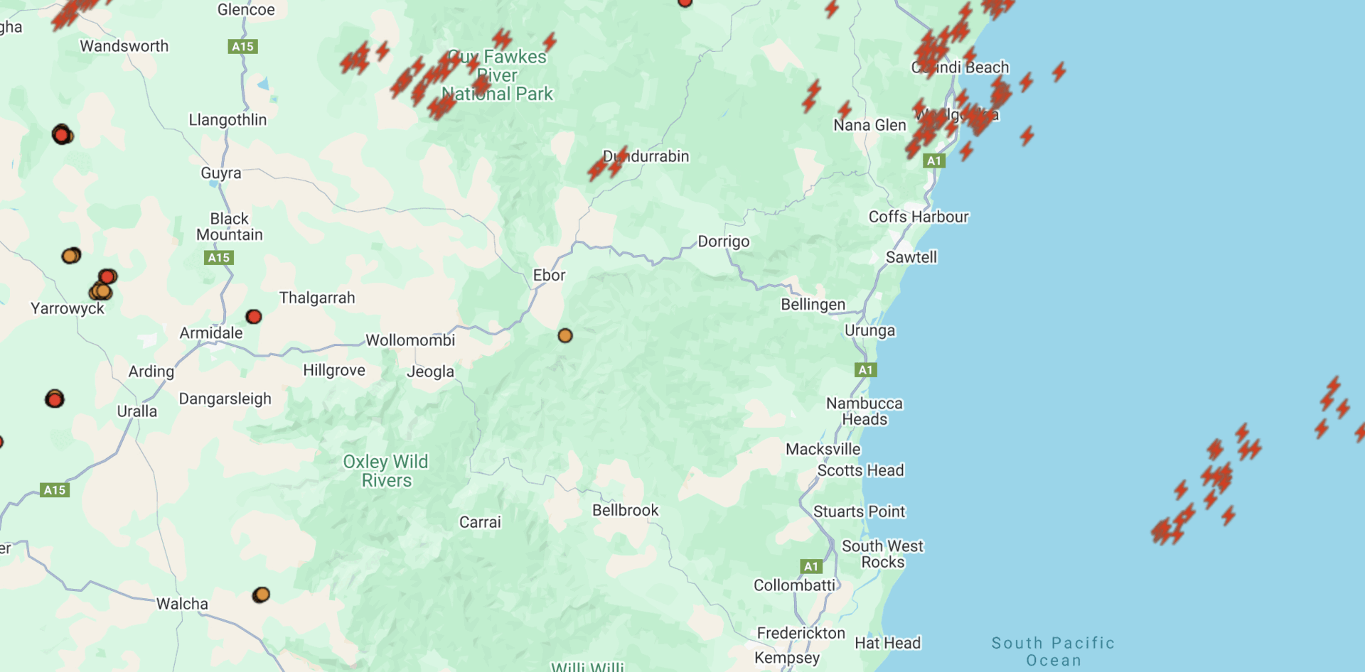
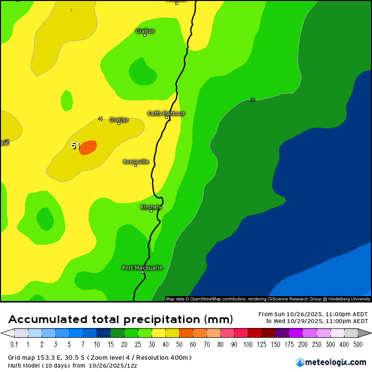
Well the promised storms certainly rolled through. Bigger storms late on Friday and then more in the west of the valleys through yesterday. Some decent rain totals as well -…