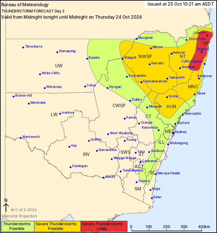
A quick post to flag the chance of some stormy weather as we move through Thursday. According to the BoM: “Thunderstorms are possible in NSW across the northeast quarter, western parts of Sydney Metro and elevated parts of the Illawarra and south coast.
Thunderstorms may be severe about the Hunter and the north coast and adjacent ranges as well as the northern slopes bringing risks of damaging winds (gusts > 90km/h) and large hail (diameter > 2cm). Organised storms are likely on the coast north of Kempsey to the northern border and adjacent ranges with the slight chance of giant hail (diameter > 5cm).
Thunderstorms are expected to initiate in the early afternoon and dissipate late in the evening”.
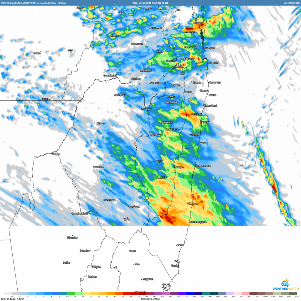
The high resolution model shows some decent totals in the usual locations – a focus on the hills to the west and north of the valley….but also flags that the heaviest falls will likely be to the south of our region:
Worth keeping an eye on the radar tomorrow – and some protection should hail look like moving through!
Thanks to BoM / Meteologix for the images ⛈️