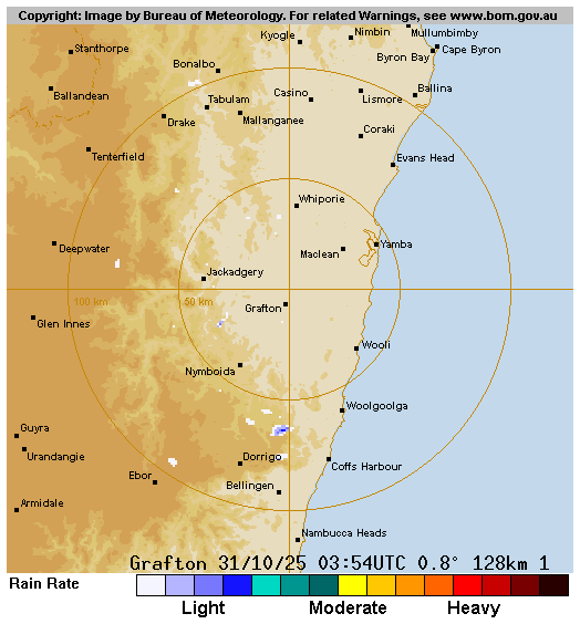
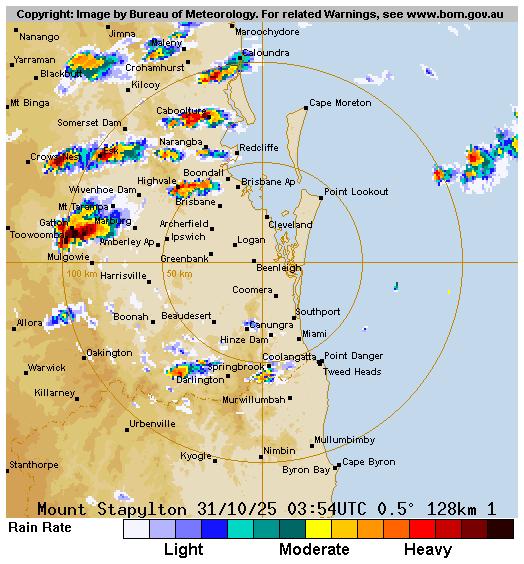
We’ve got a few showers popping up right now across our region but nothing much as of yet – we could see some showers and storms developing later this afternoon. Here’s the radar at the time of writing:
….but look at the radar to our north and we get a hint of what’s coming in for tomorrow:
Worth emphasising that the strongest storms tomorrow look to be to our west and north, but we’re close enough to risk copping one, or more. Kicking off with the BoM storm forecast for tomorrow and it’s pretty clear that it’ll be a big day:
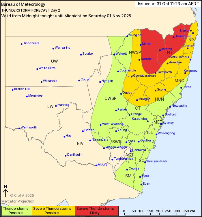
Thunderstorms are possible tomorrow (Saturday 1 November) for much of central inland NSW and for the entire NSW coast due to a trough. Severe thunderstorms are possible in the northeast, the Central West Slopes and Plains and for the upper Hunter and may extend as far south as the Blue Mountains. Additionally, severe thunderstorms are likely for the northern ranges, slopes and plains in an area east of Moree and north of Tamworth. These severe thunderstorms may bring the risk of damaging winds gusts (>90km/h), large hail (>2cm) and localised heavy rainfall.
In addition to severe thunderstorms, very dangerous thunderstorms are possible for the New England and the north west region in an area north of Armidale, potentially bringing destructive winds (>125km/h), giant hail (>5cm diameter) and localised intense rainfall leading to flash flooding.
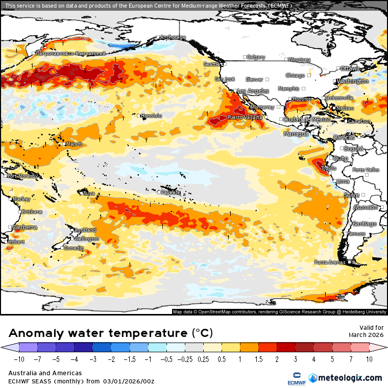
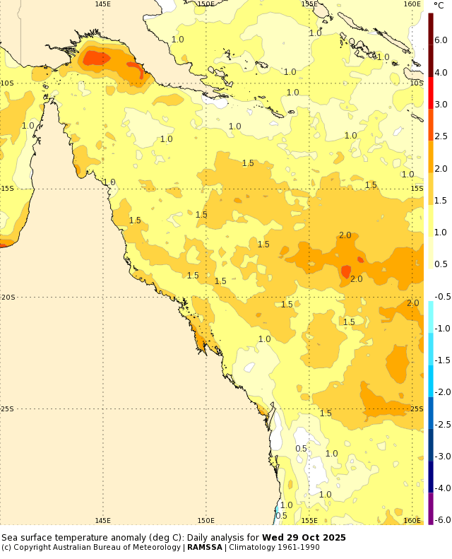
So a big day to come. The reason – an inland low will help destabilise the atmosphere and drag in moisture-laden air from a warmer than average Coral Sea:
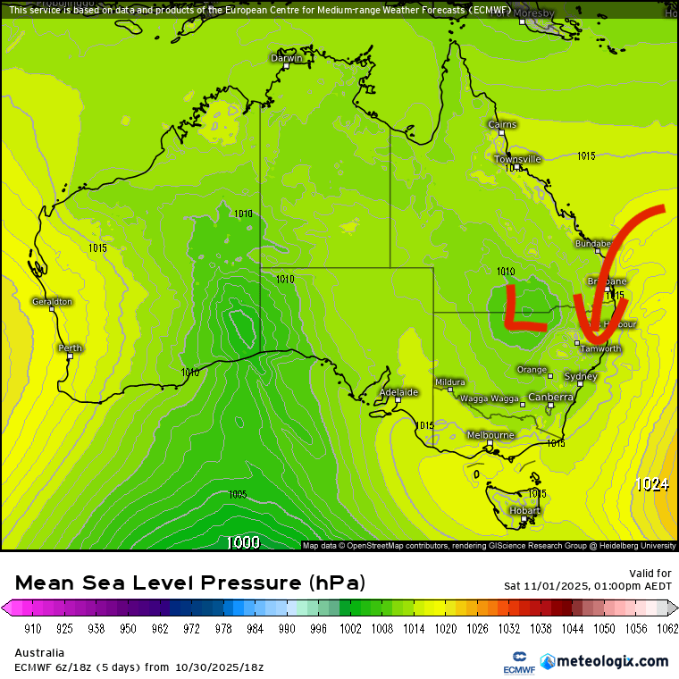
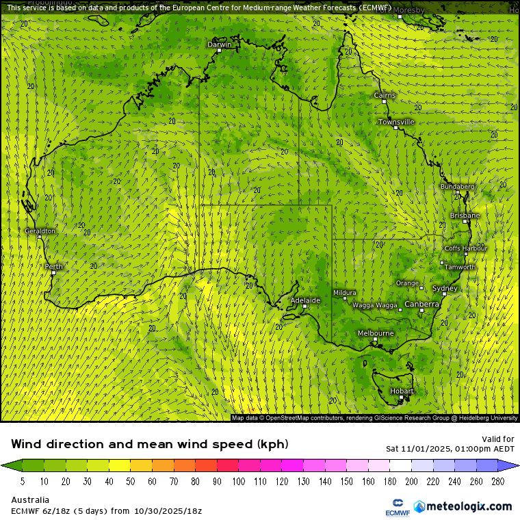
And you can see this clearly in the 1pm wind forecast with surface winds moving across the above-average Coral Sea before landing on the east coast:
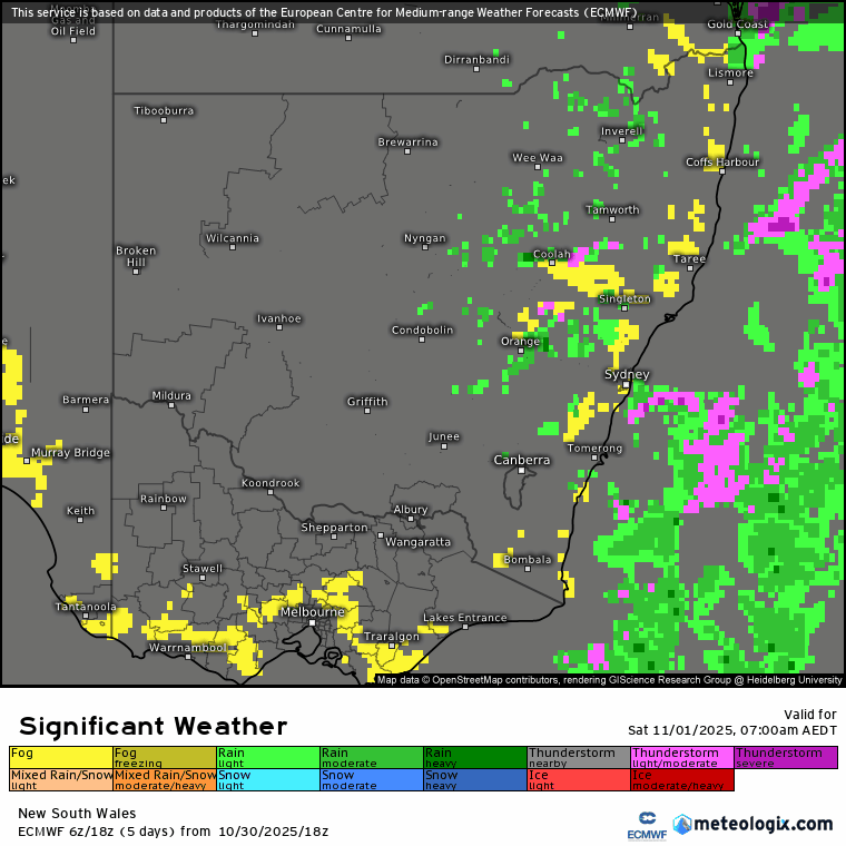
Add in strong late-spring heating and you’ll get an explosive day for some. Not everyone will see a severe storm – in fact most won’t – but once they get going they’ll be likely to pack a real punch. Here’s the notable weather forecast for tomorrow – worth noting the storms developing quickly, severe storms forming mainly just to our north and west – and fog moving in as storms clear away into the evening:
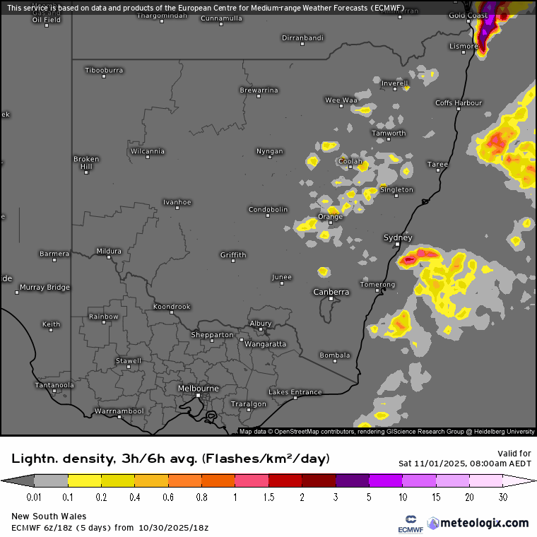
….and if we add in the lightning forecast for tomorrow we can see storms for many, with significant storms likely around Inverell / other inland areas of NE NSW:
The turning in the atmosphere (winds moving in different directions at different levels) will increase through tomorrow so don’t be too surprised to see reports of the odd tornado, particularly to our north and north west. An interesting day to come. Worth keeping an eye on the radar as we move into the afternoon and to get the washing out to dry (and back in again) earlier in the day!