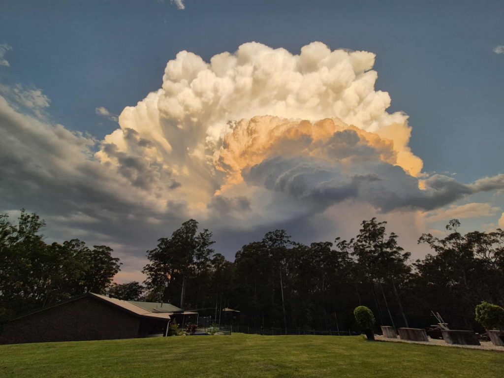
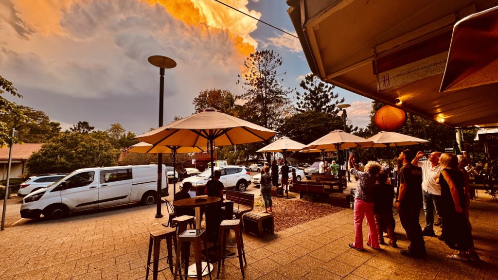
Wow, those storms last week…not only stunning supercells but also existing in isolation so we got to see them in all their beauty…Yes, appreciate some damage from these storms and that’s always hard to hear and experience (and they can be pretty scary – as a family we all ended up in one room in the early hours as the house shook!) but as a part of nature their power and presence is hard to ignore. Here’s how the afternoon storm looked from Bello:

Here’s how that storm looked on the radar – can see it building and then left moving as it strengthened:
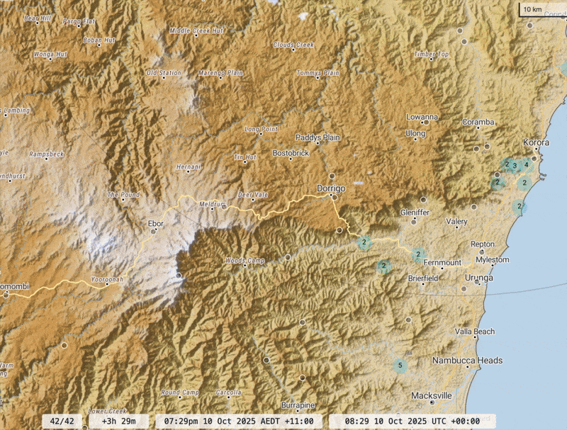
That left move as it approaches the coast is a sure sign of a very strong storm. Here’s the radar image of the storm at it’s peak:
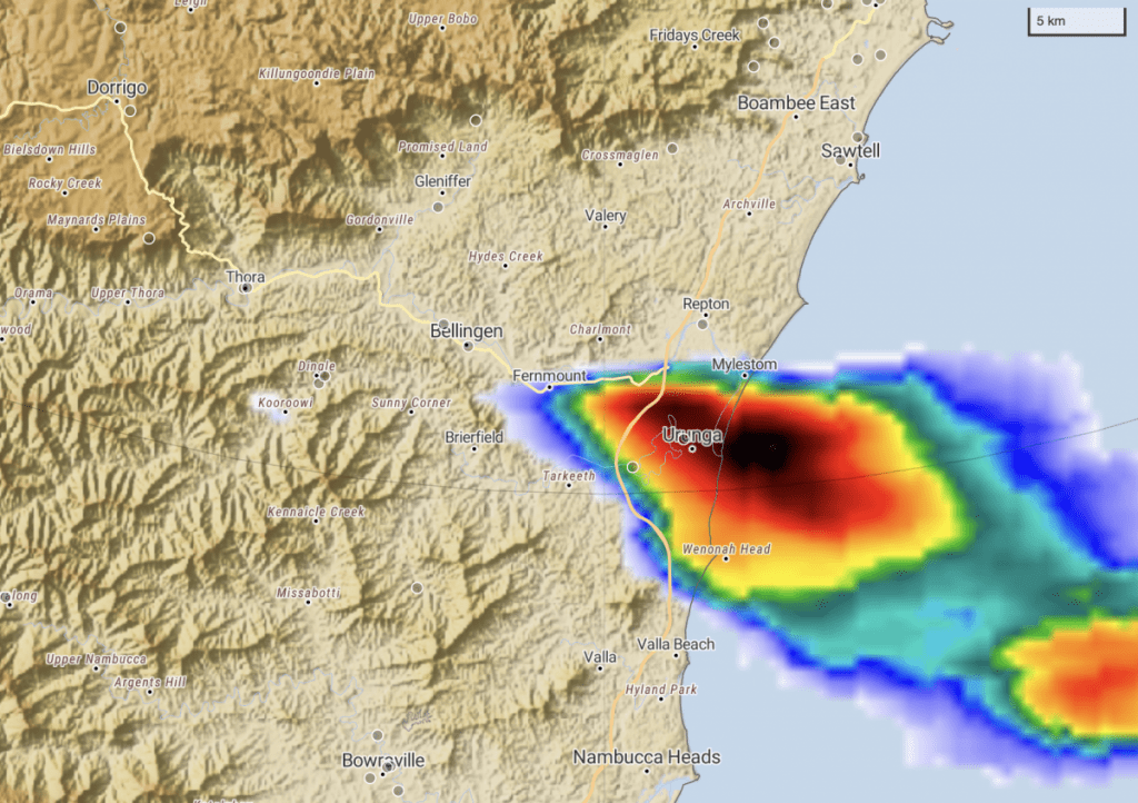
Not content with one show nature threw another supercell at us in the early hours of the following morning – here’s how it looked on the radar as it moved down from the north west. This one is also going against the general flow – this time a right mover:
A monster of as storm. Here’s how this one looked as it moved through:
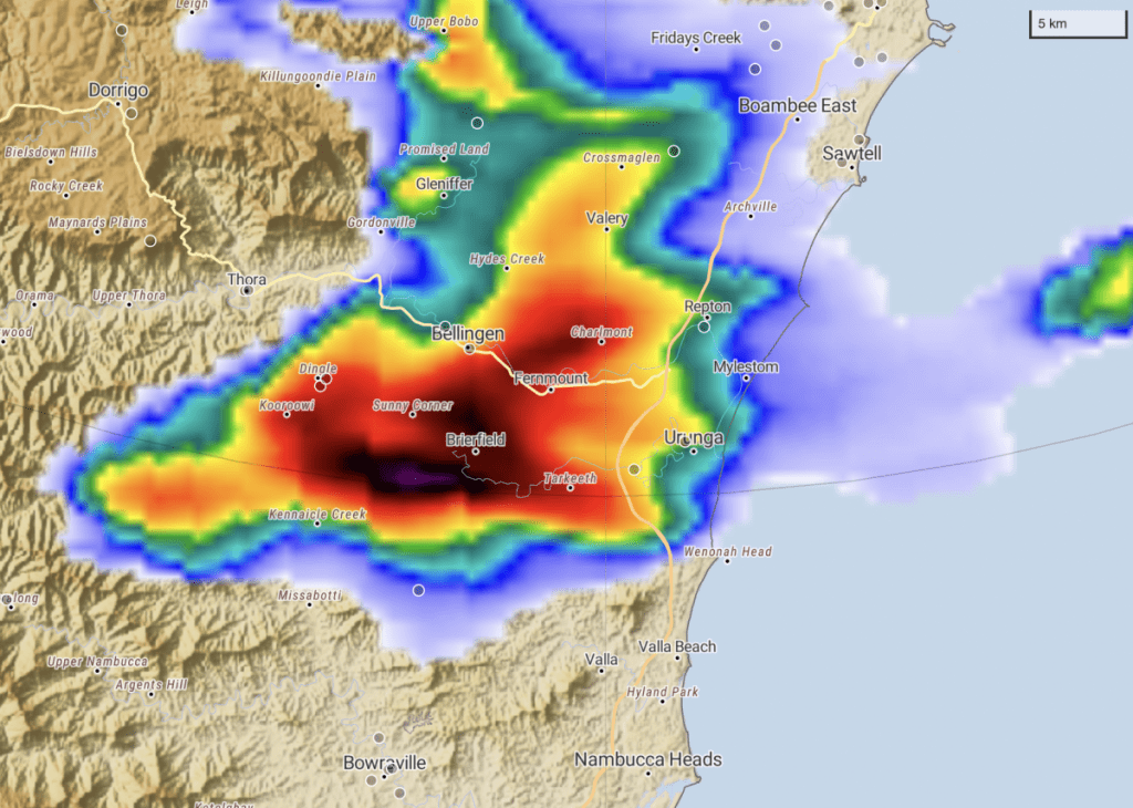
The purple in the centre of the storm is not something you usually want to be under – some good hail (and damaging winds) under that one. The scale above is the same for both storms, giving some idea of how large the overnight storm was.
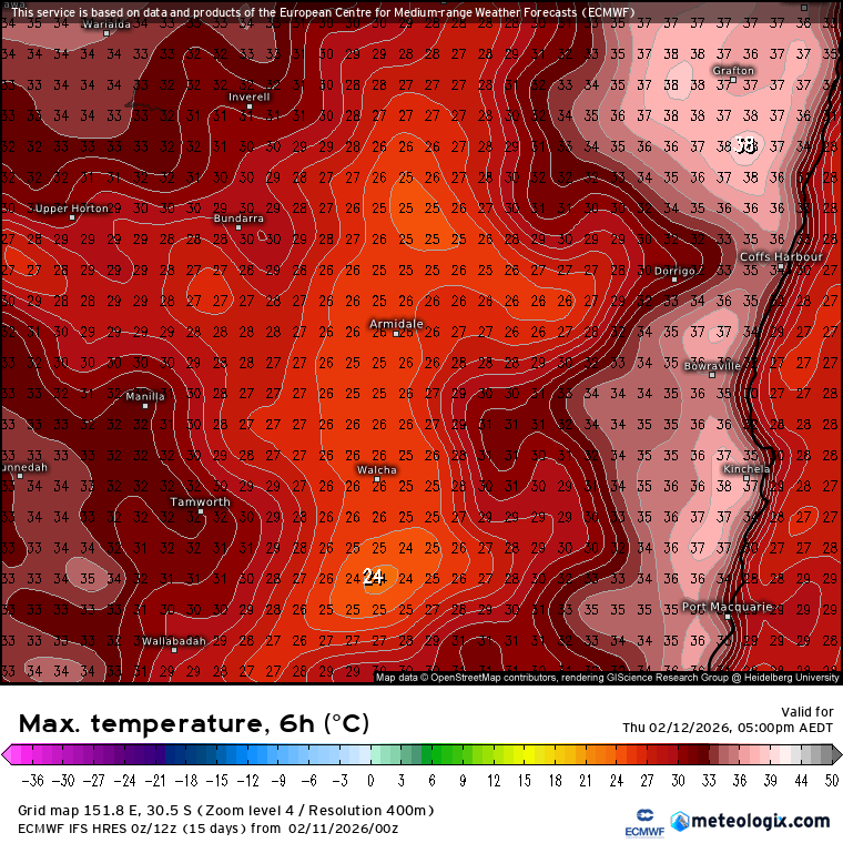
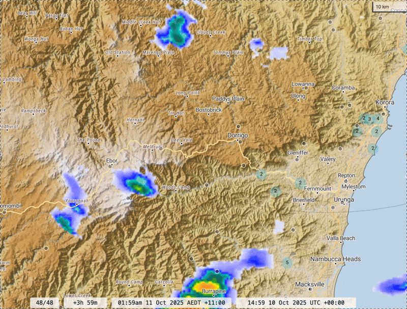
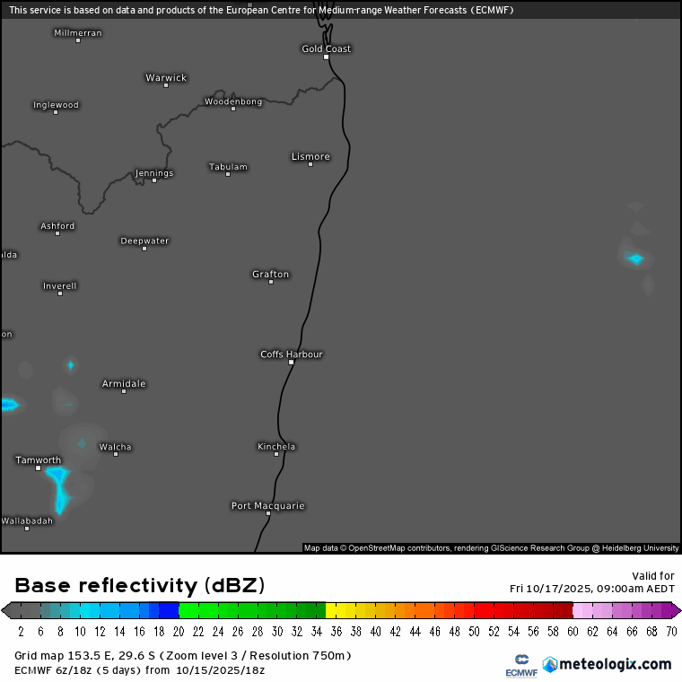
Coming up we have a change moving through later tomorrow. As the change approaches we’ll likely see instability increase and some storms kicking off through the afternoon, mainly on the hills…and may even see some develop today in the same locations…but will then likely see a stronger band of storms move through late evening with the change. The forecast radar below shows that – (1) daytime storms popping up (2) band of storms moving through with the change late evening (3) a clearance and then some afternoon onshore showers on a brisk south-easterly wind:
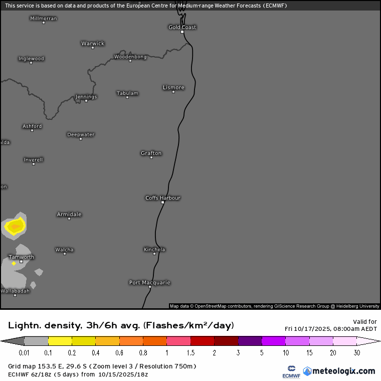
Here’s the lightning forecast for the same period – chance of lighting with daytime storms, again with the change, and perhaps again (more likely inland) with onshore showers / storms on Saturday afternoon:
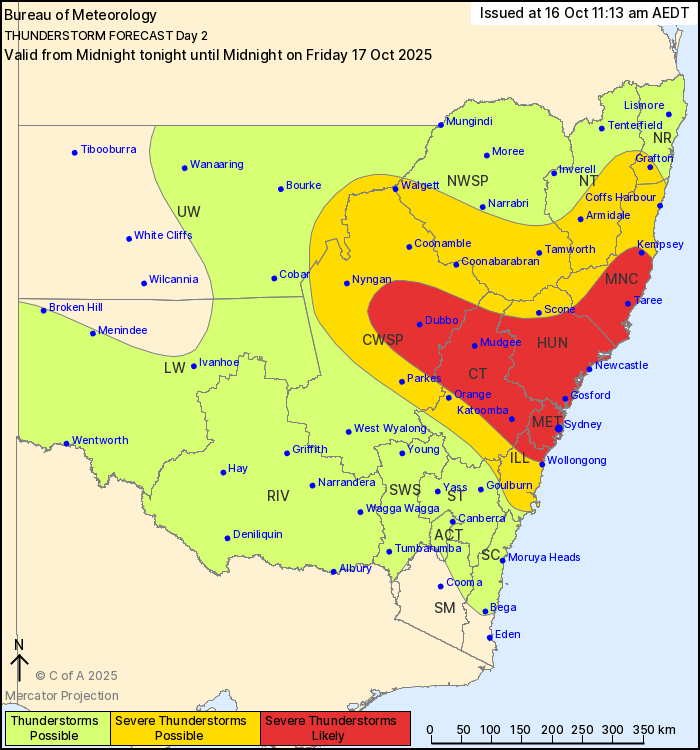
Worth being aware that there is, once again, a risk of stronger storms later tomorrow and particularly through the evening…in fact the storm forecast from the BoM for tomorrow covers it well:
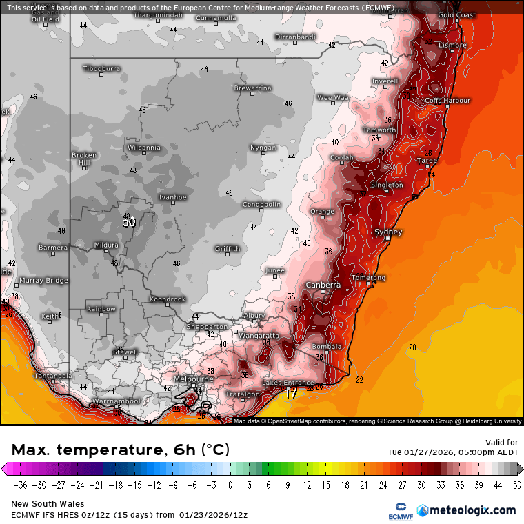
Severe thunderstorms are possible across central eastern and northeastern areas, becoming likely across parts of the Central West, northern Illawarra, Sydney, Hunter and Mid North Coast. Damaging wind gusts (> 90 km/h) and large hailstones (> 2 cm) are the main risks in these storms. If isolated supercells form, they may bring destructive gusts (> 125 km/h) and giant hailstones (> 5 cm)
Initiation is likely during the afternoon commencing with isolated cells inland. As the southerly change reaches the central coastal areas, severe thunderstorm risk increases significantly with isolated supercell formation being possible in metro areas. Thunderstorms may continue into the late evening following the change up the coast, or even overnight.
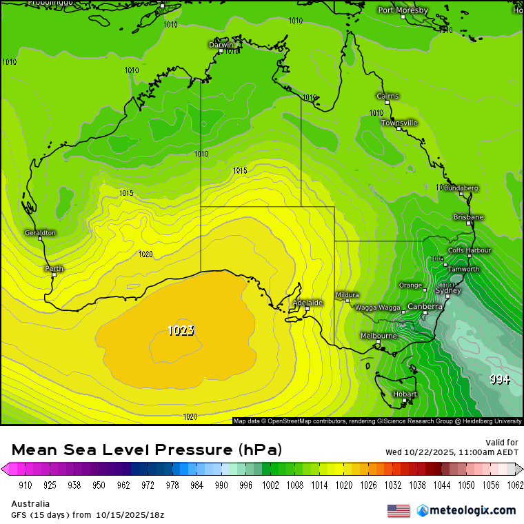
We’ll have another stronger change move through during the middle of next week. Models are still unsure if the trough will be captured above a high sitting to our south and thus bring us onshore winds and (likely) some decent rain and storms:
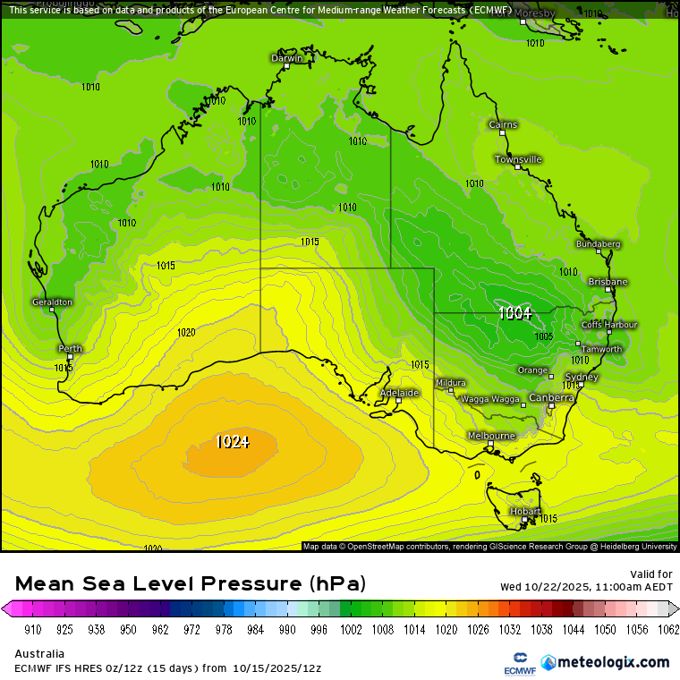
…or if the trough will be caught by a southern low and sit further to our south:
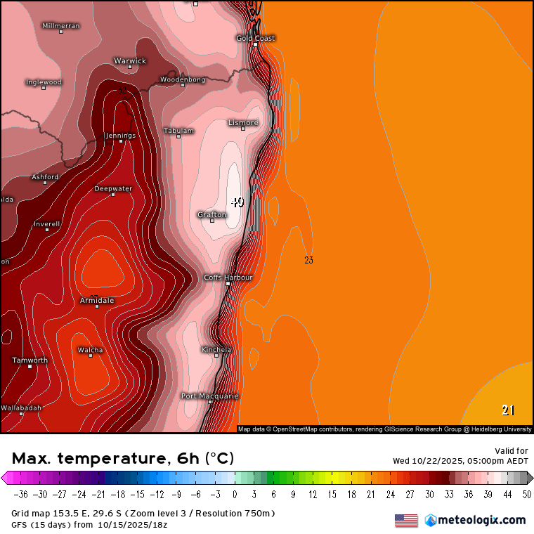
If the top (European) model is right then we’ll see decent cloud coverage, showers and storms and relatively cool temperatures:
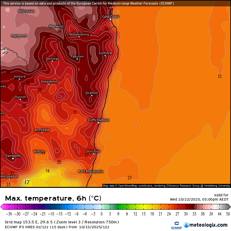
…however if the GFS model is correct we’ll be to the north of the low, under westerly winds…and temps will be significantly higher:
At these times it’s good to check other models, and the new AI models are trending towards the GFS outcome – low to our south and hot westerlies…and right now I suspect that is where we will head…however we’ll just keep an awareness that the middle of next week could be stormy but could also be very hot and dry – we’ll get through this incoming change and by that point models should be starting to agree…Will post again as the models settle down.
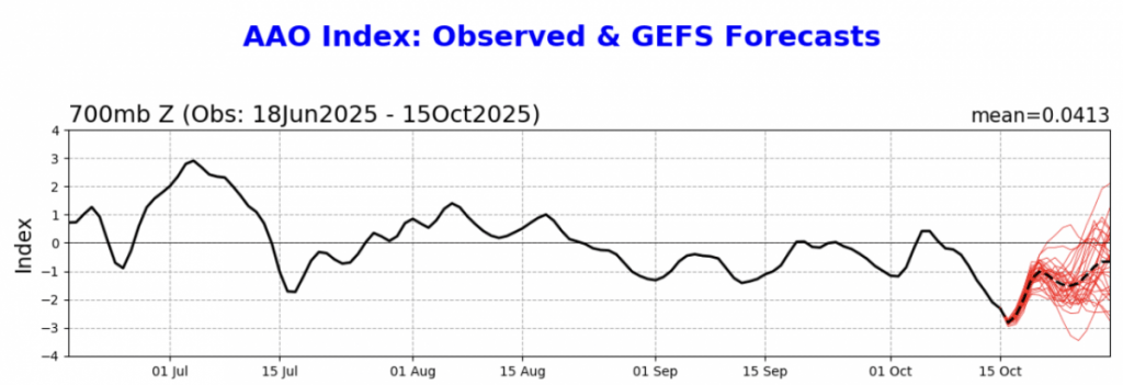
Looking at the bigger drivers and the southern circulation is currently very weak – increasing the risk of drier westerly spells over the next couple of months:
The drier forcing from our south will battle against wetter drivers from both the Indian and Pacific oceans. It’s certainly setting the scene for an interesting couple of months – if the south wins we’ll see a risk of more significant fire weather…but if the oceans to our west and east win we’ll see wetter weather. The likelihood however is that we’ll see a mix of some drier weather as the southern circulation shows it’s hand, mixed in with wetter spells as the other oceans push for influence. We could well end up with some stormy weather if we sit close to the battle lines between warm / wet and cool / dry.
Once we hit the end of the year the seasonal impacts from both the southern circulation and Indian Ocean weaken so we’ll be led by the Pacific, which is still looking wetter for a time as we head into late summer. For now I’ll keep an eye on what is coming up and keep you posted through what appears to be an interesting time meteorologically speaking. Thanks for making it to the end of this long post and keep an eye out for any storms tomorrow.