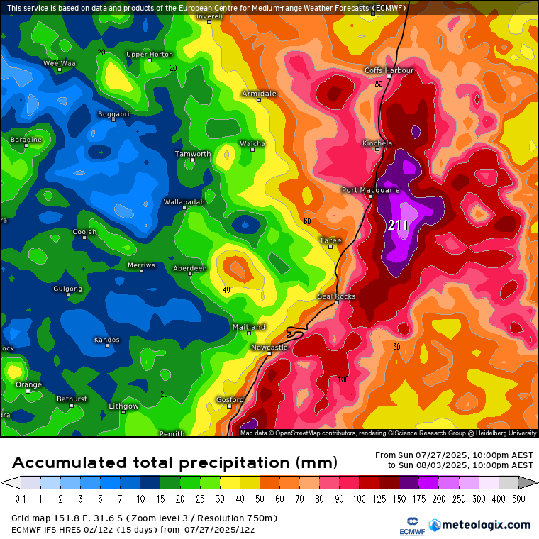
We’ve had a good storm move through to our south over the weekend, and it looks like another system will move across NSW to our south mid week as very cold upper air continues to destabilise the atmosphere. That mid-week system is likely to help pull some even colder air up high across NSW, and that very cold pool of air will likely generate an East Coast Low next weekend. With that system likely to sit further north there’s a higher chance (though no guarantees at this stage) that we’ll be impacted, so it’s one to watch. Here’s how the latest European model handles it:
We’ll likely sit close to the northern boundary of the rain…anywhere north of the system will see offshore winds and very little rain, while areas to the south could see some localised flooding. While the European model shows us getting some decent falls:
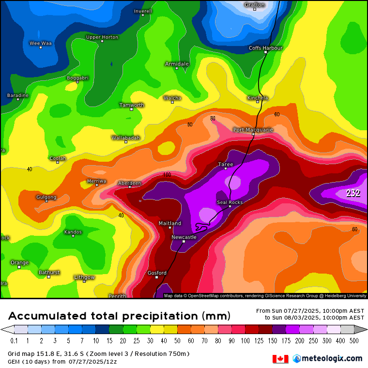
…other models show the heaviest rain to our south, with our region on the border between wet and dry (which makes it hard right now to know which side we’ll end up on):
That means this week will be a wait-and-see. Models should settle down later in the week and we’ll have a clearer idea of how much wind and rain we’ll see….for now all we know is that there is a good chance somewhere on the NSW coast will see a big dump later this week / weekend. I’ll post again later this week when forecasts settle down…
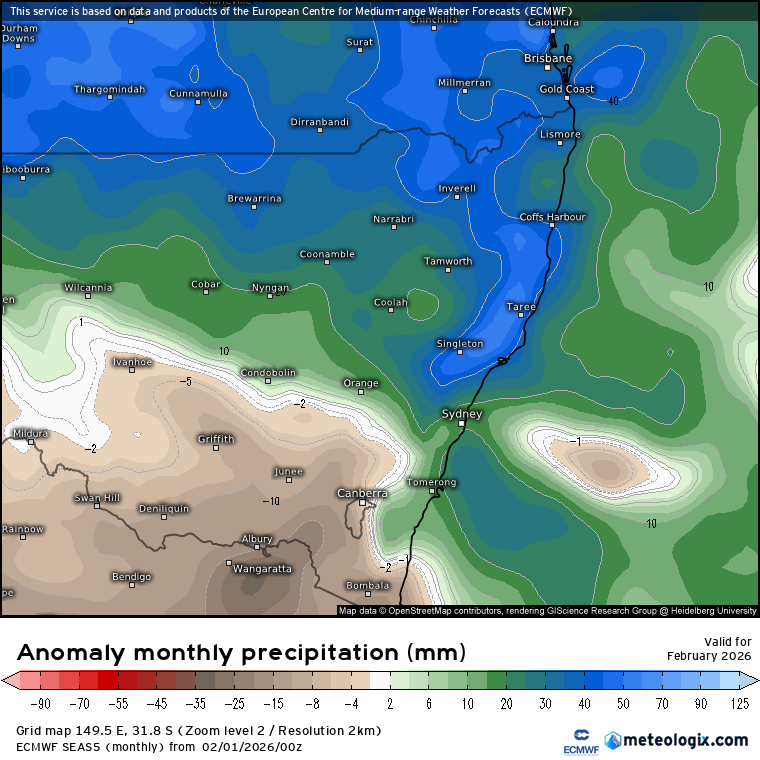
Looking further ahead and the Coral Sea (and much of the East Coast) is already well above average for this time of year:
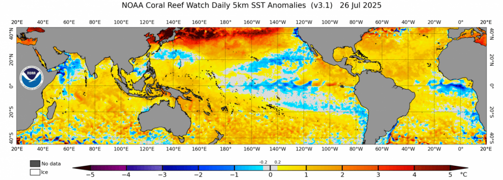
We’ll see some of that heat continue to feed down the east coast over coming months, increasing rain totals when other conditions line up. Looking further afield and there is also a large cold pool developing under the eastern Pacific:
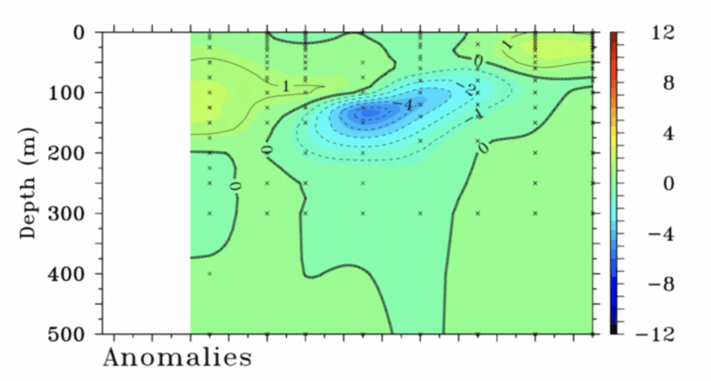
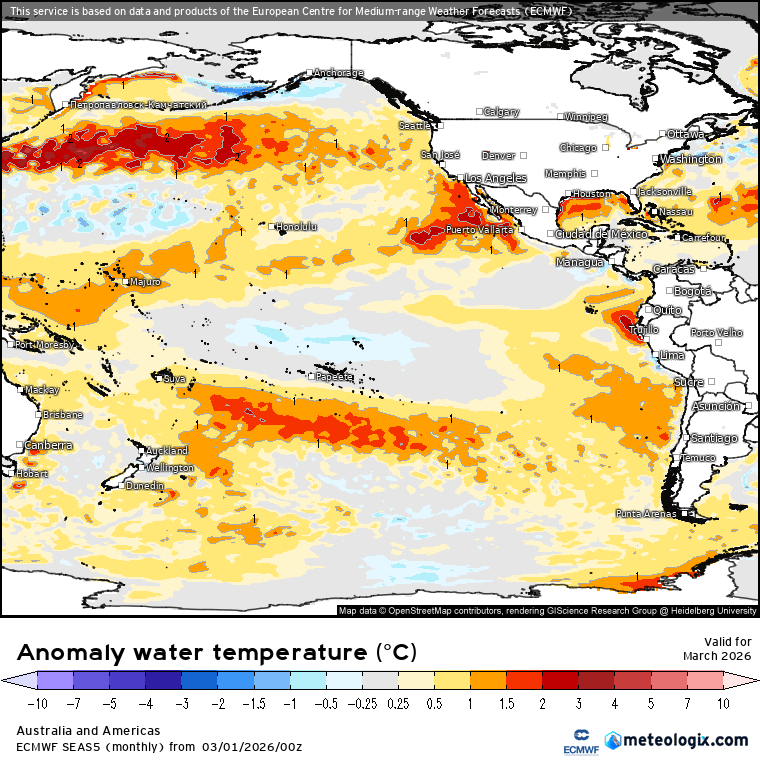
Forecast stronger than average trade winds across the Pacific over coming months will help pull that cold water towards the surface off the South American coast – and that will once again increase the chances of wetter weather as we head into late spring and summer. What it is also worth being aware of is the forecast that once that cold pool dissipates in early 2026 we could well be looking at a warm pool developing in the same area – check out the monthly forecast below and you can see the cold pool move across, surface, fade away and get replaced with much warmer water:
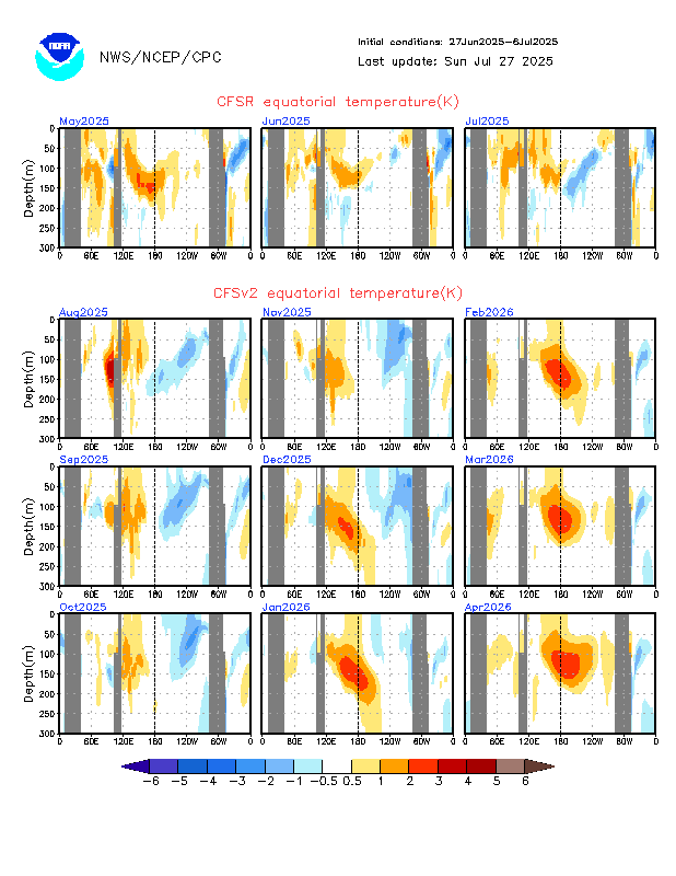
The Pacific is very hard to forecast at the longer term, but certainly some early indications that we could see much drier weather / possible El Nino conditions move in as we head into summer 2026. I’ll post updates on that one over the coming year.
For now I’ll be keeping a close eye on the short term forecast – see you again later this week for an update!