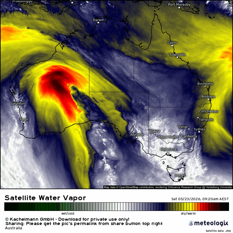
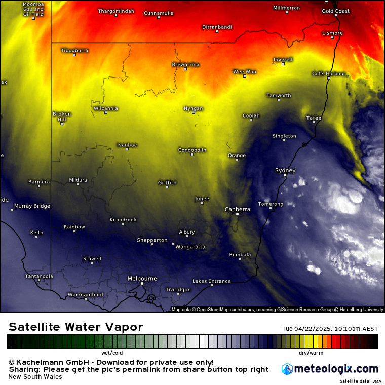
Easter finished with a line of showers and storms moving across our region from the west as cooler air moved in up high and hit up against warmer, wetter air close to the surface. Sitting to the north of the cold pool we also saw drier westerly winds move in late yesterday, and that drier air is bringing a beautiful day across our region today. We’ve got that same very decent pool of cold air moving overhead right now:

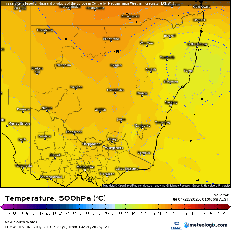
Another way to look at the cold air is to look at the temperatures up high (approx 5km above us) – and right now they’re down around -17C:
Combine that with still warm ocean temperatures:
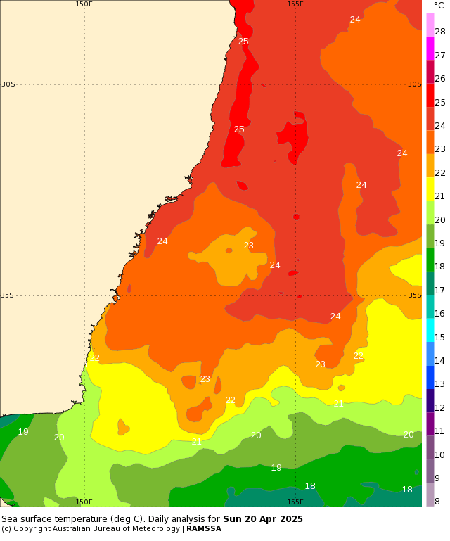
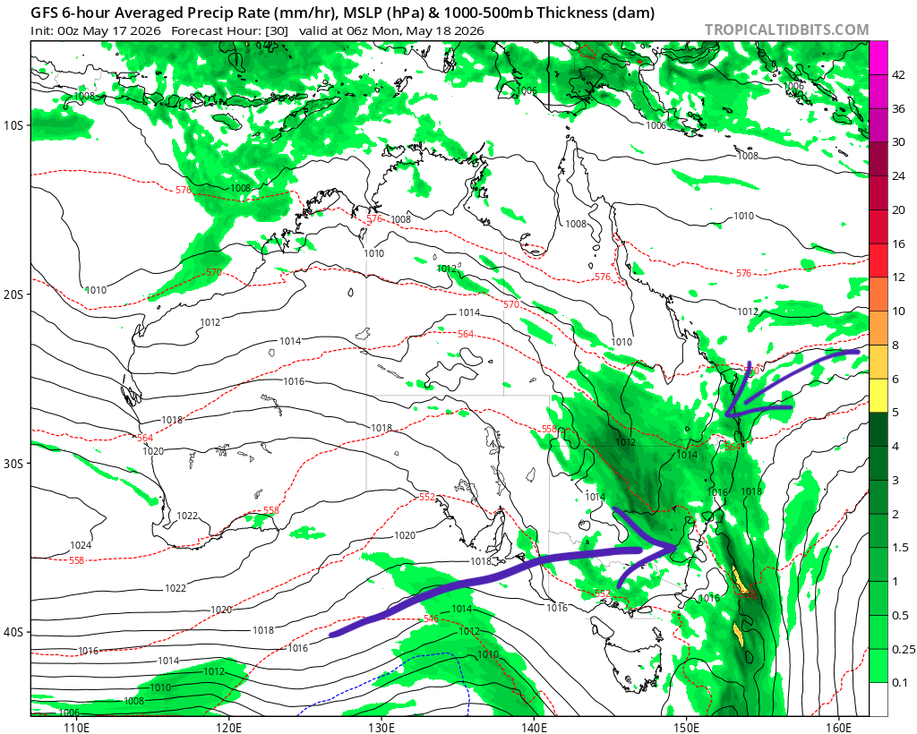
…and assuming the air temperature over the ocean is reflecting the temperature of the water and you have a temperature difference of 42C over 5km…which is pretty unstable. Right now that cold pool is centred just to our south so we’ve got those offshore winds – and continuing dry air still getting pulled around the upper feature:
…however…as that cold pool moves north east we’ll start to see onshore winds to the south of the system move across our region. By that time – tomorrow – the upper temperatures won’t be quite as cold, but they’ll definitely be cold enough to bring some decent showers / rain periods onshore. That will then set the scene for the remainder of the week with showers moving inland from a warm ocean. Given the instability and the fact that the showers will last a few days we could see some decent accumulations, with up to 80mm or so predicted across our region:
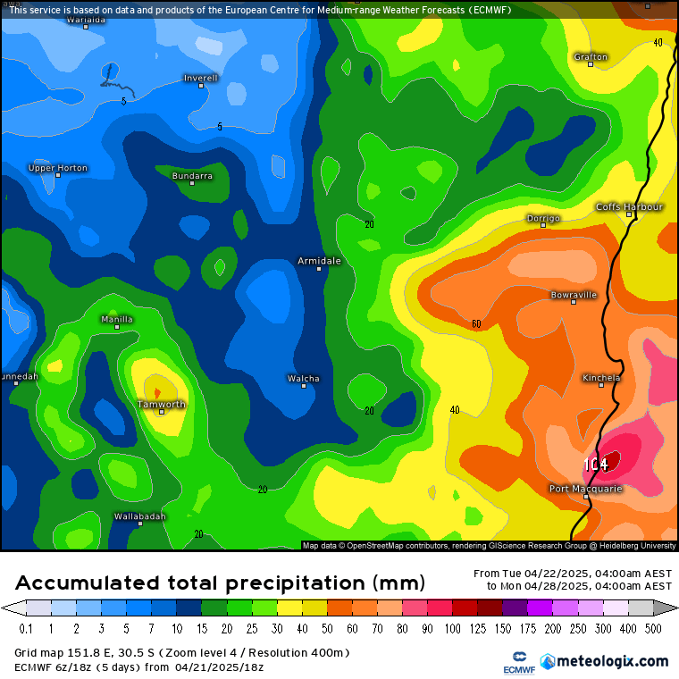
As most of the rain will come in the form of showers we’ll see the usual thing, with some areas seeing higher totals while other spots receive quite a bit less. With decent instability there is also the chance of a rumble of thunder as heavier showers move across. The ground is still saturated following recent wet weather so we could see some (likely minor) creek / potential river rises in areas that receive higher falls, however at this time we’re not looking at anything significant.
Once the showers clear away we’ll see some decent sunshine returning over the weekend, with more sunshine to follow as we move into next week – another chance to dry out after a long wet spell. We’re soon to enter our drier time of year so we *should* see a decrease in rain totals over time, but with a still warm ocean any instability could see a return of wetter conditions…and I’ll post again if that looks like happening. Until then hope you get to enjoy the sunshine today!
Thanks to Meteologix for the images, and to our ongoing local sponsors: