After a stormy period recent days have seen drier (and much cooler) weather move in. This is mainly due to a stronger negative period for the southern circulation. A negative (weaker) circulation means the winds tend to spread further out from the Antarctic, affecting areas further north and allowing colder air to likewise escape and move further north. We can see the current and forecast state of the circulation on the graph below:
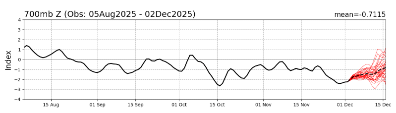
With a chart like that expect further westerlies at times over the next month. The Southern Circulation was similarly negative in 2019 and we should be grateful that the Pacific and Indian Oceans have been pushing wetter conditions over recent months – much reducing the bushfire risk.
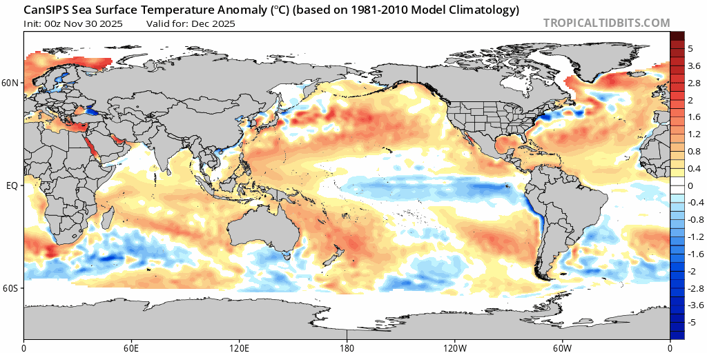
Going forward and we should find the impact of the southern circulation diminish over time – just as the BoM declare a La Nina is in progress. A La Nina increases the risk of wetter weather as we move into / through summer…and that risk will also be magnified by significantly warmer than average waters offshore. Here’s how much warmer than average the ocean temperatures are sitting off the Qld and NSW coasts right now:

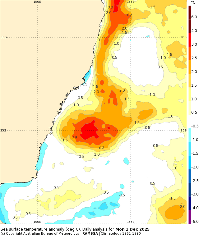
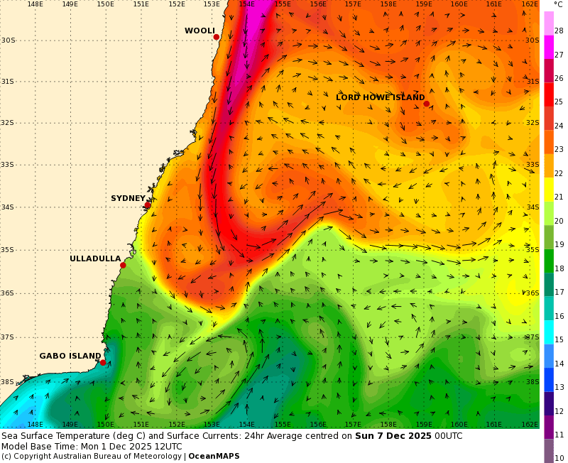
2c above average is significant, and can likewise significantly increase any rain totals over coming months. With so much warm water across the Coral Sea we’ll likely see even more warm waters moving south along the East Australia Current over coming weeks. Here’s how that current looks right now – pumping 27C waters down the east coast, way ahead of schedule:
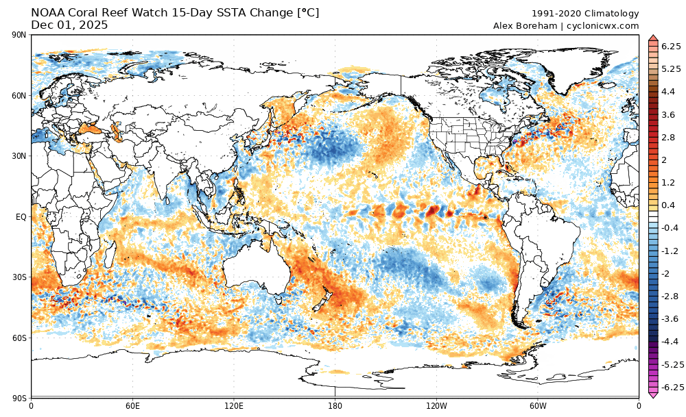
All that hot water could have little impact weather-wise but if conditions align it would likely enhance rain totals from any systems / events that come our way. As we move into summer and the Coral Sea continues to warm we’ll see conditions that can easily support cyclones. In fact to give some perspective – those Coral Sea anomalies are currently some of the strongest on earth:

…and as we look at changes we can see that same area is continuing to warm – here’s the changes over the last 2 weeks:
That level of heat can have a significant impact on ocean life, with much of the region under a bleaching watch or warming already:

Looking ahead and we still have cool anomalies across the eastern Pacific – but the undersurface heat in the west Pacific is starting to build:
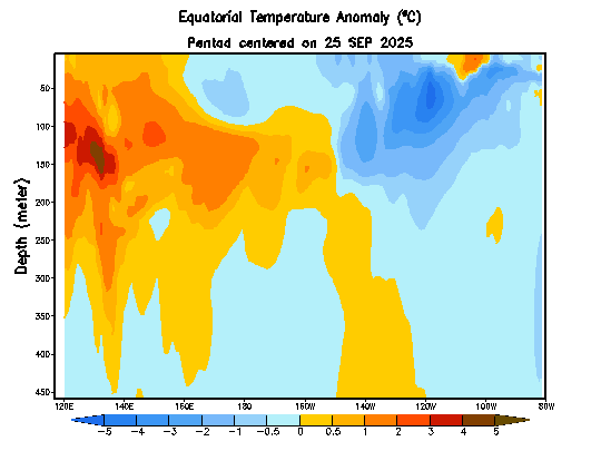
That heat is likely to move further across the Pacific over coming months, and then potentially surface in the east as we head into the middle of next year. El Nino incoming? Too early to be sure, but models are indicating a significant change over coming months:
If it does play out as forecast we’ll likely see warmer and drier than average conditions move in as we head into winter…but that’s a long way off. More on that as we get closer – we’ve got the current La Nina and potentially wetter conditions to move through first!
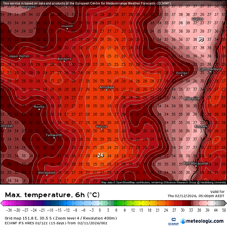
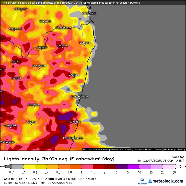
Much shorter term…we’ve got dry and increasingly warm weather as we head into the weekend…before a thundery breakdown occurs on Sunday. Chance of some decent storms with the change – here’s the current lightning forecast for Sunday arvo:
…but some lovely sunny weather to come before that change hits, hope you get a chance to enjoy it and keep an eye on warnings and radar as we move through the weekend.