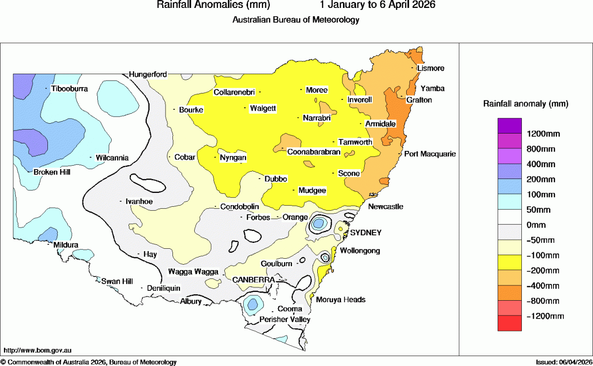
….and just like that the trough made it a little further north and we’re under a strong rain train. Yesterday evening actually brought some very heavy showers across parts of our region, adding to the 199mm recorded in the Kalang to 9am this morning. Rivers are either flooding or heading that way, and the forecast rain radar for the next 48 hours looks like this:
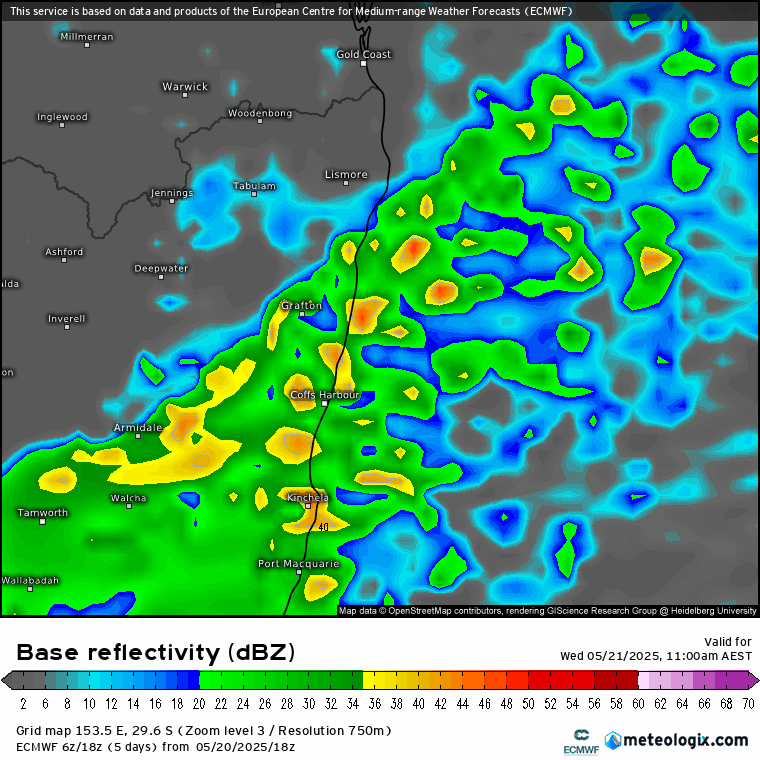
You can see the rain train continue to move a little north before moving south once again tomorrow. The result for us – across models we see the following 48 hour totals forecast:
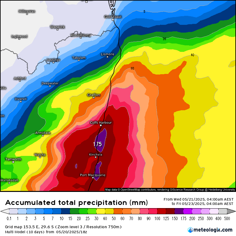
…but as an average the models it tends to blur out some of the higher falls, with some point totals likely to be considerably above the totals above (while others see less). The result – flooding likely to continue / worsen over the next 24 hours before slowly receding later tomorrow and into Friday. With ongoing damage still waiting for a fix from previous rain events we’re likely to see impacts across our road network for some time.
You’ll find access to a range of emergency information from the tab above, including SES, RFS, Council, Kombu Floodcam and more. Some good news? At this stage it’s looking a lot drier for next week.
Take care out there!