Going to kick off this quick post with this amazing view from inside Hurricane Erin, currently moving across the tropical Atlantic. Was a Cat 5 system – absolute monster – when this video was taken from one of the Hurricane Hunter aircraft:

What you can see is the blue-sky view from the pinhole eye of the cyclone with the steep bank of clouds (known as the stadium effect) wrapping around on all sides. You only really see this on the strongest cyclones. Here’s how it looked from above – just incredible:
Back to our weather and it’s looking a little less interesting than the centre of a cat 5 cyclone – but we do still have some interesting weather coming up this week. Yet another pool of upper cold air is going to move across northern NSW over the coming days:
It will sit across NE NSW for a few days as it gradually weakens, but will combine with onshore winds that are moving across a warmer-than-average ocean to bring days of onshore showers. Going to see these totals add up over the coming days. As is the case with showers some places will see heaps while other locations see a lot less…so the best thing to do is take an average across all key models, and that gives us these totals through this coming week:
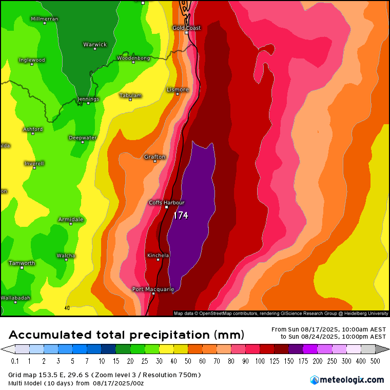
Worth emphasising that this is an average – some models show more while others show significantly less – keep an eye on the radar and day to day forecasts for the latest information.
Chance of a few coastal showers tomorrow but the more significant showers (which may merge into periods of rain at times) will kick in later on Tuesday and then last through the remainder of the week:
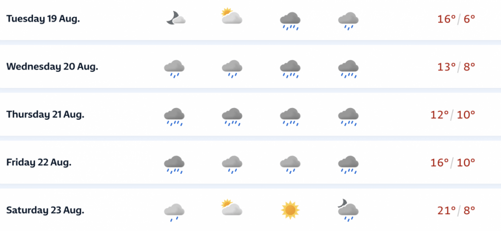
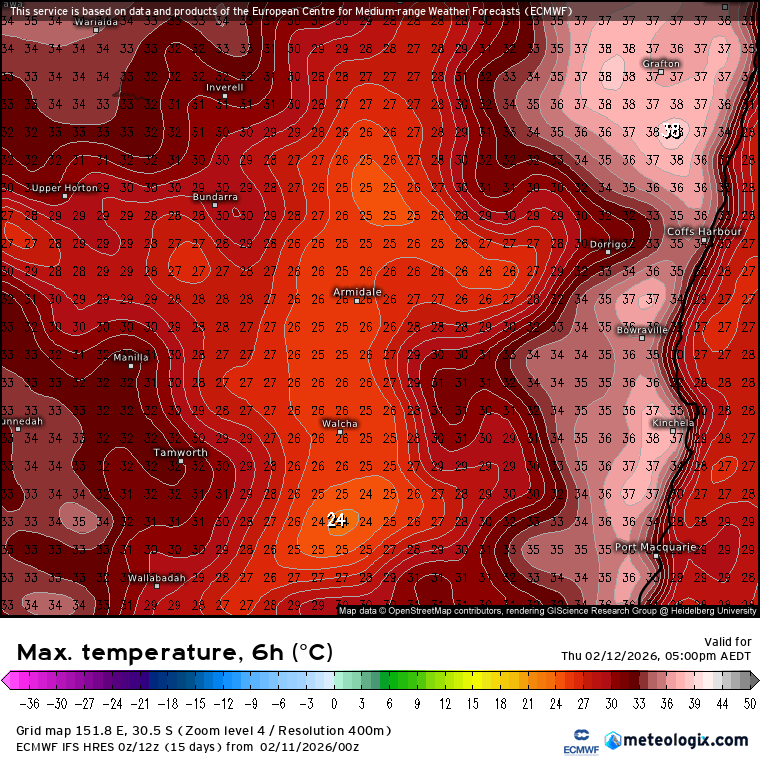
Worth checking the forecast maximum temps for this week as well – going to feel really cool in the rain. The combination of cold air and precipitation could well mean we’ll see further snow across the usual places inland this week. Total snowfall currently looking like this:
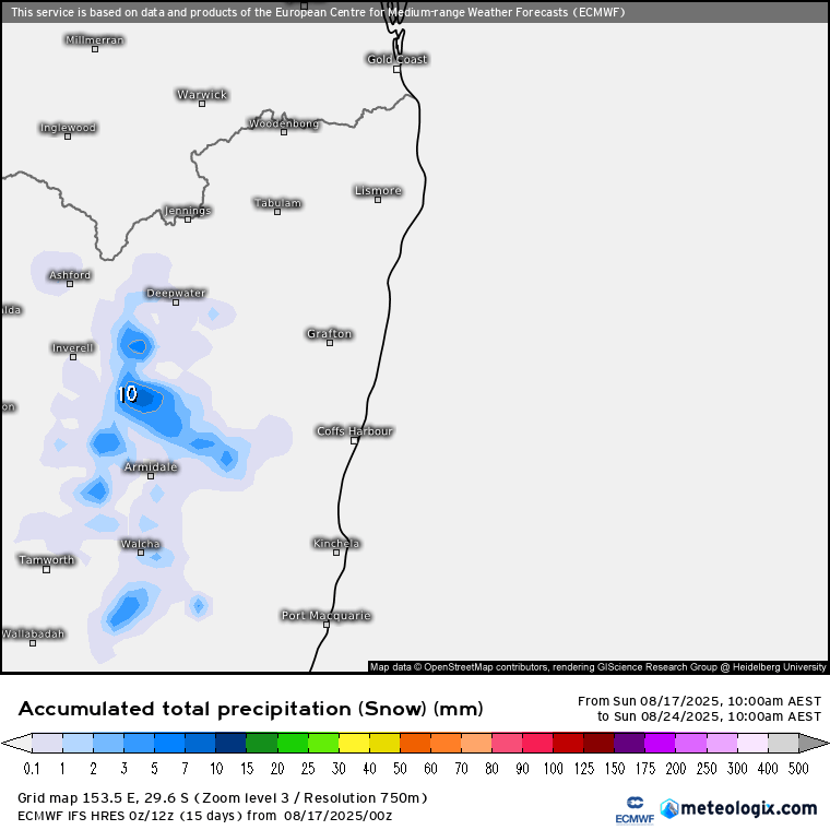
Expect to see the usual Guyra photos over coming days – but very unlikely to see as much snow as we saw in the last event. No snow down here on the coast, but could see enough rain for a flood watch over coming days – the ground is still wet so it won’t take much for rivers to come up. [EDIT: Flood Watch now issued – Minor to Moderate for our region]
Looking further ahead and models show the wetter pattern continuing as we head into summer – before hints of drier weather moving in as we head into autumn:
…with temperatures following as you might expect – below average through wetter times before transitioning to warmer than average when it dries out:
It won’t be wet all the time, and as we move through spring any drier spells could be a bit of a shock as temperatures rocket in the rapidly strengthening sunshine – not likely this week however!
Wherever you are I hope you can keep dry and warm 🙂