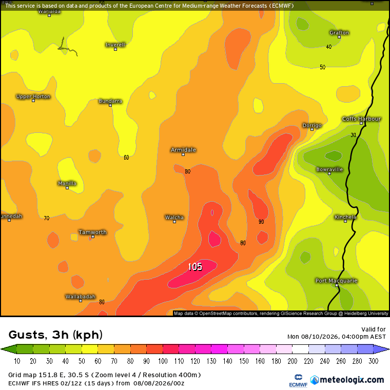
Writing this down in Newcastle where the alignment of the land means that showers moving swiftly north in the southerly air stream are clattering onshore once again. We’ve still got high pressure areas sitting to the south of Aus, and that is continuing to push showers onto the east coast. Not many making it into the valleys today, but anyone exposed to the southerly flow has felt that combo of cold air mixed with rapidly moving downpours. Right now the high is located just off the Tasmanian coast. This morning it was located over Tas itself:
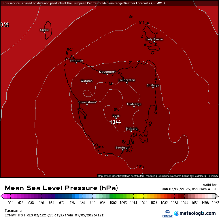
And if that looks like a solid high it was – with a weather station north west of Hobart measuring the highest pressure ever recorded on land in Australia – 1044.5hpa!
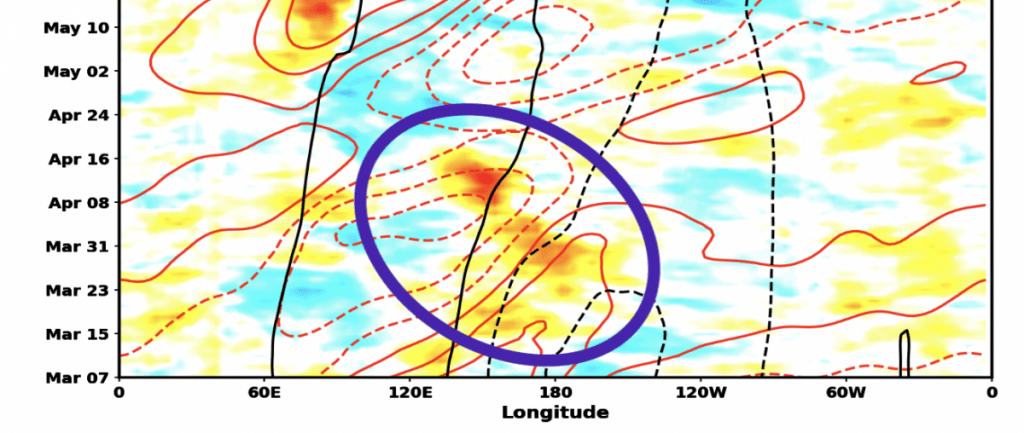
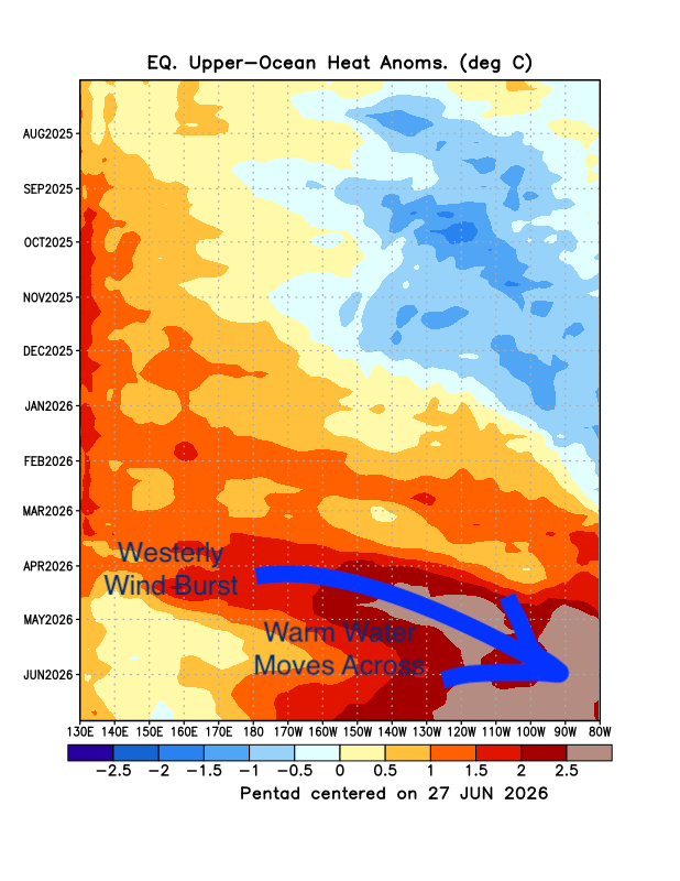
There’s a lot of fairly extreme things going on weather wise at the moment. The El Nino is still gathering strength in the Pacific. There was a westerly wind burst (WWB) to the north east of Australia in April. That WWB generated a wave of warm water that travelled under the Pacific and emerged off the South American coast, kicking off the first part of the El Nino. We can see the wind burst circled in this image:
That first burst brought a lot of heat across to the Eastern Pacific:
But we’ve now got another massive westerly wind burst happening – and check out the size of this one (in the square, forecast and hindcast) compared to the one in April (in the circle):
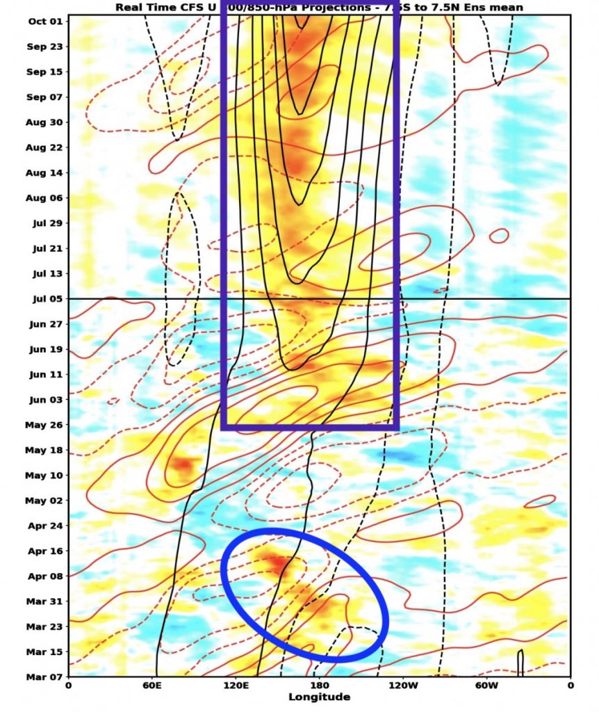
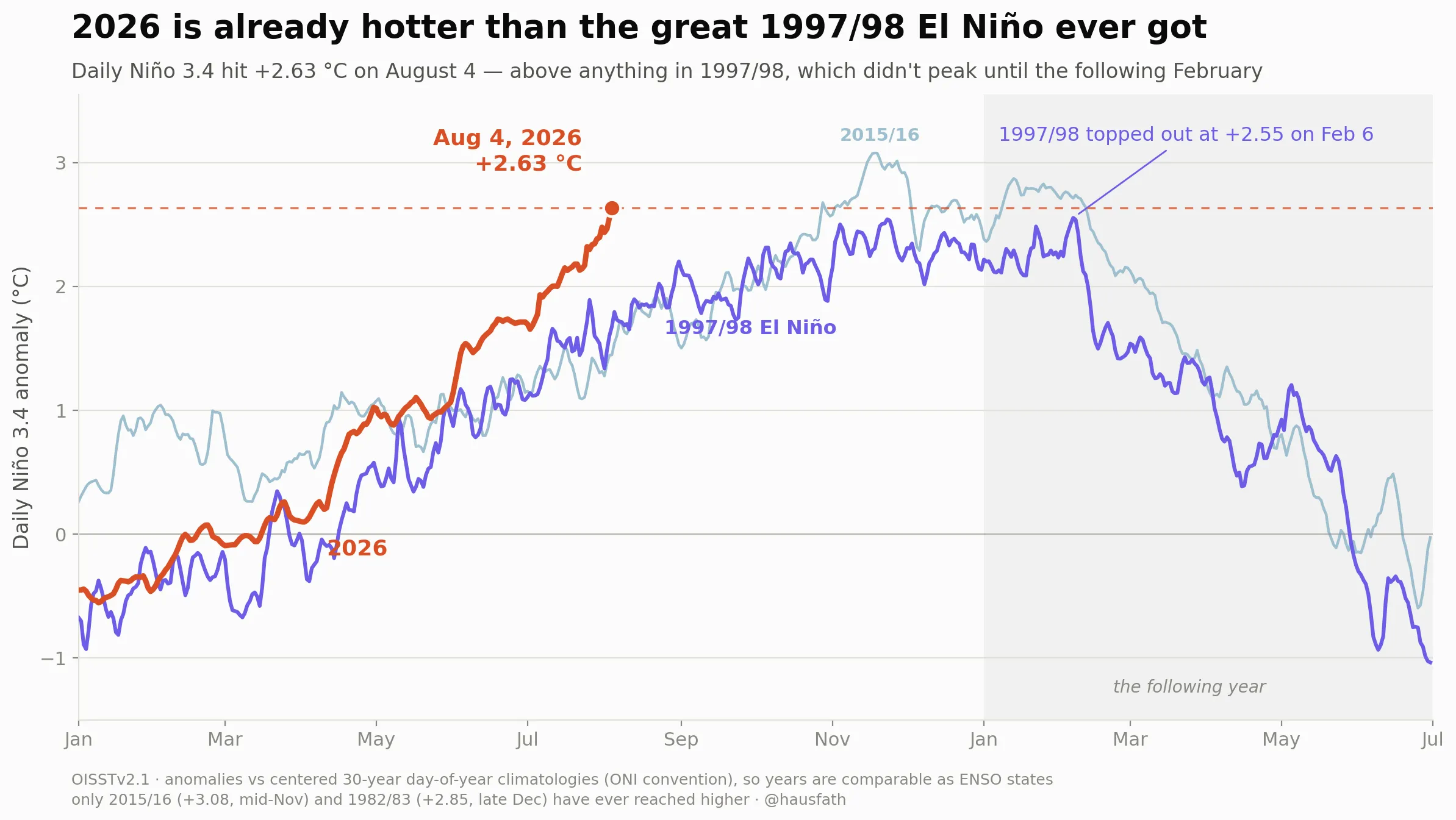
Just a massive event, and the end result? If it comes off as forecast we could see ocean temperature anomalies across the Eastern Pacific up to 4c above normal, which is well into record territory:
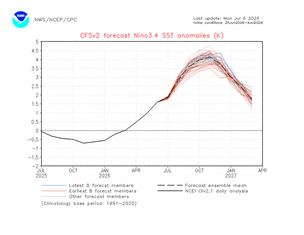
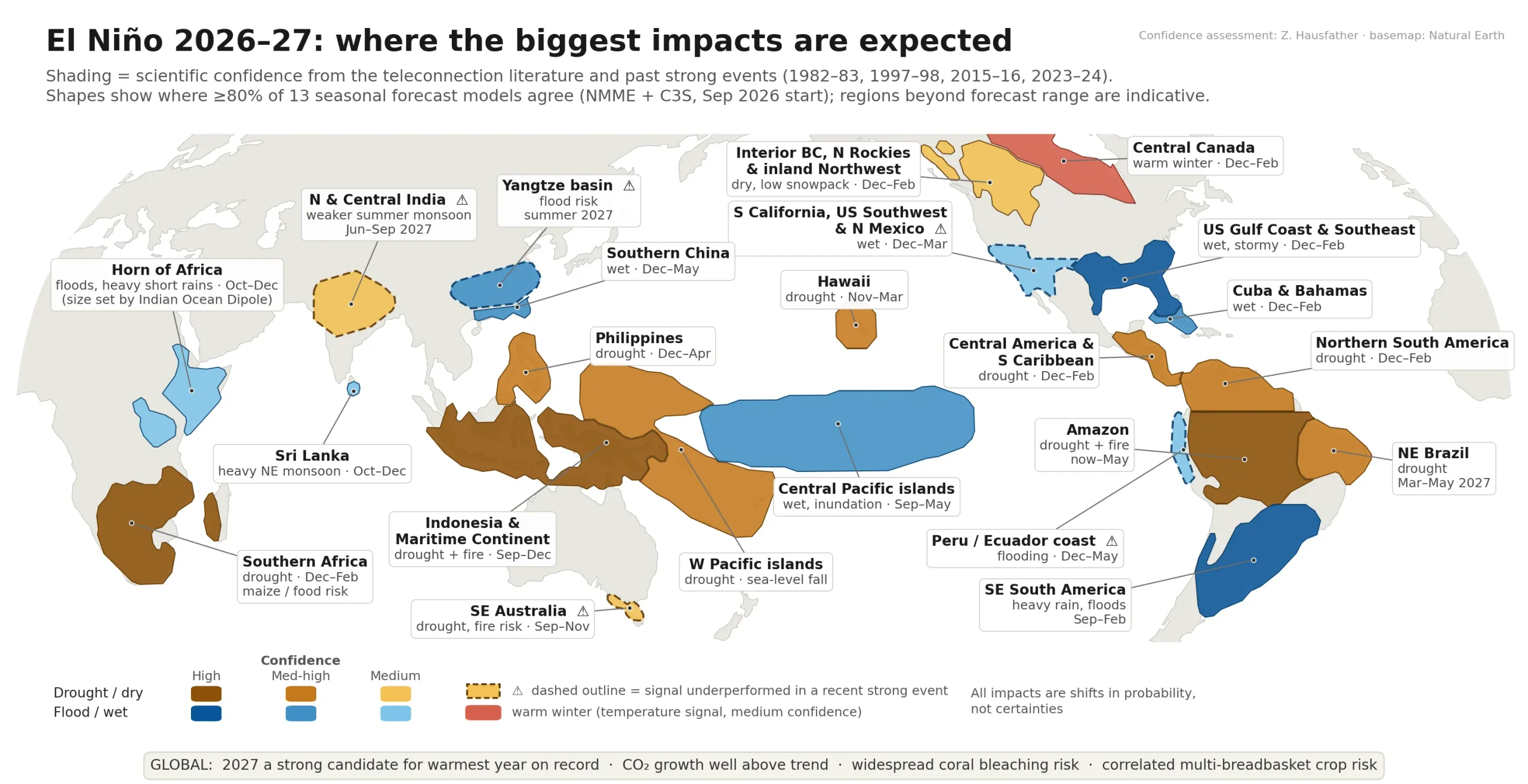
We’ll see some of the impacts of this event this year with drier weather (eventually) for some, and lasting impacts next year with a likely permanent jump in global temperatures. We’ve just had record breaking heatwaves across Europe (and another forecast for North America) – and that’s before the full impact of the El Nino has been factored in. Expect to see more records over the next couple of years.
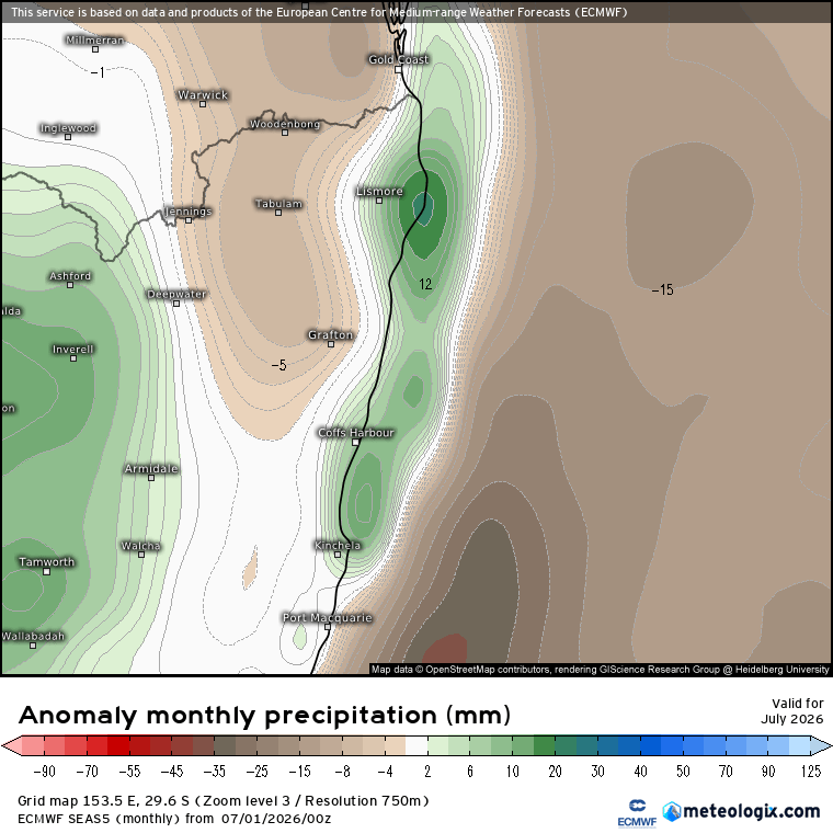
Whilst all this is going on we’ve also got a VERY strong southern circulation happening. That event is keeping westerly winds well to the south of Aus, allowing high pressure to move further south…and bring ongoing easterly winds to the east coast. It’s forecast to continue at times through this month, with the forecast rainfall now looking to sit a little above average along the coast through July:
but…the circulation, which has been sitting in strongly positive (strong than normal) territory through the last couple of months (blue circle) is weakening a little, and is likely to return to average levels later this month (red circle):
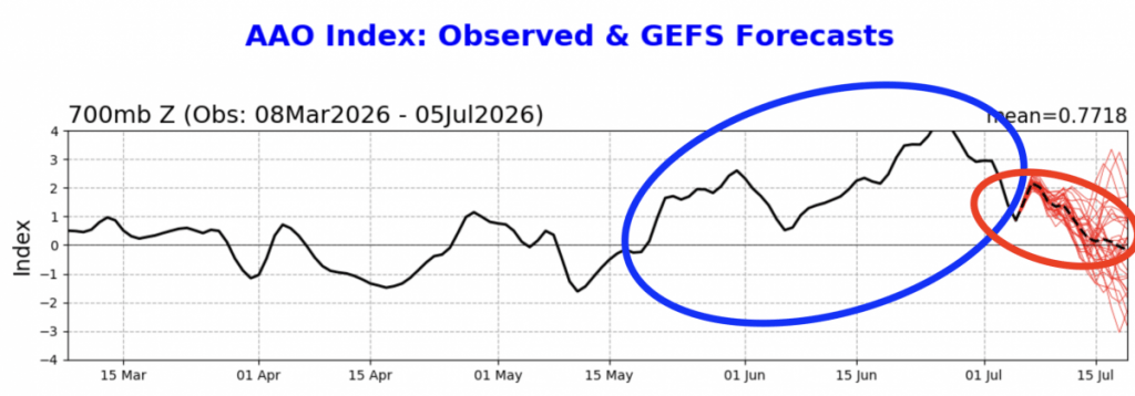
If that comes off as forecast we’ll see the westerly winds move a little further north. With the El Nino continuing to develop we could then see drier conditions develop across eastern NSW. Here’s the forecast for September – looking a lot drier than July:
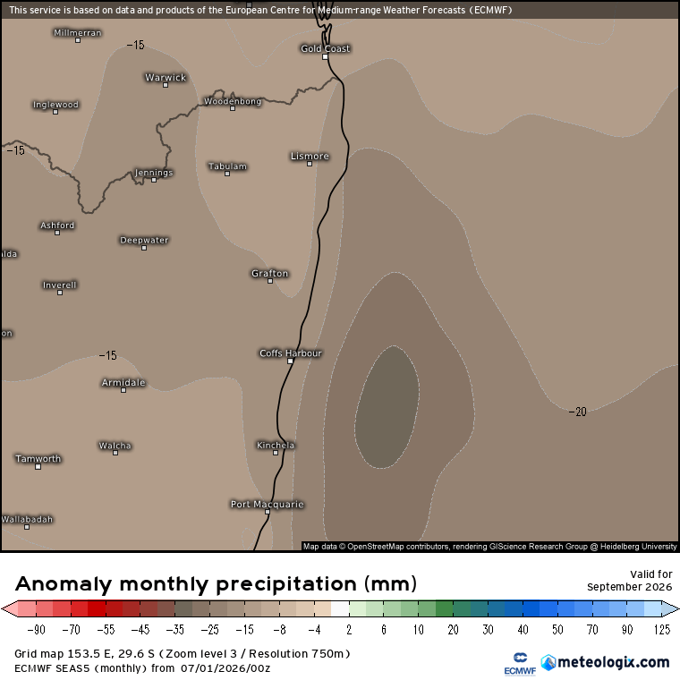
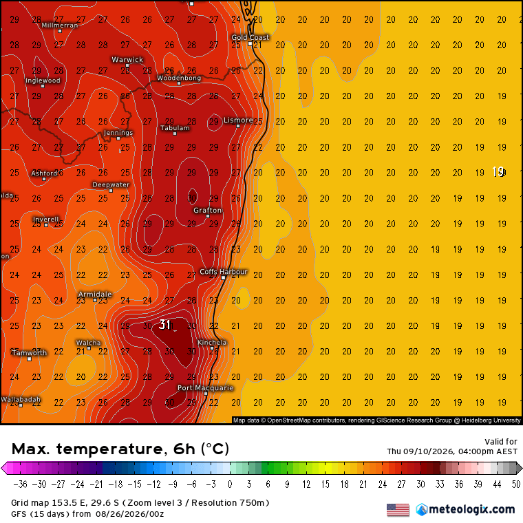
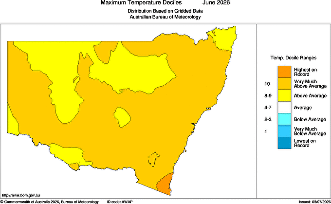
The current wetter period has contained some drier spells, and likewise any drier spells could well contain some wetter weather…however as we move into spring it still looks like we’ll see the focus turn drier than it has been. We’ll also likely see above average temperatures as we move into spring, with some hot spells looking likely. Inland from us is currently very wet, which will help moderate higher temperatures moving in from the west…but as it dries out we could well see some decent heat spikes this coming season. Talking of heat – even though it’s been chilly in the rain the temperatures last month sat well above average across much of NSW – in fact parts of the SE coast saw record temperatures:
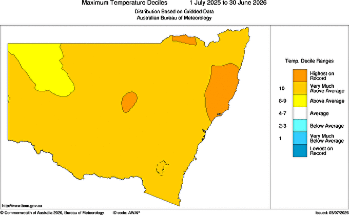
If we look back even further, over the previous 12 months, we can see that much of the Mid North Coast also experienced the warmest average temperatures on record:
On that note enjoy the remainder of winter – the cold will be gone before we blink! Thanks for reading – back again with another update soon.