It looks like the models are sticking to their guns with big falls looking likely to our north as a tropical low moves inland across N Qld and then swings SE ahead of an approaching upper trough:
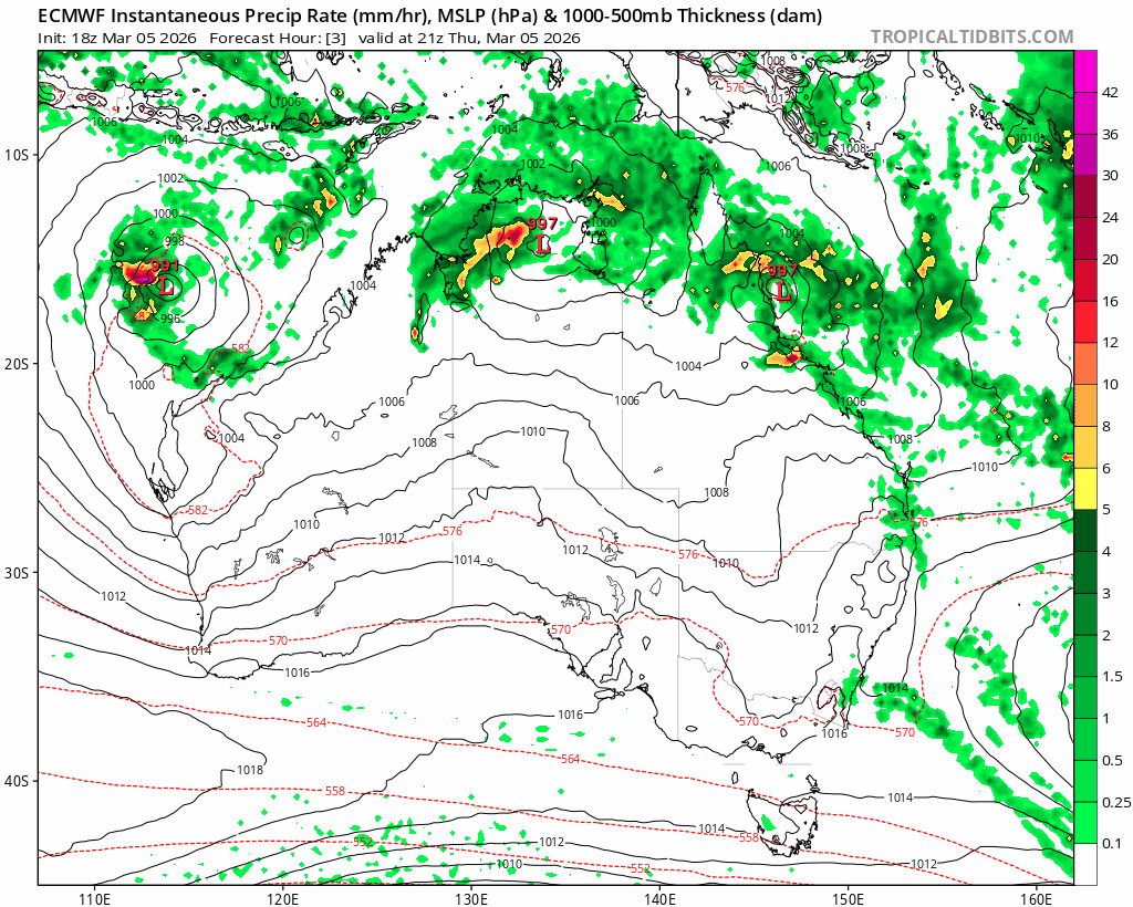
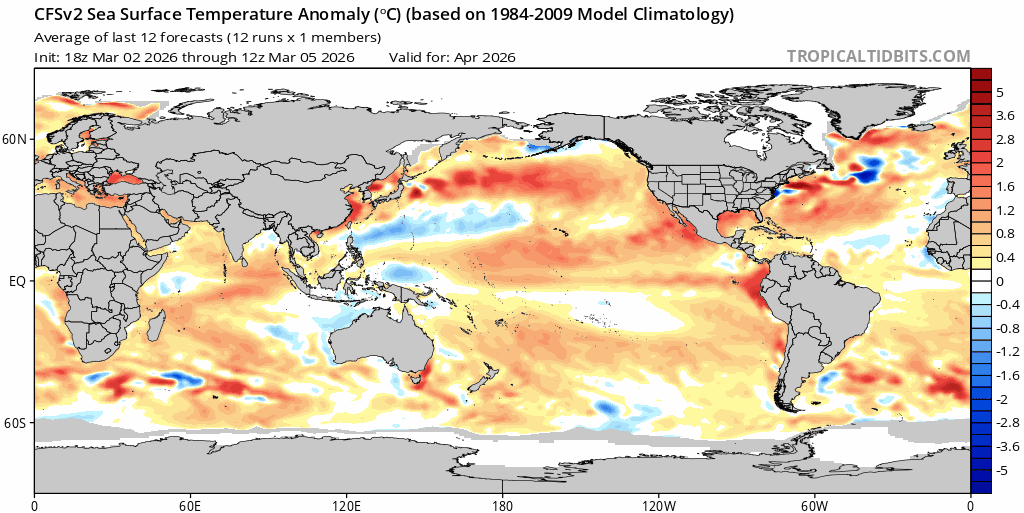
If it plays out as forecast we’ll miss the main rain areas associated with the low itself, but sitting to the south of the system we’ll see onshore winds increasing. Those winds are moving across a very warm ocean:
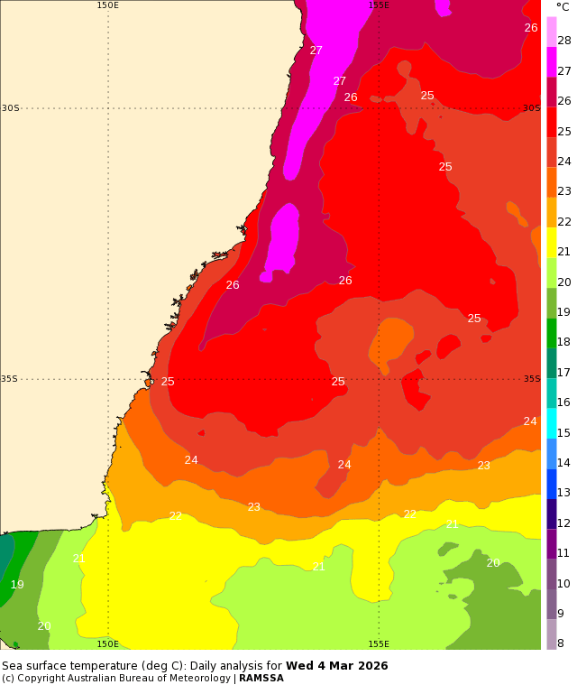
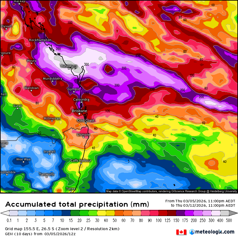
…combine that with an approaching upper trough and we’ll see showers move in across a number of days. The main focus will be on the hills and the Dorrigo / Coffs range but we’ll likely all see a few. 6 day totals from key models across SE Qld / NE NSW looking like this:
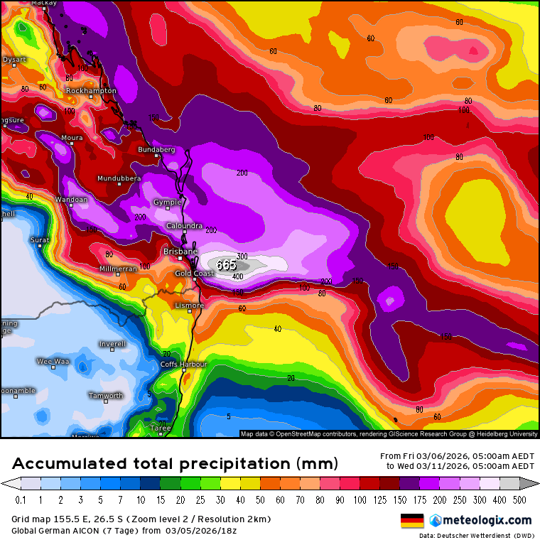
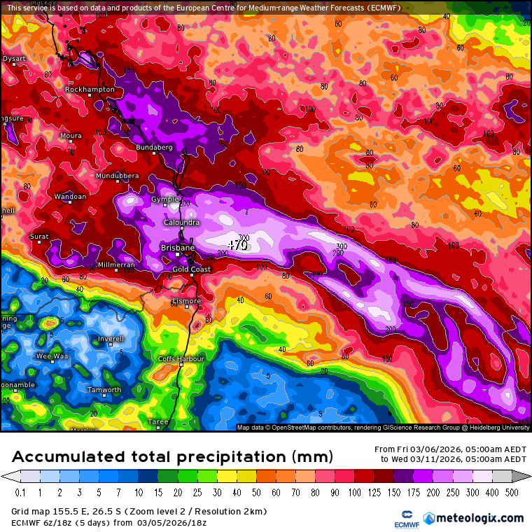
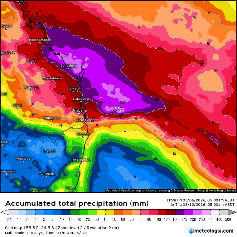
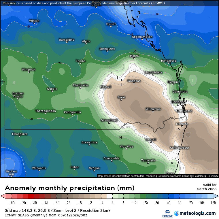
Averaged across all models it’s looking like this – few showers and possibly a little wet at times but at this stage not looking like flooding rain for us:
Looking slightly further ahead and there is the risk of more showers at times over the coming weeks. With 27c ocean temps it won’t take much for us to see some decent totals – if that looks likely I’ll post again.
Looking even further ahead and most models are still forecasting a decent El Nino incoming. Here’s the forecast from the US model:
The European model is also looking very El Nino-ish over coming months:
Worth flagging that we are still some way off from being able to confirm an El Nino – conditions are not there yet and we are still to move through the autumn predictability barrier – but models feel pretty confident so we’ll work on that basis for now.
The European model shows it much drier through winter:
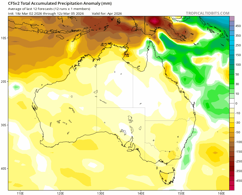
The US model however shows conditions turning a little drier as we move through winter but a much more mixed bag – wetter at times / for some and drier for others:
As such the take out for now – could be much drier through winter / spring but not locked in yet. Regardless, through our drier months it only takes one decent rain event to move us from drought to drought-free, and longer term models only looks at what is likely, not the day to day detail. With the hills to our west if anyone gets to see wetter weather in a drier spell it’s usually us.
Worth also flagging that it has, so far, been a much drier than average ‘wet’ season – here are the summer anomalies – note the deficiencies through NE NSW:
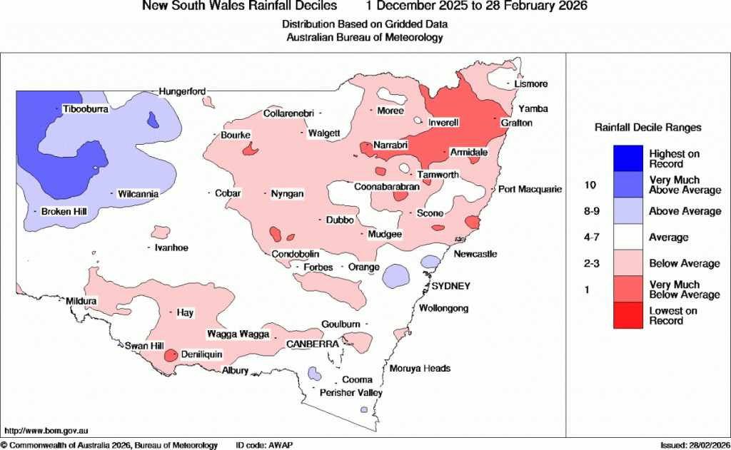
Those anomalies can be easily wiped out by a couple of decent wet spells; it will be interesting to see if we get them before our dry season arrives. For now however it’s worth being aware that there is a higher risk than we have seen (for some years) of drier weather incoming through winter / spring…but not locked in. Don’t stress, just be aware and plan accordingly.


