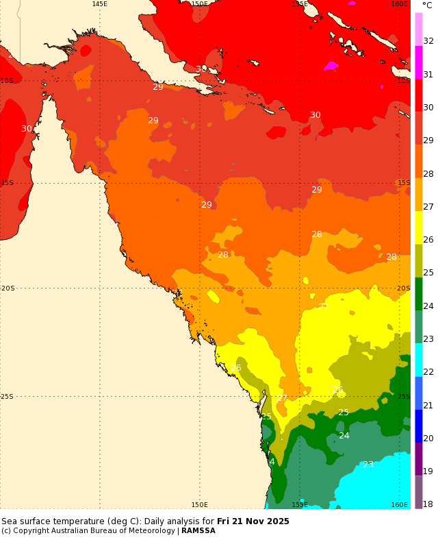
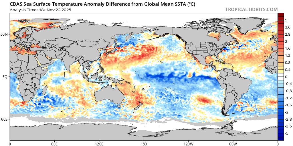
The humidity is rolling back in as we head towards summer and we’re well into our storm season. Kicking off with the humidity – and the oceans to our north-east are well above average for the time of year – in fact a good month ahead of themselves. On a practical level that means that with the right conditions (onshore winds) we could see our summer weather kick in earlier than usual. Looking at the ocean temperatures off the Qld coast (which feeds down our coast via the East Australia Current) and here’s how they are looking right now:
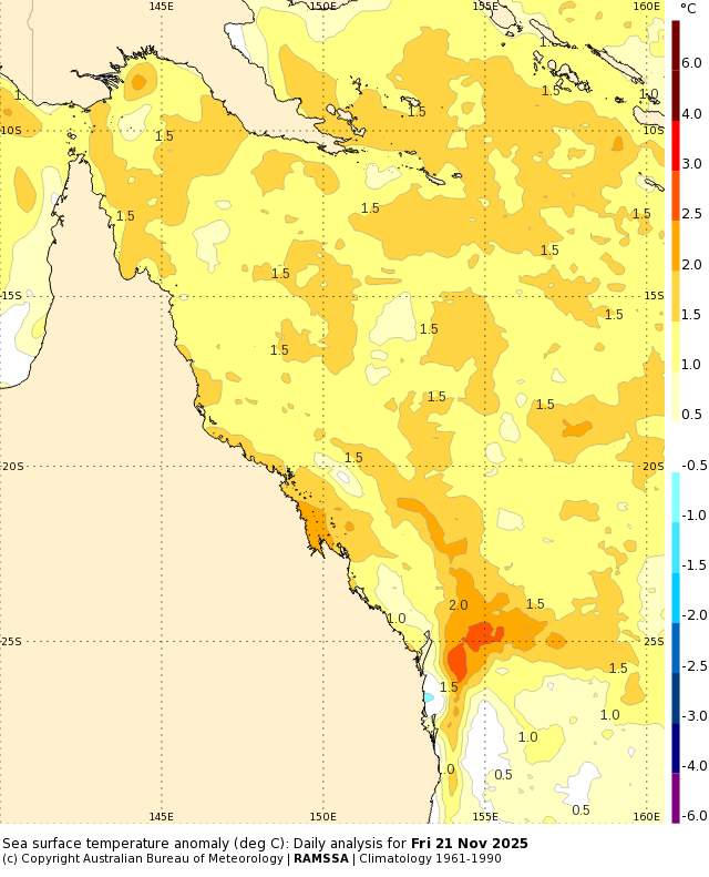
Fascinating to see how that heat is sucked south via the aforementioned current! If it looks pretty toasty that’s because it is – here’s how much higher than average the ocean temperatures are sitting right now:
The East Australia Current is likely to strengthen over coming days – and that will draw some of that really warm water south and into Northern NSW coastal waters. Here’s the 6 day forecast – you can see the warmer water really starting to move in our direction:
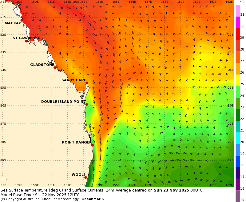
This current sits a few km offshore so don’t expect to feel it when you jump in for a swim…but a fair amount of time you can actually see where it is when you look offshore – looks for a line of cumulus clouds a few km offshore and running north / south 🙂
All that means that by the time we move towards the end of the week we could see ocean temperatures approaching 27C offshore from Byron. You can just see them arriving at the far north of the 168 hour forecast map:
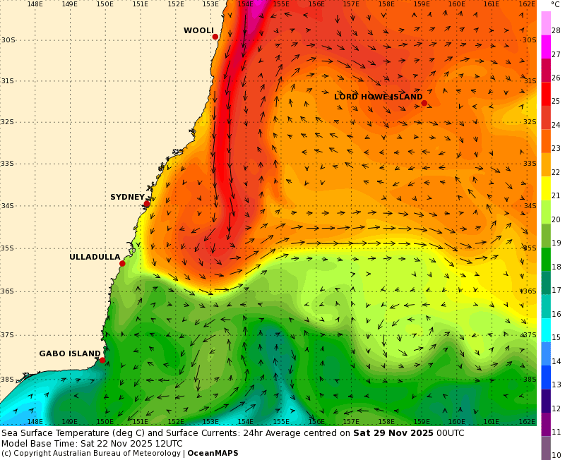
…and expect to see them moving further south over coming weeks. I’ll keep you posted.
Those ocean temperatures will work to increase humidity when winds turn onshore – and also help power showers and storms when conditions are right. As such we’ll see a chance of showers and storms forming through much of this week. The focus for much of the time will be inland on the hills / tablelands and to our north…but always a chance most days of seeing some of that activity make it closer to the coast. Here’s the lightning forecast for 5pm each day from today through Thursday:
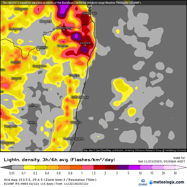
Don’t place too much faith on the precise locations of the lightning each day – it’s more of a guide as to the chances of seeing storms form. What we can see are the purple areas which indicate the chance of some intense storms for some. Again don’t place too much faith on exactly where those purple areas are marked…but definitely a flag that some locations will see some intense storms this week…and we could find some of those storms moving through / close to our region. Large hail and strong winds are all possible – so a period where keeping an eye on the afternoon radar / warnings could be useful…Worth noting that despite the chance of storms through much of this week we’re not looking at much in the way of rain, particularly close to the coast.
Talking of warm waters, and worth noting that those warmer than average waters across the north of Australia have in fact already kicked off the first cyclone of the season – here’s the Darwin radar at the time of writing:
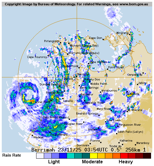
Amazing to see so early in the season – but less surprising when you see how warm the waters are across the north coast of Aus.
Looking slightly further ahead and we’ve got the Southern Oscillation Index heading significantly more positive:
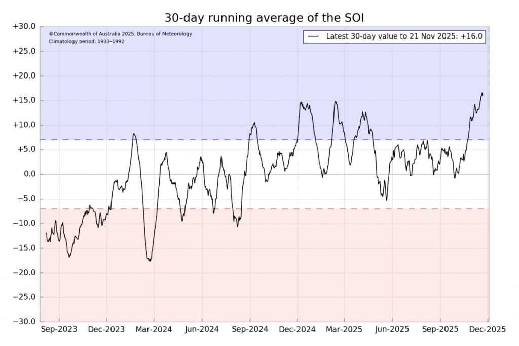
…and that indicates that the atmosphere is starting to match the La Nina-ish conditions in the Pacific:
…and that will work to increase the chances of wetter weather once the competing influence of the southern circulation (which is still strongly negative / drier) starts to wane over coming weeks. Those competing patterns mean that in the short term there’s just as much a risk of drier / westerly conditions over coming weeks (with associated fire risk) as there is wetter weather, but in the longer term we should see wetter weather win out, once again.
Looking even further ahead and models still suggest that we’ll see the current La Nina pattern:
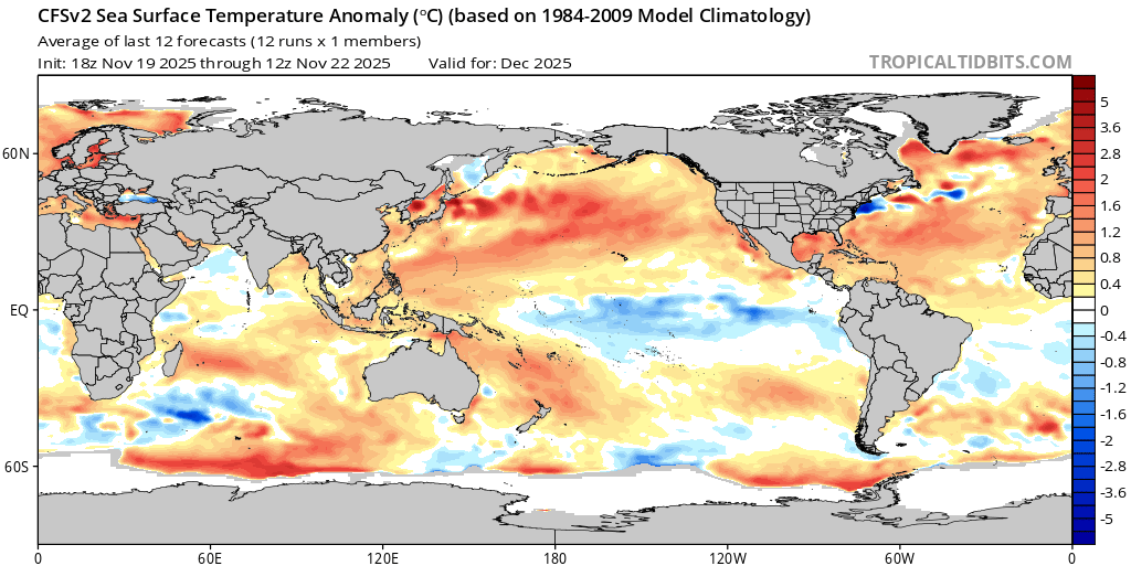
…replaced with a more El Nino type pattern as we head into next spring:
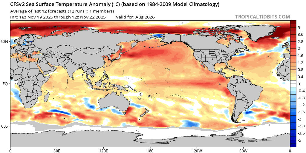
…check out those temperature changes forecast across the eastern Pacific!
No guarantees that it will play out as forecast…and in fact there have been a few examples over recent years where El Nino forecasts have busted in reality…but something to have some awareness over. If it does play out as forecast we’ll be grateful that the rare southern circulation warming happened this year rather than next.
That’s it for now…thanks to our long term sponsors Kombu Wholefoods and Snapfrozen for sponsoring this site, and thanks for reading to the end 🙂


