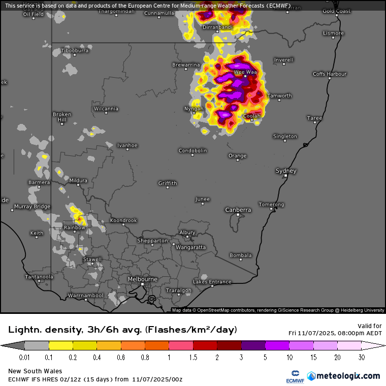
We’ve had a beautiful day today with an inland trough far enough away to leave us with blue sky and not-too-hot temps. Tomorrow however that trough moves closer and we’ll see storms forming a lot closer to our region. Looking at the lighting forecast for this evening and we can see storms well inland:
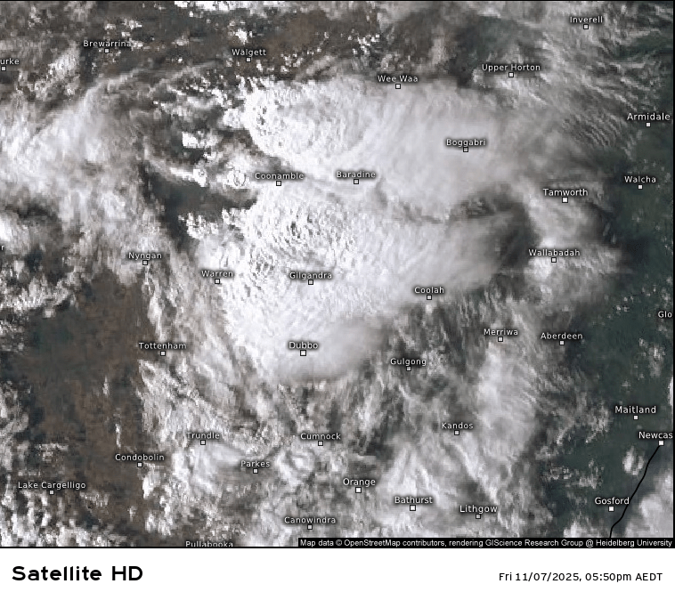
….and that’s confirmed by the latest satellite image:
…but by the time we get to tomorrow we can see the storms have continued overnight and into the early morning with more forecast to develop a lot closer to the coast – and there could be some decent storms out there as well later in the afternoon:
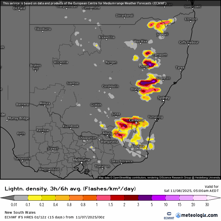
Chances are the most severe storms will sit just to our south, but still a chance we’ll see storms through the arvo with severe storms possible – a good day to keep an eye on the radar as we could see very little, but could just as easily see a decent storm move through. From the BoM storm forecast:
“Severe thunderstorms are possible across the northeast quarter and the central eastern areas, most likely during the afternoon and evening. The focus areas of severe thunderstorms will be the Hunter, Mid North Coast, and adjacent ranges where damaging winds (gust > 90 km/h), large hail (>2cm) and localised heavy falls leading to flash flooding are all concerns”
Warmer than average temperatures off our coast will add energy (ands higher rain totals) to any storms that kicks off before much drier westerlies move in…and those westerlies are something to watch as they could well move in early, dry out the atmosphere and wipe out any chances of storms…but come in later and the dry line can enhance storms – it’s going to be balance today and not sure how it’ll play out. Anyway, here’s how those ocean temp anomalies look now:
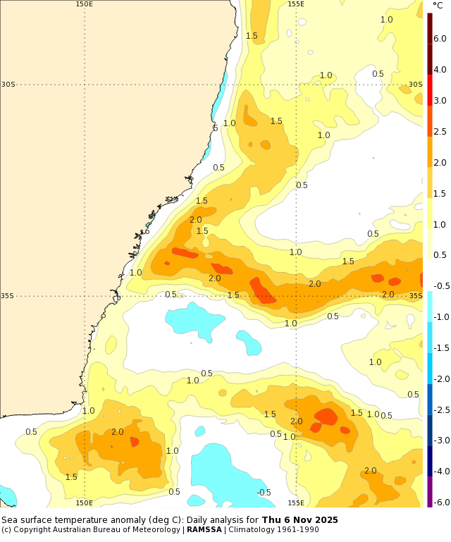
…with those warmer temperatures moving south on a strong East Australia current, which is being fed by a significantly warmer than average Coral Sea:
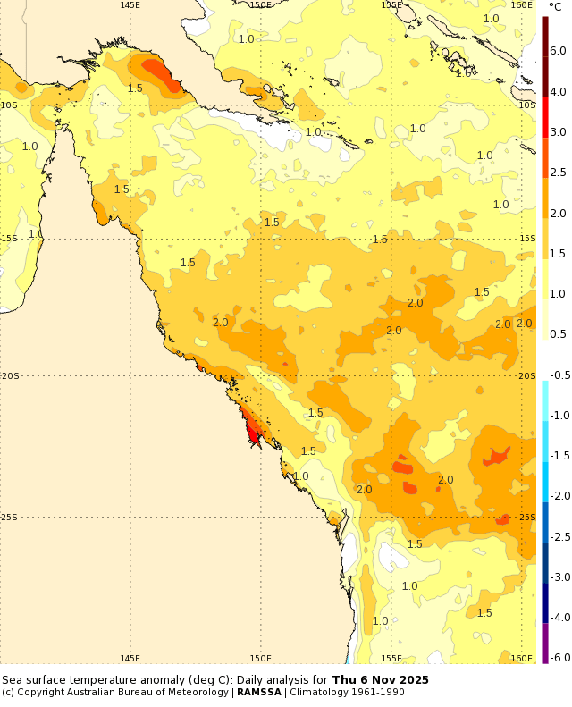
I’ll be hoping to see those anomalies drop away before we hit summer / cyclone season! Looking slightly further ahead and we’ll see a shower or two at times through the following week with the next significant change looking to move in again towards the end of next week (could we have three Stormy Saturday posts in a row?) More details on that one as we get closer.
Models are continuing with their weaker than average southern circulation (drier) v the ongoing wetter signals from the Pacific and Indian Oceans. Longer term models still show a transition from the current La Nina-ish signal to a more El Nino-ish signal as we head into next winter. Here’s the forecast ocean temperature anomaly change from now through to May next year:
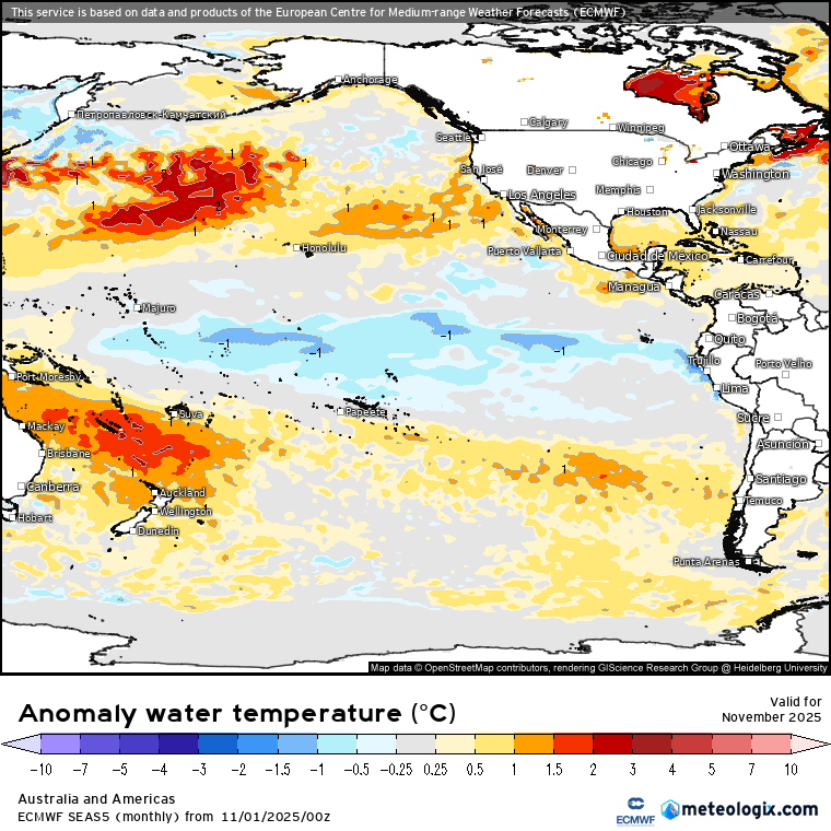
If that plays out as forecast we’ll see a wetter trend through summer before a drier trend as we head into winter. That’s some way off – will post more as we get closer. In the meantime keep an eye on the radar and enjoy the cooler weather on Sunday once the change moves through.


