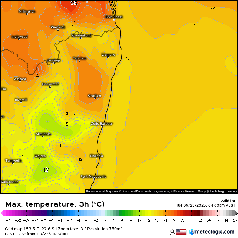
Definitely a cool change overnight – but we’re well into spring now so the cold air won’t last for long in the strong sunshine. Worth checking the max temp forecast for today through Sunday to give you an idea of how quickly temps will climb again:
Going to see some drier weather as well over the coming few days. Worth a flag that we’ve got fire permits coming in from next Wednesday 1st October – another sign winter has gone. Until then you can burn if you meet all the conditions, weather conditions are conducive, and you notify online at https://www.rfs.nsw.gov.au/notify . From 1st October you’ll need to apply for a permit – same website but click on the Apply For Fire Permit tab instead.
Looking longer term and the Indian Ocean Dipole (IOD) is strongly negative:
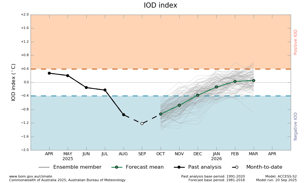
This will help pump higher levels of moisture across Australia, running from NW to SE – increasing rainfall across SE Aus, particularly west of the divide. The IOD should fade away as we head towards the end of the year and the monsoon moves in.
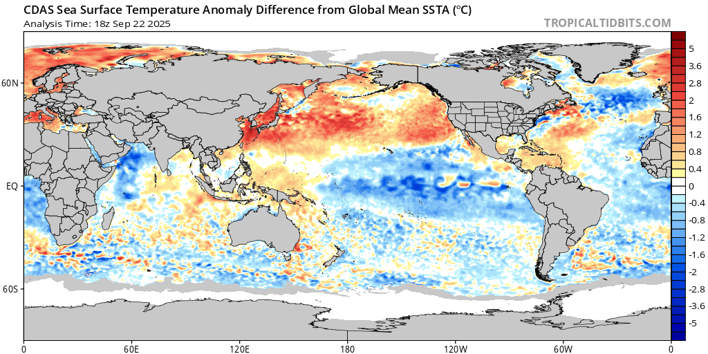
Looking at the Pacific and the ocean temperature anomaly chart shows how much colder the eastern Pacific is sitting right now – definitely has a La Nina vibe:
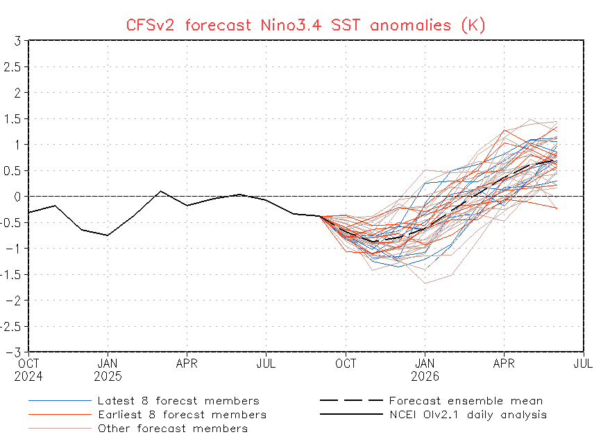
This pattern will also increase rain chances across eastern Australia, this time particularly east of the divide. Unlike the IOD this event can last through summer, increasing our risk of higher than average rain totals through into early 2026. Models then show a swing the other way, with warmer temperatures looking possible across the eastern Pacific as we move through 2026:
Our other key climate indicator right now is the southern circulation – and that is looking a lot weaker than average:
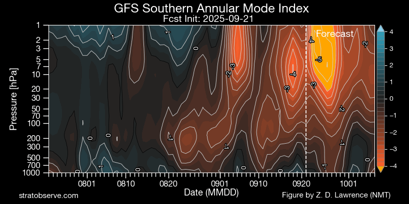
This can push westerlies further north than normal (and is what we saw in 2019) – but the difference this year is (1) the negative IOD, meaning the air moving across our region is likely to be more humid than we experienced in 2019 (2) the La Nina-like conditions across the Pacific and (3) we’ve had a lot of winter rain – in 2019 we saw fires breaking out right through winter across parts of NE NSW…so while we could see an increase in fire risk over coming weeks as a result of the weakened circulation it won’t reach the levels it did a few years back. Regardless, worth keeping an eye on conditions until we hit our wetter summer season.


