Another beautiful day in paradise today – in fact you might not know it was mid-winter, with warm sunshine and (at least in this part of the Kalang) blossom on some of the trees:

It looks like things could get a little wilder for parts of the NSW coast over the coming week however. In the post last week I flagged the upcoming strengthening of southern circulation – which means westerlies contracting further south and an increasing risk of easterlies developing across the east coast of Australia. Here’s how it looked on the BoM forecast:
At that time few of the models were indicating a wetter spell, but as the circulation tightened we see the potential energy increasing offshore – and sure enough a strong east coast low is now forecast to form off our coast. Here’s how one global model forecasts it:
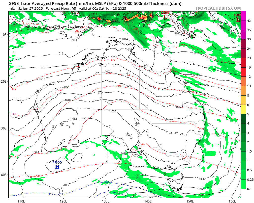
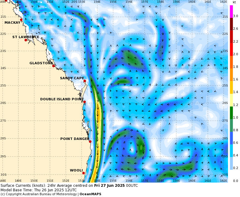
You can see the onshore winds develop, a pulse of tropical air move south off the Qld coast, meet the incoming upper system – and a very decent east coast low develop as a result. These features are always hard to forecast, but right now it looks like the low will sit just offshore with some very strong winds wrapping around it. The latest EC forecast shows offshore winds averaging close to 100km/h just off the Coffs Coast:
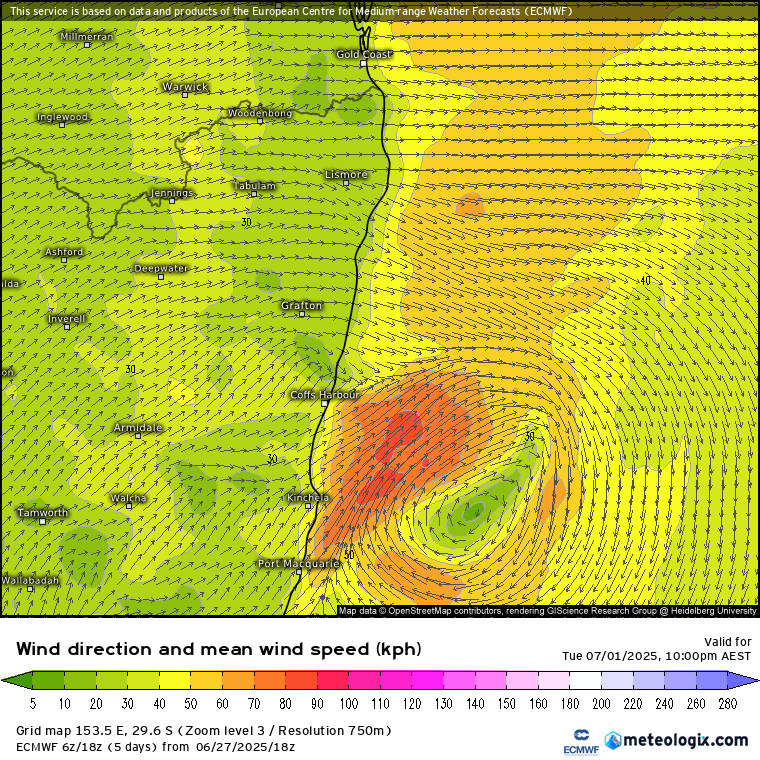
We’re going to have to keep an eye on this feature – whilst all models keep the strongest winds *just* offshore we’ll likely see some gusty winds across our region as well, with the risk of higher winds if the low ends up moving closer to shore / further north. One to watch carefully. We’ll also likely see an increase in wetter weather once again. The latest modelling keeps the highest falls to our south however with the risk of further flooding in areas impacted by the last severe weather event:
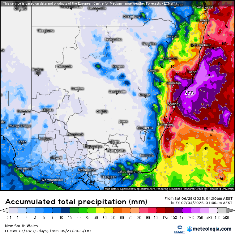
…however until we get closer to the event and the low forms it’s hard to know exactly who will see the higher falls, so again worth keeping an eye on the forecasts and warnings over coming days – it’s one of those events where we could see some stronger winds and very little rain if the low remains to our south, or potentially some higher falls if the low forms / moves further north.
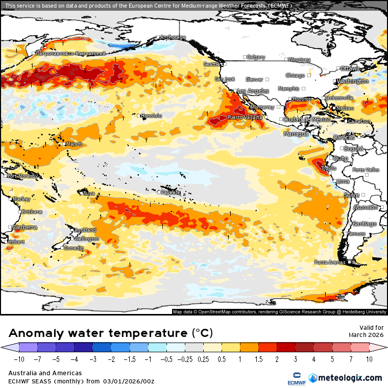
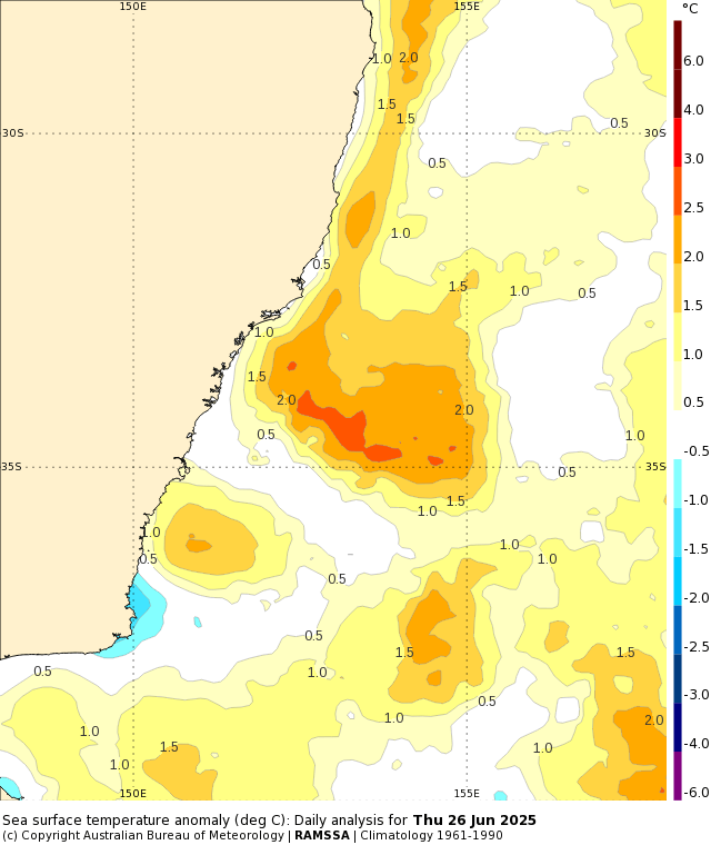
One thing helping power this upcoming event is the ongoing higher than average ocean temperatures off the east coast. The Coral Sea remains well above average:
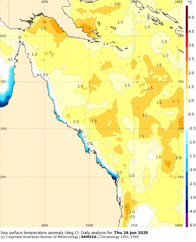
…and as the East Australia current continues to drag that warmer water south:
…we continue to see higher than average ocean temperatures off our coast as well:
Looking further ahead and models are still indicating a likely drop back close to La Nina territory as we move into our spring:

This is in part a result of a forecast significant strengthening of the trade winds across the Pacific over coming weeks. In the chart below blue indicates stronger than normal trades (across the eastern Pacific) while red and yellow show stronger westerlies (across the Indian Ocean in particular):

The stronger trades will draw cooler water to the surface once again across the key Nino 3.4 region, while the convergence zone (where the westerly anomaly meets the stronger trades) will once again likely sit close to the east Australian region…which will (once again) increase the chances of higher than average rains across our region later this year.
Feels like it has been raining for years? One of the reasons for the ongoing La Nina type weather has been the Pacific Decadal Oscillation, or PDO. The PDO is like a long-term version of El Niño and La Niña, but it lasts much longer — usually 20 to 30 years. It describes big shifts in sea surface temperatures in the Pacific Ocean, mainly north of the equator. In a “warm” phase, the western Pacific (near Asia) is cooler, and the eastern Pacific (near North America) is warmer. In a “cool” phase, it’s the opposite: the western Pacific is warmer and the eastern side is cooler.
We’re currently in a strong cool phase – and that significantly increases the risk of La Nina and wetter weather along the east coast of Australia. You can see the cool phase clearly in the last PDO chart:

At some point the PDO will switch positive once again, resulting in an increase in more El Nino events and a drier trend across our region. It won’t mean dry all the time, but we’ll likely see a real change from current conditions. Of concern right now is the fact that cooler PDO periods are meant to actually cool global temperatures…but despite the ongoing cool phase we’re sitting close to record highs. When the POD turns positive we’ll likely see global temperatures push even higher.
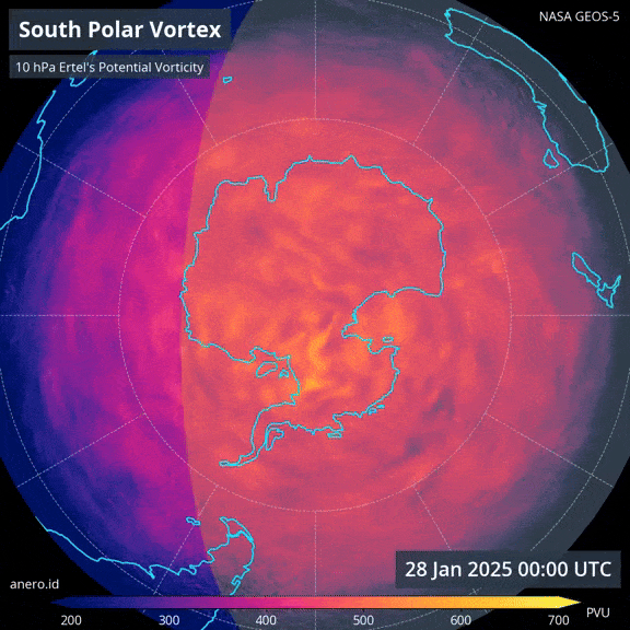
Going to finish today with a fantastic animation from Andrew Miskelly, a weather software engineer at Weatherzone. As you’ll know from previous posts the circulation around the south pole forms late summer, runs hard through winter and then dissipates late spring. He managed to capture these images of the southern circulation forming this year – amazing to watch:
I’ll post again early in the week with more details on the upcoming east coast low. Until then wishing you a fantastic weekend, and congratulations on making it to the end of the post!